 2015, Vol. 30


2. 中国科学院地质与地球物理研究所, 北京 100029
2. Institute of Geology and Ggeophysics, Chinese Academy of Sciences, Beijing 100029, China
中国东北是大陆块体作用比较活跃的地区,它在大地构造上位于西伯利亚与华北克拉通之间的中亚增生型造山带东部与中生代环太平洋构造域,其中包括华北克拉通东北区域(Chen et al., 2006).壳幔物质的运动迫使深部物质重新分异与调整(郝天珧等,1997),形成深、浅部物质与能量的交换、元素聚集与迁移(Darbyshire et al., 2004).因此深部物质运移的动力成矿效应与成矿机理既是前沿的科学问题(Ai et al., 2003),也是对中国东北地区矿产资源的突破具有重大的指导意义(Ozalaybey et al., 1997).本文利用收集整理东北地区的固定与流动地震台站数据,利用接收函数方法研究台站下方的地壳结构,研究结果对于地球深部物质与能量的交换及其深层动力过程有着重要的实际意义(Zhu and Kanamori, 2000). 1 东北地区区域概况
本文研究区域经纬度120°E~135°E,38°N~54°N,位于中国东北地区.中国东北地区包括黑龙江省、吉林省、辽宁省和内蒙古自治区东北部地区.西面是陆地,太平洋板块俯冲运动方向为北西西向,从而使特提斯域不再向东滑移(Chen et al., 2009).大兴安岭地区是在地质历史上具长期活动性质(Evernden,1953),由一系列褶皱带和微陆块组成(张岳桥等,2004).中生代以来,这些微陆块群体(Suteau-Henson,1990)作为西伯利亚板块和华北板块之间的拼合板块,运动于诸大板块之间(Chen et al., 2009),而且作为欧亚板块的一部分,又受到太平洋板块俯冲的影响(Huang et al., 2009).微陆块群拼合的属性(Zheng et al., 2006),使得东北地区难于找到典型造山带的一系列特征(杨宝俊等,2005). 中心部分是辽阔的松辽大平原和渤海凹陷(戴黎明等,2013).平原面积和山地面积几乎相等.该区域水资源也很丰富,主要河流有黑龙江、松花江、乌苏里江、嫩江、牡丹江.还有兴凯湖、镜泊湖、呼伦湖、查干湖等湖泊(杜晓娟等,2009). 东北地区位于西伯利亚和华北克拉通之间,属于中亚造山带东部(Li et al., 1995),主要由松辽盆地、吉黑褶皱带和兴蒙造山带三个构造单元组成(卢造勋和夏怀宽,1992).大地构造上属东部陆缘构造域的北-中段(黄忠贤等,2009).区内发育着一系列小型的断陷盆地和山间盆地(Li et al., 2006),并有较强的火山活动(Menzies et al., 2007).早、中侏罗世的沉积盆地形状大多呈东西向展布,晚侏罗世盆地则多为北东向(李明明和何玉梅,2011).从晚中生代到新生代,中国东部经历了裂谷作用(Chen et al., 2005),发生了广泛的拉张伸展(Huang and Zhao, 2006),其中生代花岗岩和火山岩时代存在着明显的东西差异(危自根等,2011). 2 资料观测与数据处理
本研究运用了中国东北地区的141个宽频带地震台站的数字记录,有中国国家数字地震台网(CNDSN)99个台站(2007-2010年)其中包括黑龙江地区32个台站、吉林地区24个台站、辽宁地区33个台站和内蒙古东部地区的10个台站,区域流动台站和固定台网42个台站其中包括长白山地区22个台站和辽宁地区移动台站20个.研究区域具体的台站分布我们通过图 1展示,不难看出研究区域台站分布不是很均匀,整体来看东南向的台站分布较密集主要集中在吉黑褶皱带、长白山和辽东地区,其余台站位于大兴安岭造山带,松辽盆地内台站分布稀少,在进行数据处理时我们选择震中距在30°到90°范围内三分量齐全震相清晰的数据以保证大多数地震时间的背方位角在110°和230°之间.通过远震分布图我们看到本次研究地震时间分布并不均匀,多数地震时间主要分布在太平洋俯冲地带.在大西洋、地中海地区和印度洋也都有地震事件分布,这样所有的地震事件都有着较好的方位覆盖.
 | 图 1 研究区域台站分布及远震震中分布Fig. 1 The distribution of stations and Distant earthquake epicenter distribution |
利用天然地震所激发出的地震波携带的地下信息研究得到地壳和地幔间断面的结构(张广成等,2013).远震P波波形数据里包含了震源时间函数、地震波传播路径和接收区介质结构的丰富信息,而且相对于其它震相来看能够更加清楚的显示地球内部的结构(吴庆举和曾融生,1998).由于震源距离远我们视p波垂直入射.远震径向分量和垂直分量反褶积得到的时间序列-接收函数(Zhu and Kanamori, 2000),能够解决天然地震震源复杂的时间函数和传播路径的带来的问题(许卫卫和郑天愉,2005).利用接收函数Ps转换波和多次波走时的特征得出地壳厚度和地壳平均泊松比估计方法(Lombardi et al., 2008).
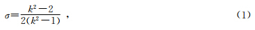
地壳厚度对波速比变化明显,可以同时考虑莫霍面Ps(陈凌等,2010)转换波和多次波时可以在假定地壳平均波速的情况下同时得到地壳厚度和地壳平均泊松比的估计值(查小惠等,2013).泊松比的关系:
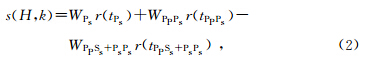
 ,对单个台站接受函数叠加得到叠加函数
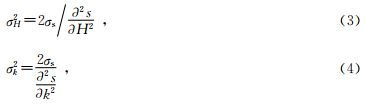
H-κ叠加分析方法误差可以通过下列两个式子计算得出:
在保证接收函数的优选条件下,我们还要考虑其他因素的干扰问题.分别取不同的P波平均速度进行测试,得到Vp与地壳厚度是正比关系,与波速比却是反比关系(Xu,2007).测试结果与前人研究结合分析得出选取纵波速度为6.3 km/s.方位角和频率选取都会对H-κ 叠加结果产生影响,方位角(朱介寿等,2002)不同接收函数得到的波形相差较大.本文选择背方位角在110°与230°之间,频率范围通过反复用不同数值测试,发现在0.03~0.5 Hz频段做滤波对高频噪声影响和低频较低分辨率两者的平衡方面效果最好(刘殿秘等,2007).加权系数的选择是根据不同接收函数波形选择的,Lombardi等(2008)等研究出现低的Ps加权系数和高的多次波加权系数在结构复杂区域可能会产生较大的误差.但在东北地区加权系数组合对结果影响不大,我们分别测试了几组加权组合,最后选定用0.7,0.2,0.1,部分台站接收函数及H-κ叠加结果如图 2所示.
 | 图 2 台站接收函数叠加图和H-κ搜索分析结果Fig. 2 Receiver functions and H-κ searching results for representative |
通过对研究区域布设的141个台站下的接收函数进行H-κ叠加分析,得到按震中距排列接收函数道集和东北地区地壳厚度和泊松比的平均值分布信息(表 1).中国东北地区自西向东地壳厚度有明显的差异.通过研究区域台站分布图可以看出,整体的台站分布并不是很均匀,台站分布高密度的地方主要集中在辽东地区、下辽河盆地和燕山带东部、吉林和吉林东部长白山地区最后还有黑龙江地区,所以为了便于分析本文把东北地区分为四个区块研究,主要地区是辽东地区和下辽河盆地及其燕山带东部、黑龙江地区、内蒙古东部地区和吉林地区及其东部长白山地区.表 1是研究区域里图 1中红色三角表示的所有台站信息和地壳厚度与泊松比分布.
|
|
表 1 研究区域台站下方地壳厚度和泊松比的分布 Table 1 Crustal thickness and Poisson ratio under the stations |
对接收函数H-κ叠加结果进行分析后,我们选取接收函数波形质量高,叠加图清晰的结果进行下一步的研究.图 3是研究区域地壳厚度分布图,可以看出东北地区的地壳厚度分布是在东西两侧厚度数值较高而中间地区则出现低值.内蒙古东部地区大兴安岭造山带地区地壳厚度,向东南相的佳木斯地块和其下方的兴凯地块还有长白山地区的地壳厚度较厚,厚度范围在34 km至37 km之间.在依兰-伊通断裂带和敦化-密山断裂带之间的吉林地区和长白山西南侧的地壳厚度偏薄,厚度分布大都在29 km至36 km之间.在往西南辽东地区和下辽河平原地壳厚度也很薄,通过地壳厚度分布图我们不难看出在该区域内地壳厚度变化程度之复杂,地壳厚度范围在29 km至34 km之间厚度的平均值在33 km左右.小兴安岭褶皱带和张广才岭地区的地壳厚度范围大约为30 km至32 km之间,大兴安岭东侧地区由西向东穿过重力梯度带地壳厚度由34 km减小到30 km.图 2分别是黑龙江地区和长白山地区选取的H-κ搜索结果.
 | 图 3 东北地区地壳厚度分布Fig. 3 The crust thickness distribution in northeast China |
与地壳厚度对应的东北地区的泊松比的分布情况,泊松比在整个研究区域变化很复杂,在依兰-伊通断裂带和敦化-密山断裂带之间的变化尤为复杂.整体上看地壳厚度从松辽盆地中间相向两侧不断变小,而泊松比值却是向两侧变大的过程.辽东地区泊松比变化相对稳定,主要变化范围在0.245到0.291之间.小兴安岭褶皱带和张广才岭地区的泊松比数值较大变化范围在0.283到0.311之间.吉黑褶皱带地区泊松比变化范围在0.242到0.321之间.大兴安岭西缘穿过重力梯度带地区地壳厚度减薄但是泊松比自西向东由0.291增加到0.332.图 4是台站地壳泊松比的变化图.
 | 图 4 东北地区泊松比变化分布Fig. 4 Poissons ratio change distribution in northeast China |
通过对中国东北地区固定台站下方接收函数进行H-κ叠加搜索分析,获得了东北地区和华北克拉通北缘地壳厚度与平均波速比信息(王新胜等,2012).研究区域的地壳厚度普遍存在地壳厚度减薄,泊松比变化相对复杂,地壳厚度与海拔的相关关系存在区域差异.这些结果表明了地壳结构的强烈横向不均匀性,暗示着地壳可能经历了强烈拉涨和减薄过程(张兴洲等,2006).内蒙古东部地区地壳较厚大致随着海拔增高逐渐增厚,波速比变化相对平稳,在南北重力梯度带向东地壳厚度明显减薄(郑亚东等,2000).黑龙江地区从吉黑褶皱带向佳木斯地块地壳厚度呈增厚的趋势,泊松比变化明显,这种差异可能来自于太平洋板块俯冲作用不同程度的响应(张广成等,2013).辽东地区地壳相对较薄且厚度变化范围小但是变化相对复杂,泊松比相对稳定;西侧燕山带地壳相对较厚且由东向西厚度显著增加(底青云等,2013),泊松比分布范围较大.这一特征表明了这两部分对中亚造山带增生和太平洋板块俯冲构造过程.
从得到的结果不难看出中国东北地区地下结构变化复杂,存在明显的区域差异性.与前人结果对比,大兴安岭造山带地壳厚度在30 km至34 km,穿过重力梯度带地壳厚度变薄.莫霍界面起伏不大,变化相对平缓,与Liu等(1992)等的结果基本一致.Li等(1993)等采用深地震测深资料获得了中国大陆的地壳厚度分布,发现在本文研究区,燕山带最西端和兴蒙造山带内部的地壳较厚.本文研究结果得到该区域也同样得到了约37 km的地壳厚度.在依兰-伊通断裂附近开始变深,地壳厚度有加厚趋势,在敦化-密山断裂处出现明显的错断,而且在依兰-伊通断裂和敦化-密山断裂之间,显示出两个界面.在敦化-密山断裂以东地区莫霍面减薄,地壳厚度变薄.东边界是郯庐断裂之一的依兰-伊通断裂,此凹陷造成松辽盆地内地壳厚度变厚,与布格重力异常图和满洲里-绥芬河地学断面地震探测的结果截然相反,认为造成这种和前人结果有如此巨大的出入原因是松辽盆地内存在巨厚的沉积层.Ps震相的到时与地壳厚度有密切关系,其大小与地壳厚度成正相关关系. 5 结 论
根据研究结果显示,中国东北地区的地壳厚度分布是在东西两侧厚度数值较高而中间地区则出现低值.内蒙古东部地区大兴安岭造山带地区地壳厚度(危自根等,2011),向东南佳木斯地块和其下方的兴凯地块还有长白山地区的地壳厚度较厚,厚度范围在34 km至37 km之间,地区对应的泊松比平均值在0.311,海拔高度范围在在0.24 km到1.515 km之间.在依兰-伊通断裂带和敦化-密山断裂带之间的吉林地区和长白山西南侧的地壳厚度偏薄(嵇少丞等,2009),厚度分布大都在29 km至36 km之间,对应海拔高度范围在0.05 km到0.775 km之间.西南向辽东地区和下辽河平原地壳厚度也很薄,通过地壳厚度分布图我们不难看出在该区域内地壳厚度变化程度之复杂,地壳厚度范围在29 km至34 km之间,泊松比主要变化范围在0.245到0.291之间(郑秀芬等,2009),该地区的地形复杂变化表明了东北地区地壳在可能存在着沉降、侵蚀或垂向运动等过程,泊松比值较大,有可能该区域由于其自身的地壳结构复杂性和紧邻太平洋板块前缘从而在中新生代遭受到了与太平洋板块俯冲相关的更为强烈的地壳减薄或幔源物质上涌.小兴安岭褶皱带和张广才岭地区的地壳厚度范围大约为30 km至32 km之间,泊松比数值较大变化范围在0.283到0.311之间.黑龙江地区吉黑褶皱带地壳厚度范围在29 km到35 km之间,海拔高度范围在在0.14 km到0.58 km之间,吉黑褶皱带地区泊松比变化范围在0.242到0.321之间.研究区域内燕山带地壳厚度和泊松比复杂的变化特征显示,该地区可能受到中亚造山带增生和太平洋板块俯冲的共同影响,从而发生了更为复杂的地壳改造形变.东北地区构造演化与东北亚地区大地幔内软流圈上涌与西太平洋板块俯冲滞有着密切的相关.东北地区的岩浆活动在矿产与油气资源的形成过程中起着提供物源和深层控制作用.
致 谢 感谢中国科学院地质与地球物理研究所地震台阵实验室提供流动地震数据资料;感谢中国地震局地球物理研究所“国家数字测震台网数据备份中心”提供固定台站地震波形数据;感谢艾印双和许卫卫分别提供地壳结构的接收函数波形反演和技术指导.| [1] | Ai Y S, Zheng T Y, Xu W W, et al. 2003. A complex 660 km discontinuity beneath northeast China[J]. Earth Planet. Sci. Lett., 212(1-2): 63-71. |
| [2] | Chen L, Wen L X, Zheng T Y. 2005. A wave equation migration method for receiver function imaging: 1. Theory[J]. J. Geophys. Res., 110(B11): B11309, doi: 10.1029/2005JB003665. |
| [3] | Chen L, Zheng T Y, Xu W W. 2006. A thinned lithospheric image of the Tanlu Fault Zone, eastern China: constructed from wave equation based receiver function migration[J]. Journal of Geophysical Research, 111(B9): B09312. doi: 10.1029/2005JB003974. |
| [4] | Chen L, Cheng C, Wei Z G. 2009. Seismic evidence for significant lateral variations in lithospheric thickness beneath the central and western North China Craton[J]. Earth and Planetary Science Letters, 286(1-2): 171-183. |
| [5] | Chen L. 2009. Lithospheric structure variations between the eastern and central North China Craton from S- and P-receiver function migration[J]. Phys. Earth Planet. Interiors, 173(3-4): 216-227. |
| [6] | Chen L, Cheng C, Wei Z G. 2010. Contrasting structural features at different boundary areas of the North China Craton and its tectonic implications[J]. Advances in Earth Science (in Chinese), 25(6): 571-581. |
| [7] | Dai L M, Li S Z, Lou D, et al. 2013. Numerical modeling on the stress field in the Huanghua depression, Bohai Bay basin[J]. Chinese J. Geophys. (in Chinese), 56(3): 929-942, doi: 10.6038/cjg20130321. |
| [8] | Darbyshire F A, Larsen T B, Mosegaard K, et al. 2004. A first detailed look at the Greenland lithosphere and upper mantle, using Rayleigh wave tomography[J]. Geophys. J. Int., 158(1): 267-286. |
| [9] | Di Q Y, Fang G Y, Zhang Y M. 2013. Research of the Surface Electromagnetic Prospecting (SEP) system[J]. Chinese J. Geophys. (in Chinese), 56(11): 3629-3639, doi: 10.6038/cjg20131104. |
| [10] | Du X J, Meng L S, Zhang M R, et al. 2009. Research on fault distribution and tectonic divisions in northeast China in terms of gravity field[J]. Journal of Earth Sciences and Environment, 31(2): 200-206. |
| [11] | Evernden J F. 1953. Direction of approach of rayleigh waves and related problems: (Part I) [J]. Bull. Seism. Soc. Am., 43(4): 335-374. |
| [12] | Hao T Y, Liu Y K, Duan C. 1997. The characteristic of geophysical field in the east China and adjacent regions and its tectonics significance[J]. Chinese J. Geophys. (in Chinese), 40(5): 677-690. |
| [13] | Huang J L, Zhao D P. 2006. High-resolution mantle tomography of China and surrounding regions[J]. J. Geophys. Res., 111(B9): B09305, doi: 10.1029/2005JB004066. |
| [14] | Huang Z X, Li H Y, Zheng Y J, et al. 2009. The lithosphere of North China Craton from surface wave tomography[J]. Earth Planet. Sci. Lett., 288(1-2): 164-173. |
| [15] | Huang Z X, Xu Y, Hao T Y, et al. 2009. Surface wave Tomography of lithospheric structure in the seas of east China[J]. Chinese J. Geophys. (in Chinese), 52(3): 653-662. |
| [16] | Ji S C, Wang Q, Yang W C. 2009. Correlation between crustal thickness and poisson's ratio in the North China Craton and its implication for lithospheric thinning[J]. Acta Geologica Sinica (in Chinese), 83(3): 324-330. |
| [17] | Li M M, He Y M. 2011. Lithospheric structure beneath northeastern boundary region of the North China Craton from Rayleigh wave dispersion inversion[J]. Acta Seismologica Sinica (in Chinese), 33(2): 143-155. |
| [18] | Li S G, Xiao Y L, Liou D L, et al. 1993. Collision of the North China and Yangtse Blocks and formation of coesite-bearing eclogites: Timing and processes[J]. Chemical Geology, 109(1-4): 89-111. |
| [19] | Li S L, Mooney W D, Fan J C. 2006. Crustal structure of mainland China from deep seismic sounding data[J]. Tectonophysics, 420(1-2): 239-252. |
| [20] | Li S T, Mo X X, Yang S G. 1995. Evolution of circum pacific basins and volcanic belts in East China and their geodynamic background[J]. Earth Science-Journal of China University of Geosciences, 6(1): 48-58. |
| [21] | Liu D, Nutman A P, Compston W, et al. 1992. Remnants of ≥3800 Ma crust in the Chinese part of the Sino-Korean craton[J]. Geology, 20(4): 339-342. |
| [22] | Liu D M, Han L G, Weng A H, et al. 2007. Partial geophysical features of the northwest boundary in Songliao basin[J]. Progress in Geophysics (in Chinese), 22(6): 1722-1727, doi: 10.3969/j.issn.1004-2903.2007.06.006. |
| [23] | Lombardi D, Braunmiller J, Kissling E, et al. 2008. Moho depth and Poisson's ratio in the Western–Central Alps from receiver functions[J]. Geophys. J. Int., 173(1): 249-264. |
| [24] | Menzies M, Xu Y G, Zhang H F, et al. 2007. Integration of geology, geophysics and geochemistry: A key to understanding the North China Craton[J]. Lithos, 96(1-2): 1-21. |
| [25] | Nazalaybey S, Savage M, Sheehan A, et al. 1997. Shear-Wave velocity structure in the Northern basin and range province from the combined analysis of receiver functions and surface waves[J]. Bull. Seismol. Soc. Am., 87(1): 183-199. |
| [26] | Suteau-Henson A. 1990. Estimating azimuth and slowness from three-component and array stations[J]. Bulletin of the Seismological Society of America, 80(6B): 1987-1998. |
| [27] | Wang X S, Fang J, HSU Houtse, et al. 2012. Density structure of the lithosphere beneath North China Craton[J]. Chinese J. Geophys. (in Chinese), 55(4): 1154-1160, doi: 10.6038/j.issn.0001-5733.2012.04.011. |
| [28] | Wei Z G, Chen L, Yang X L. 2011. Transverse variations of crustal thickness and (VP/VS)ratio under the stations in the Liaodong anteclise-Yanshan belt-Xingmeng orogenic belt and their tectonic implications[J]. Chinese J. Geophys. (in Chinese), 54(11): 2799-2808, doi: 10.3969/j.issn.0001-5733.2011.11.010. |
| [29] | Wu Q J, Zeng R S. 1998. The crustal structure of Qinghai-Xizang plateau inferred from broadband teleseismic waveform[J]. Acta Geophysica Sinica (in Chinese), 41(5): 669-679. |
| [30] | Xu W W, Zheng T Y. 2005. Distribution of Poisson's ratios in the northwestern basin-mountain boundary of the Bohai Bay Basin[J]. Chinese J. Geophys. (in Chinese), 48(5): 1077-1084. |
| [31] | Xu Y G. 2007. Diachronous lithospheric thinning of the North China Craton and formation of the Daxin'anling-Taihangshan gravity lineament[J]. Lithos, 96(1-2): 281-298. |
| [32] | Yang B J, Liu W S, Wang X C, et al. 2005. Geophysical characteristics of Daxinganling gravitational gradient zone in the East China and its geodynamic mechanism[J]. Chinese J. Geophys. (in Chinese), 48(1): 86-97. |
| [33] | Zha X H, Sun C Q, Li S. 2013. The effects of dipping interface and anisotropic layer on the result of H-κ method[J]. Progress in Geophys. (in Chinese), 28(1): 121-131, doi: 10.6038/pg20130113. |
| [34] | Zhang G C, Wu Q J, Pan J T, et al. 2013. Study of crustal structure and Poisson ratio of NE China by H-K stack and CCP stack methods[J]. Chinese J. Geophys. (in Chinese), 56(12): 4084-4094, doi: 10.6038/cjg20131213. |
| [35] | Zhang X Z, Yang B J, Wu F Y, et al. 2006. The lithosphere structure in the Hingmong-Jihei (Hinggan-Mongolia-Jilin-Heilongjiang) region, northeastern China[J]. Geology in China (in Chinese), 33(4): 816-823. |
| [36] | Zhang Y Q, Zhao Y, Dong S W, et al. 2004. Tectonic evolution stages of the Early Cretaceous rift basins in Eastern China and adjacent areas and their geodynamic background[J]. Earth Science Frontiers (in Chinese), 11(3): 123-133. |
| [37] | Zheng T Y, Chen L, Zhao L, et al. 2006. Crust-mantle structure difference across the gravity gradient zone in North China Craton: Seismic image of the thinned continental crust[J]. Physics of the Earth and Planetary Interiors, 159(1-2): 43-58. |
| [38] | Zheng X F, Ouyang B, Zhang D N, et al. 2009. Technical system construction of Data Backup Centre for China Seismograph Network and the data support to researches on the Wenchuan earthquake[J]. Chinese J. Geophys. (in Chinese), 52(5): 1412-1417, doi: 10.3969/j.issn.0001-5733.2009.05.031. |
| [39] | Zheng Y D, Davis G A, Wang C, et al. 2000. Major Mesozoic tectonic events in the Yanshan belt and the plate tectonic setting[J]. Acta Geologica Sinica (in Chinese), 74(4): 289-302. |
| [40] | Zhu J S, Cao J M, Cai X L, et al. 2002. High resolution surface wave tomography in east Asia and west pacific marginal seas[J]. Chinese J. Geophys. (in Chinese), 45(5): 646-664. |
| [41] | Zhu L P, Kanamori H. 2000a. Moho depth variation in southern California from teleseismic receiver functions[J]. J. Geophys. Res., 105(B2): 2969-2980. |
| [42] | Zhu L P, Kanamori H. 2000b. Moho depth variation in southern California from teleseismic receiver functions[J]. Journal of Geophysical Research, 105(2): 2969-2980. |
| [43] | 陈凌, 程骋, 危自根. 2010. 华北克拉通边界带区域深部结构的特征差异性及其构造意义[J]. 地球科学进展, 25(6): 571-581. |
| [44] | 戴黎明, 李三忠, 楼达,等. 2013. 渤海湾盆地黄骅坳陷应力场的三维数值模拟分析[J]. 地球物理学报, 56(3): 929-942, doi: 10.6038/cjg20130321. |
| [45] | 底青云, 方广有, 张一鸣. 2013. 地面电磁探测系统(SEP)研究[J]. 地球物理学报, 56(11): 3629-3639, doi: 10.6038/cjg20131104. |
| [46] | 杜晓娟, 孟令顺, 张明仁. 2009. 利用重力场研究东北地区断裂分布及构造分区[J]. 地球科学与环境学报, 31(2): 200-206. |
| [47] | 郝天珧, 刘伊克, 段昶. 1997. 中国东部及其邻域地球物理场特征与大地构造意义[J]. 地球物理学报, 40(5): 677-690. |
| [48] | 黄忠贤, 胥颐, 郝天珧,等. 2009. 中国东部海域岩石圈结构面波层析成像[J]. 地球物理学报, 52(3): 653-662. |
| [49] | 嵇少丞, 王茜, 杨文采. 2009. 华北克拉通泊松比与地壳厚度的关系及其大地构造意义[J]. 地质学报, 83(3): 324-330. |
| [50] | 李明明, 何玉梅. 2011. 利用瑞雷面波反演华北克拉通东北部边界的岩石圈结构[J]. 地震学报, 33(2): 143-155. |
| [51] | 刘殿秘, 韩立国, 翁爱华,等. 2007. 松辽盆地西北边界部分地球物理特征[J]. 地球物理学进展, 22(6): 1722-1727, doi: 10.3969/j.issn.1004-2903.2007.06.006. |
| [52] | 卢造勋, 夏怀宽. 1992. 内蒙古东乌珠穆沁旗至辽宁东沟地学断面[M]. 地震出版社. |
| [53] | 王新胜, 方剑, 许厚泽,等. 2012. 华北克拉通岩石圈三维密度结构[J]. 地球物理学报, 55(4): 1154-1160, 011. |
| [54] | 危自根, 陈凌, 杨小林. 2011. 辽东台隆?燕山带和兴蒙造山带台站下方地壳厚度和平均波速比(VP/VS)的横向变化及其构造意义[J]. 地球物理学报, 54(11): 2799-2808, doi: 10.3969/j.issn.0001-5733.2011.11.010. |
| [55] | 吴庆举, 曾融生. 1998. 用宽频带远震接收函数研究青藏高原的地壳结构[J]. 地球物理学报, 41(5): 669-679. |
| [56] | 许卫卫, 郑天愉. 2005. 渤海湾盆地北西盆山边界地区泊松比分布[J]. 地球物理学报, 48(5): 1077-1084. |
| [57] | 杨宝俊, 刘万崧, 王喜臣,等. 2005. 中国东部大兴安岭重力梯级带域地球物理场特征及其成因[J]. 地球物理学报, 48(1): 86-97. |
| [58] | 查小惠, 孙长青, 李聪. 2013. 倾斜界面和各向异性地层对H-κ搜索结果的影响[J]. 地球物理学进展, 28(1): 121-131, doi: 10.6038/pg20130113. |
| [59] | 张广成, 吴庆举, 潘佳铁,等. 2013. 利用H-K叠加方法和CCP叠加方法研究中国东北地区地壳结构与泊松比[J]. 地球物理学报, 56(12): 4084-4094, doi: 10.6038/cjg20131213. |
| [60] | 张兴洲, 杨宝俊, 吴福元,等. 2006. 中国兴蒙—吉黑地区岩石圈结构基本特征[J]. 中国地质, 33(4): 816-823. |
| [61] | 张岳桥, 赵越, 董树文,等. 2004. 中国东部及邻区早白垩世裂陷盆地构造演化阶段[J]. 地学前缘, 11(3): 123-133. |
| [62] | 郑秀芬, 欧阳飚, 张东宁,等. 2009. “国家数字测震台网数据备份中心”技术系统建设及其对汶川大地震研究的数据支撑[J]. 地球物理学报, 52(5): 1412-1417, doi: 10.3969/j.issn.0001-5733.2009.05.031. |
| [63] | 郑亚东, Davis G A, 王琮,等. 2000. 燕山带中生代主要构造事件与板块构造背景问题[J]. 地质学报, 74(4): 289-302. |
| [64] | 朱介寿, 曹家敏, 蔡学林,等. 2002. 东亚及西太平洋边缘海高分辨率面波层析成像[J]. 地球物理学报, 45(5): 646-664. |