 2019, Vol. 62


2. 中国科学院地球科学研究院, 北京 100029;
3. 中国科学院大学, 北京 100049
2. Institutions of Earth Science, Chinese Academy of Sciences, Beijing 100029, China;
3. University of Chinese Academy of Sciences, Beijing 100049, China
腾冲火山地区位于云贵高原西部、青藏高原东南缘,处于印度板块和欧亚板块碰撞带的东侧.区域断裂发育,地质结构复杂,地震活动活跃.区内主要断裂包括龙川江断裂、怒江断裂、盈江断裂、龙陵断裂和畹町断裂等(图 1).根据区域地质研究,腾冲地块与怒江缝合带在侏罗纪-白垩纪时期与欧亚板块碰撞,新近纪时期缅甸微板块俯冲到腾冲地块下方,形成一系列新生代火山(Jiang, 1985; Socquet and Pubellier, 2005).火山自中部地区向东、西两侧, 形成年龄由新到老逐渐过渡.腾冲火山目前处于休眠期,但推测腾冲火山区地下岩浆作用依然活跃.地热研究表明,腾冲地块地表热流、地幔热流和深部地温均为全区最高值(周真恒等,1997);接收函数方法探测到腾冲和龙江附近存在莫霍面上隆(Yang et al., 2013);层析成像结果研究显示腾冲火山区下方地幔存在低速异常(Wang and Huangfu, 2004; Huang and Zhao, 2006;李飞等,2011;Lü et al., 2014;Huang et al., 2015),认为该区域存在地幔热物质上涌.

|
图 1 腾冲火山地区地形及断层分布 F1:龙川江断裂;F2:怒江断裂;F3:盈江断裂;F4:龙陵断裂;F5:畹町断裂;F6:苏典断裂;TCV:腾冲火山群,其中红色三角表示腾冲火山群分布;BS:保山;CN:昌宁;GD:固东;LC:陇川;LL:龙陵;LS:泸水;LX:潞西;SD:施甸;TC:腾冲;YD:永德;YJ:盈江;YP:永平.断层数据邓起东等(2003). Fig. 1 Map showing topography and fault distribution of the Tengchong volcanic area |
虽然前人研究推测火山区下方存在岩浆囊(Bai et al., 2001;王椿镛等,2002;秦嘉政等,2000;高星等,2008;张龙等,2015;Li et al., 2018),但是由于数据和分辨率等方面的原因,火山区地震活动性与区域构造的联系以及壳内岩浆囊的构造形态等还不够明确.本研究利用腾冲火山地区大量P波走时数据,使用双差层析成像方法,同时获得了腾冲火山及邻区(97.5°E—100°E,24°N—26°N)的地震精定位结果和P波三维速度结构,探讨了地震活动性与区域构造的联系和腾冲火山地区岩浆囊的构造特征.
1 数据和方法 1.1 双差层析成像方法Waldhauser和Ellsworth(2000)提出双差地震定位方法,引入事件对的到时残差之差(即双差)来求解地震定位问题.双差地震定位没有主事件,满足一定条件的事件可建立事件对,定位精度不依赖于单个事件.Zhang和Thurber(2003, 2006)基于双差地震定位方法提出双差层析成像方法,该方法与传统走时层析成像方法相结合,利用相邻地震之间走时残差之差和地震到台站之间的绝对走时进行震源位置和速度结构联合反演.
基于射线理论的体波走时方程可以写为:

|
(1) |
式中Tki表示台站k记录到的第i次地震到时,ti表示事件i的发震时刻,u是慢度矢量,ds是路径积分元,
将式(1)一级泰勒展开,并用三维网格速度模型离散介质,可以得到线性方程:

|
(2) |
rki是台站k观测i次地震到时和理论到时之差.Mik是地震i到台站k的射线路径的分段数,wmn是以第m个节点为中心的第n个网格点插值加权系数.
第j和第i次地震在k台站观测到时之差和理论到时之差可以表示为:

|
(3) |
式中rkj-rki称为双差, 即为震源i和震源j的观测到时之差和理论到时之差的残差,即

|
(4) |
假设有的地震(i,j=1, 2,…,p),每个地震有Np到时,(2)式写成矩阵形式:

|
(5) |
式中Ap(Np×4)是震源参数和发震时刻的偏微分矩阵,ΔXp(4×1)是地震位置参数和发震时刻的扰动量矢量,Cp(Np×L)是模型偏微商矩阵(路径长度乘以节点权重),ΔM(L×1)是慢度扰动量矢量,ΔTp(Np×1)是到时残差矢量.
方程(5)写成矩阵的形式为:

|
(6) |
实际反演中使用LSQR求解方程:
|
(7) |
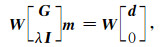
其中W为每个方程的权重因子w构成的矩阵,w是绝对走时和相对走时的相对权重因子,G为M×4N偏微分矩阵(M为相对走时数目,N为地震数目),λ为阻尼因子,I是单位矩阵.
双差层析成像方法被广泛运用于震源区精细速度结构反演、火山区速度结构反演以及俯冲带高分辨率成像等方面(Thurber et al., 2004, 2007; Allam et al., 2014; Watkins et al., 2018),对于认识火山、地震的孕育和发生规律具有重要作用.
1.2 数据处理本次研究收集了腾冲火山周边区域(97°E—100.5°E,23.5°N—26.5°N)15个固定台站记录到的1990年至2017年的7923次地震,共62577个P波绝对走时和397440个P波相对走时数据(图 2).主要讨论腾冲及邻近区域(97.5°E—100°E,24°N—26°N)岩石圈结构(图 3红框所示区域).研究区域内地震数据量大,射线覆盖密集,为该区域速度结构精细研究提供了良好的数据基础.

|
图 2 地震P波震中距-走时图 Fig. 2 Traveltime-hypocenter distance curve of P waves |

|
图 3 研究区域内P波射线分布 黑色三角表示台站位置,红色三角表示腾冲火山,蓝线表示P波射线路径. Fig. 3 Distribution of P-wave ray paths used in this study Black triangles are seismic stations. Red triangles are volcanoes. Blue lines denote P wave ray paths. |
双差层析成像中假定震源位置接近的地震产生的地震波的传播路径相似,因此利用双差层析成像方法联合反演地震定位和速度结构需要对数据进行筛选.本研究中限制相邻地震之间间距小于20 km,并且每个地震最少记录台站数为5个.研究区域横向网格大小为0.25°×0.25°,依据crust1.0地壳模型(Laske et al., 2013)建立纵向一维初始速度模型,如表 1所示.纵向网格深度为-1.5 km,0 km,8 km,15 km,22 km,29 km,34 km,39 km,80 km,程序实际运行中,任意一点的速度值可以由周围8个节点插值得到.
|
|
表 1 一维初始速度模型 Table 1 The 1-D initial velocity model |
双差层析成像研究中光滑因子用来约束慢度的变化量,阻尼因子同时约束了地震位置和慢度的变化量(肖卓和高原,2017).我们利用L曲线(Hansen, 1992; Hansen and O′Leary, 1993)选取最佳阻尼参数和光滑因子(如图 4).图 4中(a)横坐标表示慢度变化量归一化范数,图 4中(b)横坐标表示地震位置和慢度变化量归一化范数,纵坐标均表示总走时残差的归一化范数.光滑因子选择40,阻尼因子选择150.经过20次迭代反演,走时残差的均方差从0.27 s下降为0.09 s.

|
图 4 利用L曲线法选择光滑因子(a),利用L曲线法选择阻尼因子(b) Fig. 4 Parameter of smooth (a) selected by L curve method, Parameter of damp (b) selected by L curve method |
为了检验速度结构反演的可靠性及空间分辨能力,我们进行了检测板测试.在0.25°×0.25°的网格点输入±5%的速度异常,按照与实际反演一致的反演参数进行反演.测试结果显示,在深度0~39 km内,射线相对集中的区域具有良好的反演分辨能力(图 5).

|
图 5 不同深度检测板测试结果 Fig. 5 Checkerboard test results for varied depths |
地震与断裂的潜在活动有着密切的联系,更为精确的地震定位可以帮助我们更好的认识壳内断裂的分布及活动规律.我们截取东西和南北方向两条剖面,并将剖面10 km范围内的地震投影到剖面上(图 6、图 7).沿25°N纬线的剖面自西向东穿过苏典断裂、盈江断裂、龙川江断裂、怒江断裂等断裂.在苏典断裂和盈江等主要断裂附近,地震呈现丛集的线性分布特征.沿98°E经线的剖面自北向南穿过苏典断裂、盈江断裂、龙陵等断裂,同样可以清晰的看到在三个主要断裂对应的纬度方向,精定位后的地震呈现丛集的分布特征.我们的地震精定位结果显示,腾冲火山地区地震分布与断层具有显著的对应关系,区域断裂构造活跃.

|
图 6 地震定位前震中分布 Fig. 6 Distributions of earthquake epicenters before relocating |

|
图 7 地震定位后震中分布 Fig. 7 Distributions of earthquake epicenters after relocation |
腾冲火山区的岩浆源和热流通道一直是地球物理探测关注的重点.前人研究发现该区域地幔存在地震波低速并推测腾冲火山下方存在岩浆囊(秦嘉政等,2000;Bai et al., 2001;贺传松等,2004;Huang and Zhao, 2006;赵慈平等,2006;Pei et al., 2007;Xu et al., 2012),但是由于研究数据、方法及分辨能力等方面的差异,岩浆囊数量、横向尺度和深度范围等仍存在较大的不确定性.赵慈平等(2006)利用相对地热梯度推测上地壳(4~12 km)存在3个岩浆囊.地壳三维速度成像(楼海等,2002)和大地电磁测深结果(Bai et al., 2001)推测岩浆囊深度分别为7~27 km、12 km以下和4~12 km.前人推测腾冲火山地区中地壳低速区代表了仍处于活动状态的壳内岩浆源,热流通道有可能通过腾冲断裂延伸至地壳深部,地幔深处热物质可能向地壳岩浆囊流动(Lei et al., 2009, 2014;杨晓涛等,2011;Huang et al., 2015).Wang和Huangfu(2004)认为低速异常源于上地幔源区的热活动和岩浆分异作用.秦嘉政等(2000)、胥颐等(2017)提出腾冲北部几座火山下方存在相互连通的壳内岩浆囊的观点.Ye等(2018)给出了该区域下方存在岩浆囊的大地电磁学证据.
我们使用了相对前人研究更多更新的地震走时数据,获得了更高分辨率的三维速度结构.图 8显示了我们获得的地壳和上地幔顶部速度结构的横向变化,可以看出在研究区域内,P波速度结构存在明显的横向不均匀性.15 km深度及29 km深度上,火山群临近区域存在明显的低速区,盈江断裂周围存在低速区,与前人接收函数(贺传松等,2004)、大地电磁(孙洁等,1989)和层析成像结果(曹令敏等,2013)一致.在39 km深度上,火山群临近区域存在较大规模的低速异常,与王椿镛等(2002)人工地震测深结果吻合.由于边界处分辨率不高,对区域边界附近的结构不做讨论.结合垂直剖面(图 9),在中上地壳可见多个地震波低速区存在于腾冲火山群东西两侧,低速区P波速度比整个区域地壳速度平均值低超过15%.赵慈平等(2006)的相对地温梯度结果与Bai等(2001)的大地电磁测深结果认为低速区存在于腾冲火山下方5~25 km的深度,而我们的研究显示10 km和25 km存在多个低速区,我们认为这代表地壳内的岩浆囊,并且岩浆囊之间可能存在热流通道连通.以往研究认为腾冲火山附近存在三个岩浆囊(楼海等,2002;赵慈平等,2006),我们的结果认为腾冲火山下方存在四个岩浆囊,这与Li等(2018)利用接收函数与面波资料新获得的岩浆囊模型具有很高的一致性.综合成像结果,我们认为腾冲火山地区地幔热物质以较大规模上涌到地幔顶部,进而在地壳内上侵,并在较浅区域以岩浆囊形式存储,壳内岩浆囊之间可能存在岩浆通道.

|
图 8 研究区不同深度P波速度结构图 Fig. 8 Horizontal slices of P-wave velocity images at varied depths |

|
图 9 垂直剖面P波速度结构图 Fig. 9 Vertical profiles of P-wave velocity structure |
本文利用云南腾冲火山地区15个固定台站记录的7923次地震的P波到时资料,采用双差层析成像方法,反演得到腾冲火山地区及周围地区地壳及上地幔顶部三维P波速度结构和地震重定位结果.通过联合反演获得的地震重定位结果显示,地震呈现出明显的条带状分布,丛集地震展布特征与断裂构造存在明显的对应关系,显示区域内断裂构造活跃.速度成像结果显示,腾冲火山地区地壳内存在明显的地震波低速区,P波速度比整个区域地壳速度平均值低超过15%,上地幔顶部存在规模较大的低速异常区.推测腾冲火山地区存在较为显著的地幔热物质上涌以及向地壳的侵入,中上地壳存在多个岩浆囊,壳内岩浆囊之间可能存在岩浆通道.获得的高分辨率三维P波层析成像结果,为进一步认识火山地区岩浆存储特征以及地震分布与区域构造之间的关系提供了新的地震学依据.
致谢 感谢国家地震科学数据共享中心提供的震相数据,感谢中国科学技术大学张海江教授提供的TomoDD程序.本文使用了GMT软件(Wessel et al., 2013)进行制图.
Allam A A, Ben-Zion Y, Kurzon I, et al. 2014. Seismic velocity structure in the hot springs and trifurcation areas of the San Jacinto fault zone, California, from double-difference tomography. Geophys. J. Int., 198(2): 978-999. DOI:10.1093/gji/ggu176 |
Bai D H, Meju M A, Liao Z J. 2001. Magnetotelluric images of deep crustal structure of the Rehai geothermal field near Tengchong, Southern China. Geophys. J. Int., 147(3): 677-687. DOI:10.1046/j.0956-540x.2001.01568.x |
Cao L M, Xu Y, Wu S G. 2013. Finite difference tomography of the crustal velocity structure in Tengchong, Yunnan province. Chinese J. Geophys. (in Chinese), 56(4): 1159-1167. DOI:10.6038/cjg20130411 |
Deng Q D, Zhang P Z, Ran Y K, et al. 2003. Active tectonics and earthquake activities in China. Earth Science Frontiers (in Chinese), 10(S1): 66-73. |
Gao X, Guo Z, Wang W M, et al. 2008. Crust structure beneath Tengchong-Lincang region, Yunnan province, revealed by transform function. Chinese J. Geophys. (in Chinese), 51(2): 451-459. |
Hansen P C. 1992. Analysis of discrete ill-posed problems by means of the L-curve. SIAM Res., 34(4): 561-580. DOI:10.1137/1034115 |
Hansen P C, O'Leary D P. 1993. The use of the L-curve in the regularization of discrete ill-posed problems. SIAM J. Sci. Comput., 14(6): 1487-1503. DOI:10.1137/0914086 |
He C S, Wang C Y, Wu J P. 2004. S-wave velocity structure inferred from receiver function inversion in Tengchong volcanic area. Acta Seismol. Sin. (in Chinese), 26(1): 11-18. |
Huang J L, Zhao D P. 2006. High-resolution mantle tomography of China and surrounding regions. J. Geophys. Res., 111(B9): B09305. DOI:10.1029/2005JB004066 |
Huang Z C, Wang P, Xu M J, et al. 2015. Mantle structure and dynamics beneath SE Tibet revealed by new seismic images. Earth Planet. Sci. Lett., 411: 100-111. DOI:10.1016/j.epsl.2014.11.040 |
Jiang C S. 1985. Volcanoes and earthquakes in Tengchong area, Yunnan province, China. J. Seismol. Res., 8(1): 107-120. |
Laske G, Masters G, Ma Z T, et al. 2013. Update on CRUST1. 0-A 1-degree global model on earth's crust.//EGU General Assembly. Vienna, Austria.
|
Lei J S, Zhao D P, Su Y J. 2009. Insight into the origin of the Tengchong intraplate volcano and seismotectonics in southwest China from local and teleseismic data. J. Geophys. Res.:Solid Earth, 114(B5): B05302. DOI:10.1029/2008JB005881 |
Lei J S, Li Y, Xie F R, et al. 2014. Pn anisotropic tomography and dynamics under eastern Tibetan plateau. J. Geophys. Res.:Solid Earth, 119(3): 2174-2198. DOI:10.1002/2013JB010847 |
Li F, Zhou S Y, Su Y J, et al. 2011. Study on Pn-wave velocity structure and anisotropy in the Sichuan-Yunnan and its adjacent areas. Chinese J. Geophys. (in Chinese), 54(1): 44-54. DOI:10.3969/j.issn.0001-5733.2011.01.006 |
Li M K, Zhang S X, Wu T F, et al. 2018. Fine crustal and uppermost mantle S-wave velocity structure beneath the Tengchong volcanic area inferred from receiver function and surface-wave dispersion:constraints on magma chamber distribution. Bull. Volcanol., 80: 25. DOI:10.1007/s00445-018-1197-1 |
Lou H, Wang C Y, Huangfu G, et al. 2002. Three-dimensional seismic velocity tomography of the upper curst in Tengchong volcanic area, Yunnan Province. Acta Seismol. Sin. (in Chinese), 24(3): 243-251. |
Lü Y, Zhang Z J, Pei S P, et al. 2014. 2.5-Dimensional tomography of uppermost mantle beneath Sichuan-Yunnan and surrounding regions. Tectonophysics, 627: 193-204. |
Pei S P, Zhao J M, Sun Y S, et al. 2007. Upper mantle seismic velocities and anisotropy in China determined through Pn and Sn tomography. J. Geophys. Res., 112(B5): B05312. DOI:10.1029/2006JB004409 |
Qin J Z, Huangfu G, Li Q, et al. 2000. 3-D chromatography of velocity structure in Tengchong volcano areas and nearby. J. Seismol. Res. (in Chinese), 23(2): 157-164. |
Socquet A, Pubellier M. 2005. Cenozoic deformation in western Yunnan (China-Myanmar border). J. Asian Earth Sci., 24(4): 495-515. DOI:10.1016/j.jseaes.2004.03.006 |
Sun J, Xu C F, Jiang Z, et al. 1989. The electrical structure of the crust and upper mantle in the west part of Yunnan province and its relation to crustal tectonics. Seismology and Geology (in Chinese), 11(1): 35-45. |
Thurber C, Roecker S, Zhang H J, et al. 2004. Fine-scale structure of the San Andreas fault zone and location of the SAFOD target earthquakes. Geophys. Res. Lett., 31(12): L12S02. DOI:10.1029/2003GL0193 |
Thurber C, Brocher T M, Zhang H J, et al. 2007. Three-dimensional P wave velocity model for the San Francisco Bay region, California. J. Geophys, Res., 112(B7): B07313. DOI:10.1029/2006JB004682 |
Waldhauser F, Ellsworth W L. 2000. A double-difference earthquake location algorithm:method and application to the northern Hayward Fault, California. Bull. Seismol. Soc. Am., 90(6): 1353-1368. DOI:10.1785/0120000006 |
Wang C Y, Mooney W D, Wang X L, et al. 2002. Study on 3-D velocity structure of crust and upper mantle in Sichuan-Yunnan region, China. Acta Seismol. Sin. (in Chinese), 24(1): 1-16. |
Wang C Y, Huangfu G. 2004. Crustal structure in Tengchong Volcano-Geothermal Area, western Yunnan, China. Tectonophysics, 380(1-2): 69-87. DOI:10.1016/j.tecto.2003.12.001 |
Watkins W D, Thurber C H, Abbott E R, et al. 2018. Local earthquake tomography of the Jalisco, Mexico region. Tectonophysics, 724-725: 51-64. DOI:10.1016/j.tecto.2018.01.002 |
Wessel P, Smith W H F, Scharroo R, et al. 2013. Generic mapping tools:improved version released. Eos Trans. AGU, 94(45): 409-410. |
Xiao Z, Gao Y. 2017. Crustal velocity structure beneath the northeastern Tibetan plateau and adjacent regions derived from double difference tomography. Chinese J. Geophys. (in Chinese), 60(6): 2213-2225. DOI:10.6038/cjg20170615 |
Xu Y, Yang X T, Li Z W, et al. 2012. Seismic structure of the Tengchong volcanic area southwest China from local earthquake tomography. Journal of Volcanology and Geothermal Research, 239-240: 83-91. DOI:10.1016/j.jvolgeores.2012.06.017 |
Xu Y, Li X L, Wang S. 2017. Crustal thickness and Poisson's ratio of the Tengchong volcanic area in southwestern China. Chinese J. Geophys. (in Chinese), 60(6): 2256-2264. DOI:10.6038/cjg20170618 |
Yang H Y, Hu J F, Hu Y L, et al. 2013. Crustal structure in the Tengchong volcanic area and position of the magma chambers. J. Asian Earth Sci., 73: 48-56. DOI:10.1016/j.jseaes.2013.04.027 |
Yang X T, Xu Y, Liu J H, et al. 2011. Seismic tomography in the Tengchong volcanic area and its tectonic implication. Chinese J. Geophys. (in Chinese), 54(8): 2050-2059. DOI:10.3969/j.issn.0001-5733.2011.08.012 |
Ye T, Huang Q, Chen X, et al. 2018. Magma chamber and crustal channel flow structures in the Tengchong volcano area from 3-D MT inversion at the intracontinental block boundary southeast of the Tibetan Plateau. J. Geophys. Res.:Solid Earth, 123(12): 11112-11126. DOI:10.1029/2018JB015936 |
Zhang H J, Thurber C H. 2003. Double-difference tomography:the method and its application to the Hayward Fault, California. Bull. Seismol. Soc. Am., 93(5): 1875-1889. DOI:10.1785/0120020190 |
Zhang H J, Thurber C H. 2006. Development and applications of double-difference seismic tomography. Pure Appl. Geophys., 163(2-3): 373-403. DOI:10.1007/s00024-005-0021-y |
Zhang L, Hu Y L, Qin M, et al. 2015. Study on crustal and lithosphere thicknesses of Tengchong volcanic area in Yunnan. Chinese J. Geophys. (in Chinese), 58(5): 1622-1633. DOI:10.6038/cjg20150514 |
Zhao C P, Ran H, Chen K H. 2006. Present-day magma chambers in Tengchong volcano area inferred from relative geothermal gradient. Acta Petrol. Sin. (in Chinese), 22(6): 1517-1528. |
Zhou Z H, Xiang C Y, Deng W M. 1997. Lithospheric geothermal structure in Yunnan, China. Earthq. Res. China (in Chinese), 13(3): 213-222. |
曹令敏, 胥颐, 吴时国. 2013. 腾冲地区地壳速度结构的有限差分成像. 地球物理学报, 56(4): 1159-1167. DOI:10.6038/cjg20130411 |
邓起东, 张培震, 冉勇康, 等. 2003. 中国活动构造与地震活动. 地学前缘, 10(S1): 66-73. |
高星, 郭志, 王卫民, 等. 2008. 用转换函数方法研究腾冲-临沧地区地壳结构. 地球物理学报, 51(2): 451-459. DOI:10.3321/j.issn:0001-5733.2008.02.017 |
贺传松, 王椿镛, 吴建平. 2004. 腾冲火山区S波速度结构接收函数反演. 地震学报, 26(1): 11-18. DOI:10.3321/j.issn:0253-3782.2004.01.002 |
李飞, 周仕勇, 苏有锦, 等. 2011. 川滇及邻区Pn波速度结构和各向异性研究. 地球物理学报, 54(1): 44-54. DOI:10.3969/j.issn.0001-5733.2011.01.006 |
楼海, 王椿镛, 皇甫岗, 等. 2002. 云南腾冲火山区上部地壳三维地震速度层析成像. 地震学报, 24(3): 243-251. DOI:10.3321/j.issn:0253-3782.2002.03.003 |
秦嘉政, 皇甫岗, 李强, 等. 2000. 腾冲火山及邻区速度结构的三维层析成象. 地震研究, 23(2): 157-164. DOI:10.3969/j.issn.1000-0666.2000.02.010 |
孙洁, 徐常芳, 江钊, 等. 1989. 滇西地区地壳上地幔电性结构与地壳构造运动的关系. 地震地质, 11(1): 35-45. |
王椿镛, Mooney W D, 王溪莉, 等. 2002. 川滇地区地壳上地幔三维速度结构研究. 地震学报, 24(1): 1-16. DOI:10.3321/j.issn:0253-3782.2002.01.001 |
肖卓, 高原. 2017. 利用双差成像方法反演青藏高原东北缘及其邻区地壳速度结构. 地球物理学报, 60(6): 2213-2225. DOI:10.6038/cjg20170615 |
胥颐, 李雪垒, 汪晟. 2017. 腾冲火山区的地壳厚度和平均泊松比研究. 地球物理学报, 60(6): 2256-2264. DOI:10.6038/cjg20170618 |
杨晓涛, 胥颐, 刘建华, 等. 2011. 腾冲火山区的地震层析成像及其构造意义. 地球物理学报, 54(8): 2050-2059. DOI:10.3969/j.issn.0001-5733.2011.08.012 |
张龙, 胡毅力, 秦敏, 等. 2015. 云南腾冲火山区地壳及岩石圈厚度研究. 地球物理学报, 58(5): 1622-1633. DOI:10.6038/cjg20150514 |
赵慈平, 冉华, 陈坤华. 2006. 由相对地热梯度推断的腾冲火山区现存岩浆囊. 岩石学报, 22(6): 1517-1528. |
周真恒, 向才英, 邓万明. 1997. 云南岩石圈热结构. 中国地震, 13(3): 213-222. |