 2016, Vol. 59


2 Sanshandao Gold Mine, Shandong Gold Mining (Laizhou) Company Limited, Shandong Laizhou 261442, China
High-density resistivity method may be also called resistivity tomography or electrical imaging method, which as a new resistivity method was developed in the United States and Japan in the 1980's. This method has the abilities of electric profile and electrical sounding, and has been used widely for engineering foundation and quality detecting, mining hydrogeological exploration, water-inrushing channel monitoring, dike leakage detection, etc. (Zhang et al., 1994; Di et al., 1997, 2001, 2002, 2003, 2005; He et al., 1997; Huang, 2014; Leng et al., 2003; Ma and Wen, 2015; Song et al., 2015; Wu et al., 2015; Xiao et al., 2015; Yang et al., 2015).
The above-mentioned method is a kind of array exploration method. The field measurement of this method just needs to put all electrodes (tens to hundreds) on measuring points and takes SPC electrode change-over switch and microcomputer engineering electric pilot to realize fast and automatic data collection. This method can process data on-line, and monitor, in real time, the quality of the collected data. That makes changes in traditional working style of the resistivity method, reduces the labor intensity and improves data quality. Meanwhile, large amounts of collected data provide the prerequisites for processing and interpreting data precisely, and for electrical resistivity tomography. These works greatly optimize the electric data processing and interpretation, and give a reliable guaranty to shallow exploration of small target body with high precision.
The present research selected -135 m strike drift under seawater from the Xinli mine district of Sanshandao gold mine in Shandong province, as a site for the application of the high-density resistivity method. By setting electrodes in drift to measure electrical parameters of underground media and calculate their real resistivities, water-bearing structures were deduced in rockmass 200 meters below the strike drift. These results may provide important geophysical data for the hydrogeological work of seabed mine.
2 FIELD DETECTION AND DATA COLLECTION 2.1 Detecting Area OverviewThe detecting area is located in the Xinli mine district of Sanshandao gold mine on the Laizhou Bay coast in Shandong province. The main orebody of this district is Xinli gold deposit, which occurs between 0 and 35 meters below the main fracture of Sanshandao-Cangshang ore-controlling fault (F1) and under seawater entirely (Fig. 1). The orebody strikes N62°E, dipping 46° to the southeast with an average thickness of 25 m and originated from contact hydrothermal alteration. Xinli mine district was completed and put into operation in 2005. During this detection, seven mining midsections had been excavated (including -165 m, -200 m, -240 m, -280 m, -320 m, -360 m, and -400 m level), and the orebody under -165 m level was being mined. The prospector tunnels of -105 m and -135 m level have been reserved.

|
Fig. 1 Distribution of the Xinli gold deposit
1 Quaternary; 2 Cuizhao unit of Linglong super-unit; 3 Luanjiazhai unit of Malianzhuang super-unit; 4 Measured and supposed faults; 5 Gold deposits. |
In order to detect the distribution of the groundwater in rockmass around orebody and according to measurement condition of mining area, measuring line was laid in the strike drift at -135 m level. This drift penetrated into the monzonitic granite footwall, along the strike direction, of the mine vein, and was about 2 m of width and 2.5 m in height. In this drift, air was humid, leaking seawater was slipping from walls and the drift floor was covered with mud and water. Though these conditions could make implementation difficult, electrodes were given favorable conditions for connecting to ground.
According to on-the-spot actual survey and geophysical conditions, the working methods and projects of engineering geophysical exploration were formulated. One survey line was laid on the mid-line of the drift, about one meter away from each side wall of the drift. Dot spacing was five meter, and total length of the survey line was 635 m. High-density resistivity method was applied and data was acquired by 128 channels.
2.3 Operating PrincipleDouble-pole device, trielectrode device and four-pole device are three modes of observation of many highdensity electrical methods. The double-pole device is not commonly used in practical work because of two infinite electros. AMN and NMB of the trielectrode method, symmetrical four-pole and dipole-dipole device of the four-pole method are commonly used in practice.
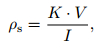
The four-pole device generally supplies current (I) through two current electrodes (A and B) into subsurface, and measures the potential difference (∆UMN) between two measuring electrodes (M and N). Then, apparent resistivity can be calculated by the following equation
|
where K is the electrode coefficient related to arrangement mode of the four electrodes.
To acquire much richer underground parameters and better geological explanation, Wenner, Dpole-Dpole, and Schlumberger were used, whose device working and data collecting schematic diagrams are shown in Fig. 2, Fig. 3, and Fig. 4.

|
Fig. 2 Wenner working and data collecting scheme |

|
Fig. 3 Dipole-Dipole working and data collecting scheme |

|
Fig. 4 Schlumberger working and data collecting scheme |
The electric exploration system of E60BN produced by Geopen was used in this field detection, which was composed of host, switching cable, electrode bar and related software. The switching cable is a heptcable which can connect multiple channels and is practically lightweight. The host can automatically and conveniently generate constant voltage and current power supply. The grounding electrode bar is stainless steel electrode bar 40 cm in length and 6 mm of diameter.
Because of low ground resistance, supply voltage of the three devices was set to the constant of 100 V. Taking working time and efficiency into account and to meet the demand of detection, the number of detection layer was set to 42 for Wenner, 60 for Dpole-Dpole and 30 for Schlumberger. Computer screen automatically monitored the whole working state and displayed measurement results in real time, as shown in Fig. 5.

|
Fig. 5 Field data collection and image of host computer |
Rock and soil can be considered for convenience as composed of two-phase media including framework mineral and water. Different mineral components can make rock and soil have different resistivity. The changes of structure and water-holding condition of rock and soil can also alter the resistivity in a large range.
The first step of the geological explanation is analyzing the relations between lithology and resistivity, then dividing conductive layers according to the values of the resistivity, and identifying geologic horizons, structural breaks and groundwater activities from their electrical changes. Finally electric profiles show the final results.
3.2 Interpretation FlowRaw data was imported firstly into computer, and after format conversion, the data was processed, including smoothing and eliminating flying-points etc. Finally the results of inversion were interpreted and mapped. For every layer data, outlier elimination was done followed by data inversion and contrastive analysis, for many times to ensure the reliability of inversion results.
A general sequence of data processing is: raw data→format conversion→processing and editing→inversion →data imaging.
3.3 Inversion ResultsApparent resistivities of the three aforementioned devices were measured on the mid-line of the drift. Outcome maps of each device include measured apparent resistivity pseudosection and inversed resistivity section, shown in Fig. 6, Fig. 7, and Fig. 8.

|
Fig. 6 Inversion results of the Wenner (The above one is measured apparent resistivity pseudosection and the below one is inversed resistivity section) |

|
Fig. 7 Inversion results of the Dipole-Dipole (The above one is measured apparent resistivity pseudosection and the below one is inversed resistivity section) |

|
Fig. 8 Inversion results of the Schlumberger (The above one is measured apparent resistivity pseudosection and the below one is inversed resistivity section) |
Gallery electrical prospecting is different from surface electrical prospecting, because the latter is a half space problem while the former is neither a half space problem nor a full space problem. Gallery electrical prospection will be affected by air layer when used in shallow drifts, and also influenced by the space of drifts themselves if they are in deep depth. There are several mining drifts below the -135 m drift, such as -165 m, -200 m, -240 m drifts that may give strong disturbances to the electrical survey. In addition, frequently raising and lowering the winches at pit mouth also strongly disturbs the results. To eliminate disturbances as many as possible, a lot of measures were taken, as demolishing the railway of the drift, suspending work of the winches at pit mouth and adopting multiple devices and repeating detection and the like. Because the working drift is buried relatively deep and the electrode spacing used in high-density resistivity method is small, the problem can be treated as a full space problem. And for the complexities of the gallery electrical prospection, its measurement results were only analyzed semi-quantitatively.
As can be seen from these interpretive figures, three interfaces exist (Fig. 9). The rock mass of 30 m thick under the level -135 m has a high resistivity of 600 Ωm. That of 30 m to 60 m has resistivity lower than 100 Ωm. Deeper than 60 m under the -135 m, the resistivity is higher than 4000 Ωm.

|
Fig. 9 Distribution of underground boundaries of resistivity (The zero is -135 m level crossdrift, left side of the zero point is the southwest section and right side of the zero point is the northeast section of the strike drift) |
Some interpretive results of each figure of section lines were analyzed briefly as follows:
(1) In Fig. 6, the locations of 160 m and from 250 m to 270 m on measuring line have low resistivity.
(2) In Fig. 7, the locations of 160 m, 240 m, 320 m, 400 m, 480 m and 530 m show low resistivity, which are obvious at 240 m, 320 m and 400 m.
(3) In Fig. 8, the locations from 183 m to 283 m have obvious resistivity, and especially that between 183 m and 243 m.
(4) The depth index of the electrical exploration can only be a semi-quantitative parameter. In this research, the transformed depth was a factor of 0.5 to 0.75 for theoretical depth and achieved the theoretical requirement of 200 m.
4 COMPREHENSIVE ANALYSIS AND RESULT VALIDATION(1) Comprehensive analysis of the inversion results of apparent resistivities acquired by Wenner, DpoleDpole and Schlumberger can give following knowledge. In vertical direction, the rock mass of 30 m thick under the measuring line is a high resistivity layer, which indicates no or little water is in the rock mass between the levels of -135 m and -165 m and most water has been discharged into -165 m drift. Field survey shows that in -165 m level drift there are fewer water leakage points. The interval ranging from 30 m to 60 m in depth under the line has low resistivity and bears fracture water. And a very high resistivity layer deeper than 60 m under the line reflects the aquosity of the rock mass under -200 m drift progressively decreases. Field survey found that in -200 m level drifts there were more water leakage points than in -165 m level and bigger seepage strength in local areas about 10 to 30 times the flow for the -165 m level in overlapping water seepage zone. These phenomena indicate the rockmass between -165 m and -200 m levels are rich in water. In -240 m level drift corresponding area, leakages are distributed sporadically and their seepage strength is relatively small. And between -240 m and -320 m levels, leakages are fewer and seepage strength smaller.
(2) In horizontal direction, obvious low resistivity anomalies were detected at the locations of 160 m, 183 m to 243 m, 250 m to 270 m, 320 m, 400 m, 480 m and 530 m on the measuring line, that correspond to the locations of water flowing fractures where the distance to crossdrift of the -135 m strike drift are 155 m, 132 m to 75 m, 65 m to 45 m and 0 m along southwestern section, and are 75 m, 155 m and 205 m along its northeastern section, respectively.
5 CONCLUSIONS(1) Applying Wenner, Dpole-Dpole and Schlumberger to detect water-bearing structures in a gallery of a mine under seawater obtained different effects. Wenner and Dpole-Dpole can contribute to vertical water bearing structures. Schlumberger is sensitive to horizontal water bearing structures. Besides, the outcome images of Wenner and Dpole-Dpole are triangular and not so good for interpretation. While the outcome images of Schlumberger are regular parallelogram and help for interpreting.
(2) Wenner, Dpole-Dpole and Schlumberger got similar inversion results of apparent resistivity and all indicated that there was a low resistivity layer between 30 m and 60 m in depth under the -135 m level, which was inferred as a major water-bearing structure within exploration depth. These detection results agree well with the conclusions of field hydrogeology surveys and hydrological structure analyses and that high-density resistivity method is feasible for uncovering water-bearing structures in drift.
ACKNOWLEDGMENTSThe research was supported by the National Key Research Projects of China (2016YFC0402802) and the National Natural Science Foundation of China (41172271, 41372323). Grateful appreciation is expressed for these supports.
| [] | Di Q Y, Wang M Y, Yan S M, et al. 1997. The application of the high density resistivity method for the seawave-proof dam in Zhuhai-Harbour. Progress in Geophysics (in Chinese) , 12 (2) : 79-88. |
| [] | Di Q Y, Shi K F, Wang M Y, et al. 2001. Water resources exploration with CSAMT and high density electric resistivity method. Progress in Geophysics (in Chinese) , 16 (3) : 53-57. |
| [] | Di Q Y, Wang M Y, Xu K, et al. 2002. The application to dam exploration with electical resistivity tomography. Journal of Engineering Geology (in Chinese) , 10 (1) : 74-77. |
| [] | Di Q Y, Wang M Y. 2003. Prospecting possibility with electric method for thin water-bearing rock layer upper the coal layers. Progress in Geophysics (in Chinese) , 18 (4) : 707-710. |
| [] | Di Q Y, Wu F Q, Wang G J, et al. 2005. Geophysical exploration over long deep tunnel for west route of south-to-north water transfer project. Chinese Journal of Rock Mechanics and Engineering (in Chinese) , 24 (20) : 3631-3638. |
| [] | He J S. 1997. Development and prospect of electrical prospecting method. Acta Geophysica Sinica (in Chinese) , 40 (S1) : 308-316. |
| [] | Huang X R. 2014. Application of mine high-density resistivity method in detection of water-filled karst fissures. Mining Safety & Environmental Protection (in Chinese) , 41 (5) : 56--58, 68. |
| [] | Leng Y B, Huang J T, Zhang Z X, et al. 2003. Research progress in scatheless detection of hidden troubles in embankments. Progress in Geophysics (in Chinese) , 18 (3) : 370-379. |
| [] | Ma W T, Wen J Q. 2015. Application of high density resistivity in testing karst grouting in Yun-gui railway subgrade. Railway Standard Design (in Chinese) , 59 (4) : 35-37. |
| [] | Song W P, Du W X. 2015. Application of high-density resistivity method in groundwater exploration of BaiYun western mine. Mining Engineering (in Chinese) , 13 (3) : 12-14. |
| [] | Wu X J, Zhang Q, Chen C L, et al. 2015. The application of comprehensive electrical prospecting to exploration of thermal mineral water in Wuzhishan area. Chinese Journal of Engineering Geophysics (in Chinese) , 12 (3) : 348-353. |
| [] | Xiao L L, Wei J C, Niu C, et al. 2015. Comprehensive application of electrical surveying watery property of tectonic in driving roadway. Coal Mining Technology (in Chinese) , 20 (3) : 21-24. |
| [] | Yang Y, Xu H F, Li Z, et al. 2015. Huolinhe reservoir seepage detection and anti-seepage effectiveness analysis. Journal of China Three Gorges University (Natural Sciences) (in Chinese) , 37 (3) : 11-14. |
| [] | Zhang S Z, Wang Q Y, Luo Y Z. 1994. An overview on the development of the electrical prospecting method in China. Acta Geophysica Sinica (in Chinese) , 37 (S1) : 408-424. |