 2015, Vol. 28
The Chinese Meteorological Society
Article Information
- WEN Yongren, XUE Lin, LI Ying, WEI Na, LÜ Aimin. 2015.
- Interaction Between Typhoon Vicente (1208) and the Western Pacific Subtropical High During the Beijing Extreme Rainfall of 21 July 2012
- J. Meteor. Res., 28(2): 293-304
- http://dx.doi.org/10.1007/s13351-015-4097-8
Article History
- Received September 4;
- in final form December 2, 2014


2 State Key Laboratory of Severe Weather, Chinese Academy of Meteorological Sciences, Beijing 100081;
3 Shanghai Typhoon Institute, China Meteorological Administration, Shanghai 200030;
4 National Meteorological Center, China Meteorological Administration, Beijing 100081
The heaviest rainfall in recent six decades fell inBeijing on 21 July 2012, reaching a record of 460 mmwithin 18 h, with the hourly rainfall rate exceeding85 mm(Zhang et al., 2013). Sun et al.(2013)foundthat multiple synoptic systems influenced this extremerainfall event, including a westerly trough, a cold front, a low-level mesoscale vortex, and moisture jet streams.Typhoon Vicente(1208) in the South China Sea wasconsidered to provide favorable conditions for transportingmoisture from the ocean to the rainfall area.Zhang et al.(2013)indicated that the progression ofTyphoon Vicente from the South China Sea towardGuangdong Province altered the southwesterly monsoonalflow ahead of the cold front by weakening it incentral China and reducing frontal rainfall.
Distant tropical cyclones(TCs)over the coastalregions of South China are usually found to be relatedto rainstorm events in North China(Jiang, 1983; Sun and Zhao, 2000; Ding et al., 2001; Cong et al., 2011, 2012), particularly from mid July to late August when TCs are active in the western North Pacific(WNP).Chen(2007)defined such rainfall, occurring outsidethe typhoon circulation but having a physical connectionwith the typhoon, as typhoon remote precipitation(TRP). Cong et al.(2011)investigated the statisticalcharacteristics of TRP events in China from 1971to 2006 and noted that, while TRP events occurredin 27 provinces across China, high frequencies wereparticularly observed in North China. Furthermore, Hou et al.(2006)showed that the correlation betweenextreme rainstorms in Shanxi Province in NorthwestChina and near-coast typhoons could reach 87%, and Sun et al.(2005)found that the TRP events in NorthChina are closely linked to the interaction betweenwesterly troughs and distant typhoons.
TRP events were also found in Japan and Korea.Wang et al.(2009)illustrated how TyphoonSongda(0418) enhanced precipitation over centralJapan. It seems that the effect of southerly typhoonsis to enhance northward moisture transport into a preconditionedprecipitation region. Murata(2009)alsodemonstrated that the moisture supply associatedwith the outer circulation of a typhoon is a crucialfactor for the enhancement of rainfall along the mountainsin Kii Peninsula in Japan. Yoshida and Itoh(2012)found that Typhoon Maggie(9903)hu. Similarly, Byun and Lee(2012)identified the critical factorsresulting in TRP events from a remote typhoon asa convectively unstable environment and large-scaleconvergence.
Similar distant effects from hurricanes in NorthAtlantic were first documented by Bosart and Carr(1978)in a case study on Hurricane Agnes(1972).A weak short-wavelength wave in the middle to uppertroposphere triggered the growth of remote heavyrainfall, and the moisture channel associated withthe circulation of Hurricane Agnes provided abundantwater vapor from the western Atlantic to the rainfallarea, significantly enhancing the rate and totalamount of rainfall. Cote(2007)classified this type of TC rainfall, which occurs in advance of recurving TCsover the eastern United States, as a predecessor rainevent(PRE). Schumacher et al.(2011)suggested thatdeep moisture originating from Hurricane Erin(2007) maximized low-level frontogenesis, thereby sustainingthe mesoscale convective system in the rainfall region.Galarneau et al.(2010) and Bosart et al.(2012)alsoshowed that the indirect effects of TCs include moisturetransport in their outer circulation, which drivesthe growth of PREs.
It is evident from the previous studies describedabove that TCs exert a remarkable effect on distantprecipitation, and the moisture transport associatedwith their outer circulation is a crucial factor in theenhancement of rainfall. However, the developmentof the moisture channel and its impacts on TRP arestill not fully understood and require further detailedinvestigations. In the WNP, the western Pacific subtropicalhigh(WPSH)plays an important role in thedevelopment of TCs, including the formation of moisturechannels associated with TC circulation, thataffects remote rainfall.
This study aims to explore the interactionsbetween TCs and the WPSH, and to evaluatetheir combined impacts on TRP events throughthe case study of the extreme Beijing rainstormof 21 July 2012. Various datasets, includingthe NCEP Global Forecast System’s(GFS)global data(0.5°×0.5°, 6 hourly, downloaded fromhttp://rda.ucar.edu/datasets/ds335.0/index.html#sfolwl-/data/ds335.0?g=9), surface observation data, and typhoon best-track data from the China MeteorologicalAdministration, are used in this study. Note:the GFS global data are a subset of the NCARHistorical Unidata Intenet Data Distribution(IDD)Gridded Model Data(ds335.0). The Advanced ResearchWeather Research and Forecasting(ARWWRF)model is used to perform numerical simulations and sensitivity experiments. Section 2 describes theextreme rainfall event in Beijing on 21 July 2012 and its numerical simulations. Section 3 presents an analysisof the sensitivity experiment results. Finally, theconclusions are given in Section 4.
2. Numerical simulation of the Beijing rainstorm of 21 July 20122.1 OverviewFigure 1 shows the 500-hPa geopotential heightdistribution at 1200 UTC 21 July 2012, when the rainstormoccurred in the Beijing area(indicated by thepink closed loop). It is found that a westerly trough(brown line)was present to the north of China atthis time. The WPSH body, indicated by the 5880-gpm geopotential height isoline, subsequently withdreweastward and remained over the East China Sea, while Typhoon Vicente moved westward after passingthrough the Bashi Channel. At the same time, alow-level vortex(indicated by D in Figs. 1 and 2)at850 hPa, originated in the northeast of the Qinghai-Tibetan Plateau, moved northeastward, and arrivedin the Beijing area at 1200 UTC 21 July(blue linein Fig. 1). It developed with its central geopotentialheight decreased by 20 gpm in the subsequent 6 h, correspondingto a peak in the 1-h accumulated rainfallover Beijing(Fig. 3b). The rainstorm ceased after thevortex center left the Beijing area.
 |
| Fig. 1. Distribution of geopotential height(contours; gpm) and wind vectors(arrows; m s−1)at 500 hPa at 1200 UTC21 July 2012 from the GFS global data. The pink closed loop denotes the Beijing area; the typhoon symbol indicatesVicente’s location at this time, the red line with dots shows its track between 1200 UTC 18 and 0000 UTC 22 July at6-h intervals; the brown line indicates a westerly trough; the letter D shows the location of the low-level vortex, and theblue line indicates its track at 850 hPa at 6-h intervals. |
 |
| Fig. 2. Distributions of moisture flux vectors(10−3 g cm−1 hPa−1 s−1; shadings indicate the regions with flux values≥ 9×10⁻³ g cm−1 hPa−1 s−1)at 850 hPa at(a)0000 UTC and (b)0600 UTC 21 July from the GFS global data. |
 |
| Fig. 3.(a)Distribution of observed(contours) and simulated(shaded)24-h accumulated rainfall(mm)from 0000UTC 21 to 0000 UTC 22 July 2012(blue closed loop denotesthe Beijing area; solid lines indicate the strike ofrainb and s).(b)Time series of observed(blue) and simulated(red)1-h accumulated rainfall averaged over theheavy rainfall area denoted by the black box in(a). |
Additionally, two water vapor channels were connectedto the Beijing area at 850 hPa during the rainfallevent(Fig. 2). The first was a low-level southwesterlymoisture jet from the Bay of Bengal, whichtransported water vapor to the north via the IndochinaPeninsula and central China. This delivered a largemoisture flux(≥ 9×10⁻³ g cm−1 h Pa−1 s−1), whicharrived in the Beijing area at 0000 UTC 21 July, before the rainstorm began(Fig. 2a). The secondwas a low-level southeasterly moisture jet extendingbetween Vicente and the WPSH. This flow, with alarge moisture flux, stretched northward and arrivedin North China at 0600 UTC 21 July(Fig. 2b). The two moisture channels converged near the Beijing area and provided abundant water vapor for the rainfallevent. During the rainfall process, the southwesterlychannel was gradually weakened, but the southeasterlychannel was enhanced, indicating its major rolein supplying water vapor to the Beijing rainfall.
Generally, it may be concluded that the heavyrainfall in Beijing on 21 July 2012 was triggered by theinteractions of the westerly trough, a low-level vortexfrom Northwest China, and moisture transport fromthe two low-level channels. The moisture jet betweenVicente and the WPSH was found to play an importantrole in supplying water vapor for the heavy rainfall.To further investigate the formation of this moisturechannel and its impact on the Beijing rainfall, a set of sensitivity experiments were performed withTCs of different intensities on the basis of the ARWWRFmodel.
2.2 Model configuration and verificationThe ARW-WRF model version 3.4 with two-waynested grids of 15- and 5-km horizontal spacings wasemployed in the following numerical simulations. Thefine-grid domain primarily covered North China, theHuang-Huai area, and the Jiang-Huai area(see Fig. 5a). The following schemes were used for both domains:the Lin et al. microphysics scheme(Lin et al., 1983), the Mellor-Yamada-Janjic planetary boundarylayer scheme(Janjic, 1994), the RRTM longwaveradiation scheme(Mlawer et al., 1997), and the Dudhiashortwave radiation scheme(Dudhia, 1989). TheKain-Fritsch cumulus convection scheme(Kain, 2004)was used in domain 1(D01; Fig. 5a)only. The NCEPGFS 0.5×0.5 global data were used to provide initial and lateral boundary conditions, which were updated every 6 h. The simulation ran from 1200 UTC 20 to1200 UTC 22 July 2012, including the heavy rainfallprocess.
Figure 3a shows the distribution of simulated accumulativerainfall on 21 July compared with observeddata. The simulated rainb and occurred over the Beijingarea and Hebei Province, stretching from southwestto northeast, as indicated by the black solid line, with several rainfall centers. This was similar to theobserved rainb and , except for a northwestward deviationin the position of around 0.3 latitude degree. Thesimulated maximum daily rainfall was 402 mm, occurringin the southwest part of the rainb and , which wasslightly less than the observed value of 460 mm. However, a second simulated rainfall center in the northeasternpart of the rainb and had a maximum dailyrainfall of 300 mm, which was more than the nearbyobservations of approximately 200 mm.
Figure 3b compares the observed and simulatedtemporal variation in 1-h accumulated rainfall, averagedover the heavy rainfall area of 39°–41°N, 114.5°–117°E(the black box in Fig. 3a). The trends of observed and simulated rain rates are similar, with apeak around 1200 UTC 21 July, although the simulationshows a delay of approximately 3 h. The maximumrain rates from both observation and simulationaround 15 mm h−1. Thus, the simulation has quitereasonably described the rain rate and rainfall distributionover Beijing on 21 July 2012. This simulationis therefore used as a control run(Ctrl)to providecomparison for sensitivity experiments in the followingtext. Additionally, under these conditions, thewestward track of Vicente was simulated with a littlenorthward deviation(red and black lines denote theobserved and simulated tracks respectively in Figs. 5a and 5b); however, its intensification process was predictedreasonably well(Fig. 5c).
2.3 Sensitivity experiments and resultsFour sensitivity experiments were designed to investigatethe impact of typhoons on rainfall over Beijing.The model configurations are the same as in theCtrl simulation mentioned above, except for TC intensity.A spatial scale separation method provided byLu and He(1992)was used to alter TC intensity. For this method, Legendre spherical harmonics are usedto divide the meteorological elements into high and low frequency waves according to a cutoff wavenumber.Given that a TC is approximately 800 km indiameter, the cutoff wavenumber is set as 15, i.e., theTC circulation is dominated by high frequency waves.New circulation fields, including TC circulations of differentintensities, are built through a modification ofthe high frequency waves, which can be expressed asfollows:
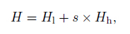
In our sensitivity experiments, s is set as 0.0, 0.5, 1.5, and 2.0 for experiments W1, W2, S1, and S2, respectively, to change the wind components u and v, and geopotential height of the initial fields. Consideringthe potential effects of the lateral boundaryconditions during the integral process, the GFS globaldata used to form lateral boundary conditions werealso modified in the same way. Figure 4 shows theinitial fields at 1200 UTC 20 July 2012 when Vicentehad just formed in the five different simulations. Comparedwith the Ctrl(Fig. 4a), the TC disturbance wasremoved in W1(Fig. 4b) and was weakened in W2(Fig. 4c). In both S1(Fig. 4d) and S2(Fig. 4e), TCcirculations were stronger than in the Ctrl, and thiswas particularly more prominent in S2.
 |
| Fig. 4. Initial wind vectors(m s−1)at 1200 UTC 20 July 2012 for(a)Ctrl, (b)W1, (c)W2, (d)S1, and (e)S2. |
Figure 5 displays the tracks and changes in intensityof the TCs in all simulations during the integrationperiod. TC tracks in the sensitivity experiments weresimilar to that in the Ctrl, with a maximum error ofapproximately 170 km in the later periods(Fig. 5b).TC intensity also changed over time reasonably consistently(Fig. 5c). In general, TCs were enhanced inS1 and S2 and diminished in W2 and W1 compared with the Ctrl during the integration period, implyingthat the intensity of the TCs was effectively modifiedaccording to the design requirements of the sensitivityexperiments. In W1, entire TC circulation wasremoved at the initial time and the low depression occurringsubsequently was too weak to be defined as atyphoon.
 |
| Fig. 5.(a)Simulation domains(the rectangle labeled D02 denotes the fine-grid area)with observed and simulated TCtracks, (b)typhoon tracks on a smaller scale, and (c)time series of the minimum sea level pressure(hPa)at the typhooncenter during the integration period. |
Figure 6 compares the distributions of heavy daily rainfall(greater than 300 mm only)in the Ctrl(shaded) and sensitivity experiments(contours)on 21July. In W1(Fig. 6a), the rain rate showed a distinctdecrease, with a maximum reduction of 90 mm at thesouthwest rainfall center, while the heavy rainfall areagenerally contracted and dispersed. In W2(Fig. 6b), the maximum rain rate decreased by 60 mm, and theheavy rainfall area also contracted slightly. In bothstronger typhoon runs, S1 and S2(Figs. 6c and 6d), the areas of heavy rainfall were exp and ed, particularlyin the northeast parts of the rainb and . The maximumrain rate was observed to increase significantly at bothrainfall centers in S1. For S2, the maximum rain rateat the southwest rainfall center was slightly less thanthe Ctrl, but was doubled in the northeast rainfall center.Thus, an enhanced(weakened)TC could be expectedto extend(contract)the rainfall area northward and increase(reduce)the rain rate. The two simulationswith the most notable differences, W1 and S2, are particularly focused on in the following sections.
 |
| Fig. 6. 24-h accumulated rainfall(mm)distributions(exceeding 300 mm only)in the Ctrl(shaded) and sensitivity(contours)experiments on 21 July 2012 for experiments(a)W1, (b)W2, (c)S1, and (d)S2. |
A TC over the WNP usually moves along thesouthern edge of the WPSH, interacting with theWPSH along its track(Chen and Ding, 1979). Figure 7 shows the variation in the WPSH representedby the 5880-gpm geopotential height isolines(solidlines)in all simulations. The WPSH was connectedwith the continental high over South Chinain all experiments at 0000 UTC 21 July beforethe Beijing rainstorm began(Fig. 7a). Thesetwo highs would subsequently break over SouthChina. At 1800 UTC 21(Fig. 7c), the 5880-gpmisoline was broken and the WPSH retreated eastwardquite obviously in S2(blue line), and the WPSH disconnectedfrom the continental high and withdrewsomewhat eastward in S1 and Ctrl(orange and redlines, respectively); however, the two highs remainedconnected in W1 and W2(black and green lines, respectively, in Fig. 7c)until 2100 UTC 21 July(figuresomitted). Because of the difference in timing ofthe WPSH disconnection from the continental high and its subsequent eastward movement, the positionsof the WPSH’s western edge in the four experimentsare different. In particular, the WPSH in S2 was approximately4° in longitude further east than in W1by 0000 UTC 22 July(Fig. 7d). Thus, it can be inferredthat a strengthened TC is more favorable to theeastward withdrawal of the WPSH. A stronger TC isusually associated with stronger horizontal vorticity and stronger cyclonic wind circulation(see the dashedisolines over the South China Sea in Fig. 7d, see alsoFig. 4). When moving northward, the stronger TC usually results in greater positive vorticity-driven convection, together with the larger-scale cyclonic circulation, pushing the WPSH to retreat eastward. Notably, there was little difference in the positions of the 5840-gpm isolines(dashed lines)over the midlatitude areasamong the sensitivity experiments, indicating that theposition of the westerly trough was barely affected bychanges in the distant TCs.
 |
| Fig. 7. Comparison of distributions of 5880-(solid lines) and 5840-gpm(dashed lines)geopotential height isolinesbetween the five simulations at(a)0000 UTC 21, (b)1500 UTC 21, (c)1800 UTC 21, and (d)0000 UTC 22 July. |
 |
| Fig. 8. Distributions of water vapor flux vectors(10−3 g cm−1 hPa−1 s−1; shaded area indicates values of ≥ 9×10⁻³ g cm−1 hPa−1 s−1)at 850 hPa in(a)Ctrl, (b)W1, and (c)S2; and vertical distributions of specific humidity(shaded; gkg−1) and their difference with the Ctrl(contours; g kg−1)along 40°N at 1800 UTC 21 July in(d)W1 and (e)S2. Thesymbols “–” and “+” indicate negative and positive anomaly centers of specific humidity, respectively. |
Figures 8d and 8e show vertical cross-sectionsof specific humidity along 40°N in W1 and S2 and their differences compared with the Ctrl at 1800UTC 21 July. The most remarkable difference occurredbetween 115°25′ and 117°35′E, which representsthe rainfall area over Beijing in both simulations.A maximum decrease center(≤ –2 g kg−1) and a second center(≤ –1 g kg−1)could be foundnear 700 hPa in W1(Fig. 8d), while a seriesof positive abnormal centers, denoted by “+” in Fig. 8e, could be found over the Beijing area inS2(Fig. 8e). Therefore, the high moisture layer wasnotably deeper in S2 than that in W1, indicating thata stronger TC would increase the magnitude of watervapor supply for the heavy rainfall.
3.3 Local precipitation conditionsAs mentioned in Section 3.2, TCs of different intensitieswould impact the activity of the WPSH and low-level moisture transport, which may alter the localprecipitation conditions of remote rainy areas inturn. Comparison of the time series of vertical velocitynear the heavy rainfall center(40.5°N, 116.7°E)in the northeastern part of the rainb and shows salient differences between W1 and S2 during the rainstorm(Figs. 9a–c). Compared with the Ctrl(Fig. 9a), theupdrafts decreased substantially in W1(Fig. 9b), butsignificantly increased in S2(Fig. 9c), with the largestincrease of approximately 70 × 10−2 m s−1. This suggeststhat local upward motion over the rainfall areais also sensitive to remote TC intensity. Moreover, the strongest ascending motion was found mainly inthe high-level troposphere in S2, implying the developmentof deeper convection in the presence of an enhancedTC.
 |
| Fig. 9. Temporal variations of vertical velocity(10−2 m s−1)in(a)Ctrl, (b)W1, and (c)S2, and temporal evolutionof vorticity(contours; 10−5s−1) and divergence(shading; 10−5 s−1)in(d)Ctrl, (e)W1, and (f)S2 at the heavy rainfallcenter(40.5°N, 116.7°E). |
Figures 9d–f show the temporal evolution of thevorticity(contours) and divergence(shading)over theheavy rainfall center(40.5°N, 116.7°E). During the heavy rainfall period from 1500 to 2100 UTC 21 July, positive vorticity and negative divergence were observedin the lower troposphere, whereas negative vorticity and positive divergence were dominant in the uppertroposphere for all three simulations. This is characterizedby cyclonic convergence in the lower layer and anticyclonic divergence in the upper layers. However, positive vorticity in the middle and lower layersdecreased notably when the TC was removed in W1(Fig. 9e)compared with the Ctrl(Fig. 9d). In contrast, both positive vorticity in the lower layers and negative vorticity in the upper layers were strengthenedin S2(Fig. 9f), implying that deeper convectionoccurred in the rainfall area under an enhanced TC.Thus, we can conclude that the local weather conditionsin Beijing become more favorable for a rainstormunder the effects of a stronger remote TC.
The variations in local rainfall conditions areclosely related to the combined effects of TCs and theWPSH. In strengthened TC experiments(e.g., S2), astrong southeasterly moisture channel developed and water vapor was easily transported from the tropicalocean to the low-level vortex area around Beijing(seeFig. 2). Consequently, the vorticity in the lower layerwas enhanced, which contributed to the developmentof a high-level southwesterly jet stream ahead of thewesterly trough. This in turn resulted in the intensificationof the high-level divergence on its right side overthe Beijing area. However, in the experiments witha weakened or removed TC(e.g., W1), the moisturechannel was also weakened and water vapor transportto the north was blocked by the WPSH, which is generallyunfavorable for the development of a vortex inthe Beijing area.
4. Concluding remarksThe extreme rainfall event in Beijing on 21 July2012 is closely related to the distant Typhoon Vicentethrough its supply of abundant water vapor tothe northern rainy region. It has been shown thatthe moisture channel between Vicente and the WPSHplayed a key role in the rainstorm process. The interactionbetween the WPSH and the TC, and theirassociated impacts on the rainstorm were investigated based on a WRFV3.4 control simulation and four sensitivityexperiments. The results indicate that TCs ofdifferent intensities can alter the rain rate and rainfalldistribution in distant areas. The rain rate wouldbe increased and the rain area would be exp and ed inthe presence of a strengthened TC, and vice versa.These differences are mainly attributed to the interactionbetween TC and the WPSH. In the presenceof an enhanced TC on its southwest side, the WPSHwould withdraw earlier and further to the east, whilethe WPSH would retreat eastward later if the TCwere removed or weakened. Thus, a strengthened TCwould lead to enhancement of the low-level southeasterlymoisture channel between the TC and theWPSH, allowing water vapor to be transported morenorthward along the rim of the WPSH. Conversely, the moisture channel would be weakened or blockedby the WPSH if the TC was weakened or removed.
It should be noted that the WPSH activity isdominant and can be affected by multiscale systems, such as a westerly trough, a Tibetan high, or a TC. Tosome extent, the impact of a TC on the WPSH maybe minor, and limited by its circulation size and intensity.Therefore, the interaction between TCs and theWPSH may differ from case to case, and the generalpatterns found here should be verified further withmore specific cases.
| Bosart, L. F., and F. H. Carr, 1978: A case study of excessive rainfall centered around Wellsville, New York. Mon. Wea. Rev., 106, 348-362. |
| Bosart, L. F., J. M. Cordeira, T. J. Galarneau, et al., 2012: An analysis of multiple predecessor rain events ahead of tropical cyclones Ike and Lowell: 10-15 September 2008. Mon. Wea. Rev., 140, 1081-1107. |
| Byun, K. Y., and T. Y. Lee, 2012: Remote effects of tropical cyclones on heavy rainfall over the Korean Peninsula—Statistical and composite analysis. Tellus A, 64, 14983, doi: 10.3402/tellusa.v64i0.14983. |
| Chen Lianshou and Ding Yihui, 1979: An Introduction to the Western Pacific Typhoon. Science Press, Beijing, 491 pp. (in Chinese) |
| Chen Lianshou, 2007: The studies and predictions of heavy rainfall related to the landing tropical cyclones. The Abstracts of Papers on the Fourteenth Symposium on the Tropical Cyclones, Shanghai, China, 6-8 November, 3-7. (in Chinese) |
| Cong Chunhua, Chen Lianshou, Lei Xiaotu, et al., 2011: An overview on the study of tropical cyclone remote rainfall. J. Trop. Meteor., 27, 264-270. (in Chinese) |
| Cong Chunhua, Chen Lianshou, Lei Xiaotu, et al., 2012: A study on the mechanism of the tropical cyclone remote precipitation. Acta Meteor. Sinica, 70, 717- 727. (in Chinese) |
| Cote, M. R., 2007: Predecessor rain events in advance of tropical cyclones. Master dissertation, Department of Atmospheric and Environmental Sciences, University at Albany, State University of New York, 200 pp. |
| Ding Zhiying, Zhang Xinqiang, He Jinhai, et al., 2001: The study of storm rainfall caused by interaction between the non-zonal high level jet streak and the far distant typhoon. J. Trop. Meteor., 17, 144-154. (in Chinese) |
| Dudhia, J., 1989: Numerical study of convection observed during the winter monsoon experiment using a mesoscale two-dimensional model. J. Atmos. Sci., 46, 3077-3107. |
| Galarneau, T. J., L. F. Bosart, and R. S. Schumacher, 2010: Predecessor rain events ahead of tropical cyclones. Mon. Wea. Rev., 138, 3272-3297. |
| Hou Jianzhong, Zhang Hong, Du Jiwen, et al., 2006: Ambient field and cloud-picture characteristics of typhoon and cold-front heavy rainfall in northeastern Tibet. Meteor. Sci. Technol., 34, 41-46. (in Chinese) |
| Janjić, I. Zaviša, 1994: The step-mountain Eta coordinate model: Further developments of the convection, viscous sublayer, and turbulence closure schemes. Mon. Wea. Rev., 122, 927-945. |
| Jiang Shangcheng, 1983: A synoptic model of the hard rain storm in westerly belt affected by the far distant typhoon. Acta Meteor. Sinica, 41, 147-158. (in Chinese) |
| Kain, J. S., 2004: The Kain-Fritsch convective parameterization: An update. J. Appl. Meteor., 43, 170-181. |
| Li Ying, Chen Lianshou, and Lei Xiaotu, 2006: Numerical study on impacts of upper-level westerly trough on the extratropical transition process of Typhoon Winnie (1997). Acta Meteor. Sinica, 64, 552-563. (in Chinese) |
| Lin, Yuh-Lang, Richard D. Farley, and Harold D. Orville, 1983: Bulk parameterization of the snow field in a cloud model. J. Climate Appl. Meteor., 22, 1065- 1092. |
| Lu Xianchi and He Bin, 1992: Two ways to perform initial data grid-spectral transform. Chinese J. Comput. Physics., 9, 768-770. (in Chinese) |
| Meng Zhiyong, Xu Xiangde, and Chen Lianshou, 2002: Mesoscale characteristics of the interaction between TC Tim (9406) and midlatitude circulation. Acta Meteor. Sinica, 60, 31-39. (in Chinese) |
| Mlawer, E. J., S. J. Taubman, P. D. Brown, et al., 1997: Radiative transfer for inhomogeneous atmospheres: RRTM, a validated correlated-k model for the longwave. J. Geophys. Res., 102, 16663-16682. |
| Murata, A., 2009: A mechanism for heavy precipitation over the Kii Peninsula acompanying Typhoon Meari (2004). J. Meteor. Soc. Japan, 87, 101-117. |
| Schumacher, R. S., T. J. Galarneau, and L. F. Bosart, 2011: Distant effects of a recurving tropical cyclone on rainfall in a midlatitude convective system: A high-impact predecessor rain event. Mon. Wea. Rev., 139, 650-667. |
| Sun Jianhua and Zhao Sixiong, 2000: Diagnoses and simulation of typhoon (Tim) landing and producing heavy rainfall in China. Chinese J. Atmos. Sci., 24, 223-237. (in Chinese) |
| Sun Jianhua, Zhang Xiaoling, Wei Jie, et al., 2005: A study on severe heavy rainfall in North China during the 1990s. Climatic Environ. Res., 10, 492-505. (in Chinese) |
| Sun Jianhua, Zhao Sixiong, Fu Shenming, et al., 2013: Multi-scale characteristics of record heavy rainfall over Beijing area on July 21, 2012. Chinese J. Atmos. Sci., 37, 705-718. (in Chinese) |
| Wang, Y. Q., Y. Q. Wang, and H. Fudeyasu, 2009: The role of Typhoon Songda (2004) in producing distantly located heavy rainfall in Japan. Mon. Wea. Rev., 137, 3699-3716. |
| Yoshida, K., and H. Itoh, 2012: Indirect effects of tropical cyclones on heavy rainfall events in Kyushu, Japan, during the Baiu season. J. Meteor. Soc. Japan, 90, 377-401. |
| Zhang Dalin, Lin Yonghui, Zhao Ping, et al., 2013: The Beijing extreme rainfall of 21 July 2012: “Right results” but for wrong reasons. Geophys. Res. Lett., 40, 1426-1431. |