 2019, Vol. 77
中国气象学会主办。
文章信息
- 王东海, 赵艳风, 翟盘茂. 2019.
- WANG Donghai, ZHAO Yanfeng, ZHAI Panmao. 2019.
- 持续性强降水的区域模式动力中期预报研究
- A study of the regional model medium-term dynamic forecasting of persistent severe rainfall
- 气象学报, 77(1): 1-14.
- Acta Meteorologica Sinica, 77(1): 1-14.
- http://dx.doi.org/10.11676/qxxb2018.042
-
文章历史
- 2017-11-09 收稿
- 2018-05-11 改回


2. 中国气象科学研究院灾害天气国家重点实验室, 北京, 100081
2. State Key Laboratory of Severe Weather, Chinese Academy of Meteorological Sciences, Beijing 100081, China
中国位于世界著名的东亚季风区, 随着东亚夏季风的爆发和北移, 中国南方进入雨季(Ding, et al, 2005; 武炳义等, 2011), 进入雨季的特征之一就是持续性极端强降水及其次生灾害频发。持续性强降水是一种连续暴雨事件, 一般指一定区域范围内连续3 d及以上逐日降水量不低于50 mm的过程(鲍名, 2007)。此类事件持续时间长, 影响范围广, 致灾性强, 直接或者间接地给人民的生产和生活造成严重的影响, 甚至威胁人民生命安全。如1998年夏季, 长江流域持续性强降水过程引发了全流域洪涝灾害, 造成直接经济损失2500亿元人民币, 死亡超过3000人(黄荣辉等, 1998)。2016年6月30日—7月6日的持续性强降水过程引发的洪涝、风雹、滑坡、泥石流等灾害, 造成江苏、安徽、江西、河南、湖北、湖南、广西、重庆、四川、贵州、云南11个省3100.8万人受灾, 164人死亡, 26人失踪。近60年来, 尤其是1990年以来, 中国区域性持续性暴雨呈现出频次增多、持续时间变长、强度增强、影响范围增大的趋势(Chen, et al, 2013), 如何提高此类事件的预报能力成为中外气象界关注的热点问题(翟盘茂等, 2013, 2016)。
区域模式是在全球预报场驱动下进行的高精度区域天气预报模式, 对于中小尺度天气预报有明显优势, 是提高降水预报的主要途径。区域模式的动力预报是灾害性天气预报的重要手段(矫梅燕等, 2006)。本研究对现有模式预报时效做进一步延伸, 在提高大尺度环流场预报时效和准确性的基础之上, 减小模式对中小尺度的预报误差, 延长持续性强降水的中期预报时效, 为防灾、减灾提供参考依据, 这正是目前国际大气科学领域研究的最前沿问题之一(Brunet, et al, 2010)。
持续性强降水过程是高影响天气事件, 如何将降水过程量级及落区的预报时效延伸到对政府有决策价值的时间长度(7 d以上)已成为气象领域面临的重大挑战。针对此类事件的预报研究多是集中在利用动力统计相结合的方法对大尺度低频环流进行模拟试验(Wheeler, et al, 2004; 陈官军等, 2012; 章基嘉等, 1994)及对环流和降水的预报做订正(Peng, et al, 2013; 刘琳等, 2013), 而从天气预报的角度对持续性强降水的模式动力预报研究较少。近几年来, 一些研究基于对持续性强降水形成机理及区域模式动力预报的认识, 从模式误差来源以及多尺度环流系统的模式预报评估方面对区域模式预报误差进行深入分析, 并对不同类型的误差有针对性地提出现有的模式改进动力预报方法及其发展和应用, 提出针对持续性强降水的动力中期预报理论框架。文中对近年来中国南方持续性强降水的区域模式动力中期预报研究进行概述。
2 模式动力中期预报的理论基础大气本身是不稳定的, 由于非线性的互相作用和模式误差的存在, 以及动力预报系统本身的不“完美”, 使预报误差随预报时间的延长而增大, 预报技巧随预报时效的延长而降低(郭换换等, 2016)。从动力预报的角度出发, 预报误差主要来源于初始场和预报模式, 主要从两个方面改进:(1)通过改进观测和同化系统, 减小初值的不确定性, (2)通过提高分辨率, 改进动力框架, 使模式更接近于实际大气(王东海等, 2011a)。
在目前的短期预报实践中, 一般要素预报误差中的相当大部分源自初值的误差, 而不是模式本身的误差(Pappenberger, et al, 2011; 杜钧, 2002), 初始场中不同的误差传播速度增大了初值的不确定性, 从而产生了一系列模式预报的不确定性(Jung, et al, 2010)。例如, 初始条件的误差容易引起高频振荡和计算不稳定, 产生虚假波动, 一般采用滤波同化的方法对其进行削弱(陆如华等, 1997)。此外, 初值的不确定问题还可以采用集合预报的方法来改善(Persson, et al, 2011), Lavers等(2013)研究分析了数值天气预报系统对2013年9月9—16日美国科罗拉多持续性强降水的预报效果, 表明集合预报可以提前4 d预报出降水初期的分布, 并且模式分辨率的提高对于累积降水的预报有一定的改进作用。
除了初始条件的误差以外, 模式本身的误差也是造成预报误差的原因之一。模式误差总体上可以分为系统误差和随机误差两种(Reynolds, et al, 2015), 其中, 系统误差是模式动力结构造成的, 如各种参数化过程、有限分辨率、不完美的边界条件等因素。模式系统性环流误差对于不同预报时效的来源不同(Lorenz, 1982), 如北太平洋中部大尺度反气旋环流误差对于中期及延伸期天气预报的系统误差均有一定的影响(Tibaldi, et al, 1990), 动能传输、高纬度天气尺度系统以及大气阻塞形式的预报不足主要影响延伸期天气预报的系统误差(Skamarock, 2004)。因此, 对于持续性强降水的高分辨率区域模式动力中期预报, 减小边界条件误差是改善模式系统误差的有效途径之一。
大范围持续性强降水过程的热力、动力和水汽条件一般是在天气系统的异常或持续少动形势背景下产生(Ding, et al, 1982; Piaget, et al, 2015; Samel, et al, 2003; 牛若芸等, 2012), 其降水量多少和持续时间与大气环流的持续异常所造成的干冷空气和暖湿空气持续交汇有关(Chen, et al, 2014a; Qian, et al, 2007; Zhou, et al, 2005; Wang, et al, 2009; 王东海等, 2011b), 并且天气尺度扰动流场的辐合线对暴雨落区有很好的指示意义(钱维宏等, 2012), 把握影响此类事件的不同尺度环流系统变化及其异常是做好持续性强降水预报的关键(Chen, et al, 2014b; Zhou, et al, 2016)。不同类型持续性强降水过程的大尺度环流及波动时空分布特征不同, 华南前汛期类型的环流场调整发生在降水过程前3 d, 加深发展的东亚大槽(3—5波)与西伸的副热带高压(1—2波)相互作用; 华南后汛期环流场在降水过程前5 d调整变化, 低槽南压(2—4波)发展与副热带高压相互作用, 并受高纬度3波高压脊的阻塞影响; 江淮梅雨期环流形势在过程前3 d调整, 50°N的低槽长波能量向短波传递, 中低纬度副热带高压西伸北抬(Zhao, et al, 2017a)。
从多尺度环流系统的模式预报评估来看, 不同空间尺度大气运动的可预报时间长度是存在差异的, 一般大尺度环流系统的预报时效高于中小尺度环流系统(Lorenz, 1969), 董颜等(2015)对2012年7月11—31日00时(世界时, 下同)美国国家环境预报中心(National Centers for Environmental Prediction, NCEP)的全球预报系统(Global Forecast System, GFS)在东亚地区不同高度层及不同波段的位势高度场预报进行了评估, 结果表明不同高度层的长波、超长波的预报误差明显小于全场的误差。不同要素场的可预报时效以及时空分布规律也不同(丑纪范等, 2010), 降水具有不连续、非线性等特点, 其预报随机性较强, 一直为较难预报的分量之一(Mullen, et al, 2001; Sanders, 1986)。持续性强降水过程大型关键影响系统的集合预报检验和评估也表明了关键天气系统的预报明显好于极端降水的预报(Niu et al, 2013, 2015; Zhou, et al, 2015), 并且集合模式整体上优于确定性预报, 尤其在10—15 d的预报中。
综上所述, 基于稳定少动以及预报时效相对较长的大尺度环流预报场, 发展减小区域模式初始条件、边界条件以及内场预报误差的动力预报理论和方法, 在提高环流场预报的基础之上延长降水预报时效, 是针对持续性强降水事件的区域模式动力中期预报理论的基础。
3 内场谱逼近与侧边界滤波方法及其应用基于区域模式误差分析的滤波方法是去除高频重力波振荡, 保留有天气意义扰动的有效误差改进方案(杨燕等, 1997), 通过滤波调整模式中的大尺度环流场可以有效改进中小尺度的预报(Feser, 2006), 并且基于滤波方法建立的相似方法的降尺度模型可以有效延长持续性强降水的预报时效(Zhou, et al, 2016)。很多研究应用主要集中的预报时段进行延伸期以及更长时间序列的气候预测, 并且多是利用滤波方法进行模式初值调整或者统计预报(孙国武等, 2013), 而对于中期预报以及模式边界场的应用研究较少。
针对数值模式中大尺度环流的预报, Waldron等(1996)最早提出谱逼近(Spectral Nudging, SN)的思想, 利用滤波的方式将大尺度信息添加到区域模式中。von Storch等(2000)在已有研究的基础之上提出将谱逼近技术作为模式侧边界方案的替代方法, 在谱空间向模式加入逼近项调整模式的大尺度环流, 使其与真实强迫场保持一致, 当大尺度系统发展较为深厚时, 这些逼近项主要对地面以上的高层起作用, 使近地面的中小尺度局地对流过程自由发展。谱逼近方法已经被广泛地应用到全球多个区域的区域气候模拟中, 包括西欧(Feser, 2006)、北美大陆(Kanamaru, et al, 2007; Otte, et al, 2012; Spero, et al, 2014)以及东亚(Cha, et al, 2009; 曾先锋等, 2012; 宋寔等, 2011)等地区, 试验均表明该方法能够提高区域气候模式对气象要素场的模拟能力, 但对于区域模式从天气过程预报的角度出发而针对持续性强降水过程的预报试验研究相对较少。
王淑莉等(2016)应用谱逼近方法模拟了2008年初中国南方的持续性冰冻雨雪过程, 并对其水汽通道周期特征进行分析, 表明该方法能够提高区域模式对经向风场的模拟能力, 改善了模式对降水区水汽收支周期的模拟能力, 从而进一步改善降水的模拟。Zhao等(2016, 2017a)基于对中国南方持续性强降水过程的大尺度环流动力学特征分析, 从可预报性较强的大尺度波动的角度出发, 采用WRF(Weather Research and Forecasting)模式对华南前汛期、华南后汛期及江淮梅雨期的3次持续性强降水事件进行侧边界场低通滤波(Lateral Boundary Filtering, LBF)和内场谱逼近(SN)试验。侧边界滤波可表示为

|
(1) |
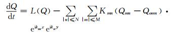
式中, Hall代表全球预报系统全场, H0—n表示0—n波的低通波段, H0—n—0.5w表示用于侧边界场滤波试验的高频削弱场, 不同类型降水的侧边界试验开始时间及低通滤波波段(n)不同。WRFv3.1以来新增加的谱逼近方案是基于Miguez-Macho等(2014)的研究。具体可表示为
|
(2) |
式中, Q为用来谱逼近的模式预报量, L(Q)为模式运算符, Qmn为Q的谱系数, Qomn为驱动场变量的谱系数, kmn为逼近系数, 表示逼近时的最低波数, 与x方向的波数(m)和y方向的波数(n)有关。波矢分量km和kn取决于模拟区域的x方向(Dx)和y方向(Dy)长度以及波数, 可以表示为
|
(3) |
本研究中WRF模式对于谱逼近的设置为逐6 h进行一次逼近。研究表明, 谱逼近方案对小雨以上量级的降水预报改进明显, 尤其是提前3 d以上的预报改进较大, 谱逼近+侧边界滤波方案对提前5—7 d预报的降水总体效果优于谱逼近方案的预报(图 1)。这两种方法对降水预报时效的改进主要体现在大尺度关键环流系统的预报(图 2)中, 其中, 500 hPa中谱逼近+侧边界滤波(图 2c—d)较对照试验区域模式预报(图 2a—b)的相对误差有明显减小, 尤其在中高纬度地区, 谱逼近+侧边界滤波对中低纬度关键系统低压槽及副热带高压的预报也明显好于对照试验, 证实了从大尺度环流角度出发的预报方法的可行性。谱逼近方案对大尺度环流场的改进主要体现在提前1—5 d预报距平相关系数值较低的阶段, 对不同高度层高度场、温度场、相对湿度及经纬向风场的均方根误差均有较明显的减小, 尤其是对均方根误差较大的高度范围改进更为显著。侧边界滤波方案对提前7—11 d的温度场、500 hPa以上风场及位势高度场的改进效果较明显(图略)。

|
| 图 1 华南前汛期(2013年5月19日00时—22日00时)、后汛期(2012年7月15日00时—19日00时)及江淮梅雨期(2013年7月5日00时—8日00时)的3个持续性强降水过程不同预报时效试验24 h降水过程平均TS评分(Zhao, et al, 2016) (a—d.提前1、3、5、7 d预报试验, e.a—d的平均TS评分) Figure 1 Threat scores of 24-hour accumulated rainfall forecasts at different lead times (a-d. 1, 3, 5 and 7 days, respectively, e. averaged TS over different forecast lead times) using different schemes for three persistent severe rainfall cases in the pre-flood season (00:00 UTC 19 May to 00:00 UTC 22 May 2013) and the post-flood season (00:00 UTC 15 July to 00:00 UTC 19 July 2012) in South China, and in the Mei-yu period over the Yangtze-Huaihe river basin (00:00 UTC 5 July to 00:00 UTC 8 July 2013), respectively (Zhao, et al, 2016) |

|
| 图 2 华南前汛期持续性强降水过程(2013年5月19日00时—22日00时)不同预报时效不同预报试验的500 hPa环流场(Zhao, et al, 2016) (a、c.提前3 d预报, b、d.提前7 d预报, a、b.对照试验, c、d.谱逼近+侧边界滤波试验; 黑色等值线为FNL场, 红色等值线为WRF预报场(单位:gpm), 色阶表示相对误差(WRF-FNL)/FNL)(单位:%), 黑色框线表示降水区域) Figure 2 500 hPa geopotential height fields (unit: gpm) for the persistent severe rainfall event in the pre-flood season in South China (00: 00 UTC 19 May to 00: 00 UTC 22 May 2013) at different lead times (a, c. 3 days; b, d. 7 days) using different schemes (a, b. CTL; c, d. SN+LBF) (The solid black lines show the FNL reanalysis field, the red lines indicate the WRF forecast field, the shaded areas denote the relative error ((EWRF-EFNL)/EFNL, unit: %), the black box marks the area where precipitation occurred; Zhao, et al, 2016) |
全球模式对于大尺度环流场的预报有较长的预报时效, 但由于其较低的空间分辨率以及相对简单的参数化方案, 无法进行精确的中小尺度预报(Schwartz, et al, 2014), 而区域模式对于中小尺度扰动的预报具有明显优势(Grazzini, et al, 2015), 为了更好地保留全球模式的大尺度预报场以及区域模式的中小尺度信息, 多尺度混合技术被广泛应用于区域模式的预报研究中(Yang, 2005)。一些研究表明, 该方法可以有效提高3 d以内的集合预报能力(Wang et al, 2014a, 2014b; Zhang, et al, 2015)及台风路径的同化预报效果(Hsiao, et al, 2015), 但该方法在中期及其以上预报时长的确定性预报应用研究较少。
Zhao等(2017b)综合考虑全球模式对于大尺度环流系统较长的预报时效以及高分辨率区域模式对中小尺度天气系统特征的较好描述, 在内场低频谱逼近的基础之上, 针对高分辨率区域模式进一步提出多尺度混合更新初值滚动预报方法(谱逼近+更新初值滚动(UIC, Update Initial Condition)预报), 在1—15 d的预报时长内不断更新模式初值场, 对中国华南前汛期4次持续性强降水过程进行预报试验(图 3)。多尺度混合初值方法可以表示为

|
| 图 3 更新初值滚动预报试验流程(Zhao, et al, 2017b) Figure 3 Schematic diagram of the Update Initial Condition (UIC) forecast flow with the update cycle (Zhao, et al, 2017b) |

|
(4) |
式中, WRF为更新初值时刻WRF模式的输出场, WRFLG为经过滤波以后保留的大尺度WRF输出场, (WRF-WRFLG)为WRF预报的中小尺度场, GFSLG为滤波保留的大尺度全球预报系统预报场。WRF预报的中小尺度场与全球预报系统的大尺度场结合产生新的WRF模式初值场(ICNEW)。考虑到选择历史个例时段全球模式预报场分辨率较低的问题, 多尺度混合方案主要应用在前3 d的更新初值中, 之后的更新初值用全球预报系统预报资料代替。此外, 初值更新方案的气象要素除了谱逼近变量(经纬向风场、温度场及扰动位势高度场)以外, 增加了水汽混合比。
试验表明, 谱逼近+更新初值滚动预报方案对中雨及以上量级(10—100 mm/d)的24 h降水预报评估有明显改进效果, 尤其是对提前3 d以上的预报, 并且对于大雨量级的改进最为显著(相比对照试验区域模式预报的TS评分改进率为46.2%)(图 4)。对于过程累积降水, 谱逼近+更新初值滚动预报方案对提前5—11 d的50及100 mm以上的降水预报效果显著提高。随着预报提前天数的增加, 谱逼近+更新初值滚动预报方案的改进率增大。

|
| 图 4 华南前汛期4个持续性强降水过程(2011年5月12日00时—15日00时、2011年6月4日00时—8日00时、2013年5月6日00时—10日00时及2013年5月19日00时—22日00时)不同预报时效及预报方案的24 h降水过程平均TS评分(Zhao, et al, 2017b) (a—f.提前1、3、5、7、9、11 d的预报试验) Figure 4 Threat scores of 24-hour accumulated rainfall forecast at different lead times (a-f. 1, 3, 5, 7, 9 and 11 days, respectively) using different schemes for four persistent severe rainfall cases in the pre-flood season in South China (case 1:00:00 UTC 12 May- 00:00 UTC 15 May 2011; case 2: 00:00 UTC 4 June-00:00 UTC 8 June 2011; case 3:00:00 UTC 6 May-00:00 UTC 10 May 2013; and case 4:00:00 UTC 19 May-00:00 UTC 22 May 2013) (Zhao, et al, 2017b) |
从提前不同预报时长的相对湿度均方根误差(RMSE)垂直廓线分布(图 5)可知, 随着预报时长的增加, 谱逼近+更新初值滚动预报和谱逼近方案相对于对照试验对相对湿度均方根误差的减小越明显, 影响的高度范围也越广。谱逼近+更新初值滚动预报相对于对照试验和谱逼近试验在不同高度层相对湿度均方根误差的平均改进率分别为5.67%和1.49%。总体上, 谱逼近+更新初值滚动预报方案相对于对照试验的误差减小值大于相对于谱逼近试验的预报结果, 并且误差减小值随着预报时长的延长而增大。对于高度场、温度场及风场的预报, 谱逼近+更新初值滚动预报方案的预报相比于其他方案预报误差减小。

|
| 图 5 华南前汛期4个持续性强降水过程(同图 4)提前不同预报时长及不同预报方案试验的相对湿度均方根误差(单位:%)平均值随高度的变化(Zhao, et al, 2017b) (a—f.提前1、3、5、7、9、11 d预报试验; 绿色实线为NCEP全球预报系统预报评估结果) Figure 5 Averaged changes of RMSE of relative humidity (unit: %) with height for four persistent severe rainfall cases in the pre-flood season in South China (as in Figure 4) at (a) 1-, (b) 3-, (c) 5-, (d) 7-, (e) 9-, and (f) 11-day lead times prior to the occurrence of the persistent severe rainfall with different methods used (the green line is the NCEP GFS forecast; Zhao, et al, 2017b) |
考虑到区域模式分辨率的提高有利于改善强降水过程的预报效果(Givati, et al, 2011; Iorio, et al, 2004; Jang, et al, 2014), 而全球模式对降水的预报受计算资源的限制, 因此, Zhao等(2017c)在已有试验设计的基础之上提高了区域模式分辨率, 对更新初值滚动预报试验进行调整, 对15 d预报时段内的4次更新初值都采用多尺度混合的方法进行, 对2016年汛期中国长江流域重大灾害性持续降水过程进行预报试验和分析。
2016年6月30日—7月6日的暴雨过程为当年中国南方汛期最强降雨过程, 引发了1998年以来最为严重的洪涝灾害。此次持续性强降水与1998年夏天的强降水过程均与厄尔尼诺的强度有关(Huang, et al, 1998; Shankman, et al, 2016; Wang, et al, 2015)。对此次过程模式预报累积降水分布以及全球模式全球预报系统的降水预报分析(图 6)可以看出, 谱逼近+更新初值滚动预报对于提前5—7 d (图 6c2—d2)的预报明显好于对照试验(图 6c1—d1), 对于100 mm以上的过程累积降水在提前1—3 d(图 6a2—b2)的预报中也明显好于对照试验(图 6a1—b1)。分辨率较低的全球预报系统全球模式预报场(图 6a3—d3)对100 mm以上范围的降水没有很好的预报, 对于50—100 mm范围累积降水雨带的预报较宽, 特别是提前3—7 d的预报(图 6b3—c3)。总的来说, 预报时效越长, 降水量级越大, 谱逼近+更新初值滚动预报对此次过程的预报优势越明显, 这主要基于对全球预报系统和WRF预报优势有效结合的较好初值场作用。

|
| 图 6 2016年6月30日—7月6日持续性强降水观测(OBS)及不同试验方案的预报 (a.提前1 d预报, b.提前3 d预报, c.提前5 d预报, d.提前7 d预报; a1—d1.对照试验, a2—d2.谱逼近+更新初值滚动预报, a3—d3.全球预报系统预报)的累积降水分布(Zhao, et al, 2017c) Figure 6 Total accumulative rainfall distributions of persistent severe rainfall (30 June to 6 July 2016) from observations (OBS) and forecasts at different lead times (a. 1 days, b. 3 day, c. 5 day, d. 7 days) using different experimental schemes (a1-d1. CTL, a1-d2. SN+UIC, a3-d3. the NCEP GFS forecasts; Zhao, et al, 2017c) |
基于对中国南方持续性强降水形成机理及区域模式动力预报的认识, 以减小区域模式初始条件、边界条件以及内场预报误差为目的, 提出了针对持续性强降水的动力中期预报理论基础, 总结概述了近年来中国南方持续性强降水的区域模式动力中期预报研究, 预报方案框架如图 7所示。全球模式预报场为区域模式提供初始条件及边界条件, 同时为区域模式的内场谱逼近强迫提供大尺度环流场。对于边界条件进行低通滤波方案, 依据持续性强降水过程的大尺度环流动力学特征, 保留全球预报场的大尺度环流特征, 并对全球预报场的中小尺度特征进行削弱; 针对区域模式预报的内场执行谱逼近方案, 逼近场为全球预报的大尺度环流场; 针对区域模式的初始条件进行多尺度混合更新初值方案, 对预报3、6、9及12 d的初值进行更新, 混合全球预报的大尺度场及区域模式预报的中小尺度场。最终得到高分辨率区域模式15 d的预报场。

|
| 图 7 区域模式动力中期预报框架 Figure 7 Frame diagram of medium-term dynamic forecasting by the regional model |
以上动力预报方法在提高环流场预报的基础之上延长了持续性强降水的预报时效, 具体表现为:
(1) 内场谱逼近的方案对小雨以上量级的降水预报改进明显, 尤其是提前3 d以上的预报改进较大; 同时采用内场谱逼近和侧边界滤波对提前5—7 d预报的降水总体效果优于仅内场谱逼近的预报结果。对降水预报时效的改进主要体现在大尺度关键环流系统的预报中。
(2) 内场谱逼近对大尺度环流场的改进主要体现在提前1—5 d预报距平相关系数值较低的阶段, 对不同高度层高度场、温度场、相对湿度及经纬向风场的均方根误差均有较明显的减小。侧边界滤波对提前7—11 d的温度场、500 hPa以上风场及位势高度场的改进效果较明显(Zhao et al, 2016, 2017d)。
(3) 更新初值滚动预报方案有效地改进了24 h降水的中雨、大雨及暴雨量级降水的预报(10—100 mm/d), 而且对于提前5—11 d的50及100 mm以上的累积降水预报有明显改进。对于比湿场、高度场、温度场及风场的预报误差也有明显减小(Zhao et al, 2017b, 2017d)。随着提前预报时长的延长, 改进率不断增大。
文中概述的区域模式动力中期预报方法为延长高影响天气事件的预报时效提供了新方法和新思路, 尤其是对于中国南方持续性强降水事件的预报改进明显。然而, 如何将预报时效延长到中期及延伸期仍是目前研究的难题。近年来, 中期天气预报及季节尺度的气候预测也随着理论及模式的进步不断发展, 季节内至季节尺度预测(15—60 d)的发展填补了中长期天气预报到季节预测之间的缝隙, 并且对于持续性强降水形成机理及前兆信号的研究成果较多, 如何深入地结合模式预报及动力统计研究成果来进一步延长降水的预报时效, 将是未来继续探索的方向。
| 鲍名. 2007. 近50年我国持续性暴雨的统计分析及其大尺度环流背景. 大气科学, 31(5): 779–792. Bao M. 2007. The statistical analysis of the persistent heavy rain in the last 50 years over China and their backgrounds on the large scale circulation. Chinese J Atmos Sci, 31(5): 779–792. DOI:10.3878/j.issn.1006-9895.2007.05.03 (in Chinese) |
| 曾先锋, 周天军. 2012. 谱逼近方法对区域气候模式性能的改进:不同权重函数的影响. 气象学报, 70(5): 1084–1097. Zeng X F, Zhou T J. 2012. Impact of the spectral nudging on the simulation of a regional climate model:Different weight function. Acta Meteor Sinica, 70(5): 1084–1097. (in Chinese) |
| 陈官军, 魏凤英. 2012. 基于低频振荡特征的夏季江淮持续性降水延伸期预报方法. 大气科学, 36(3): 633–644. Chen G J, Wei F Y. 2012. An extended-range forecast method for the persistent heavy rainfall over the Yangtze Huaihe River Valley in summer based on the low-frequency oscillation characteristics. Chinese J Atmos Sci, 36(3): 633–644. (in Chinese) |
| 丑纪范, 郑志海, 孙树鹏. 2010. 10-30 d延伸期数值天气预报的策略思考:直面混沌. 气象科学, 30(5): 569–573. Chou J F, Zheng Z H, Sun S P. 2010. The think about 10-30 d extended-range numerical weather prediction strategy:Facing the atmosphere chaos. Scientia Meteor Sinica, 30(5): 569–573. DOI:10.3969/j.issn.1009-0827.2010.05.001 (in Chinese) |
| 董颜, 刘寿东, 王东海, 等. 2015. GFS对我国南方两次持续性降水过程的预报技巧评估. 气象, 41(1): 45–51. Dong Y, Liu S D, Wang D H, et al. 2015. Assessment on forecasting skills of GFS model for two persistent rainfalls over southern China. Meteor Mon, 41(1): 45–51. (in Chinese) |
| 杜钧. 2002. 集合预报的现状和前景. 应用气象学报, 13(1): 16–28. Du J. 2002. Present situation and prospects of ensemble numerical prediction. J Appl Meteor Sci, 13(1): 16–28. DOI:10.3969/j.issn.1001-7313.2002.01.002 (in Chinese) |
| 郭换换, 智协飞, 段明铿, 等. 2016. 数值天气预报中的不一致性问题综述. 气象科学, 36(1): 134–140. Guo H H, Zhi X F, Duan M K, et al. 2016. Review on the inconsistency of numerical weather prediction. Scientia Meteor Sinica, 36(1): 134–140. (in Chinese) |
| 黄荣辉, 徐予红, 王鹏飞, 等. 1998. 1998年夏长江流域特大洪涝特征及其成因探讨. 气候与环境研究, 3(4): 300–313. Huang R H, Xu Y H, Wang P F, et al. 1998. The features of the catastrophic flood over the Changjiang River Basin during the summer of 1998 and cause exploration. Climatic Environ Res, 3(4): 300–313. DOI:10.3878/j.issn.1006-9585.1998.04.02 (in Chinese) |
| 矫梅燕, 龚建东, 周兵, 等. 2006. 天气预报的业务技术进展. 应用气象学报, 17(5): 594–601. Jiao H Y, Gong J D, Zhou B, et al. 2006. An overview of the development of weather forecasting. J Appl Meteor Sci, 17(5): 594–601. DOI:10.3969/j.issn.1001-7313.2006.05.009 (in Chinese) |
| 刘琳, 陈静, 程龙, 等. 2013. 基于集合预报的中国极端强降水预报方法研究. 气象学报, 71(5): 853–866. Liu L, Chen J, Cheng L, et al. 2013. Study of the ensemble-based forecast of extremely heavy rainfalls in China:Experiments for July 2011 cases. Acta Meteor Sinica, 71(5): 853–866. (in Chinese) |
| 陆如华, 徐传玉, 张玲, 等. 1997. 卡尔曼滤波的初值计算方法及其应用. 应用气象学报, 8(1): 34–43. Lu R H, Xu C Y, Zhang L, et al. 1997. Calculation method for initial value of Kalman filter and its application. Quart J Appl Meteor, 8(1): 34–43. (in Chinese) |
| 牛若芸, 张志刚, 金荣花. 2012. 2010年我国南方两次持续性强降水的环流特征. 应用气象学报, 23(4): 385–394. Niu R Y, Zhang Z G, Jin R H. 2012. The atmospheric circulation features of two persistent heavy rainfalls over southern China in the summer of 2010. J Appl Meteor Sci, 23(4): 385–394. DOI:10.3969/j.issn.1001-7313.2012.04.001 (in Chinese) |
| 钱维宏, 单晓龙, 朱亚芬. 2012. 天气尺度扰动流场对区域暴雨的指示能力. 地球物理学报, 55(5): 1513–1522. Qian W H, Shan X L, Zhu Y F. 2012. Capability of regional-scale transient wind anomalies to indicate regional heavy rains. Chinese J Geophys, 55(5): 1513–1522. (in Chinese) |
| 宋寔, 汤剑平. 2011. 谱逼近方法在东亚夏季降水区域模式模拟中的适用性研究:区域大小和位置的影响. 气象学报, 69(2): 297–309. Song S, Tang J P. 2011. An application of the spectral nudging technique to the simulation of summer precipitation over East Asia using a regional climate model:The impact of domain size and position. Acta Meteor Sinica, 69(2): 297–309. (in Chinese) |
| 孙国武, 李震坤, 信飞, 等. 2013. 延伸期天气过程预报的一种新方法:低频天气图. 大气科学, 37(4): 945–954. Sun G W, Li Z K, Xin F, et al. 2013. Low-frequency synoptic map:New method for extended range forecasting. Chinese J Atmos Sci, 37(4): 945–954. (in Chinese) |
| 王东海, 杜钧, 柳崇健. 2011a. 正确认识和对待天气气候预报的不确定性. 气象, 37(4): 385–391. Wang D H, Du J, Liu C J. 2011a. Recognizing and dealing with the uncertainty in weather and climate forecasts. Meteor Mon, 37(4): 385–391. (in Chinese) |
| 王东海, 夏茹娣, 刘英. 2011b. 2008年华南前汛期致洪暴雨特征及其对比分析. 气象学报, 69(1): 137–148. Wang D H, Xia R D, Liu Y. 2011b. A preliminary study of the flood causing rainstorm during the first rainy season in South China in 2008. Acta Meteor Sinica, 69(1): 137–148. (in Chinese) |
| 王淑莉, 徐祥德, 康红文, 等. 2016. 应用谱逼近方法模拟2008年初南方持续性降水过程及其水汽通道周期特征分析. 大气科学, 40(3): 476–488. Wang S L, Xu X D, Kang H W, et al. 2016. Simulation of continuous rainfall over south China in early 2008 with the spectral nudging method and the periodicity characteristics of the water vapor channel. Chinese J Atmos Sci, 40(3): 476–488. (in Chinese) |
| 武炳义, 张人禾. 2011. 东亚夏季风年际变率及其与中、高纬度大气环流以及外强迫异常的联系. 气象学报, 69(2): 219–233. Wu B Y, Zhang R H. 2011. Interannual variability of the East Asian summer monsoon and its association with the anomalous atmospheric circulation over the mid high latitudes and external forcing. Acta Meteor Sinica, 69(2): 219–233. DOI:10.3969/j.issn.1004-4965.2011.02.010 (in Chinese) |
| 杨燕, 纪立人. 1997. 数字滤波方法在月尺度数值预报中的应用Ⅱ:保留不同低频过程的效果比较. 大气科学, 21(5): 533–544. Yang Y, Ji L R. 1997. The application of the digital filtering method in monthly numerical weather prediction. Part Ⅱ:The comparison of the forecast skill with the different low frequency processes. Chinese J Atmos Sci, 21(5): 533–544. DOI:10.3878/j.issn.1006-9895.1997.05.03 (in Chinese) |
| 翟盘茂, 倪允琪, 陈阳. 2013. 我国持续性重大天气异常成因与预报方法研究回顾与未来展望. 地球科学进展, 28(11): 1177–1188. Zhai P M, Ni Y Q, Chen Y. 2013. Mechanism and forecasting method of persistent extreme weather events:Review and prospect. Adv Earth Sci, 28(11): 1177–1188. DOI:10.11867/j.issn.1001-8166.2013.11.1177 (in Chinese) |
| 翟盘茂, 李蕾, 周佰铨, 等. 2016. 江淮流域持续性极端降水及预报方法研究进展. 应用气象学报, 27(5): 631–640. Zhai P M, Li L, Zhou B Q, et al. 2016. Progress on mechanism and prediction methods for persistent extreme precipitation in the Yangtze-Huai River Valley. J Appl Meteor Sci, 27(5): 631–640. (in Chinese) |
| 章基嘉, 李维京, 徐祥德, 等. 1994. 1991年江淮暴雨期间环流异常的动力延伸预报试验. 气象学报, 52(2): 180–186. Zhang J J, Li W J, Xu X D, et al. 1994. The experiment of DERF with T42L9 model for DEKAD and monthly mean circulation anomaly during the summer heavy rainfall period in 1991. Acta Meteor Sinica, 52(2): 180–186. (in Chinese) |
| Brunet G, Shapiro M, Hoskins B, et al. 2010. Collaboration of the weather and climate communities to advance subseasonal-to-seasonal prediction. Bull Amer Meteor Soc, 91(10): 1397–1406. DOI:10.1175/2010BAMS3013.1 |
| Cha D H, Lee D K. 2009. Reduction of systematic errors in regional climate simulations of the summer monsoon over East Asia and the western North Pacific by applying the spectral nudging technique. J Geophys Res:Atmos, 114(D14): D14108. DOI:10.1029/2008JD011176 |
| Chen Y, Zhai P M. 2013. Persistent extreme precipitation events in China during 1951-2010. Climate Res, 57(2): 143–155. DOI:10.3354/cr01171 |
| Chen Y, Zhai P M. 2014a. Two types of typical circulation pattern for persistent extreme precipitation in Central-Eastern China. Quart J Roy Meteor Soc, 140(682): 1467–1478. DOI:10.1002/qj.2014.140.issue-682 |
| Chen Y, Zhai P M. 2014b. Precursor circulation features for persistent extreme precipitation in central-eastern China. Wea Forecasting, 29(2): 226–240. DOI:10.1175/WAF-D-13-00065.1 |
| Ding Y H, Chan J C L. 2005. The East Asian summer monsoon:An overview. Meteor Atmos Phys, 89(1-4): 117–142. DOI:10.1007/s00703-005-0125-z |
| Ding Y H, Reiter E R. 1982. A relationship between planetary waves and persistent rain and thunderstorms in China. Arch Met Geoph Biocl, Ser B, 31(3): 221–252. DOI:10.1007/BF02278295 |
| Feser F. 2006. Enhanced detectability of added value in limited-area model results separated into different spatial scales. Mon Wea Rev, 134(8): 2180–2190. DOI:10.1175/MWR3183.1 |
| Givati A, Lynn B, Liu Y B, et al. 2011. Using the WRF model in an operational streamflow forecast system for the Jordan River. J Appl Meteor Climatol, 51(2): 285–299. |
| Grazzini F, Vitart F. 2015. Atmospheric predictability and Rossby wave packets. Quart J Roy Meteor Soc, 141(692): 2793–2802. DOI:10.1002/qj.2564 |
| Hsiao L F, Huang X Y, Kuo Y H, et al. 2015. Blending of global and regional analyses with a spatial filter:Application to typhoon prediction over the western North Pacific Ocean. Wea Forecasting, 30(3): 754–770. DOI:10.1175/WAF-D-14-00047.1 |
| Iorio J P, Duffy P B, Govindasamy B, et al. 2004. Effects of model resolution and subgrid-scale physics on the simulation of precipitation in the continental United States. Climate Dyn, 23(3-4): 243–258. DOI:10.1007/s00382-004-0440-y |
| Jang J, Hong S Y. 2014. Quantitative forecast experiment of a heavy rainfall event over Korea in a global model:Horizontal resolution versus lead time issues. Meteor Atmos Phys, 124(3-4): 113–127. DOI:10.1007/s00703-014-0312-x |
| Jung T, Miller M J, Palmer T N. 2010. Diagnosing the origin of extended-range forecast errors. Mon Wea Rev, 138(6): 2434–2446. DOI:10.1175/2010MWR3255.1 |
| Kanamaru H, Kanamitsu M. 2007. Scale-selective bias correction in a downscaling of global analysis using a regional model. Mon Wea Rev, 135(2): 334–350. DOI:10.1175/MWR3294.1 |
| Lavers D A, Villarini G. 2013. Were global numerical weather prediction systems capable of forecasting the extreme Colorado rainfall of 9-16 September 2013?. Geophys Res Lett, 40(24): 6405–6410. DOI:10.1002/2013GL058282 |
| Lorenz E N. 1969. The predictability of a flow which possesses many scales of motion. Tellus, 21(3): 289–307. DOI:10.3402/tellusa.v21i3.10086 |
| Lorenz E N. 1982. Atmospheric predictability experiments with a large numerical model. Tellus, 34(6): 505–513. DOI:10.3402/tellusa.v34i6.10836 |
| Miguez-Macho G, Stenchikov G L, Robock A. 2004. Spectral nudging to eliminate the effects of domain position and geometry in regional climate model simulations. J Geophy Res Atmos, 109(D13): D13104. |
| Mullen S L, Buizza R. 2001. Quantitative precipitation forecasts over the United States by the ECMWF ensemble prediction system. Mon Wea Rev, 129(4): 638–663. DOI:10.1175/1520-0493(2001)129<0638:QPFOTU>2.0.CO;2 |
| Niu R Y, Zhai P M, Zhou B Q. 2015. Evaluation of forecast performance of Asian summer monsoon low-level winds using the TIGGE dataset. Wea Forecasting, 30(2): 455–470. DOI:10.1175/WAF-D-13-00141.1 |
| Niu R Y, Zhai P M. 2013. Synoptic verification of medium-extended-range forecasts of the northwest Pacific subtropical high and South Asian high based on multi-center TIGGE data. Acta Meteor Sinica, 27(5): 725–741. DOI:10.1007/s13351-013-0513-0 |
| Otte T L, Nolte C G, Otte M J, et al. 2012. Does nudging squelch the extremes in regional climate modeling?. J Climate, 25(20): 7046–7066. DOI:10.1175/JCLI-D-12-00048.1 |
| Pappenberger F, Cloke H L, Persson A, et al. 2011. HESS Opinions "On forecast (in)consistency in a hydro-meteorological chain:Curse or blessing?". Hydrol Earth Syst Sci, 15(7): 2391–2400. DOI:10.5194/hess-15-2391-2011 |
| Peng X D, Che Y Z, Chang J. 2013. A novel approach to improve numerical weather prediction skills by using anomaly integration and historical data. J Geophys Res:Atmos, 118(16): 8814–8826. DOI:10.1002/jgrd.50682 |
| Persson A, Riddaway B. 2011. Increasing trust in medium-range weather forecasts. ECMWF Newsl, 129: 8–12. |
| Piaget N, Froidevaux P, Giannakaki P, et al. 2015. Dynamics of a local Alpine flooding event in October 2011:Moisture source and large-scale circulation. Quart J Roy Meteor Soc, 141(690): 1922–1937. DOI:10.1002/qj.2015.141.issue-690 |
| Qian W H, Fu J L, Yan Z W. 2007. Decrease of light rain events in summer associated with a warming environment in China during 1961-2005. Geophys Res Lett, 34(11): L11705. DOI:10.1029/2007GL029631 |
| Reynolds C A, Satterfield E A, Bishop C H. 2015. Using forecast temporal variability to evaluate model behavior. Mon Wea Rev, 143(12): 4785–4804. DOI:10.1175/MWR-D-15-0083.1 |
| Samel A N, Liang X Z. 2003. Understanding relationships between the 1998 Yangtze River flood and northeast Eurasian blocking. Climate Res, 23(2): 149–158. |
| Sanders F. 1986. Trends in skill of Boston forecasts made at MIT, 1966-84. Bull Amer Meteor Soc, 67(2): 170–176. |
| Schwartz C S, Liu Z Q. 2014. Convection-permitting forecasts initialized with continuously cycling limited-area 3DVAR, ensemble kalman filter, and "Hybrid" variational-ensemble data assimilation systems. Mon Wea Rev, 142(2): 716–738. DOI:10.1175/MWR-D-13-00100.1 |
| Shankman D, Keim B D. 2016. Flood risk forecast for China's Poyang Lake region. Phys Geogr, 37(1): 88–91. DOI:10.1080/02723646.2016.1158517 |
| Skamarock W C. 2004. Evaluating mesoscale NWP models using kinetic energy spectra. Mon Wea Rev, 132(12): 3019–3032. DOI:10.1175/MWR2830.1 |
| Spero T L, Otte M J, Bowden J H, et al. 2014. Improving the representation of clouds, radiation, and precipitation using spectral nudging in the Weather Research and Forecasting model. J Geophys Res:Atmos, 119(20): 11682–11694. DOI:10.1002/2014JD022173 |
| Tibaldi S, Molteni F. 1990. On the operational predictability of blocking. Tellus A, 42(3): 343–365. DOI:10.3402/tellusa.v42i3.11882 |
| von Storch H, Langenberg H, Feser F. 2000. A spectral nudging technique for dynamical downscaling purposes. Mon Wea Rev, 128(10): 3664–3673. DOI:10.1175/1520-0493(2000)128<3664:ASNTFD>2.0.CO;2 |
| Waldron K M, Paegle J, Horel J D. 1996. Sensitivity of a spectrally filtered and nudged limited-area model to outer model options. Mon Wea Rev, 124(3): 529–547. DOI:10.1175/1520-0493(1996)124<0529:SOASFA>2.0.CO;2 |
| Wang D H, Liu C J, Liu Y, et al. 2009. A preliminary analysis of features and causes of the snow storm event over the southern areas of China in January 2008. J Meteor Res, 23(3): 374–384. |
| Wang H J, Fan K, Sun J Q, et al. 2015. A review of seasonal climate prediction research in China. Adv Atmos Sci, 32(2): 149–168. DOI:10.1007/s00376-014-0016-7 |
| Wang H, Huang X Y, Xu D, et al. 2014a. A scale-dependent blending scheme for WRFDA:Impact on regional weather forecasting. Geosci Model Dev, 7(4): 1819–1828. DOI:10.5194/gmd-7-1819-2014 |
| Wang Y, Bellus M, Geleyn J F, et al. 2014b. A new method for generating initial condition perturbations in a regional ensemble prediction system:blending. Mon Wea Rev, 142(5): 2043–2059. DOI:10.1175/MWR-D-12-00354.1 |
| Wheeler M C, Hendon H H. 2004. An all-season real-time multivariate MJO index:Development of an index for monitoring and prediction. Mon Wea Rev, 132(8): 1917–1932. DOI:10.1175/1520-0493(2004)132<1917:AARMMI>2.0.CO;2 |
| Yang X H. 2005. Analysis blending using spatial filter in grid-point model coupling. HIRLAM Newslett, 48: 49–55. |
| Zhang H B, Chen J, Zhi X F, et al. 2015. Study on multi-scale blending initial condition perturbations for a regional ensemble prediction system. Adv Atmos Sci, 32(8): 1143–1155. DOI:10.1007/s00376-015-4232-6 |
| Zhao Y F, Wang D H, Liang Z M, et al. 2016. Improving numerical experiments on persistent severe rainfall events in southern China using spectral nudging and filtering schemes. Quart J Roy Meteor Soc, 142(701): 3115–3127. DOI:10.1002/qj.2016.142.issue-701 |
| Zhao Y F, Wang D H, Liang Z M, et al. 2017a. On the dynamics of the large-scale circulation during the persistent severe rainfall events in southern China. J Meteor Soc Japan, 95(2): 111–125. DOI:10.2151/jmsj.2017-006 |
| Zhao Y F, Wang D H, Xu J J. 2017b. An attempt to improve the forecasting of persistent severe rainfall using the spectral nudging and update cycle methods. Wea Forecasting, 32(2): 713–723. DOI:10.1175/WAF-D-16-0103.1 |
| Zhao Y F, Wang D H, Xu J J. 2017c. Improving the regional model forecasting of persistent severe rainfall over the Yangtze River Valley using the spectral nudging and update cycle methods:A case study. Atmos Sci Lett, 18(2): 96–102. DOI:10.1002/asl.731 |
| Zhao Y F, Wang D H, Xu J J. 2017d. A combined approach to improving the regional model forecasts for the rainy season in China. Mon Wea Rev, 145(11): 4593–4603. DOI:10.1175/MWR-D-17-0037.1 |
| Zhou B Q, Niu R Y, Zhai P M. 2015. An assessment of the predictability of the East Asian Subtropical Westerly Jet based on TIGGE data. Adv Atmos Sci, 32(3): 401–412. DOI:10.1007/s00376-014-4026-2 |
| Zhou B Q, Zhai P M. 2016. A new forecast model based on the analog method for persistent extreme precipitation. Wea Forecasting, 31(4): 1325–1341. DOI:10.1175/WAF-D-15-0174.1 |
| Zhou T J, Yu R C. 2005. Atmospheric water vapor transport associated with typical anomalous summer rainfall patterns in China. J Geophys Res:Atmos, 110(D8): D08104. |