 2018, Vol. 76
中国气象学会主办。
文章信息
- 武利阳, 左洪超, 冯锦明. 2018.
- WU Liyang, ZUO Hongchao, FENG Jinming. 2018.
- 华北平原地下水灌溉对区域气候影响的数值模拟
- Numerical simulation of the impacts of groundwater irrigation over the North China Plain on regional climate
- 气象学报, 76(4): 635-648.
- Acta Meteorologica Sinica, 76(4): 635-648.
- http://dx.doi.org/10.11676/qxxb2018.017
-
文章历史
- 2017-06-28 收稿
- 2018-03-09 改回


2. 中国科学院大气物理研究所东亚区域气候-环境重点实验室, 北京, 100029
2. CAS Key Laboratory of Regional Climate-Environment for Temperate East Asia, Institute of Atmospheric Physics, Chinese Academy of Sciences, Beijing 100029, China
随着人口的增加和社会经济的发展,人类对土地的改造在近几十年变得更加剧烈(如农田灌溉、城市化、森林砍伐等),对局地、区域乃至全球的气候产生了重要影响(Boucher,et al,2004;Sacks,et al,2009;Feng,et al,2012;Pessacg,et al,2012;Cao,et al,2015;Yang,et al,2016;Pei,et al,2016)。其中,农田灌溉是土地利用变化中重要的人为因素,影响了水的自然循环,并导致地表能量重新分配,研究灌溉的区域气候效应具有重要意义。
默认的气候模式中通常不考虑灌溉影响,为了研究灌溉的气候效应,不同的灌溉方案被耦合进不同的数值模式。比较常见的几种灌溉方案有:(1)把土壤湿度设定为定值(田间持水量、土壤饱和含水量等)(Adegoke,et al,2003;Kanamaru,et al,2008;Lobell,et al,2008;毛慧琴等,2011;Harding,et al,2012;Kueppers,et al,2012;Huber,et al,2014;Jiang,et al,2014;Aegerter,et al,2017),此方案过于简单,与真实的灌溉过程并不吻合;(2)使用估算出的真实灌溉量作用于农田(Sacks,et al,2009;Lo,et al,2013;Zou,et al,2014;Zeng,et al,2017),但此方案与第一种方案一样,没有考虑天气和气候对灌溉量的影响;(3)动态灌溉方案,根据土壤湿度来判断农田是否需要灌溉(Qian,et al,2013;Sorooshian,et al,2014;Yang,et al,2016;Pei,et al,2016;Yang,et al,2017;Zhang,et al,2017),根据冠层状态(叶面积指数、叶温度)和根部水分胁迫来判断灌溉与否(Leng,et al,2014;Lu,et al,2015),然后灌溉用水以降水的形式作用于农田。尽管以上模拟研究基本都能揭示出灌溉导致降温的事实,但是由于采用的灌溉方案、模拟区域及其气候条件不同,得出的降温幅度有差异。另外,灌溉对日最低气温的影响还存在争议(Kanamaru,et al,2008;Huber,et al,2014)。
由于气候系统的复杂性,灌溉对降水的影响存在很大的不确定性。一些研究认为,灌溉区蒸散的增加导致低层大气中水汽含量增大,同时增加对流有效位能,有助于降水的增多(Boucher,et al,2004;DeAngelis,et al,2010;Harding,et al,2012;Yang,et al,2017;Zeng,et al,2017),但灌溉的冷却效应降低大气边界层高度,增强大气稳定性,对降水起负效应(Harding,et al,2012;Marcella,et al,2014;Zhang,et al,2017)。也有研究发现,在灌溉区下风向降水增多(DeAngelis,et al,2010;Lo,et al,2013;Huber,et al,2014;Zou,et al,2014;Pei,et al,2016;Yang,et al,2017)。灌溉引起的风场异常也会对降水产生影响(Huber,et al,2014;Yang,et al,2016;Pei,et al,2016;Zeng,et al,2017;Zhang,et al,2017),总之,降水变化是由不同机制共同作用的,存在区域和季节的差异。
中国是世界上灌溉面积最大的国家(国际灌排委员会2016年统计数据),很多学者对中国区域灌溉的气候效应开展了研究:东北地区(Zhu,et al,2012;Zhao,et al,2016),华北地区(Shi,et al,2014;Zou,et al, 2014, 2016;Yang,et al,2016;Chen,et al,2017),西北地区(Wen,et al,2012;Han,et al,2013;Jiang,et al,2014;Xu,et al,2017;Zhang,et al,2017)。华北平原作为中国面积最大的灌溉区,是冬小麦和夏玉米(两季作物)的主产区,据统计该地区超过70%的农田需要灌溉来保证粮食产量的稳定(Liu,et al,2001),河北和河南省地下水灌溉农田占比分别为85%和70%左右(Siebert,et al,2013),地下水灌溉量占华北平原地下水总开采量的80%左右(张光辉等,2013),因此,华北平原地下水的动态变化过程与灌溉密切相关。近年来已有研究考虑了地下水与灌溉的耦合过程,例如,Leng等(2014)和Zou等(2015)采用离线陆面模式(CLM)研究地下水灌溉对陆面水文过程的影响,Zou等(2014)和Zeng等(2017)分别在区域模式(RegCM4)和全球模式(CESM1.2.0)中考虑了地下水开采过程,并研究其气候效应,但其耦合模式中采用的是前面提到的第2种灌溉方案,忽略了气候条件对地下水开采量的影响。Noah-MP是一个考虑地下水过程和有多种可选的参数化方案的陆面模式(Niu,et al,2011),物理过程较为完善,却很少有研究在此陆面模式中添加灌溉方案。因此,本研究将在耦合模式WRF/Noah-MP中加入一个考虑地下水过程的动态灌溉方案,来研究华北平原地下水灌溉对区域气候的影响。
2 方法 2.1 模式配置本研究采用的区域气候模式是动力核为ARW的WRF(3.7.1版本)(Skamarock,et al,2008)。模拟试验所采用的各物理过程参数化方案如下:WSM 6-class graupel微物理过程方案(Hong,et al,2006a)、RRTM长波辐射方案(Mlawer,et al,1997)、Dudhia短波辐射方案(Dudhia,1998)、YSU边界层方案(Hong,et al,2006b)、Kain-Fritsch积云方案(Kain,2004)和Noah-MP陆面过程方案(Niu,et al,2011)。Noah-MP中包含了多个可供选择的参数化方案,地下水过程选择SIMGM方案(Niu,et al,2007),在2 m土壤层的下面添加一个无限制的地下含水层,并考虑土壤和含水层之间的水交换。在陆面模式中选用基于MODIS(Moderate-resolution Imaging Spectrora-diometer)的20类土地利用分类系统。
模拟区域中心为(36°N,116°E),水平分辨率采用30 km,格点数为150 (经向)×140(纬向)(图 1),垂直方向为30层,模式顶层气压为50 hPa。模式的侧边界选用指数松弛方案,缓冲区为10个网格。模式所需的初始和侧边界条件来自NCEP-FNL全球分析资料(National Centers for Environmental Prediction (NCEP)Final(FNL) operational global analysis data),水平分辨率为1°×1°,每日4个时次(00:00、06:00、12:00、18:00 UTC),侧边界强迫场、海表温度、植被覆盖度和叶面积指数每6 h更新一次,其中海表温度也来自NCEP-FNL分析资料,模式默认的植被覆盖度和叶面积指数来自静态的地形数据。

|
| 图 1 模拟区域及地形高度 (图中方框标示区域为华北平原;下同) Figure 1 Simulated region and topography height (The North China Plain is marked by the solid rectangle; the same hereafter) |
在WRF/Noah中加入动态灌溉方案的研究已有不少(Ozdogan,et al,2010;Qian,et al,2013;Yang,et al, 2016, 2017;Pei,et al,2016),本研究在参考这些灌溉算法的基础上,做了一些修改,将考虑地下水过程的动态灌溉方案引入到WRF/Noah-MP模式中,具体如下:
首先,确定灌溉区域,图 2a、b是图 1方框区域的植被分布和灌溉网格百分比分布(Siebert,et al,2013),土地利用类型为农田且灌溉面积超过5%的网格即为华北平原地下水灌溉区域。需要说明的是,参照谷歌地球对安徽省北部的灌溉面积数据进行了修正(图 2b);江苏省基本上是需水量大的稻田,以地表水灌溉为主,所以模拟时没有考虑灌溉过程。

|
| 图 2 华北平原(a)土地利用类型,(b)灌溉网格百分比的空间分布;(c)灌溉区区域平均后的植被覆盖度随时间的变化 Figure 2 Spatial distributions of (a) land use type and (b) percentage irrigation area in the North China Plain, (c) temporal variation of green vegetation fraction averaged over the irrigated area |
陆面模式Noah-MP分别计算植被和裸土的地表能量和温度,然后根据植被覆盖度加权求和,可见植被覆盖度的重要性,本研究将NOAA(National Oceanic and Atmospheric Administration)全球植被指数系统的周植被覆盖度数据(Jiang,et al,2010)经过处理后,替换模式默认的植被覆盖度数据。图 2c是替换后的植被覆盖度在灌溉区区域平均后随时间的变化,与默认值相比,更新后的植被覆盖度具有年变化,与实际更为接近。叶面积指数与植被覆盖度保持一致,由植被覆盖度根据式(1)(田静等,2009)计算得到。植被覆盖度在每年的4和8月出现了双峰,这与华北平原农田大多采用冬小麦和夏玉米两茬的种植方式一致。冬小麦一般在3月初开始返青到6月初收割,接种玉米,并到9月底收割,所以在每年3月1日00时—10月1日00时(世界时),植被处于生长季时考虑灌溉,生长季根据式(2)来判断。

|
(1) |

|
(2) |
式中,GVF和LAI分别为植被覆盖度和叶面积指数,GVFmin和GVFmax分别是GVF的最小值和最大值,在冬小麦和夏玉米生长期分别计算阈值GVFthresh来判断所在网格植被是否处于生长季。
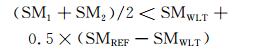
满足上面条件的基础上,在每天07时(地方时,下同)来判断第1层和第2层土壤湿度的平均值是否满足式(3),如满足则开始灌溉,连续灌溉2 h,至09时结束,灌溉方法为漫灌,灌溉率为30 mm/h,灌溉用水是以有效降水的形式作用于农田。
|
(3) |
式中,SM1和SM2分别是第1层(0—10 cm)和第2层(10—40 cm)土壤湿度,SMWLT和SMREF分别是土壤凋萎点和田间持水量,单位为m3/m3。
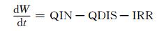
陆面模式Noah-MP考虑了地下水过程,且本研究假设华北平原灌溉用水全部来自地下水,所以在地下水储存量(W,单位:mm)的变化中考虑灌溉的抽水作用(式(4))
|
(4) |
式中,QIN、QDIS和IRR分别是地下水补给率、地下径流和抽水率(灌溉率),单位为mm/s。
2.3 试验设计本研究共设计两组试验,一组为不考虑灌溉的对照试验(CTL),一组为考虑灌溉的敏感性试验(SEN),其余设置完全一样。两组试验的积分时间都是2001年1月1日00:00 UTC—2011年1月1日00:00 UTC,每6 h输出一次模拟结果,2001年作为模式的起转时间,不做分析。
3 结果分析 3.1 模式验证图 3a—c分别是2002—2010年夏季(6—8月)平均的观测(OBS)、对照试验和敏感试验的2 m气温空间分布,其中气温的观测数据来自中国气象局气象数据中心制作的月值0.5°×0.5°格点数据集。对照试验基本可以模拟出夏季多年平均气温的空间分布,与观测气温的空间相关系数达0.954,但中国东北和南方的气温模拟偏低,华北的气温模拟偏高。在华北气温模拟偏高的地区正好是农田灌溉区,下文将提到灌溉导致地面气温下降,因此,考虑灌溉的敏感试验正好可以降低华北平原模拟偏高的气温(图 3c)。由表 1也可以看出,考虑灌溉之后,灌溉区气温的平均偏差由原来的0.84℃降至0.22℃,均方根误差由原来的1.26℃降至0.85℃,空间相关系数也有改善,说明模式中考虑灌溉有助于改善华北平原夏季气温的模拟。由于对照试验中华北平原春季(3—5月)多年平均地面气温模拟的偏低(图略),导致考虑灌溉的敏感试验并没有明显改善春季气温的模拟。春季气温模拟偏低的可能原因有:模拟试验中华北平原春季反照率偏高;本研究的土地利用类型是主导型,没有考虑次网格的异质性。

|
| 图 3 2002—2010年(a)观测,(b)对照试验和(c)敏感试验夏季平均2 m气温的空间分布;(d)观测和对照试验的华北平原区域平均后的夏季平均降水量的年变化 Figure 3 Spatial distributions of the summer mean 2 m temperature (a. OBS, b. CTL, c. SEN) from 2002 to 2010; (d) temporal variations of the summer mean precipitation averaged over the North China Plain based on OBS and CTL |
| 试验 | 平均偏差(℃) | 均方根误差(℃) | 空间相关系数 |
| 对照 | 0.84 | 1.26 | 0.856* |
| 敏感 | 0.22 | 0.85 | 0.862* |
| *表示相关系数通过99%的信度检验。 | |||
尽管对照试验在中国南方模拟的夏季降水明显偏多(图略),但对华北平原的模拟效果较好。图 3d是观测和对照试验的夏季降水量在华北平原区域平均的年变化,其中降水的观测数据来自分辨率为0.25°×0.25°的TRMM卫星3B43降水产品。对照试验模拟的华北平原夏季降水量的年变化趋势与观测基本一致,由于土壤湿度受降水影响较大,而本研究模式中灌溉的开关是由土壤湿度控制的,因此,较好的降水量的模拟会使得该区域的灌溉量与实际更接近。
3.2 灌溉率与地下水位图 4a是灌溉率在灌溉区的平均的年变化,其中每年分别计算冬小麦生长期(3—5月)和夏玉米生长期(6—9月)的平均灌溉率。灌溉率年变化明显,在2002、2004和2009年夏玉米生长期灌溉率超过1.2 mm/d(其中2009年超过1.8 mm/d),对应于华北平原的3 a旱季(图 3d),对照试验模拟的降水量仅为4 mm/d,加上春季降水稀少,地下水位在这3 a下降较快(图 4b),仅2009年就下降2 m左右。2005—2008年的灌溉率在0.3—0.9 mm/d,地下水位缓慢下降(图 4b),对照试验模拟的2007年夏季降水量最大(超过6 mm/d)导致这一年夏玉米生长期的灌溉率最低(图 4a)。图 4a显示冬小麦期的灌溉率普遍低于玉米期的灌溉率,实际上春季降水稀少,冬小麦生长期的需水量比较大,这个矛盾是由于区域平均的区域和时间平均的时段导致的,春季灌溉率大的区域集中在河北省,而模式中3月的灌溉率却很低,区域平均的区域是整个灌溉区域,实际平均的时间是3—5月。考虑地下水灌溉后,2002—2010年地下水位有增有减,总体下降(图 4b),这一特征与观测到的海河流域地下水位变化类似(Zou,et al,2015)。

|
| 图 4 灌溉区区域平均后的(a)灌溉率(小麦和玉米生长期分别时间平均)和(b)地下水位随时间的变化,(c)2002—2010年灌溉期(3—9月)平均的灌溉率空间分布,(d)模拟结束时地下水位的差值(敏感试验-对照试验)空间分布 Figure 4 Temporal variations of the (a) irrigation rate (averaged over the growth periods of wheat and maize, respectively) and (b) water table depth averaged over the irrigated area. Spatial distributions of the (c) irrigation rate averaged over the irrigation period (March to September) from 2002 to 2010 and (d) differences (SEN minus CTL) in the water table depth at the end of the simulation |
图 4c是灌溉率在灌溉期(每年3—9月)多年(2002—2010年)平均后的空间分布,灌溉率超过1.0 mm/d(224 d平均)的区域主要位于河北和河南省,与刘钰等(2009)根据观测估算的冬小麦和夏玉米的灌溉量之和(250—500 mm)接近。经过10 a开采地下水进行农田灌溉,导致地下水位下降,在河北省局部地区下降超过8 m(图 4d),这符合灌溉导致华北平原地下水超采的事实(张光辉等,2013)。
3.3 陆面物理量灌溉用水以有效降水的形式作用于农田,直接增加了土壤湿度。在对照试验中,每年前两个月灌溉区的土壤湿度是升高的,进入3月,随着太阳辐射增强和气温升高,蒸发增强,加上降水稀少,土壤湿度下降明显(尤其是第1层(0—10 cm)),到6月中上旬,土壤湿度降至谷值,降水集中的7—8月,土壤湿度升高到峰值,之后又开始下降(图略)。对应于对照试验中灌溉区土壤湿度的变化,灌溉引起的土壤湿度变化呈现出相反的趋势(图 5a),第1层土壤湿度升高量从3月中下旬开始增大,分别在6月和9月达到峰值,7月下旬—8月上旬处于谷值,第2(10—40 cm)和第3层(40—100 cm)土壤湿度增加量的变化趋势和第1层类似,但稍有延迟,第4层(100—200 cm)土壤湿度增加量除了在7月达到峰值外,基本变化不大。由于土壤湿度有较长的记忆时间,在非灌溉期(10月—次年2月),土壤湿度也是增大的,第3层土壤湿度增加最大,在灌溉期,第3层土壤湿度增加量也仅次于第1层,Pei等(2016)的研究也有类似结论。

|
| 图 5 灌溉引起的灌溉区(a)土壤湿度和(b)日最高、最低及平均2 m气温的逐半月变化(多年(2002—2010年)平均及灌溉区区域平均后的值);2002—2010年灌溉期(3—9月)平均的(c)潜热,(d)感热,(e)2 m气温的差值(敏感试验-对照试验)空间分布 (打点区域表示通过95%的信度检验) Figure 5 Temporal variations of differences (SEN minus CTL) in half-monthly mean (a) soil moisture and (b) daily maximum, minimum, and mean 2 m temperature averaged over the irrigated area from 2002 to 2010. Spatial distributions of differences (SEN minus CTL) in mean (c) latent heat, (d) sensible heat, and (e) 2 m temperature during the irrigation period (March to September) from 2002-2010 (Black points are for values significant at the 95% confidence level) |
灌溉引起的土壤湿度升高导致蒸发增大,潜热在灌溉剧烈的区域增加量超过15 W/m2(图 5c),且通过了95%的信度检验,根据地表能量平衡,潜热和感热之和基本等于地表净辐射,且本研究地表吸收的太阳辐射在灌溉前后变化不大,因此,感热变化和潜热变化的空间分布一致,但符号相反,感热的减少量小于潜热的增多量(图 5d),原因是蒸发吸热的作用导致地表温度降低,向上长波辐射减少,进而地表净辐射增大。另外,地表温度降低引起地-气温差减小,向上输送的感热减少,2 m气温在灌溉区显著降低0.6—1.0℃(图 5e)。在本研究的灌溉区,气温下降的幅度与Yang等(2016)的结果接近,但高于Zou等(2014)和Chen等(2017)的结果,这与灌溉方案及其采用的模式有关。灌溉对潜热、感热和2 m气温的显著影响主要位于灌溉区,非灌溉区影响很小。
日最低、最高和平均气温在灌溉期都是降低的(图 5b),与白天相比,晚上的蒸发量很小,导致日最低气温的下降程度小于日最高气温,进而气温日较差变小,日最高气温在6月下旬下降超过1.2℃。在非灌溉期(11月—次年2月),日最低气温有弱的升高(约0.2℃),原因可能与非灌溉期晚上向上土壤热通量的增大有关。有关灌溉对灌溉期日最低气温的影响方向的结论不一致,Qian等(2013)、Huber等(2014)研究表明灌溉导致日最低气温降低(与本研究一致),Christy等(2006)、Kanamaru等(2008)研究发现灌溉引起日最低气温升高。Kanamaru等(2008)认为土壤湿度增大引起土壤导热系数增大,进而白天向下的土壤热通量增大,晚上把白天多储存的热量释放,向上土壤热通量增大,加热低层大气,导致日最低气温升高。而在WRF/Noah-MP模式中,地表温度与第1层土壤温度的差值对土壤热通量的计算影响更大,是本研究得出灌溉导致日最低气温降低的原因。
3.4 垂直廓线由前面分析可知,灌溉增加了土壤湿度,导致地表潜热增大、感热减少和2 m气温降低,这些陆面物理量的变化可以影响到垂直层大气的热力状况(图 6)。与夏季相比,春季平均的太阳短波辐射少,地表温度低,感热输送较弱,在垂直方向上以下沉气流为主(图略),大气较为稳定,所以春季灌溉的影响主要局限在边界层内,灌溉的冷却作用持续到2000 m左右(图 6a),水汽混合比(图 6c)和相对湿度(图 6d)的增加分别持续到1600和2000 m左右。夏季大气不稳定,灌溉的冷却作用可以持续到5000 m以上(图 6a),灌溉对水汽混合比和相对湿度的影响也可以持续到5000 m以上,但水汽混合比和相对湿度分别以1400和2000 m为界,往下是增大的,往上是减小的(图 6c、d)。灌溉引起的下沉气流异常(图 6b),削弱了夏季的上升运动,导致输送到边界层之上的水汽减少。

|
| 图 6 (a) 温度、(b)垂直风速(向下为负)、(c)水汽混合比、(d)相对湿度和(e)云量的垂直廓线 (这里的结果是2002—2010年春季和夏季平均及华北平原区域平均的差值(敏感试验-对照试验)) Figure 6 Vertical profiles of differences (SEN minus CTL) in the summer and spring mean (a) temperature, (b) vertical wind speed (negative values represent downward movement), (c) water vapor mixing ratio, (d) relative humidity, and (e) cloud fraction averaged over the North China Plain from 2002 to 2010 |
春季低空云量(3000 m以下)是增多的(图 6e),这与春季向下短波辐射的减少一致(图略)。夏季云量在400 m以上是减少的(图 6e),增加了夏季(尤其是7—8月)向下短波辐射(图略),夏季边界层内水汽的增加并没有引起云量的增多,这与灌溉所引起的下沉气流异常有关(图 6b),不利于云的形成。实际上华北平原的夏季云量的变化很复杂,不仅在空间分布上有增有减,在时间分布上也不一致;由于灌溉区的上升运动被削弱,夏季边界层内的水汽混合比在有的年份(如2002、2004和2008年)仅在近地层是增大的(图略)。但这里的廓线都是多年平均和区域平均后的结果,没有体现出单年和区域的变化,包括前面陆面物理量的变化也是多年平均的结果,本研究侧重分析的是各个要素的气候平均。
3.5 降水与灌溉对陆面物理量(潜热、感热和2 m气温)的局地影响不同,降水对灌溉的响应较为复杂,灌溉对局地和区域的降水都会有影响,且降水变化的空间分布非常不均匀。春季大气较为稳定,中国北方降水稀少且主要由非对流性降水贡献,灌溉导致灌溉区非对流性降水增多(图 7b),但与其他区域一样,降水的变化并不显著(图 7a—c),文中将主要分析灌溉对夏季降水的影响。

|
| 图 7 2002—2010年春季(a—c)和夏季(d—f)平均的(a、d)总降水量,(b、e)非对流性降水量和(c、f)对流性降水量的差值(敏感试验-对照试验)空间分布(单位:mm/d) (打点区域表示通过90%的信度检验) Figure 7 Spatial distributions of differences (SEN minus CTL) in the spring (a-c) mean (a) total, (b) non-convective, (c) convective precipitation, and the summer (d-f) mean (d) total, (e) non-convective, (f) convective precipitation from 2002 to 2010 (unit: mm/d) (Black points indicate significance at the 90% confidence level) |
受夏季风影响,中国(尤其是东部季风区)降水主要集中在夏季,灌溉对夏季降水的影响远强于春季(图 7d)。夏季非对流性降水的变化和对流性降水的变化尽管存在区域性差异,但总体量级相当(图 7e、f),说明灌溉对夏季降水既有局地的影响(指对流性降水),也有大尺度的影响(指非对流性降水)。在灌溉区,灌溉对边界层大气的增湿和冷却效应对降水产生相反的影响(Zhang,et al,2017),一方面,边界层大气中水汽的增加导致对流有效位能和可降水量增大,对降水变化起正效应,另一方面,灌溉的冷却效应引起下沉气流异常,增强大气稳定性,减少向上的水汽输送,抑制降水的发生(负效应)。在灌溉区非对流性降水有增有减,河南北部至山东西北部增多,其他灌溉区减少(图 7e),这里非对流性降水减少的原因可能是灌溉的负效应起主要作用,原因是非对流性降水是由大尺度气象条件控制的,此类降水事件对流活动较弱,向上的水汽输送减少不利于降水的发生;灌溉区对流性降水增多(图 7f),原因可能是在对流性降水事件中,对流活动强,能够克服灌溉所增强的大气稳定性,低层大气中水汽的增加对降水起到促进作用。在灌溉区的河南北部至山东西北部,非对流性和对流性降水都是增多的,总的降水增多;在其他灌溉区,受非对流性降水减少的较大影响,总的降水减少,这与Zeng等(2017)的结果不一致,其研究表明华北平原的灌溉导致华北平原降水增多。由于灌溉两种相反的影响机制的存在,加上水汽输送(下文提及)的共同影响,灌区降水的变化并不显著(图 7d)。
灌溉通过对低层(850 hPa)风场和水汽输送的影响,引起非灌溉区降水的变化。图 8a、b是灌溉对风场和水汽输送的影响,水汽输送的异常变化与850 hPa风场的异常变化的方向基本一致。水汽输送的辐合(辐散)异常,有利于(不利于)降水的发生,例如,蒙古国南部和福建的夏季降水显著减少(图 7d),对应水汽输送的辐散异常,福建降水的减少也与来自南海的水汽输送的减弱有关;广西南部的夏季降水显著增多(图 7d),对应于水汽输送的辐合异常。中国东北降水显著减少(图 7d)的可能原因是水汽输送的异常减弱了背景水汽输送场;华北水汽输送的异常(自西北方向由陆地向海洋)导致华北水汽减少,有可能也是华北部分地区降水减少的原因;中国东部海域位于灌溉区的水汽输送下风向,降水显著增多(图 7d)。

|
| 图 8 2002—2010年夏季平均的(a)850 hPa风场(矢线)和位势高度(色阶)、(b)水汽输送的差值(敏感试验-对照试验)空间分布 Figure 8 Spatial distributions of differences (SEN minus CTL) in the summer mean (a) 850 hPa wind fields (vector) and geopotential height (shaded) and (b) water vapor transport from 2002 to 2010 |
夏季灌溉降低了对流层大气的温度,导致灌溉区200 hPa高度(附近)以下的对流层存在下沉气流异常,对流层内的位势高度在越高层减少得越多,华北平原上空200 hPa出现位势高度低值中心,由此产生的气旋式环流异常引起200 hPa高度以上出现上升气流异常,因此,位势高度在中国北方上空200 hPa的减少量达到最大,低值中心减少量超过7 gpm(图 9a)。围绕着这个低值中心产生了一个范围较大的气旋式环流异常(图 9a),这将导致高空(200 hPa)西风急流轴的南北两侧分别对应于纬向(指西风)风速的增大和减小(图 9b),进而西风急流轴的位置向南移动(图 9c)。已有研究表明东亚西风急流轴向南移动,将导致中国长江中下游流域降水增多(Liang,et al,1998;Zhang,et al,2005;Yang,et al, 2016, Wang,et al,2017),因此,西风急流轴的南移可能是长江中下游流域夏季降水增多的原因(图 7d)。

|
| 图 9 2002—2010年夏季平均的(a)200 hPa风场(矢线)和位势高度(色阶)的差值(敏感试验-对照试验)空间分布;(b)2002—2010年夏季平均200 hPa纬向风(单位:m/s)的空间分布,阴影是差值(敏感试验-对照试验),轮廓线是对照试验值,粗实线表示西风急流轴的位置;(c)2002—2010年夏季平均的西风急流轴的位置 Figure 9 Spatial distributions of differences (SEN minus CTL) in the summer mean (a) 200 hPa wind field (vector) and geopotential height (shaded) from 2002 to 2010. (b) Spatial distributions of the summer mean 200 hPa zonal wind speed (unit: m/s) from 2002 to 2010, the differences (SEN minus CTL) in wind speed (shaded), CTL wind speed (contours) and CTL westerly jet core location (thick solid line). (c) The summer mean westerly jet core location from 2002 to 2010 |
本研究在WRF/Noah-MP模式中引入考虑地下水过程的动态灌溉方案,设计了两组试验(分别为考虑和不考虑地下水灌溉)来研究华北平原地下水灌溉对区域气候的影响,得到如下结论:
(1) 考虑灌溉之后,模式对华北平原灌溉区夏季气温的模拟有所改善,降低了模拟偏高的气温。灌溉率年变化明显,在少雨季节灌溉量大,地下水位下降较快,在多雨季节灌溉量小,地下水位下降缓慢。
(2) 灌溉升高了灌溉区的土壤湿度,由于土壤湿度的记忆时间较长,非灌溉期(10月—次年2月)的土壤湿度也有增大。土壤湿度的增大导致地面蒸发增大,潜热在灌溉量大的区域增加超过15 W/m2,感热的变化与潜热一致,但符号相反,蒸发吸热的作用导致2 m气温显著下降0.6—1.0℃。日最高气温的下降幅度大于日最低气温,气温日较差减小,但灌溉对日最低气温的影响方向的结论还不一致,需进一步研究。
(3) 灌溉对边界层大气有冷却和增湿作用,春季灌溉对垂直层温度、水汽混合比和相对湿度的影响主要局限在边界层内,且水汽的增多有助于春季低空云量的增多。夏季灌溉的影响可以持续到5000 m以上,在灌溉区上升运动被削弱,不利于云的形成。
(4) 春季灌溉对降水的影响不显著,夏季灌溉对降水的影响远强于春季。灌溉对低层大气的增湿和冷却效应分别对夏季降水产生正效应和负效应,共同影响灌溉区降水变化,除灌溉区的河南北部至山东西北部外,其他灌溉区降水减少。灌溉通过对水汽输送的影响,引起非灌溉区域的降水变化。高空(200 hPa)西风急流轴南移,可能是导致长江中、下游流域降水增多的原因。
尽管本研究的灌溉方案考虑了地下水过程,使得水循环在模式中更合理,但农田灌溉用水并非全部来自地下水,江河湖泊也是灌溉用水的来源之一,模式中的地下水方案也较理想化,需进一步完善。灌溉量和灌溉时间对于模拟出灌溉对陆面过程及区域气候的真实影响非常重要,尽管本研究的灌溉方案是动态的,但与实际还存在差距,比如庄稼施肥时需要灌溉,而此时土壤湿度可能还没低于设定的阈值。本研究植被类型采用的是主导型,没有考虑次网格的异质性,灌溉面积采用了最大化处理,可能会放大灌溉的气候效应。WRF模式的物理参数化方案还存在不确定性等,这些存在的不足需要进一步研究。
致谢: 感谢陈伯龙博士和董龙翔博士审阅了初稿并提出了很有价值的修改意见。| 刘钰, 汪林, 倪广恒, 等. 2009. 中国主要作物灌溉需水量空间分布特征. 农业工程学报, 25(12): 6–12. Liu Y, Wang L, Ni G H, et al. 2009. Spatial distribution characteristics of irrigation water requirement for main crops in China. Trans Chinese Soc Agric Eng, 25(12): 6–12. DOI:10.3969/j.issn.1002-6819.2009.12.002 (in Chinese) |
| 毛慧琴, 延晓冬, 熊喆, 等. 2011. 农田灌溉对印度区域气候的影响模拟. 生态学报, 31(4): 1038–1045. Mao H Q, Yan X D, Xiong Z, et al. 2011. Modeled impact of irrigation on regional climate in India. Acta Ecol Sinica, 31(4): 1038–1045. (in Chinese) |
| 田静, 苏红波, 孙晓敏, 等. 2009. 基于地面试验的植被覆盖率估算模型及其影响因素研究. 国土资源遥感(3): 1–6. Tian J, Su H B, Sun X M, et al. 2009. The estimation of vegetation fractional cover and its affecting factors based on surface experiments. Remote Sens Land Res(3): 1–6. DOI:10.6046/gtzyyg.2009.03.01 (in Chinese) |
| 张光辉, 费宇红, 刘春华, 等. 2013. 华北平原灌溉用水强度与地下水承载力适应性状况. 农业工程学报, 29(1): 1–10. Zhang G H, Fei Y H, Liu C H, et al. 2013. Adaptation between irrigation intensity and groundwater carrying capacity in North China Plain. Trans Chinese Soc Agric Eng, 29(1): 1–10. (in Chinese) |
| Adegoke J O, Pielke Sr R A, Eastman J, et al. 2003. Impact of irrigation on midsummer surface fluxes and temperature under dry synoptic conditions:A regional atmospheric model study of the U.S. High Plains. Mon Wea Rev, 131(3): 556–564. |
| Aegerter C, Wang J, Ge C, et al. 2017. Mesoscale modeling of the meteorological impacts of irrigation during the 2012 Central Plains drought. J Appl Meteor Climatol, 56(5): 1259–1283. DOI:10.1175/JAMC-D-16-0292.1 |
| Boucher O, Myhre G, Myhre A. 2004. Direct human influence of irrigation on atmospheric water vapour and climate. Climate Dyn, 22(6-7): 597–603. |
| Cao Q, Yu D Y, Georgescu M, et al. 2015. Impacts of land use and land cover change on regional climate:A case study in the agro-pastoral transitional zone of China. Environ Res Lett, 10(12): 124025. |
| Chen L, Ma Z G, Zhao T B, et al. 2017. Simulation of the regional climatic effect of irrigation over the Yellow River Basin. Atmos Oceanic Sci Lett, 10(4): 291–297. |
| Christy J R, Norris W B, Redmond K, et al. 2006. Methodology and results of calculating central California surface temperature trends:Evidence of human-induced climate change?. J Climate, 19(4): 548–563. DOI:10.1175/JCLI3627.1 |
| DeAngelis A, Dominguez F, Fan Y, et al. 2010. Evidence of enhanced precipitation due to irrigation over the Great Plains of the United States. J Geophys Res, 115(D15): D15115. DOI:10.1029/2010JD013892 |
| Dudhia J. 1998. Numerical study of convection observed during the winter monsoon experiment using a mesoscale two-dimensional model. J Atmos Sci, 46(20): 3077–3107. |
| Feng J M, Wang Y L, Ma Z G, et al. 2012. Simulating the regional impacts of urbanization and anthropogenic heat release on climate across China. J Climate, 25(20): 7187–7203. |
| Han S J, Yang Z Y. 2013. Cooling effect of agricultural irrigation over Xinjiang, Northwest China from 1959 to 2006. Environ Res Lett, 8(2): 024039. |
| Harding K J, Snyder P K. 2012. Modeling the atmospheric response to irrigation in the Great Plains. Part Ⅰ:General impacts on precipitation and the energy budget. J Hydrometeorol, 13(6): 1667–1686. |
| Hong S Y, Lim J O J. 2006a. The WRF single-moment 6-class microphysics scheme (WSM6). J Korean Meteor Soc, 42(2): 129–151. |
| Hong S Y, Noh Y, Dudhia J. 2006b. A new vertical diffusion package with an explicit treatment of entrainment processes. Mon Wea Rev, 134(9): 2318–2341. |
| Huber D B, Mechem D B, Brunsell N A. 2014. The effects of Great Plains irrigation on the surface energy balance, regional circulation, and precipitation. Climate, 2(2): 103–128. |
| Jiang L, Kogan F N, Guo W, et al. 2010. Real-time weekly global green vegetation fraction derived from advanced very high resolution radiometer-based NOAA operational global vegetation index (GVI) system. J Geophys Res, 115(D11): D11114. |
| Jiang L, Ma E J, Deng X Z. 2014. Impacts of irrigation on the heat fluxes and near-surface temperature in an inland irrigation area of Northern China. Energies, 7(3): 1300–1317. |
| Kain J S. 2004. The Kain-Fritsch convective parameterization:An update. J Appl Meteor, 43(1): 170–181. DOI:10.1175/1520-0450(2004)043<0170:TKCPAU>2.0.CO;2 |
| Kanamaru H, Kanamitsu M. 2008. Model diagnosis of nighttime minimum temperature warming during summer due to irrigation in the California Central Valley. J Hydrometeorol, 9(5): 1061–1072. |
| Kueppers L M, Snyder M A. 2012. Influence of irrigated agriculture on diurnal surface energy and water fluxes, surface climate, and atmospheric circulation in California. Climate Dyn, 38(5-6): 1017–1029. DOI:10.1007/s00382-011-1123-0 |
| Leng G Y, Huang M Y, Tang Q H, et al. 2014. Modeling the effects of groundwater-fed irrigation on terrestrial hydrology over the conterminous United States. J Hydrometeorol, 15(3): 957–972. DOI:10.1175/JHM-D-13-049.1 |
| Liang X Z, Wang W C. 1998. Associations between China monsoon rainfall and tropospheric jets. Quart J Roy Meteor Soc, 124(552): 2597–2623. |
| Liu C M, Yu J J, Eloise K. 2001. Groundwater exploitation and its impact on the environment in the North China Plain. Water Int, 26(2): 265–272. |
| Lo M H, Famiglietti J S. 2013. Irrigation in California's Central Valley strengthens the southwestern U.S. water cycle. Geophys Res Lett, 40(2): 301–306. DOI:10.1002/grl.50108 |
| Lobell D B, Bonfils C J, Kueppers L M, et al. 2008. Irrigation cooling effect on temperature and heat index extremes. Geophys Res Lett, 35(9): L09705. |
| Lu Y Q, Jin J M, Kueppers L M. 2015. Crop growth and irrigation interact to influence surface fluxes in a regional climate-cropland model (WRF3.3-CLM4crop). Climate Dyn, 45(11-12): 3347–3363. |
| Marcella M P, Eltahir E A B. 2014. Introducing an irrigation scheme to a regional climate model:A case study over West Africa. J Climate, 27(15): 5708–5723. |
| Mlawer E J, Taubman S J, Brown P D, et al. 1997. Radiative transfer for inhomogeneous atmospheres:RRTM, a validated correlated-k model for the longwave. J Geophys Res, 102(D14): 16663–16682. |
| Niu G Y, Yang Z L, Dickinson R E, et al. 2007. Development of a simple groundwater model for use in climate models and evaluation with Gravity Recovery and Climate Experiment data. J Geophys Res, 112(D7): D07103. |
| Niu G Y, Yang Z L, Mitchell K E, et al. 2011. The community Noah land surface model with multiparameterization options (Noah-MP):1.Model description and evaluation with local-scale measurements. J Geophys Res, 116(D12): D12109. DOI:10.1029/2010JD015139 |
| Ozdogan M, Rodell M, Beaudoing H K, et al. 2010. Simulating the effects of irrigation over the United States in a land surface model based on satellite-derived agricultural data. J Hydrometeorol, 11(1): 171–184. |
| Pei L S, Moore N, Zhong S Y, et al. 2016. Effects of irrigation on summer precipitation over the United States. J Climate, 29(10): 3541–3558. |
| Pessacg N L, Solman S. 2012. Effects of land-use changes on climate in southern South America. Climate Res, 55(1): 33–51. |
| Qian Y, Huang M Y, Yang B, et al. 2013. A modeling study of irrigation effects on surface fluxes and land-air-cloud interactions in the Southern Great Plains. J Hydrometeorol, 14(3): 700–721. |
| Sacks W J, Cook B I, Buenning N, et al. 2009. Effects of global irrigation on the near-surface climate. Climate Dyn, 33(2-3): 159–175. |
| Shi W J, Tao F L, Liu J Y. 2014. Regional temperature change over the Huang-Huai-Hai Plain of China:The roles of irrigation versus urbanization. Int J Climatol, 34(4): 1181–1195. |
| Siebert S, Henrich V, Frenken K, et al. 2013. Update of the digital global map of irrigation areas to version 5. Rome, Italy: Food and Agriculture Organization of the United Nations. |
| Skamarock W C, Klemp J B, Dudhia J, et al. 2008. A description of the advanced research WRF version 3. NCAR Technical Note NCAR/TN-475+STR. Boulder, Colorado: National Central for Atmospheric Research: 1-96. |
| Sorooshian S, AghaKouchak A, Li J L. 2014. Influence of irrigation on land hydrological processes over California. J Geophys Res, 119(23): 13137–13152. |
| Wang S X, Zuo H C, Zhao S M, et al. 2017. How East Asian westerly jet's meridional position affects the summer rainfall in Yangtze-Huaihe River Valley?. Climate Dyn, doi: 0.1007/s00382-017-3591-3 |
| Wen L J, Jin J M. 2012. Modelling and analysis of the impact of irrigation on local arid climate over northwest China. Hydrol Process, 26(3): 445–453. DOI:10.1002/hyp.v26.3 |
| Xu L H, Shi Z J, Wang Y H, et al. 2017. Agricultural irrigation-induced climatic effects:A case study in the middle and southern Loess Plateau area, China. Int J Climatol, 37(5): 2620–2632. |
| Yang B, Zhang Y C, Qian Y, et al. 2016. Climatic effects of irrigation over the Huang-Huai-Hai Plain in China simulated by the weather research and forecasting model. J Geophys Res, 121(5): 2246–2264. |
| Yang Z, Dominguez F, Zeng X B, et al. 2017. Impact of irrigation over the California Central Valley on regional climate. J Hydrometeorol, 18(5): 1341–1357. |
| Zeng Y J, Xie Z H, Zou J. 2017. Hydrologic and climatic responses to global anthropogenic groundwater extraction. J Climate, 30(1): 71–90. DOI:10.1175/JCLI-D-16-0209.1 |
| Zhang X Z, Xiong Z, Tang Q H. 2017. Modeled effects of irrigation on surface climate in the Heihe River Basin, Northwest China. J Geophys Res, 122(15): 7881–7895. |
| Zhang Y C, Guo L L. 2005. Relationship between the simulated East Asian westerly jet biases and seasonal evolution of rainbelt over eastern China. Chinese Sci Bull, 50(14): 1503–1508. |
| Zhao N N, Han S J, Xu D, et al. 2016. Cooling and wetting effects of agricultural development on near-surface atmosphere over Northeast China. Adv Meteor, 2016: 6439276. |
| Zhu X F, Liang S L, Pan Y Z. 2012. Observational evidence of the cooling effect of agricultural irrigation in Jilin, China. Climatic Change, 114(3-4): 799–811. |
| Zou J, Xie Z H, Yu Y, et al. 2014. Climatic responses to anthropogenic groundwater exploitation:A case study of the Haihe River Basin, Northern China. Climate Dyn, 42(7-8): 2125–2145. DOI:10.1007/s00382-013-1995-2 |
| Zou J, Xie Z H, Zhan C S, et al. 2015. Effects of anthropogenic groundwater exploitation on land surface processes:A case study of the Haihe River Basin, northern China. J Hydrol, 524: 625–641. |
| Zou J, Zhan C S, Xie Z H, et al. 2016. Climatic impacts of the Middle Route of the South-to-North Water Transfer Project over the Haihe River basin in North China simulated by a regional climate model. J Geophys Res, 121(15): 8983–8999. |