
文章信息
- 江杰, 张泽宇, 曹强, 田永超, 朱艳, 曹卫星, 刘小军
- JIANG Jie, ZHANG Zeyu, CAO Qiang, TIAN Yongchao, ZHU Yan, CAO Weixing, LIU Xiaojun
- 基于消费级无人机搭载数码相机监测小麦长势状况研究
- Use of a digital camera mounted on a consumer-grade unmanned aerial vehicle to monitor the growth status of wheat
- 南京农业大学学报, 2019, 42(4): 622-631
- Journal of Nanjing Agricultural University, 2019, 42(4): 622-631.
- http://dx.doi.org/10.7685/jnau.201904065
-
文章历史
- 收稿日期: 2019-04-30


小麦是我国主要的粮食作物之一, 目前生产上过量施肥现象较为普遍, 通过优化传统的施肥管理策略, 可以有效提高氮肥利用率, 实现肥料精确高效施用[1]。其中, 快速无损监测作物长势状况, 进而有效调控中后期追肥量, 是实现这一目标的关键技术途径之一。
遥感技术具有快速、无损、可周期观测等特点, 已广泛应用于作物长势信息的快速获取, 其常用的遥感平台主要有航空航天平台、无人机平台和地面平台。以航空航天遥感影像为数据源的作物长势探测具有监测范围广、尺度大的优点[2-3], 然而航空飞机等操作复杂, 使用成本高; 卫星遥感则易受云层、雨、雾等影响, 较长的卫星重访周期易导致作物关键生育期的遥感数据匮乏。基于地面平台的光谱仪器操作简单, 能够获得高分辨率和持续性的光谱数据[4-5], 然而手持式光谱仪测量范围有限, 数据获取耗时耗力。无人机操作简单、灵活, 作为遥感平台可应用于大面积的数据获取, 且影像分辨率高。目前, 搭载在无人机上用于作物长势监测的传感器主要有多光谱和高光谱相机[6-7], 以及主动非成像式传感器[8]。但以上传感器价格昂贵, 体积庞大, 大大影响了无人机的续航时间, 而数码相机体积较小, 价格相对较低, 许多研究者已基于数码影像进行了小麦、棉花等作物生物量、叶面积指数、叶绿素含量等指标的预测研究[9-10]。然而数码相机的数据获取方式固定, 且影像的幅宽较小, 难以直接应用于大面积作物长势监测。因此, 国内外许多研究者尝试将数码相机搭载于无人机平台, 如Zhang等[11]应用机载RGB影像能有效地对6.5 km2的作物种植区域进行作物分类及叶面积指数估测。Hunt等[12]通过飞行器搭载数码相机分别获取玉米、苜蓿和大豆的种植区域影像, 提取绿光和红光波段DN值构建归一化绿减红差值指数(normalized green minus red difference index, NGRDI), 分别评估了作物生物量及氮素营养状况等。Zhou等[6]应用无人机搭载Canon EOS 5D MarkⅢ数码相机获取了水稻关键生育期的数码影像, 构建了常见的颜色指数并进行水稻产量预测, 同时对比了无人机搭载多光谱相机用于产量预测的效果, 结果证实了无人机搭载数码相机可应用于作物长势信息监测。在监测平台系统快速发展的同时, 相关研究者也运用不同反演方法定量预测作物生长指标, 如简单回归[13]、随机森林[14]、人工神经网络[15]等, 都取得了较好的效果。
为了进一步探究无人机数码影像更好地用于小麦长势状况快速无损估测, 本研究拟实施涉及不同年份、品种类型和施氮水平的小麦田间试验, 通过无人机搭载数码相机获取关键生育期(拔节期、孕穗期、抽穗期和开花期)数码影像, 在抽穗前、后及全生育期分别运用指数函数和随机森林算法综合分析小麦叶面积指数、叶片干物质量和叶片氮积累量与基于数码影像提取的颜色指数间的定量关系, 建立基于消费级无人机搭载数码相机的小麦长势信息快速监测模型。预期结果将为小麦长势信息的无损监测与精确诊断提供理论依据和技术支持。
1 材料与方法 1.1 试验设计本研究共开展了2个田间试验, 涉及到不同年份、品种以及施氮水平处理。
试验1:2015—2016年在江苏省泗洪试验示范基地(江苏省泗洪县, 33.37°N, 118.26°E)进行。土壤类型为黏土。供试品种为‘徐麦30号’和‘淮麦20号’。试验设5个施氮水平, 分别为0(N0)、90(N1)、180(N2)、270(N3)和360(N4)kg · hm-2纯氮, 其中50%作为基肥, 50%作为拔节肥。各处理配施105 kg · hm-2 P2O5全部用作基肥, 135 kg · hm-2 K2O 50%用于基肥、50%作为拔节肥施入。随机区组排列, 3次重复, 小区面积为42 m2(6 m×7 m), 基本苗为225×104 hm-2, 人工条播, 行距25 cm。其他栽培管理措施同一般高产田。取样时期为:拔节前期、拔节中期、拔节后期、孕穗期、抽穗期、开花期。
试验2:2016—2017年在江苏省泗洪试验示范基地进行。小区面积为40 m2(5 m×8 m)。机械条播, 行距20 cm。其他试验设计同试验1。取样时期为:拔节期、孕穗期、开花期。
1.2 测定方法 1.2.1 无人机遥感数据的获取与处理本研究采用大疆精灵3专业版无人机(DJI-Innovations Inc., Shenzhen, China), 无人机净质量约1 280 g, 续航时间约23 min, 无人机配备惯性测量单位(inertial measurement unit, IMU)可以实时记录飞行状态下的地理位置和姿态信息。大疆精灵3专业版无人机自带相机(图 1), 主要参数:视场角为94°, 最大光圈为f/2.8, 像素为1 240万, 获取图像采用4 000×3 000分辨率以JEPG格式保存。

|
图 1 大疆精灵3专业版无人机自带相机 Fig. 1 The DJI Phantom 3 professional unmanned aerial vehicle built-in camera |
RGB影像于天气晴朗无云的正午12:00—13:00拍摄, 此时的太阳光辐射强度稳定, 相机感光度ISO设为100, 根据实际测试天气情况设定最佳曝光时间。无人机按照预先设定的航线飞行, 飞行高度30 m, 飞行速度5 m · s-1, 航向重叠率为80%, 旁向重叠率为75%, 航点悬停拍照。采用Agisoft PhotoScan软件(Agisoft LLC, ST. Petersburg, Russia)对无人机图像进行拼接, 获得试验区无人机数码正射影像。采用ENVI软件(EXELIS, Boulder, USA)提取每试验小区小麦冠层影像红、绿、蓝通道灰度(gray level)平均值, 分别定义为R、G和B, 归一化处理得到相应标准化值, 分别定义为r、g和b。各标准化值的计算如式(1)—(3)所示。依据已有研究成果, 基于r、g和b构建6种颜色指数(表 1), 进行小麦长势指标的估测。
|
(1) |
|
(2) |
|
(3) |
| 颜色指数Color index | 含义Meaning | 公式Formula | 文献Reference |
| NGRDI | 归一化绿减红差值指数Normalized green minus red difference index | (g-r)/(g+r) | [16] |
| ExG | 超绿指数Excess green index | 2g-r-b | [16] |
| ExR | 超红指数Excess red index | 1.4r-g | [17] |
| ExGR | 超绿减超红指数Excess green minus excess red index | 3g-2.4r-b | [18] |
| VARI | 可见光大气阻抗指数Visible atmospherically resistant index | (g-r)/(g+r-b) | [19] |
| GLI | 绿叶指数Green leaf index | (2g-b-r)/(2g+b+r) | [20] |
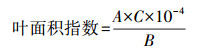
与无人机数码影像的获取同步, 每试验小区随机取小麦植株15株, 将植株按器官分为茎、叶和穗, 叶面积指数采用Li-3000c(Li-Cor, Lincoln, NE, USA)叶面积仪测定, 计算如式(4)所示。各器官样品在105 ℃下杀青30 min, 并在80 ℃下烘干至质量恒定后称质量。各器官样品经粉碎后采用凯氏定氮法测定氮含量(%)。叶片氮积累量的计算如式(5)所示。
|
(4) |
式中:A为15株小麦的总叶面积(cm2); B为15株小麦的总分蘖数; C为1 m2内小麦总分蘖数。

|
(5) |
以试验1数据为基础, 在抽穗前、后及全生育期对基于无人机RGB影像提取的6种颜色指数分别与叶面积指数、叶片干物质量和叶片氮积累量进行相关性分析, 根据相关系数(r)大小选取与叶面积指数、叶片干物质量和叶片氮积累量相关性最好的3个颜色指数, 通过指数函数建立基于优选颜色指数的小麦长势指标监测模型, 同时运用随机森林算法综合6种颜色指数在抽穗前、后及全生育期分别建立叶面积指数、叶片干物质量和叶片氮积累量监测模型。利用试验2的数据对模型进行测试验证。采用通用的决定系数(R2)和均方根误差(RMSE)表示已构建模型的准确性与普适性。6种颜色指数与叶面积指数、叶片干物质量及叶片氮积累量的相关性分析用SPSS 22.0软件(SPSS Inc., Chicago, Illinois, USA)。随机森林算法用R.3.2.0软件(R Foundation for Statistical Computing, Vienna, Austria)运行。随机森林算法有2个重要参数:生长树的数目N和节点分裂时输入的特征变量个数m, 在本文中参考前人相关研究[21-22], N设为500, m设为2。建模及验证图绘制均采用Microsoft Excel 2016软件(Microsoft Corporation, Redmond, WA, USA)完成。
|
(6) |
|
(7) |
|
(8) |
式中:n为样本数量; xi、yi、x和y分别表示模型涉及的自变量值、因变量值、自变量平均值和因变量平均值; pi为模型估测值; qi为试验观测值。
2 结果与分析 2.1 小麦长势指标的变异特征对建模及验证数据集中的叶面积指数、叶片干物质量和叶片氮积累量, 以及r、g和b值进行了统计分析, 结果(表 2)表明:以上参数在不同年份及施氮水平均达到极显著差异水平(P < 0.01), 不同品种间的差异不显著(P>0.05)。从表 3可见:对于建模数据集, 叶面积指数、叶片干物质量和叶片氮积累量分别为1.24~7.51、0.25~2.83 t · hm-2和5.73~107.81 kg · hm-2, 叶片氮积累量的变化程度最大(CV 为59.34%), 叶片干物质量次之(CV为44.09%), 叶面积指数最小(CV为41.19%)。对于验证数据集, 由于早期连续阴雨天气影响导致部分种子未发芽或麦苗长势较弱, 致使小麦整个生育期内长势普遍较差, 叶面积指数(1.34)、叶片干物质量(0.67 t · hm-2)和叶片氮积累量(18.82 kg · hm-2)的平均值都小于建模数据集中对应各指标的平均值(LAIMean=3.69, LDWMean=1.27 t · hm-2, LNAMean=41.18 kg · hm-2), 叶面积指数、叶片干物质量和叶片氮积累量分别为0.33~2.71、0.15~1.38 t · hm-2和1.49~50.06 kg · hm-2, 叶片氮积累量的变化程度最大(CV为55.47%), 叶面积指数次之(CV为40.30%), 叶片干物质量最小(CV为37.31%)。
| 因素 | 自由度 Degrees of freedom |
叶面积指数 Leaf area index |
叶片干物质量 Leaf dry weight |
叶片氮积累量 Leaf nitrogen accumulation |
r | g | b |
| 年份Year(Y) | 1 | ** | ** | ** | ** | ** | ** |
| 品种Cultivars(C) | 1 | ns | ns | ns | ns | ns | ns |
| 氮Nitrogen(N) | 4 | ** | ** | ** | ** | ** | ** |
| Y×C | 1 | ns | ns | ns | ns | ns | ns |
| Y× N | 4 | ** | ** | ** | ** | ** | ** |
| N× C | 4 | ns | ns | ns | ns | ns | ns |
| 注:“ns”表示不显著; “*”和“* *”分别表示在0.05和0.01水平差异显著。下同。 Note:“ns”means non-significance; “*”and“* *”mean significant difference at 0.05 and 0.01 levels, respectively. The same as follows. |
|||||||
| 数据集 Dataset |
农学参数 Agronomic parameter |
最小值 Minimum |
最大值 Maximum |
平均值 Mean |
标准偏差 SD |
| 建模数据 | 叶面积指数LAI | 1.24 | 7.51 | 3.69 | 1.52 |
| Calibration data | 叶片干物质量/(t·hm-2)LDW | 0.25 | 2.83 | 1.27 | 0.56 |
| (n=180) | 叶片氮积累量/(kg·hm-2)LNA | 5.73 | 107.81 | 41.18 | 24.44 |
| 验证数据 | 叶面积指数LAI | 0.33 | 2.71 | 1.34 | 0.54 |
| Validation data | 叶片干物质量/(t·hm-2)LDW | 0.15 | 1.38 | 0.67 | 0.25 |
| (n=90) | 叶片氮积累量/(kg·hm-2)LNA | 1.49 | 50.06 | 18.82 | 10.44 |
本研究综合不同品种、施氮水平和生育期的小麦叶面积指数、叶片干物质量和叶片氮积累量分别与6种颜色指数进行相关性分析, 3个长势指标与6种颜色指数在抽穗前、抽穗后及全生育期相关性程度按r大小降序排列(表 4), 对表现较好的颜色指数及r进行综合评定。6种颜色指数与叶面积指数、叶片干物质量和叶片氮积累量在抽穗前、抽穗后和全生育期都达到了极显著水平, 其中颜色指数VARI、ExR和NGRDI与3个长势指标的相关系数在抽穗前、抽穗后及全生育期均排前3位, 相关性均较好。选取VARI、ExR和NGRDI分别与叶面积指数、叶片干物质量和叶片氮积累量在抽穗前、抽穗后及全生育期构建模型(表 5), 指数函数拟合效果最好, 3种颜色指数与叶面积指数、叶片干物质量和叶片氮积累量在抽穗前期的R2分别为0.77~0.82、0.49~0.51和0.56~0.61;在抽穗后期的R2分别为0.71~0.72、0.69~0.71和0.74~0.76;在全生育期的R2分别为0.74~0.77、0.42~0.45和0.52~0.57。现将叶面积指数、叶片干物质量及叶片氮积累量与3个颜色指数在全生育期的定量关系作散点图直观展示方程的拟合效果(图 2)。同时, 综合6种颜色指数采用随机森林算法在抽穗前、后及全生育期构建叶面积指数、叶片干物质量和叶片氮积累量监测模型(表 5), 叶面积指数、叶片干物质量和叶片氮积累量监测模型在抽穗前期的R2分别为0.81、0.51和0.60, 在抽穗后期的R2分别为0.69、0.67和0.70, 在全生育期的R2分别为0.71、0.43和0.56。
| 生育期Growth stage | 颜色指数Color index | 叶面积指数LAI | 叶片干物质量LDW | 叶片氮积累量LNA |
| 抽穗前期Pre-heading stage | VARI | 0.915** | 0.751** | 0.811** |
| ExR | -0.882** | -0.748** | -0.782** | |
| NGRDI | 0.877** | 0.748** | 0.777** | |
| ExGR | 0.750** | 0.665** | 0.646** | |
| GLI | 0.589** | 0.548** | 0.491** | |
| ExG | 0.577** | 0.543** | 0.482** | |
| 抽穗后期Post-heading stage | VARI | 0.752** | 0.788** | 0.775** |
| NGRDI | 0.742** | 0.776** | 0.767** | |
| ExR | -0.739** | -0.776** | -0.760** | |
| ExGR | 0.676** | 0.727** | 0.709** | |
| ExG | 0.385** | 0.451** | 0.428** | |
| GLI | 0.353** | 0.429** | 0.418** | |
| 全生育期All growth stage | VARI | 0.834** | 0.686** | 0.753** |
| ExR | -0.810** | -0.669** | -0.719** | |
| NGRDI | 0.807** | 0.668** | 0.716** | |
| ExGR | 0.705** | 0.570** | 0.586** | |
| GLI | 0.556** | 0.432** | 0.422** | |
| ExG | 0.552** | 0.432** | 0.418** |
| 生育期Growth stage | 建模方式Modelling method | 颜色指数Color index | 叶面积指数LAI | 叶片干物质量LDW | 叶片氮积累量LNA |
| 抽穗前期 Pre-heading stage |
指数函数Exponential function 随机森林Random forest |
VARI ExR NGRDI 6 color indices |
0.82 0.79 0.77 0.81 |
0.51 0.51 0.49 0.51 |
0.61 0.58 0.56 0.60 |
| 抽穗后期 Post-heading stage |
指数函数Exponential function 随机森林Random forest |
VARI NGRDI ExR 6 color indices |
0.72 0.71 0.71 0.69 |
0.71 0.70 0.69 0.67 |
0.76 0.75 0.74 0.70 |
| 全生育期 All growth stage |
指数函数Exponential function 随机森林Random forest |
VARI ExR NGRDI 6 color indices |
0.77 0.74 0.74 0.71 |
0.45 0.43 0.42 0.43 |
0.57 0.53 0.52 0.56 |

|
图 2 全生育期颜色指数(VARI、ExR和NGRDI)与小麦叶面积指数、叶片干物质量和叶片氮积累量的定量关系 Fig. 2 The quantitative relationship between color indices (VARI, ExR and NGRDI) and LAI, LDW and LNA of wheat across all growth stages |
为了考察已建立模型的可靠性和普适性, 使用试验2独立数据对上述的抽穗前、后及全生育期基于VARI、ExR和NGRDI构建的指数函数模型及综合6种颜色指数构建的随机森林模型分别进行验证, 采用预测精度(R2)和均方根误差(RMSE)进行检验, 检验结果按RMSE升序排列(表 6)。以VARI、ExR和NGRDI为变量建立叶面积指数、叶片干物质量及叶片氮积累量监测模型, 在抽穗前期, ExR预测效果表现较好, 模拟值和观测值间的拟合决定系数分别为0.70、0.67和0.45, RMSE分别为0.78、0.20 t · hm-2和7.78 kg · hm-2; 在抽穗后期, VARI监测效果更好, 模拟值和观测值间的拟合决定系数分别为0.72、0.71和0.68, RMSE分别为0.28、0.24 t · hm-2和10.35 kg · hm-2; 在全生育期, ExR预测效果表现较好, 模拟值和观测值间的拟合决定系数分别为0.62、0.56和0.42, RMSE分别为0.65、0.17 t · hm-2和8.41 kg · hm-2。结合6种颜色指数运用随机森林算法建立叶面积指数、叶片干物质量及叶片氮积累量监测模型, 在抽穗前期, 模拟值和观测值间的拟合决定系数分别为0.56、0.55和0.38, RMSE分别为0.86、0.33 t · hm-2和11.38 kg · hm-2; 在抽穗后期, 模拟值和观测值间的拟合决定系数分别为0.67、0.68和0.62, RMSE分别为0.48、0.35 t · hm-2和13.43 kg · hm-2; 在全生育期, 模拟值和观测值间的拟合决定系数分别为0.47、0.45和0.33, RMSE分别为0.78、0.31 t · hm-2和10.66 kg · hm-2。验证结果表明, 相对于随机森林算法, 基于指数函数监测模型验证表现更优, 在抽穗前及全生育期尤以ExR监测模型用于小麦长势指标监测的效果更好, 在抽穗后期, 以VARI监测模型表现更好, 图 3为抽穗前、后及全生育期最优监测模型检验结果的1 : 1图。
| 生育期 Growth stage |
建模方式 Modelling method |
颜色指数 Color index |
叶面积指数LAI | 叶片干物质量LDW | 叶片氮积累量LNA | |||||
| 决定系数R2 | 均方根误差RMSE | 决定系数R2 | 均方根误差/ (t·hm-2) RMSE |
决定系数R2 | 均方根误差/ (kg·hm-2) RMSE |
|||||
| 抽穗前期 Pre-heading stage |
指数函数Exponential function 随机森林Random forest |
ExR NGRDI VARI 6 color indices |
0.70 0.66 0.66 0.56 |
0.78 0.78 0.79 0.86 |
0.67 0.64 0.63 0.55 |
0.20 0.21 0.22 0.33 |
0.45 0.44 0.41 0.38 |
7.78 7.85 8.01 11.38 |
||
| 抽穗后期 Post-heading stage |
指数函数Exponential function 随机森林Random forest |
VARI ExR NGRDI 6 color indices |
0.72 0.72 0.71 0.67 |
0.28 0.31 0.37 0.48 |
0.71 0.71 0.70 0.68 |
0.24 0.27 0.29 0.35 |
0.68 0.68 0.68 0.62 |
10.35 10.96 11.86 13.43 |
||
| 全生育期 All growth stage |
指数函数Exponential function 随机森林Random forest |
ExR NGRDI VARI 6 color indices |
0.62 0.58 0.58 0.47 |
0.65 0.65 0.67 0.78 |
0.56 0.52 0.51 0.45 |
0.17 0.18 0.18 0.31 |
0.42 0.40 0.38 0.33 |
8.41 8.59 8.67 10.66 |
||

|
图 3 基于优选颜色指数的抽穗前、后及全生育期小麦叶面积指数、叶片干物质量和叶片氮积累量预测值与实测值的比较 Fig. 3 Comparison of monitored values based on optimum color indices with measured LAI, LDW and LNA of wheat at pre- and post-heading and all growth stages |
作物冠层颜色深浅与叶绿素含量密切相关, 继而与氮素营养状况密切相关, 不同的作物群体结构、光温条件以及氮素营养水平等因素均显著影响作物的生长发育, 从而使作物冠层呈现不同的大小及颜色[23]。因此, 选取合适的作物冠层数码诊断指标对准确监测作物生长及氮素营养状况, 进而精准推荐氮肥用量具有重要意义。数字图像技术已成功应用于杂草探测[24]、植被识别[25]、作物叶面积指数[26]及氮素营养状况估测[27]。本研究基于RGB影像提取的6种颜色指数, 分别运用指数函数和随机森林算法构建叶面积指数、叶片干物质量及叶片氮积累量监测模型, 指数函数模型表现较优, 随机森林算法在本研究中表现并不突出, 这与相关研究者将该算法用于土地分类[28]、林地叶面积指数[29]、作物生物量[30]估算等研究结果有一定差异。随机森林算法擅长计算大规模数据, 而本文由于数据量有限(全生育期180个样本数据), 所用样本数偏少, 且在前人多数研究中表明, 在基于随机森林算法进行分类研究或反演作物生长指标时, 若加入多种类光谱信息、雷达信息、地形资料等[28, 31], 随机森林算法能够大大突显出应用优势, 而本研究只综合了6种颜色指数, 输入变量类型过少也有可能是建模及验证精度不高的重要原因。指数函数模型构建简单, 模型表现稳定, 本研究中基于颜色指数VARI、NGRDI和ExR构建的叶面积指数、叶片干物质量及叶片氮积累量指数函数监测模型均表现较好, 在抽穗前、后生育期的表现效果都优于全生育期, 这与贺佳等[32]应用高光谱遥感监测冬小麦叶面积指数研究结果类似。抽穗后期叶面积指数(R2=0.71~0.72), 叶片干物质量(R2=0.70~0.71)及叶片氮积累量(R2=0.68)的验证结果均优于抽穗前期(LAI:R2=0.66~0.70;LDW:R2=0.63~0.67;LNA:R2=0.41~0.45), 这可能是由于小麦在抽穗后期已封行, 群体达到一定生物量且长势更加均匀, 光谱数据受裸土等因素影响小[33], 促使生长后期监测效果更好。对于叶面积指数和叶片氮积累量监测, 在抽穗前、后及全生育期, 建模精度(LAI:R2=0.71~0.82;LNA:R2=0.52~0.76)优于验证精度(LAI:R2=0.58~0.72;LNA:R2=0.38~0.68), 而对于叶片干物质量监测, 验证精度(R2=0.51~0.71)优于建模精度(R2=0.42~0.71)。在验证数据集中叶片干物质量数据变异性(CV为37.31%)相对最小, 而在建模数据集中, 叶片干物质量数据变异性(CV为44.09%)大于叶面积指数(CV为41.19%), 由于建模数据集中包含拔节前期等生长早期数据, 该时期小麦依旧在产生分蘖, 且同一植株不同级别分蘖叶片大小有一定差异, 叶片干物质量数据较大的变异性可能是导致建模精度不高的原因。本研究中VARI和ExR相对于其他颜色指数有更好的验证表现, 相关研究报道VARI和ExR在估测水稻、玉米和大豆等作物的生物量、氮素营养状况时也有不错的表现[12, 34], 本研究结果与之类似。而本研究结果更进一步扩展了VARI和ExR的应用, 使其可作为开展作物长势状况监测研究的重要数字图像参数。
与传统手持式或航天航空遥感平台相比, 基于无人机遥感平台更便于实时、灵活、快速、无损获取高时空分辨率的遥感数据。国内外研究者应用无人机搭载多光谱(如Mini-MCA6)、高光谱(如Cubert UHD185)相机或者主动非成像式传感器(如RapidSCAN)监测小麦、水稻、棉花和玉米等作物的叶面积指数、地上部生物量及氮素营养状况[8, 35-37], 都取得较好结果。本研究采用无人机搭载数码相机, 基于颜色指数ExR或VARI在抽穗前、后及全生育期监测小麦叶面积指数(R2=0.72~0.79)、叶片干物质量(R2=0.43~0.71)及叶片氮积累量(R2=0.53~0.76)等长势指标, 同样取得较好效果。多光谱和高光谱相机价格昂贵(如多光谱相机Mini-MCA6价格约12万元), 现阶段还难以在农户实际生产上全面推广应用, 而本研究采用的遥感监测系统为大疆精灵3专业版无人机(自带相机)整套系统价格约9 000元, 成本低更易于推广应用。另一方面, 该无人机单节电池续航约23 min, 可支持其进行大面积的作物长势信息获取。但在数字图像快速拼接和分析等方面需要进一步优化, 以用于作物长势快速诊断与精确管理。
本研究通过分析抽穗前、后及全生育期小麦长势指标与基于对应时期试验区数码影像提取的6种颜色指数之间的关系, 比较运用指数函数和随机森林算法构建模型的效果, 最后确定基于指数函数模型的叶面积指数、叶片干物质量和叶片氮积累量为最优监测模型。由于建模及验证数据仅在同一生态点获取, 今后仍需在更多生态区对长势监测模型进行验证和完善, 提高模型的普适性, 推动作物氮素营养的无损诊断及精确追肥调控。
| [1] |
Singh B, Singh V, Singh Y S, et al. Site-specific fertilizer nitrogen management using optical sensor in irrigated wheat in the Northwestern India[J]. Agricultural Research, 2017, 6(2): 1-10. |
| [2] |
王来刚, 田永超, 朱艳, 等. 不同时空分辨率遥感数据融合估算冬小麦叶面积指数[J]. 农业工程学报, 2012, 28(17): 117-124. Wang L G, Tian Y C, Zhu Y, et al. Estimation of winter wheat leaf area index by fusing different spatial and temporal resolution remote sensing data[J]. Transactions of the Chinese Society of Agricultural Engineering, 2012, 28(17): 117-124 (in Chinese with English abstract). DOI:10.3969/j.issn.1002-6819.2012.17.017 |
| [3] |
Lamb D W, Schneider D A, Stanley J N. Combination active optical and passive thermal infrared sensor for low-level airborne crop sensing[J]. Precision Agriculture, 2014, 15(5): 523-531. DOI:10.1007/s11119-014-9350-0 |
| [4] |
Liu X J, Ferguson R B, Zheng H B, et al. Using an active-optical sensor to develop an optimal NDVI dynamic model for high-yield rice production(Yangtze, China)[J]. Sensors, 2017, 17(4): 672. DOI:10.3390/s17040672 |
| [5] |
周晓楠, 黄正来, 张文静, 等. 基于双波段光谱仪CGMD-302的小麦叶面积指数和叶干重监测[J]. 中国农业大学学报, 2017, 22(1): 102-111. Zhou X N, Huang Z L, Zhang W J, et al. Monitoring leaf area index and leaf dry weight of winter wheat with dual-wavebands spectrometer CGMD-302[J]. Journal of China Agricultural University, 2017, 22(1): 102-111 (in Chinese with English abstract). |
| [6] |
Zhou X, Zheng H B, Xu X Q, et al. Predicting grain yield in rice using multi-temporal vegetation indices from UAV-based multispectral and digital imagery[J]. ISPRS Journal of Photogrammetry and Remote Sensing, 2017, 130: 246-255. DOI:10.1016/j.isprsjprs.2017.05.003 |
| [7] |
Liu H Y, Zhu H C, Wang P. Quantitative modelling for leaf nitrogen content of winter wheat using UAV-based hyperspectral data[J]. International Journal of Remote Sensing, 2017, 38(8/9/10): 2117-2134. |
| [8] |
Krienke B, Ferguson R B, Schlemmer M, et al. Using an unmanned aerial vehicle to evaluate nitrogen variability and height effect with an active crop canopy sensor[J]. Precision Agriculture, 2017, 18(3): 1-16. |
| [9] |
贾彪, 马富裕. 不同氮素处理棉花冠层图像颜色特征分析[J]. 江苏农业科学, 2016, 44(9): 344-351. Jia B, Ma F Y. Analysis of color characteristics of cotton canopy images under different nitrogen rates[J]. Jiangsu Agricultural Sciences, 2016, 44(9): 344-351 (in Chinese). |
| [10] |
李明, 张长利, 房俊龙. 基于图像处理技术的小麦叶面积指数的提取[J]. 农业工程学报, 2010, 26(1): 205-209, 386. Li M, Zhang C L, Fang J L. Extraction of leaf area index of wheat based on image processing technique[J]. Transactions of the Chinese Society of Agricultural Engineering, 2010, 26(1): 205-209, 386 (in Chinese with English abstract). DOI:10.3969/j.issn.1002-6819.2010.01.036 |
| [11] |
Zhang J, Yang C H, Zhao B Q, et al. Crop classification and LAI estimation using original and resolution-reduced images from two consumer-grade cameras[J]. Remote Sensing, 2017, 9(10): 1054. DOI:10.3390/rs9101054 |
| [12] |
Hunt E R Jr, Cavigelli M, Daughtry C S T, et al. Evaluation of digital photography from model aircraft for remote sensing of crop biomass and nitrogen status[J]. Precision Agriculture, 2005, 6(4): 359-378. DOI:10.1007/s11119-005-2324-5 |
| [13] |
Zhang J Y, Liu X, Liang Y, et al. Using a portable active sensor to monitor growth parameters and predict grain yield of winter wheat[J]. Sensors, 2019, 19(5): 1108. DOI:10.3390/s19051108 |
| [14] |
Wang L A, Zhou X D, Zhu X K, et al. Estimation of biomass in wheat using random forest regression algorithm and remote sensing data[J]. The Crop Journal, 2016, 4(3): 212-219. DOI:10.1016/j.cj.2016.01.008 |
| [15] |
Yang S X, Feng Q S, Liang T G, et al. Modeling grassland above-ground biomass based on artificial neural network and remote sensing in the Three-River Headwaters Region[J]. Remote Sensing of Environment, 2018, 204: 448-455. DOI:10.1016/j.rse.2017.10.011 |
| [16] |
Woebbecke D M, Meyer G E, von Bargen K, et al. Color indices for weed identification under various soil, residue, and lighting conditions[J]. Transactions of the ASAE, 1995, 38: 259-269. DOI:10.13031/2013.27838 |
| [17] |
Meyer G E, Hindman T W, Laksmi K. Machine vision detection parameters for plant species identification[J]. Proceedings of SPIE:The International Society for Optical Engineering, 1999, 3543: 327-335. |
| [18] |
Meyer G E, Neto J C. Verification of color vegetation indices for automated crop imaging applications[J]. Computers and Electronics in Agriculture, 2008, 63(2): 282-293. DOI:10.1016/j.compag.2008.03.009 |
| [19] |
Gitelson A A, Kaufman Y J, Stark R, et al. Novel algorithms for remote estimation of vegetation fraction[J]. Remote Sensing of Environment, 2002, 80(1): 76-87. DOI:10.1016/S0034-4257(01)00289-9 |
| [20] |
Louhaichi M, Borman M M, Johnson D E. Spatially located platform and aerial photography for documentation of grazing impacts on wheat[J]. Geocarto International, 2001, 16(1): 65-70. DOI:10.1080/10106040108542184 |
| [21] |
Yuan H H, Yang G J, Li C C, et al. Retrieving soybean leaf area index from unmanned aerial vehicle hyperspectral remote sensing:analysis of RF, ANN, and SVM regression models[J]. Remote Sensing, 2017, 9(4): 309. DOI:10.3390/rs9040309 |
| [22] |
Li Z W, Wang J H, Tang H, et al. Predicting grassland leaf area index in the meadow steppes of northern China:a comparative study of regression approaches and hybrid geostatistical methods[J]. Remote Sensing, 2016, 8(8): 632. DOI:10.3390/rs8080632 |
| [23] |
李亚兵, 毛树春, 韩迎春, 等. 不同棉花群体冠层数字图像颜色变化特征研究[J]. 棉花学报, 2012, 24(6): 541-547. Li Y B, Mao S C, Han Y C, et al. Study on the color characteristics variation of cotton canopy digital images[J]. Cotton Science, 2012, 24(6): 541-547 (in Chinese with English abstract). DOI:10.3969/j.issn.1002-7807.2012.06.011 |
| [24] |
Pérez A J, López F, Benlloch J V, et al. Colour and shape analysis techniques for weed detection in cereal fields[J]. Computers and Electronics in Agriculture, 2000, 25(3): 197-212. DOI:10.1016/S0168-1699(99)00068-X |
| [25] |
丁雷龙, 李强子, 杜鑫, 等. 基于无人机图像颜色指数的植被识别[J]. 国土资源遥感, 2016, 28(1): 78-86. Ding L L, Li Q Z, Du X, et al. Vegetation extraction method based on color indices from UAV images[J]. Remote Sensing for Land & Resources, 2016, 28(1): 78-86 (in Chinese with English abstract). |
| [26] |
牛庆林, 冯海宽, 杨贵军, 等. 基于无人机数码影像的玉米育种材料株高和LAI监测[J]. 农业工程学报, 2018, 34(5): 73-82. Niu Q L, Feng H K, Yang G J, et al. Monitoring plant height and leaf area index of maize breeding material based on UAV digital images[J]. Transactions of the Chinese Society of Agricultural Engineering, 2018, 34(5): 73-82 (in Chinese with English abstract). |
| [27] |
Shibayama M, Sakamoto T, Takada E, et al. Continuous monitoring of visible and near-infrared band reflectance from a rice paddy for determining nitrogen uptake using digital cameras[J]. Plant Production Science, 2009, 12(3): 293-306. DOI:10.1626/pps.12.293 |
| [28] |
马玥, 姜琦刚, 孟治国, 等. 基于随机森林算法的农耕区土地利用分类研究[J]. 农业机械学报, 2016, 47(1): 297-303. Ma Y, Jiang Q G, Meng Z G, et al. Classification of land use in farming area based on random forest algorithm[J]. Transactions of Chinese Society for Agricultural Machinery, 2016, 47(1): 297-303 (in Chinese with English abstract). |
| [29] |
姚雄, 余坤勇, 杨玉洁, 等. 基于随机森林模型的林地叶面积指数遥感估算[J]. 农业机械学报, 2017, 48(5): 159-166. Yao X, Yu K Y, Yang Y J, et al. Estimation of forest leaf area index based on random forest model and remote sensing data[J]. Transactions of the Chinese Society for Agricultural Machinery, 2017, 48(5): 159-166 (in Chinese with English abstract). |
| [30] |
王云飞, 庞勇, 舒清态. 基于随机森林算法的橡胶林地上生物量遥感反演研究——以景洪市为例[J]. 西南林业大学学报, 2013, 33(6): 38-45, 311. Wang Y F, Pang Y, Shu Q T. Counter-estimation on aboveground biomass of Hevea brasiliensis plantation by remote sensing with random forest algorithm:a case study of Jinghong[J]. Journal of Southwest Forestry University, 2013, 33(6): 38-45, 311 (in Chinese with English abstract). DOI:10.3969/j.issn.2095-1914.2013.06.007 |
| [31] |
岳继博, 杨贵军, 冯海宽. 基于随机森林算法的冬小麦生物量遥感估算模型对比[J]. 农业工程学报, 2016, 32(18): 175-182. Yue J B, Yang G J, Feng H K. Comparative of remote sensing estimation models of winter wheat biomass based on random forest algorithm[J]. Transactions of the Chinese Society of Agricultural Engineering, 2016, 32(18): 175-182 (in Chinese with English abstract). DOI:10.11975/j.issn.1002-6819.2016.18.024 |
| [32] |
贺佳, 刘冰锋, 李军. 不同生育时期冬小麦叶面积指数高光谱遥感监测模型[J]. 农业工程学报, 2014, 30(24): 141-150. He J, Liu B F, Li J. Monitoring model of leaf area index of winter wheat based on hyperspectral reflectance at different growth stages[J]. Transactions of the Chinese Society of Agricultural Engineering, 2014, 30(24): 141-150 (in Chinese with English abstract). DOI:10.3969/j.issn.1002-6819.2014.24.017 |
| [33] |
Cao Q, Mao Y, Shen J, et al. Evaluating two crop circle active canopy sensors for in-season diagnosis of winter wheat nitrogen status[J]. Agronomy, 2018, 8: 201. DOI:10.3390/agronomy8100201 |
| [34] |
Sakamoto T, Shibayama M, Kimura A, et al. Assessment of digital camera-derived vegetation indices in quantitative monitoring of seasonal rice growth[J]. ISPRS Journal of Photogrammetry and Remote Sensing, 2011, 66(6): 872-882. DOI:10.1016/j.isprsjprs.2011.08.005 |
| [35] |
刘昌华, 王哲, 陈志超, 等. 基于无人机遥感影像的冬小麦氮素监测[J]. 农业机械学报, 2018, 49(6): 207-214. Liu C H, Wang Z, Chen Z C, et al. Nitrogen monitoring of winter wheat based on unmanned aerial vehicle remote sensing image[J]. Transactions of the Chinese Society for Agricultural Machinery, 2018, 49(6): 207-214 (in Chinese with English abstract). |
| [36] |
田明璐, 班松涛, 常庆瑞, 等. 基于低空无人机成像光谱仪影像估算棉花叶面积指数[J]. 农业工程学报, 2016, 32(21): 102-108. Tian M L, Ban S T, Chang Q R, et al. Use of hyperspectral images from UAV-based imaging spectroradiometer to estimate cotton leaf area index[J]. Transactions of the Chinese Society of Agricultural Engineering, 2016, 32(21): 102-108 (in Chinese with English abstract). DOI:10.11975/j.issn.1002-6819.2016.21.014 |
| [37] |
Zheng H B, Cheng T, Li D, et al. Combining unmanned aerial vehicle(UAV)-based multispectral imagery and ground-based hyperspectral data for plant nitrogen concentration estimation in rice[J]. Frontiers in Plant Science, 2018, 9: 936. DOI:10.3389/fpls.2018.00936 |