 2019, Vol. 39


2. 福建农林大学林学院, 福州 350002
2. Forestry College, Fujian Agriculture and Forestry University, Fuzhou 350002
草地火是草地生态系统重要干扰因子, 对草地结构和功能有重要影响(Bowman et al., 2009;Finch et al., 2011;Mouillot et al., 2014).草地火灾排放的大量气体污染物和颗粒物主要包括CO2、CO、NOx、SO2、NH3、VOCS、PM、OC、EC、烃类和卤代烃等污染物(Schultz et al., 2008;Van et al., 2010)对大气环境及人类健康有重要影响(Wang et al., 2018;Konovalov et al., 2018). Torlaket等(2011)研究显示全球有3.49×10⁹ hm2的草业资源, 每年有7.36×10⁸ hm2草地遭到火灾威胁(Hantson et al., 2013), 有2143 Tg草地生物量燃烧, 其中52%来源于非洲, 30%来源美洲, 14%来源亚洲, 其它区域占4%(Van et al., 2006;Wiedinmyer et al., 2011);可以释放约3626 Tg的CO2, 126.4 Tg的CO, 3.21 Tg的CH4, 6.0 Tg的NOx, 11.6 Tg的PM2.5、5.6 Tg的OC和1.1 Tg的SO2(Wiedinmyer et al., 2011).排放物中NO2、CO2、SO2、HF、O3、颗粒物和有机物等物质导致植被叶片受害和部分组织坏死, 降低气孔导度, 抑制光合放氧和电子运输,使卡尔文循环中的酶失去活性, 甚至扰乱植被生理活动, 进而抑制植物的整体生长(Lai et al., 2018;靳全锋等, 2016).卤代烃大量排放物可以破坏O3层, 影响地球太阳辐射, 促进光化学反应和阴霾形成, 降低大气能见度(Schiferl et al., 2018), 直接和间接影响全球气候变化(Kok et al., 2018;靳全锋等, 2019).草地火排放污染物对人类和动植物有显著影响.细小颗粒物可以直接进入人类呼吸系统, 增加肺病发病率(靳全锋等, 2017a).目前关于草地火灾研究已展开, 随着科学技术发展, 利用卫星遥感数据对草地火研究已成为主流, 卫星遥感影像最适用于大尺度草地火时空格局研究.遥感影像具有空间尺度大、时间周期长和成本低等优良特性, 对大尺度草地火灾研究具有其他方法不可替代的优势(Li et al., 2018).
中国是居世界第二的草地资源大国, 约有4.0×10⁹ hm2草地资源, 占国土面积的2/5, 我国也是草地火灾频发的国度, 每年有1/3的草地遭受火灾的破坏(Liu et al., 2017).由于人类活动导致草地火频发, 95%草地火由人类活动引起(靳全锋等, 2017b).目前我国已开展草地火灾研究, 并取得一定进展(Zhi et al., 2009;Liu et al., 2010;宫大鹏等, 2018), 但以往研究主要存在以下问题:①研究以草地火险等级划分为主(Li et al., 2018;傅泽强等, 2001). ②研究区域主要集中在我国北方区域(靳全锋等, 2017c;宫大鹏等, 2018b). ③主要是草地火灾影响因素分析(周怀林等, 2016;张正祥等, 2013;曲炤鹏等, 2010). ④关于烟气的研究较少(Mehmood et al., 2018).因此研究中国区域草地火排放具有重要意义.
鉴于此, 本研究以2001—2017年MODIS影像数据为研究对象, 对中国大陆区域草地火运用排放因子法, 估算中国大陆草地火排放污染物时空格局.主要研究目标为:①估测2001—2017年中国大陆地区草地火灾面积;②估测2001—2017年中国大陆区域草地生物质燃烧总量;③估算中国大陆区域草火排放污染物物总量;④分析中国大陆区域草火排放污染物时空格局.以为相关大气模型研究和大气环境污染评价提供基础科学依据.
2 资料来源与方法(Data and methods)本研究以中国大陆31个省、市、自治区和直辖市为研究区域, 运用MODIS影像结合排放因子及区域草地生物量, 估测中国大陆区域2001—2017年草地火灾释放CO2、CO、CH4、SO2、NMVOC、NOx、PM2.5、BC、OC和TC等污染物的总量及时空变化.
2.1 研究区概况中国大陆区域(图 1)位于北半球、东半球, 大部分位于北回归线以北, 北温带, 少部分属于热带, 没有寒带, 地理范围是北纬6°06′~53°30′, 东经73°20′~135°30′.土地面积9.60×10⁶ km2, 仅次于俄罗斯、加拿大, 居世界第三, 中国草地面积居世界第二, 占国土面积的41.7%, 其面积是耕地面积的3.2倍, 森林面积的2.5倍(Shen et al., 2016).
 |
| 图 1 中国大陆草地空间分布 Fig. 1 The spatial distribution of grassland in China |
MODIS-MCD64A1火产品在监测草地火灾方面具有良好的可靠性(Fornacca et al., 2017), 目前MODIS火点成功监测率为90%左右, 但通过滤除噪声、耀斑及云的干扰, 其草地火成功监测率高达100%(Zhou et al., 2006), 因此本研究是500 m空间分辨率的月尺度MCD64A1产品(https://e4ftl01.cr.usgs.gov/), 中国行政区划图(1:1000000)和中国植被覆盖图是空间分辨率为1 km的产品(http://www.resdc.cn/data.aspx?DATAID=184)进行叠加分析.
2.2.2 数据处理方法MODIS数据产品处理主要包括定义投影信息、投影转换、镶嵌、裁剪以及掩膜计算, 将2001—2017年MCD64A1火面积数据运用ENVI软件将数据由正弦曲线投影转换为兰伯特投影, 带号为48, 椭球体基准为WGS-84.将中国区域每月19景遥感影像运用ArcGIS10.2软件进行数据镶嵌、裁剪以及利用中国植被类型图进行掩膜计算, 分析发生草地区域过火像元和火日期信息.
2.3 草地燃烧生物量和污染物量计算草本燃烧量用式(1)进行计算(Zhou et al., 2017).
|
(1) |
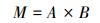
式中, M为草本燃烧量(t);A为燃烧面积(hm2);B为地上生物质密度(t·hm-2).
草地燃烧排放污染物利用公式(2)计算(Jin et al., 2018).

|
(2) |
式中, Ei为污染物排放量(t);M为草本燃烧量(t);EFi为i种污染物排放因子(g·kg-1);η为燃烧效率.
2.4 草地火排放污染物趋势和不确定分析 2.4.1 烟气排放量变化趋势及显著性分析Mann-Kandell趋势检验法(Bodas et al., 2018)是一种非参数统计检验方法.该方法优点不需要遵循一定分布, 不受少量异常值的干扰, 更适用于时间序列变化的数据趋势检验, 被广泛运用于时间序列上水文、温度和气候等趋势变化, 且计算也比较简单.
2.4.2 不确定分析本研究使用IPCC(1997)提供排放清单不确定性评估方法, 总体不确定性采用公式(3)计算.
|
(3) |
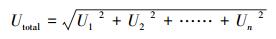
式中, Utotal为总体不确定性, Un是每个量相关的百分比不确定性.
2.5 排放因子确定本研究综合国内外学者研究结果, 目前关于国内草地燃烧的排放因子实测数据较少, 导致排放因子等级相对较低, 本研究根据Akagi等(2010;2011)、Andreae等(2001)、Goode等(1999)、Urbanski等(2014)研究成果平均值作为本研究排放因子, 其CO2、CO、CH4、SO2、NMVOC、NOx、PM2.5、BC、OC和TC排放因子分别为(1652.6±59.81)、(58±9.22)、(1.92±0.33)、(0.49±0.11)、(12.76±3.85)、(3.53±0.64)、(6.91±1.14)、(0.41±0.06)、(2.88±0.45)和(3.35±0.49) g·kg-1.草地地上生物密度运用Piao等(2007)估算中国大陆区域草地生物量, 草地燃烧效率采用Kato等(2011)、Akagi等(2010;2011)和Wu等(2018)研究成果平均95%.
3 结果与讨论(Results and discussion) 3.1 中国大陆草地生物量时空分布格局中国大陆区域草地生物量基于Piao等(2007)研究成果, 运用生长季NDVI平均值与地上生物量关系模型, 绘制2001—2017年中国大陆区域地上生物量空间分布图(图 2).图 2显示中国大陆区域生物量时空分布不均衡, 时间上年与年之间存在差异, 空间上地上生物量密度总体呈东高西低的趋势, 该研究结果与Zhou等(2018)、Gang等(2018)和Mu等(2013)的研究结果一致.朴世龙等(2004)、靳全锋等(2017c)和辛晓平等(2009)研究显示草地生物质密度与经纬度、湿度和降水呈正相关, 与温度和干燥度呈负相关关系.
 |
| 图 2 2001— 2017年中国大陆地区草地生物量空间分布(隔5年) Fig. 2 The spatial distribution of biomass density in China during 2000—2017(fiv-year interval) |
基于2001—2017年MODIS-MCD64A1中国大陆区域草地火面积数据, 运用ArcGIS10.2软件叠加分析方法, 提取2001—2017年燃烧区域草地生物质密度, 统计年草地燃烧生物量如图 3所示.图 3显示2001—2017年中国大陆区域燃烧生物量为23.86 Mt(1.40 Mt·a-1), 其中东北、华北、华东、华南、华中、西北和西南分别占燃烧总量的29.24%、31.17%、6.98%、9.99%、5.05%、2.62%和14.97%. 2001—2017年中国大陆区域草地燃烧生物量年变化总体呈波动变化, 年季变化差异不同, 全国区域2003、2008和2014年达到极大值, 分别为3.05、2.37和2.05 Mt;2006、2011和2016年为极小值, 分别为1.02、0.99和1.07 Mt.各区域年均燃烧生物量由大到小的顺序为:华北>东北>西南>华南>华东>华中>西北.
 |
| 图 3 2000—2017年中国大陆地区草地火消耗生物量时间变化 Fig. 3 The temporal change of biomass consumption by grass fires of mainland China during 2000—2017 |
为了确保研究成果精度, 本研究以内蒙古区域-新巴尔虎区2010—2016历史统计数据、MCD45A1(宫大鹏等, 2018a)与MCD64A1数据进行过火面积精度验证, 表 1显示林业部门统计2010—2016年新巴尔虎区域共有125864.16 hm2草地火面积, 运用MODIS-MCD45A1和MCD64A1遥感影像提取结果分别为150925 hm2和155223 hm2, 其统计数据总体低于MODIS影像数据.从精度上看MCD64A1平均精度达到81.09%, 与历史统计火面积数据差异不大, 因此该结果可用于宏观数据分析.而MCD64A1与MCD45A1数据相比, 其平均差异不超过5%, 具有较高的一致性.
| 表 1 不同数据源草地火过火面积对比 Table 1 The comparison of burnt area of grass fire from different data sources |
基于2001—2017年卫星火点数据, 运用ArcGIS10.2(坐标系为GWS-84投影)进行空间核密度分析, 绘制17年火点密度图.图 4显示17年中国大陆区域共发生162990次草地火灾, 年均9588次, 火点空间分布不均匀, 火点密度分布规律为东北和华北、华南和西南及华南与华东交汇域火密度较高, 华北-东北区域、东北-西北区域、西南-东南及南部区域、华南中部区域及华东和华中有少量火点密度较高区域分布.内蒙古、黑龙江、云南、广东、贵州、广西、江西、湖南、新疆和吉林等10个省分别占火点总数的29.61%、26.27%、10.43%、5.42%、4.65%、4.59%、2.52%、2.13%、1.87%和1.75%, 其余21个区域占比不足11%.
 |
| 图 4 2001—2017年中国大陆区域草地火点密度空间分布 Fig. 4 The temporal change of grass fire density of mainland China during 2001—2017 |
图 5a显示2001—2017年中国大陆区域草地火灾次数为1.63×10⁵次, 年均9588次, 火灾年变化不均衡.东北、华北、华东、华南、华中、西北和西南分别占区域总次数的28.17%、31.61%、6.16%、10.46%、4.22%、2.94%和16.42%. 2001—2017年中国大陆区域草地火灾年变化总体呈波动变化, 年季变化差异不同, 全国区域2003、2008和2014年达到极大值, 分别为17721次、15500次和13668次;2006、2011和2016年为极小值, 分别为7283次、6690次和7361次.各区域年均草地火灾次数由大到小的顺序为:华北>东北>西南>华南>华东>华中>西北.
 |
| 图 5 2001—2017年中国大陆区域草地火点(a)和火面积(b)年变化 Fig. 5 The annual change of number (a) and burnt area (b) of grass fire of mainland China during 2001—2017 |
图 5b显示2001—2017年中国大陆区域草地火面积为6.12×10⁶ hm2, 年均3.60×10⁵ hm2, 火面积区域分布不均匀.东北、华北、华东、华南、华中、西北和西南分别占区域面积27.85%、33.01%、6.26%、9.02%、4.25%、3.50%和16.11%. 2001—2017年中国大陆区域草地火面积年变化总体呈波动变化, 年季变化差异不同, 全国区域2003、2008和2014年达到极大值, 分别为7.44×10⁵、5.70×10⁵和5.18×10⁵ hm2;2006、2011和2016年为极小值, 分别为2.71×10⁵、2.48×10⁵和2.87×10⁵ hm2.各区域年均草地火面积由大到小的顺序为:华北>东北>西南>华南>华东>华中>西北.
图 6显示2001—2017年中国大陆区域草地火存在明显季节性差异, 火点月变化呈双峰分布, 峰值(3月)高于峰值(9月).时间上中国大陆火点1—3月呈增加趋势, 9—12月呈降低趋势, 火点呈先降低后增加趋势(3—9月).不同区域火点峰值存在差异, 东北、华北、西北和华东等区域呈双峰分布, 其主峰分别是3—4月、3月、10月和2月, 次峰分别为9—11月、9月、6月、6月.华南、华中和西南区域呈单峰分布.北方区域草地火多集中在3—4月和8—11月, 该研究与靳全锋等(2017)、周怀林等(2016)研究一致, 北方区域草地火集中在春、秋两季主要受自然因素(降水、空气湿度、温度和风速等)、植被属性等因素影响.张正祥等(2013)研究表明北方区域春季降水较少、相对湿度低、气温回暖快、风速较大导致植被含水量低和前一年死亡生物质较多, 极易促进草地火灾形成;秋季生物质大量死亡、降水较少、空气湿度降低和风速较强有利于草地火灾形成和扩散, 但由于气温下降较快降低火频率, 导致春季火灾频率显著高于秋季;其它月份由于降水、温度和草地属性等因子阻碍草地火发生.南方华中区域草地火多集中在8—10月, 华南集中在1—3月.
 |
| 图 6 2001—2017年中国大陆区域草地火点月尺度空间分布 Fig. 6 The spatial distribution of monthly grass fire ignitions of mainland China during 2001—2017 |
草地火排放受内、外因素共同作用不断发生变化, 运用大量静态数据, 并不能反映草地火排放动态变化, 估算污染物排放通过改变方法逐渐逼近真实值, 不可能成为真实值, 以往研究表明运用平均值是减少误差的常用估算方法.估算草地污染物排放总量分别运用草地火灾每次火面积、区域生物质密度和平均排放因子等共同估算, 如图 7显示各区域污染物排放总量不同, 各污染物分布有所差异, 2001—2017年中国大陆各区域草地火灾排放污染物CO2、CO、CH4、SO2、NMVOC、NOx、PM2.5、BC、OC和TC总量分别为37.27 Mt、1.31 Mt、43.30 kt、11.05 kt、287.74 kt、79.60 kt、155.82 kt、9.25 kt、64.95 kt和75.54 kt, 年均排放量分别为:2.19 Mt、76.94 kt、2.55 kt、0.65 kt、16.93 kt、4.68 kt、9.17 kt、0.54 kt、3.82 kt和4.44 kt, 各区域污染物详见表 2.图 7显示, 各污染物排放在空间上不均匀, 呈东多西少分布特征.东北区域由草地火排放污染物总量为11.49 Mt, 主要污染物CO2、CO、CH4、SO2、NMVOC、NOx、PM2.5、BC、OC和TC分别为10.90 Mt、0.38 Mt、12.66 kt、3.23 kt、84.13 kt、23.27 kt、45.56 kt、2.70 kt、18.99 kt和22.09 kt;其它区域华北、华东、华南、华中、西北和西南区域草地火释放污染物总量分别为:12.25 Mt、2.74 Mt、3.93 Mt、1.98 Mt、1.03 Mt和5.88 Mt;CO2、CO、CH4、SO2、NMVOC、NOx、PM2.5、BC、OC和TC等占各区域污染物总量比率分别为94.82%、3.33%、0.11%、0.03%、0.73%、0.20%、0.40%、0.02%、0.17%和0.19%. Yan等(2006)研究中国大陆草地火排放显示CO2、CO、NOx、SO2、PM2.5、TC、OC、BC、CH4和NMVOC排放范围是0.30~8.80 Mt、12.3~354.6 kt、1.1~32.6 kt、0.1 ~1.9 kt、1.0 ~29.5 kt、0.7 ~20.2 kt、0.6~18.5 kt、0.1~2.6 kt、0.4 ~12.5 kt和1.8~53.1 kt, 该研究与本研究结果较为接近;田贺忠等(2011)研究显示全国每年有12.12 kt的SO2排放, 该研究结果高于本研究, 因为其SO2源为森林和草原火排放.
 |
| 图 7 2001—2017年中国大陆区域草地火排放污染物总量区域分布图 Fig. 7 The spatial distribution of the total emissions of pollutants released from grass fire in mainand China during 2001—2017 |
| 表 2 2001—2017年中国大陆区域草地火污染物排放总量 Table 2 The total emissions of pollutants released from grass fire in mainand China during 2001—2017 |
运用Mann-Kendall趋势检验法分析中国大陆区域CO2、CO、NOx、SO2、PM2.5、TC、OC、BC、CH4和NMVOC等污染物排放年变化趋势(图 8).研究结果表明2001—2017年各区域污染物时空分布不均衡. Mann-Kendall趋势显著性检验结果表明各污染物在东北、华北、华中和西南区域呈增加趋势, 华东和西北区域呈降低趋势, 华南区域呈显著降低趋势.
 |
| 图 8 2001—2017年中国大陆区域草地火排放颗粒物趋势检验 Fig. 8 The change trend of the pollutants released from grass fire in mainland China during 2001—2017 |
草地火灾污染物排放不确定分析表明, 其不确定性受草本类型、燃烧面积、燃烧生物量、排放因子和燃烧效率等因素影响.研究表明草地火灾面积来源于MODIS-MCD64A1数据, 其平均精度超过80%(Fornacca et al., 2017), 燃烧生物量基于Piao等(2007)研究成果得到时空分布生物量, 其平均精度高于80%.排放因子基于前人研究结果平均值, 增强其可靠性, 其误差在10%~50%;本研究为了估算的准确性和精确性, 因此以多个草本燃烧效率实测数据平均值作为本研究的燃烧效率, 增强燃烧效率可靠性, 其误差控制在50%以内;本研究基于各因子不确定性运用公式(3)定量计算各污染物排放结果不确定性见表 3.
| 表 3 排放源估算误差分析 Table 3 The estimation errors from different emission sources |
1) 2001—2017年中国大陆地区草地生物质密度时空分布不均衡, 生物质密度呈东高西低趋势分布.区域总燃烧草地生物量为23.86 Mt, 其中东北、华北、华东、华南、华中、西北和西南分别占燃烧总量29.24%、31.17%、6.98%、9.99%、5.05%、2.62%和14.97%.
2) 2001—2017年中国大陆地区草地火灾时空分布不均衡, 空间上火点密度分布规律为东北和华北、华南和西南及华南与华东交汇域火密度较高, 华北-东北区域、东北-西北区域、西南-东南及南部区域、华南中部区域及华东和华中有少量火点密度较高区域分布.时间上草地火存在明显季节性差异, 火点月变化呈双峰分布, 峰值(3月)高于峰值(9月).
3) 2001—2017年全国共发生火灾次数和面积分别是1.63×10⁵次和6.12×10⁶ hm2各区域火灾次数和面积差异显著, 东北、华北、华东、华南、华中、西北和西南等区域火灾次数占总火灾比例分别是28.17%、31.61%、6.16%、10.46%、4.22%、2.94%和16.42%, 火面积比例分别是27.85%、33.01%、6.26%、9.02%、4.25%、3.50%和16.11%.
4) 2001—2017年中国大陆区域草地火灾排放污染物CO2、CO、CH4、SO2、NMVOC、NOx、PM2.5、BC、OC和TC总量分别为37.27 Mt、1.31 Mt、43.30 kt、11.05 kt、287.74 kt、79.60 kt、155.82 kt、9.25 kt、64.95 kt和75.54 kt, 年均排放量分别为2.19 Mt、76.94 kt、2.55 kt、0.65 kt、16.93 kt、4.68 kt、9.17 kt、0.54 kt、3.82 kt和4.44 kt.
5) 2001—2017年中国大陆区域草地火排放各污染物的动态变化, 显示草地燃烧释放各污染物在时间和空间上不均衡分布, 结果表明:各污染物在东北、华北、华中和西南区域呈增加趋势, 华东和西北区域呈降低趋势, 华南区域呈显著降低趋势.
Akagi S K, Yokelson R J, Wiedinmyer C, et al. 2011. Emission factors for open and domestic biomass burning for use in atmospheric models[J]. Atmospheric Chemistry and Physics, 11(9): 4039–4072.
|
Andreae M O, Merlet P. 2001. Emission of trace gases and aerosols from biomass burning[J]. Global biogeochemical cycles, 15(4): 955–966.
|
Bodas M, Siman-Tov M, Kreitler S, et al. 2018. The role of victimization in shaping households' preparedness for armed conflicts in Israel[J]. Disaster medicine and public health preparedness, 12(1): 67–75.
DOI:10.1017/dmp.2017.38
|
Bowman D M J S, Balch J K, Artaxo P, et al. 2009. Fire in the Earth System[J]. Science, 324(5926): 481–484.
DOI:10.1126/science.1163886
|
Finch J, Marchant R. 2011. A palaeoecological investigation into the role of fire and human activity in the development of montane grasslands in East Africa[J]. Vegetation History and Archaeobotany, 20(2): 109–124.
DOI:10.1007/s00334-010-0276-9
|
Fornacca D, Ren G, Xiao W. 2017. Performance of Three MODIS Fire Products (MCD45A1, MCD64A1, MCD14ML), and ESA Fire_CCI in a Mountainous Area of Northwest Yunnan, China, Characterized by Frequent Small Fires[J]. Remote Sensing, 9(11): 1131–1150.
|
傅泽强, 杨友孝, 戴尔阜. 2001. 内蒙古干草原火动态及火险气候区划研究[J]. 中国农业资源与区划, 2001(6): 21–25.
|
Gang C, Zhao W, Zhao T, et al. 2018. The impacts of land conversion and management measures on the grassland net primary productivity over the Loess Plateau, Northern China[J]. Science of the Total Environment, 645: 827–836.
DOI:10.1016/j.scitotenv.2018.07.161
|
宫大鹏, 康峰峰, 刘晓东. 2018a. 新巴尔虎草原火时空分布特征及对气象因子响应[J]. 北京林业大学学报, 2018a, 40(2): 82–89.
|
宫大鹏, 李炳怡, 刘晓东. 2018b. 草原火烧严重度燃烧指数的适用性比较分析[J]. 生态学报, 2018b, 38(7): 2434–2441.
|
Goode J G, Yokelson R J, Susott R A, et al. 1999. Trace gas emissions from laboratory biomass fires measured by open-path Fourier transform infrared spectroscopy:Fires in grass and surface fuels[J]. Journal of Geophysical Research:Atmospheres, 104(D17): 21237–21245.
DOI:10.1029/1999JD900360
|
Hantson S, Padilla M, Corti D, et al. 2013. Strengths and weaknesses of MODIS hotspots to characterize global fire occurrence[J]. Remote Sensing of Environment, 131: 152–159.
|
IPCC. 1997. Quantifying Uncertainties in Practice, Chapter 6.In: Good Practice Guidance and Uncertainty Management in National Greenhouse Gas Inventories[M].Bracknell: IES, IPCC, OECD
|
Jin Q, Ma X, Wang G, et al. 2018. Dynamics of major air pollutants from crop residue burning in mainland China, 2000-2014[J]. Journal of Environmental Sciences, 70: 195–206.
|
靳全锋, 陈磊, 黄娟, 等. 2016. 甲醛对富贵竹的生理生化响应[J]. 环境科学与技术, 2016, 39(8): 45–50.
|
靳全锋, 马祥庆, 王文辉, 等. 2017a. 中国亚热带地区2000-2014年林火排放颗粒物时空动态变化[J]. 环境科学学报, 2017a, 37(6): 2238–2247.
|
靳全锋, 王文辉, 马祥庆, 等. 2017b. 福建省2000-2010年林火排放污染物时空动态变化[J]. 中国环境科学, 2017b, 37(2): 476–485.
|
靳全锋, 鞠园华, 杨夏捷, 等. 2017c. 2005-2014年内蒙古草地火灾排放污染物的时空格局[J]. 草业学报, 2017c, 26(2): 21–29.
|
靳全锋, 叶文晶, 沈培福, 等. 2019. 浙江2001-2016年露天生物质燃烧排放污染物时空格局[J]. 环境科学学报, 2019, 39(1): 259–269.
|
Kato E, Michio K Y, Kinoshita T, et al. 2011. Development of spatially explicit emission scenario from land-use change and biomass burning for the input data of climate projection[J]. Procedia Environmental Sciences, 6(1): 146–152.
|
Kok J F, Ward D S, Mahowald N M, et al. 2018. Global and regional importance of the direct dust-climate feedback[J]. Nature Communications, 9(1): 241.
DOI:10.1038/s41467-017-02620-y
|
Konovalov I B, Lvova D A, Beekmann M, et al. 2018. Estimation of black carbon emissions from Siberian fires using satellite observations of absorption and extinction optical depths[J]. Atmospheric Chemistry and Physics Discussions, 18(20): 14889–14924.
DOI:10.5194/acp-18-14889-2018
|
Li N, Zhang J, Bao Y, et al. 2018. Himawari-8 satellite based dynamic monitoring of grassland fire in China-Mongolia Border Regions[J]. Sensors, 18(1): 276–290.
|
Lia O, Matsuura T, Munemasa S, et al. 2018. The mechanism of SO2-induced stomatal closure differs from O3 and CO2 responses and is mediated by non-apoptotic cell death in guard cells[J]. Plant, Cell & Environment.
DOI:10.1111/pce.13406
|
Liu M, Zhao J, Guo X, et al. 2017. Study on Climate and Grassland Fire in HulunBuir, Inner Mongolia Autonomous Region, China[J]. Sensors, 17(3): 616–629.
DOI:10.3390/s17030616
|
Liu X, Zhang J, Cai W, et al. 2010. Information diffusion-based spatio-temporal risk analysis of grassland fire disaster in northern China[J]. Knowledge-Based Systems, 23(1): 53–60.
DOI:10.1016/j.knosys.2009.07.002
|
陆炳, 孔少飞, 韩斌, 等. 2011. 2007年中国大陆地区生物质燃烧排放污染物清单[J]. 中国环境科学, 2011, 31(2): 186–194.
|
Mehmood K, Chang S, Yu S, et al. 2018. Spatial and temporal distributions of air pollutant emissions from open crop straw and biomass burnings in China from 2002 to 2016[J]. Environmental Chemistry Letters, 16(1): 301–309.
|
Mouillot F, Schultz M G, Yue C, et al. 2014. Ten years of global burned area products from spaceborne remote sensing-A review:Analysis of user needs and recommendations for future developments[J]. International Journal of Applied Earth Observation and Geoinformation, 26: 64–79.
DOI:10.1016/j.jag.2013.05.014
|
Mu S J, Zhou S X, Chen Y Z, et al. 2013. Assessing the impact of restoration-induced land conversion and management alternatives on net primary productivity in Inner Mongolian grassland, China[J]. Global and Planetary Change, 108: 29–41.
DOI:10.1016/j.gloplacha.2013.06.007
|
Piao S, Fang J, Zhou L, et al. 2007. Changes in biomass carbon stocks in China's grasslands between 1982 and 1999[J]. Global Biogeochemical Cycles, 21(2): 1–10.
|
朴世龙, 方精云, 贺金生, 等. 2001. 中国草地植被生物量及其空间分布格局[J]. 植物生态学报, 2001, 28(4): 491–498.
|
曲炤鹏, 郑淑霞, 白永飞. 2010. 蒙古高原草原火行为的时空格局与影响因子[J]. 应用生态学报, 2010, 21(4): 807–813.
|
Ruiz J A M, Lázaro J R G, Cano I D Á, et al. 2014. Burned area mapping in the north american boreal forest using Terra-MODIS LTDR (2001-2011):A Comparison with the MCD45A1, MCD64A1 and BA GEOLAND-2 Products[J]. Remote Sensing, 6(1): 815–840.
DOI:10.3390/rs6010815
|
Schiferl L D, Heald C L. 2018. Particulate matter air pollution may offset ozone damage to global crop production[J]. Atmospheric Chemistry and Physics, 18(8): 5953–5966.
DOI:10.5194/acp-18-5953-2018
|
Schultz M G, Heil A, Hoelzemann J J, et al. 2008. Global wildland fire emissions from 1960 to 2000[J]. Global Biogeochemical Cycles, 22(2): 1–13.
|
Shen H H, Zhu Y K, Zhao X, et al. 2016. Analysis of current grassland resources in China[J]. Chinese Science Bulletin, 61(2): 139–154.
|
Torlak G, Sevkli M, Sanal M, et al. 2011. Analyzing business competition by using fuzzy TOPSIS method:An example of Turkish domestic airline industry[J]. Expert Systems with Applications An International Journal, 38(4): 3396–3406.
DOI:10.1016/j.eswa.2010.08.125
|
Urbanski S. 2014. Wildland fire emissions, carbon, and climate:Emission factors[J]. Forest Ecology and Management, 317: 51–60.
DOI:10.1016/j.foreco.2013.05.045
|
Van D W G R, Randerson J T, Giglio L, et al. 2006. Interannual variability of global biomass burning emissions from 1997 to 2004[J]. Atmospheric Chemistry & Physics Discussions, 6(2): 3175–3226.
|
Van G R, Randerson J T, Giglio L, et al. 2010. Global fire emissions and the contribution of deforestation, savanna, forest, agricultural, and peat fires (1997-2009)[J]. Atmospheric Chemistry and Physics, 10(23): 11707–11735.
DOI:10.5194/acp-10-11707-2010
|
Wang J, Xi F, Liu Z, et al. 2018. The spatiotemporal features of greenhouse gases emissions from biomass burning in China from 2000 to 2012[J]. Journal of Cleaner Production, 181: 801–808.
DOI:10.1016/j.jclepro.2018.01.206
|
Wu J, Kong S, Wu F, et al. 2018. Estimating the open biomass burning emissions in Central and Eastern China from 2003 to 2015 based on satellite observation[J]. Atmospheric Chemistry & Physics, 18(16): 11623–11646.
|
Wiedinmyer C, Akagi S K, Yokelson R J, et al. 2011. The Fire INventory from NCAR (FINN):A high resolution global model to estimate the emissions from open burning[J]. Geoscientific Model Development, 4(3): 625–641.
DOI:10.5194/gmd-4-625-2011
|
Yan X, Ohara T, Akimoto H. 2006. Bottom-up estimate of biomass burning in mainland China[J]. Atmospheric Environment, 40(27): 5262–5273.
DOI:10.1016/j.atmosenv.2006.04.040
|
张正祥, 张洪岩, 李冬雪, 等. 2013. 呼伦贝尔草原人为火空间分布格局[J]. 生态学报, 2013, 33(7): 2023–2031.
|
中国畜牧业年鉴编辑部. 2013. 中国畜牧业年鉴2013[M]. 北京: 中国农业出版社.
|
Tong Z, Zhang J, Liu X. 2009. GIS-based risk assessment of grassland fire disaster in western Jilin province, China[J]. Stochastic Environmental Research and Risk Assessment, 23(4): 463–471.
DOI:10.1007/s00477-008-0233-7
|
周怀林, 王玉辉, 周广胜. 2016. 内蒙古草原火的时空动态特征研究[J]. 草业学报, 2016, 25(4): 16–25.
|
Zhou W, Yang H, Zhou L, et al. 2018. Dynamics of grassland carbon sequestration and its coupling relation with hydrothermal factor of Inner Mongolia[J]. Ecological Indicators, 95: 1–11.
|
Zhou X C, Wang X Q. 2006. Validate and improvement on arithmetic of identifying forest fire based on EOS-MODIS data[J]. Remote Sensing Technology & Application, 21(3): 206–211.
|
Zhou Y, Xing X, Lang J, et al. 2017. A comprehensive biomass burning emission inventory with high spatial and temporal resolution in China[J]. Atmospheric Chemistry and Physics.
DOI:10.5194/acp-2016-560
|