 2020, Vol. 63


2. 中国地质大学(北京)地球物理与信息技术学院, 北京 100083;
3. 中国科学院地质与地球物理研究所, 北京 100029;
4. 浙江大学地球科学学院, 杭州 310027
2. School of Geophysics and Information Technology, China University of Geosciences(Beijing), Beijing 100083, China;
3. Institute of Geology and Geophysics, Chinese Academy of Sciences, Beijing 100029, China;
4. School of Earth Sciences, Zhejiang University, Hangzhou 310027, China
近几十年来,青藏高原的形成和演化一直是地球科学研究的焦点.目前地质学家在地表完成了青藏高原大部分地区的地质填图(任纪舜和肖黎薇,2004;唐菊兴, 2019;许志琴等, 2016),基本查明了青藏高原的大地构造、断裂带分布、地质演化和矿产资源分布.地球物理学家也通过对青藏高原及周缘地区布设台阵和剖面研究其深部结构、地壳厚度变化和岩石圈热结构等,例如“ANTILOPE”计划(Zhao et al., 2014)对青藏高原西部,“CHINA- ARRAY”计划(Liu et al., 2014;Wang et al., 2017)对青藏高原东部都进行了深入研究.
但关于青藏高原地壳的一些核心问题还没有解决:青藏高原为什么会隆升?青藏高原巨厚地壳有怎样的物质组分?解决这些问题需要高分辨率的青藏高原地壳三维成像的数据,结合青藏高原地表丰富的地质资料,为研究青藏高原地壳构造演化提供更明确的证据.
体波地震层析成像已经成为探测岩浆和断裂带发育地区地壳上地幔地质构造的重要方法技术.青藏高原地区的地震体波层析成像工作使用经互联网公布的中国数字地震台网震相报告和全球数字地震台网国际地震中心(International Seismological Centre,简写ISC)震相报告取得了地幔P波速度扰动的三维结构模型(Li et al., 2006, 2008;胥颐等,2014).2000年之前,由于青藏高原大面积的无人区,海拔高,自然环境恶劣,中国地震台网资料相对较少,数据有限,对青藏高原70 km深度内的地壳地震波速度三维结构分辨率不足.使用面波层析成像获得S波速度结构(苏伟等,2002;Yang et al., 2010, 2012;Bao et al., 2015)增加了在地壳内扰动的射线数量,但青藏高原地壳体波精细三维速度结构仍有待深入研究.
2008年汶川地震以后,在青藏高原东缘地区开展了大量天然地震台站观测,特别是“CHINA-ARRAY”计划在青藏高原东缘布设大量宽频流动台阵,这些工作都取得了卓越的成果和认识(Li et al., 2008;Yao et al., 2008, 2010;Fu et al., 2010;Liu et al., 2014;Huang et al., 2015a, 2015b;Liang et al., 2016;Peng et al., 2016;李军等,2017;杨志高等,2019).尤其是发生汶川地震和芦山地震的龙门山断裂带及周缘地区,使用层析成像方法,得到了大量高分辨率的速度结构(Lei and Zhao, 2009;Li et al., 2009, 2010;Zhao et al., 2012;Liu et al., 2014, 2018;Wang et al., 2014a, b).但仍然缺乏青藏高原主体地区的地壳速度结构研究.
但经过近二十年的建设,“中国数字地震观测网络”完成了数字化升级改造,四川、甘肃、宁夏、青海、西藏的地震台站数量逐年增多,中国地震台网保存了大量省内地方震和小震的震相到时,完整保留了地方震和小震的波形记录,这些资料大大增加了青藏高原地壳的数据覆盖.2014年以来,在中国地质调查局“青藏高原上中下地壳物性结构和变形带成像”(121201102000150014)项目的支持下,收集了中国地震台网中与青藏高原有关的地震目录和波形数据,整理和读取走时数据共计十多万条,进行了青藏高原地壳地震波速度和泊松比的三维层析成像研究.有关地震P波的成像已经进行了报道(杨文采等, 2019a).同时进行的S波速度和泊松比扰动的三维层析成像研究,取得了更为丰富的资料,为研究青藏高原地壳构造提供了更明确的证据.
1 研究数据和方法中国地震局除中国数字地震台网的震相报告外,还有许多地方地震台网.本研究结合中国数字地震台网及地方地震台站资料,开展了青藏高原地壳地震波速度的三维层析成像.通过收集中国地震局数字台网中心和新疆、甘肃、四川、西藏和青海等地方地震局震相报告和波形数据,并经过数据集合整理,得到了青藏高原同台同源的十多万条P波和S波走时数据,使用体波走时层析成像方法,获得了分辨率达到1°×1°×20 km的地壳纵、横波速度结构,计算了泊松比空间分布,揭示青藏高原地壳内部波速结构特征.
1.1 资料选取本研究使用的纵波和横波到时数据来自中国地震局国家地震科学数据共享中心提供的中国地震台网震相数据报告(2009—2016年)、新疆、甘肃、四川、西藏和青海等省级台网地震目录、震相报告和中国数字地震台网波形资料(2010—2015年).使用的震相包括纵波震相(P、Pg、Pn)和横波震相(S、Sg、Sn).地震震源和台站分布图见图 1a.其中蓝色三角形为台站,共412个,选取了3级以上的地震共13058个,绿点为地震震源位置.图 1b为射线分布平面图,黑色实线为射线路径.

|
图 1 研究所用震源、台站、射线分布图和研究区构造简图 (a)地震震源和台站分布图,蓝色三角形为台站,绿点为地震,红框为研究区;(b)射线分布平面图,黑色实线为射线路径; (c)研究区构造简图,图中浅蓝色矩形代表青藏高原四个新生代火山岩带,其中NTZ为北部第三纪火山岩带,NQZ为北部第四纪火山岩带,SZ为南部第三纪火山岩带,EZ为东部第三纪火山岩带.图中黑色实线为断裂带或缝合带,图中红色文字为地块或断裂带名称,(c)中蓝色实线为剖面AA1和BB1位置,每一个圆点间隔1°,剖面图见图 5a和5b.INDB—印度板块;HM—喜马拉雅地体;GDS—冈底斯地体;LS—拉萨地体;NQT—北羌塘地体;SQT—南羌塘地体;QL—祁连地体;EKL—东昆仑地体;NSG—北松潘—甘孜地体;SSG—南松潘—甘孜地体;TC—腾冲地体;YZB—扬子地块;mft.—主前锋逆冲断裂;iys.—印度—雅鲁藏布江缝合带;jlf.—嘉黎断裂;bg-njs. —班公湖—怒江缝合带;jsjs.—金沙江缝合带;xshf.—鲜水河断裂;als-rrf.—哀牢山—红河断裂;anmqs.—阿尼玛卿缝合带;lmsf.—龙门山断裂带. Fig. 1 Distribution of the epicenter of earthquakes, seismic stations, rays used in this study, and general tectonic framework of the study area (a) The earthquakes and stations distribution. The blue triangles are the stations, the green points are the earthquake positions, and the red frame is the study area; (b) The ray distribution plan view. The solid black lines are the rays path; (c) is a general tectonic framework of the study area. The light blue rectangles in the picture represent the four Cenozoic volcanic rock belts of the Tibetan Plateau, of which NTZ is the northern Tertiary volcanic belt, NQZ is the northern Quaternary volcanic belt, SZ is the southern Tertiary volcanic belt, and EZ is the Eastern Tertiary Volcanic rock belt. The solid black lines in the figure are the fault zones or suture zones, the red texts in the figure are the name of the blocks or the fault zones, and the solid blue lines in (c) show the positions of the sections AA1 and BB1, and each dot is spaced 1 ° apart, profile results are shown in Figs. 5a and 5b. INDB—INDP-India Plate; HM—Himalaya terrane; GDS—Gangdese terrane; LS—Lhasa terrane; NQT—North Qiangtang terrane; SQT— South Qiangtang terrane; QL—Qilian terrane; EKL—East Kunlun terrane; NSG—North Songpan-Garzê terrane; SSG—South Songpan-Garzê terrane; TC—Tengchong terrane; YZB—Yangzi Block; mft.—Main bounded thrust fault; iys.—Indus-Yarlung Zangbo river suture zone; jlf.—Jiali fault; bg-njs.—Bangonghu-Nujiang suture zone; jsjs.—Jinshajiang suture zone; xshf.—Xianshuihe fault; als-rrf.—Alaoshan-Red river fault; anmqs.—Anyemaqen suture zone; lmsf.—Longmenshan faults. |
我们把收集的数据分为以下三类:1)中国数字地震台网震相报告;2)中国数字地震台网波形记录;3)中国省级台网重定位目录和震相报告.在不同的数据集中找出或读取同一地震的到时并加以融合.
挑选数据采用以下原则:1)把小于4级的地震定义为I类地震,把大于等于4级的地震定义为II类地震.2)对于I类地震,如果中国数字地震台网目录和省级台网重定位目录都有,我们选择省级地震台网重新定位的震源参数.3)对于II类地震,如果中国数字地震台网目录和省级台网重定位目录都有,我们选择参与定位台站更多的震相报告给出的地震参数.4)对于II类地震,如果震相报告给出的到时仅限于本省台网,使用中国数字地震台网波形记录读取研究范围内其他省地震台该地震的到时.
为保证足够多射线穿过青藏高原地壳,必须扩大实际反演区域,本文的研究区为(图 1a红框范围内)80°E—105°E,25°N—45°N,0~100 km;实际反演域为:75°E—110°E,20°N—50°N,0~400 km.
射线选取原则如下:①对于Pg和Sg射线,震源和台站都必须在研究区域内;对于Pn、Sn、P和S射线,只要求其必须有一端(台站或震源)在研究区内,另一端在反演区域内即可;②各种震相的观测走时与IASP91模型相应走时差不能大于5 s;③进行射线归并;④挑选同台同源纵波和横波射线;⑤使用中国数字地震台网报告给出的震源参数.据此得到同台同源的纵波和横波射线各264834条,分别称为DATA-P和DATA-S.
1.2 初始模型地壳水平方向沿经度和纬度划分为1.0°×1.0°网格,深度方向以水平层状界面作为纵向网格面,深度分别为0 km、10 km、30 km、50 km、70 km、90 km、120 km、160 km、200 km、250 km、300 km、350 km、400 km.其中10 km、30 km、50 km分别反映上、中、下地壳的速度变化,70 km反映地壳底部和壳幔边界附近的速度变化.
初始速度模型的地壳部分(0~70 km)P波和S波速度取自IASP91(Kennett and Engdahl, 1991);地幔部分(70~400 km)的P波速度取自胥颐等(2014)的上地幔三维模型Vpm,S波速度由Vpm除以IASP91模型相应深度纵横波波速比获得.青藏高原地区Moho面埋藏深度在不同地区之间差异很大,我们将CRUST1.0相应的莫霍面埋深值(Laske et al., 2013)置入初始模型,Moho面上下侧速度值采用IASP91模型.按IASP91模型数值取地表到Moho面上侧网格的纵、横波速度;在Moho面上侧网格和Moho面之间任一点的波速由上侧网格速度值与Moho面上侧数值内插得到;在Moho面下侧邻近Moho面的波速由Moho面下侧波速值与深度更大处的波速值内插得到.
1.3 模型参数化和检测板实验模型参数化方式是根据射线资料经检测板分辨率试验后取定的,各节点上按1.2节所述规则赋予初始波速值.图 2分别展示了DATA-P和DATA-S的上地壳(10 km),中地壳(30 km),下地壳(50 km)和下地壳底部(70 km)的分辨率检测板实验结果.检测板初始模型在节点上设置了5%正负相间的速度异常,并在重构的综合数据中加入了随机噪声,随机噪声的大小根据横波读取到时精度确定——横波为0.2 s.除青藏高原中央地区上地壳的分辨率较差外,数据基本上满足对青藏高原地壳成像的要求(杨文采等,2019a).

|
图 2 青藏高原地壳P波和S波检测板实验结果 左栏为P波,右栏为S波.第一行为上地壳10 km深度,第二行为中地壳30 km深度,第三行为下地壳50 km深度,第四行为下地壳底部70 km深度.深度和波型见各图上方标题. Fig. 2 Results of checkerboard resolution test for P-wave and S-wave tomography of the Tibetan Plateau crust The left column is the P wave and the right column is the S wave. The first line is 10 km in the upper crust, the second line is 30 km in the middle crust, the third line is 50 km in the lower curst, and the fourth line is 70 km at the bottom of the lower crust. The titles above each figure correspond to the layer depths and the wave types. |
射线路径和走时计算使用了分步快速行进射线追踪方法(FMM,Fast Marching Method)(De Kool et al., 2006;Rawlinson et al., 2006).这种方法可用于多种震相,特别适合求取复杂介质中的射线几何路径,对使用多种震相求取地壳精细结构非常合适.
1.5 逐次迭代阻尼最小二乘(LSQR)反演算法
本文反演使用了逐次迭代阻尼LSQR算法(杨文采和杜剑渊, 1994;杨文采等,2011).因为地震层析成像中既要压制数据误差对反演解估计的影响又要最大程度保证结果的分辨率,杨文采和杜剑渊(1994)改进了阻尼最小二乘法,通过逐步调整阻尼因子控制反演方程的求解方差,很好的解决分辨率和数据误差之间的矛盾.本文将逐次迭代阻尼LSQR算法应用于天然地震层析成像.同台同源的纵横波层析成像使用相同阻尼值,经过16次迭代,DATA-P数据的走时残差均方根由0.62 s减至0.23 s, DATA-S数据的走时残差均方根由0.72 s减至0.33 s,获得同台同源的P波三维速度结构VP,S波三维速度结构VS.使用反演得到的同台同源的VP和VS,根据公式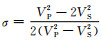
图 3中展示了深度为10 km,30 km,50 km和70 km地壳P波、S波速度扰动和泊松比值的三维层析成像结果的水平切片.

|
图 3 青藏高原地壳P波、S波速度扰动和泊松比分布水平切面图 左栏为P波速度扰动图,中栏为S波速度扰动图,右栏为泊松比分布图.第一行为上地壳10 km深度,第二行为中地壳30 km深度,第三行为下地壳50 km深度,第四行为下地壳底部和壳幔边界70 km深度.(a—l)中字母“V”标注藏北火山岩带(详见3.1节),(d—i)中“[1-4]”标明主要裂谷位置(详见3.2节),(j)和(k)中“(F)”标注下地壳流的低速异常区(详见3.4节). Fig. 3 Horizontal cross-section of P wave, S-wave velocity perturbation and Poisson′s ratio of the Tibetan Plateau crust The left column is the P-wave velocity perturbation, the middle column is the S wave velocity perturbation, and the right column is the Poisson′s ratio distribution. The first line is 10 km in the upper crust, the second line is 30 km in the middle crust, the third line is 50 km in the lower curst, and the fourth line is 70 km at the bottom of the lower crust and the crust-mantle boundary. The letter "V" in (a—l) marks the northern Tibet volcanic rock zone (see Section 3.1 for details), "[1-4]" in (d—i) indicate the location of the main rifts (see Section 3.2 for details), The letter "F" in (j) and (k) annotates the low-velocity anomalies of the lower crustal flow (see Section 3.4 for details). |
从10 km深度的S波速度扰动图中可看出,在青藏高原北部的北羌塘和可可西里地区,出现一串S波波速扰动负异常带(图中字母“V”标注),在10 km深度的泊松比分布图中“V”字区域泊松比值都比较高.并且在30 km、50 km和70 km的S波速度扰动图和泊松比分布图中,与10 km深度“V”字区域位置近乎相同,即北羌塘和可可西里地区都分布有S波波速扰动负异常和高泊松比带(图中“V”字区域).并且在P波波速扰动图中,上中下地壳在相似的位置也有速度扰动负异常带(杨文采等, 2019a).说明在青藏高原北部北羌塘和可可西里地区有贯穿上中下地壳的具有低P波和S波波速、高泊松比特点的条带.这些条带与青藏高原北部新生代火山岩分布位置接近,应该与青藏高原的新生代火山活动有关.
30 km深度的S波速度扰动图和泊松比分布图中,青藏高原南部出现4个波速扰动正负异常之间的梯度带,同样位置,泊松比也呈高低值之间的梯度变化,在图中用[1]、[2]、[3]、[4]标识,并且在50 km深度的S波速度扰动图和泊松比分布图像中也可以看到这些条带.在深度为30 km的P波波速扰动图中,在青藏高原南部的相似位置也可以清晰的看到P波速度负异常带的分布(杨文采等, 2019a).这些异常带位置与青藏高原新生代裂谷系的地表位置接近,也进一步证实了青藏高原新生代裂谷系深达中地壳底部的推论(杨文采等, 2017).
从10 km、30 km、50 km和70 km的S波速度扰动图中可以看到,上中下地壳的图像有很大的变化.在10 km的上地壳,S波波速高值区范围大,到30 km的中地壳,波速高值区范围缩小,在50 km的中下地壳波速高值区范围大面积缩小,直至地壳底部的70 km处,S波速高值区几乎消失,这与上中下地壳的P波波速成像高值区的变化一致(杨文采等, 2019a).说明青藏高原下地壳地震波速产生剧烈变化.
在50 km和70 km的S波速度扰动图中低速扰动范围面积扩大,在70 km地壳底部S波速低值区几乎覆盖整个青藏高原.
Yang等(2010, 2012)使用2003—2009年间的联合数字地震台网(FDSN)、青藏高原周边的中国省级台网和部分PASSCAL台网的波形资料对青藏高原主体进行了噪声成像,获得了1°×1°的青藏高原地壳上地幔S波速度结构.因研究范围和色标选择,Yang等(2012)的地壳S波速度模型中青藏高原显示为一个大的低速异常,但在青藏高原低速区域中,15 km处羌塘北部的速度最低,并且这个低速区随着深度增加范围向东扩展,进入上地幔,青藏高原北部大都为低速异常,这与本研究地壳S波结果形态基本一致.但本研究在地壳内部可以明显看到青藏高原北部和南部S波速度差异,这些细节也反映了本研究分辨率的进一步提高.
图 4中展示了深度为10 km,30 km,50 km和70 km地壳P波和S波反演测量误差分布图.P波误差范围为0~0.20,S波误差范围为0~0.24.10 km、30 km和50 km深度显示地壳范围内P波和S波测量误差最大的地区是扬子地块西缘与青藏高原东缘交界处的龙门山断裂带和红河断裂带,70 km深度显示下地壳到壳幔边界,拉萨地块中部P波反演误差较大,扬子地块西缘与青藏高原东缘交界处P波反演误差也较大,在这个深度范围,S波反演误差主要集中在喜马拉雅地块、冈底斯地块和拉萨地块中部.误差分布图也说明本研究得到的P波、S波速度结构和泊松比分布在青藏高原大部分地区的地壳范围是可靠的.

|
图 4 青藏高原地壳P波和S波反演测量误差分布水平切面图 左栏为P波,右栏为S波.第一行为上地壳10 km深度,第二行为中地壳30 km深度,第三行为下地壳50 km深度,第四行为下地壳底部70 km深度. Fig. 4 Horizontal cross-section of the error distribution of P-wave and S-wave inversion of the Tibetan Plateau crust The left column is the P wave and the right column is the S wave. The first line is 10 km in the upper crust, the second line is 30 km in the middle crust, the third line is 50 km in the lower curst, and the fourth line is 70 km at the bottom of the lower crust. |
AA1剖面是穿过青藏高原北部的新生代火山活动区域的一条垂直剖面,从西到东依次穿过S波扰动负异常带V1、V2、V3、V4和V5.图 5a中的白色虚线区域圈定了V2和V4之下的异常区.V2和V4之下的P波和S波速度扰动图中在0~70 km范围内都有一个明显负异常区,且在V2和V4之下0~70 km对应的泊松比值也较高;在V3之下的0~70 km处P波速度扰动为正异常,但S波速度扰动在0~50 km范围内为明显的负异常区,在泊松比分布图中V3下方的0~50 km处为高泊松比区域,且与V2下方的0~70 km范围内的高泊松比区域相连.V1和V5对应的S波速度负异常区不明显.V2和V4对应着青藏高原北部第四纪和第三纪火山岩带,从图中可以看出青藏高原的新生代火山活动在整个地壳中都留下了痕迹.

|
图 5 AA1(a)和BB1(b)的P波(上)、S波(中)速度扰动和泊松比(下)图像的垂直剖面 AA1和BB1位置见图 1c.(a)中白色虚线为藏北新生代火山岩活动相关异常区,(b)中白色实线为青藏高原新生代裂谷异常梯度带. Fig. 5 Vertical profile of P-wave (upper) and S-wave (middle) velocity perturbation and Poisson′s ratio (lower) of AA1 (a) and BB1 (b) The positions of AA1 and BB1 are shown in Fig. 1c. The white dashed lines in (a) show the range of anomalies relating to the Cenozoic volcanic rocks in northern Tibetan Plateau, and the white solid lines in (b) show the gradient band of the anomalies related with the Cenozoic rifts of Tibetan Plateau. |
BB1剖面从西向东穿过青藏高原南部波速扰动正负异常梯度带[1]、[2]、[3]、[4],异常梯度位置见图 5b中白色实线.在P波和S波速度扰动图中,[1]和[2]之间为低速扰动,而且之下的低速扰动区范围在0~70 km,贯穿整个地壳,在泊松比分布图中,[1]和[2]之间为泊松比由低向高变化的梯度带,深度范围在0~20 km之间.在[3]和[4]之间S波速度扰动呈负异常区,其P波速度扰动较左右两个正异常区域的速度扰动偏低,在泊松比分布图中深度范围0~40 km处呈由低向高变化的梯度带.
3 讨论地球物理研究表明在距今50—45 Ma以来,印度—欧亚大陆的陆-陆碰撞使得青藏高原具有独特的地壳结构和地热背景.随着印度板块俯冲于欧亚大陆之下,导致青藏高原快速隆升,且大部地区地壳缩短、增厚,并伴随大规模火山喷发和岩浆活动.青藏高原从南部的喜马拉雅地块的厚壳薄幔、热壳冷幔;到中部的冈底斯—拉萨地块的厚壳薄幔、热壳热幔;再到北部的羌塘—可可西里等较稳定的老地块的厚壳厚幔、冷壳冷幔的结构(白嘉启等,2006;张朝锋等,2018).这种复杂的壳幔热结构是印-亚大陆碰撞造成地壳上地幔物质运动的结果.对比P波速度扰动结果(杨文采等, 2019a),地壳S波波速扰动和泊松比分布结果对青藏高原地壳结构和组分提供了以下认识:
3.1 青藏高原新生代火山活动岩石物理性质测定表明,与其他岩石不同,在结晶岩中湿的玄武岩S波速度最低, 但是泊松比很高.在图 3b和3c中显示北部NTZ和NQZ火山岩带(图 1c中蓝色矩形)反映为S波波速扰动负异常带,较高的泊松比.这样的异常带从上地壳到下地壳都有分布,这也反映了藏北新生代火山岩分布和火山活动范围.在青藏高原隆升过程中,火山活动和青藏高原地壳构造演化关系密切.藏北古新世-始新世火山岩主要分布在西羌塘,火山岩地化特征为富钠基性熔岩,在青藏高原隆升之前,可能因为印度板块与欧亚板块的陆陆碰撞远程效应触发了板内地幔的部分熔融,并诱使熔融体快速上升、沿断裂喷发;渐新世-上新世青藏高原开始隆升,这一时期的藏北火山岩主要分布在北羌塘和可可西里,火山岩以富钾为特征(Mo et al., 2006, 2008; 莫宣学等,2007),陆内的“壳幔混合层”是这部分火山岩的主要来源,且火山岩喷发是“壳幔混合层”部分熔融、低压分异和快速上升、喷发的结果,受板内裂谷和青藏高原北侧塔里木地块陆内俯冲机制制约(邓万明和孙宏娟,1998;熊熊等,2007).因此贯穿整个地壳的低S波波速和高泊松比进一步证实了第三纪火山活动与高原的形成和隆升密切相关.
3.2 青藏高原新生代裂谷系因为青藏高原的隆升伴随着大量的地壳变形,在高原南部发育了大规模的新生代裂谷系.青藏高原地壳密度扰动三维成像研究可以确定西藏新生代裂谷系的作用到达了中地壳底部(杨文采等, 2017, 2019a, b).与其他类型的大裂谷不同,青藏高原南部新生代裂谷系的形成机制是陆-陆俯冲地壳拆离型裂谷,因为青藏高原下地壳在热力作用下产生蠕变,形成下地壳管道流,其中的熔融物质除了发生横向的运移之外,还对中上地壳产生持续的底辟作用.在图 3地震S波速度扰动和泊松比成像结果中,在30 km(图 3e)和50 km(图 3h)中“[1]、[2]、[3]、[4]”标明新生代裂谷位置,新生代裂谷在S波速度负异常带的两侧,这与地震P波速度成像结果相近(杨文采等,2019a).30 km深度和50 km的泊松比图像(图 3f和图 3i)在此地区也出现了清晰的泊松比高低梯度带([1]、[2]、[3]、[4]),在中下地壳裂谷梯度带一侧的泊松比从0.25减小到0.22以下.当地壳的泊松比低于0.22时有两种可能:一是岩石破裂充水,这在裂谷带是常见的;二是含大量石英岩,这在下地壳几乎是不可能的,而且此处也是密度成像(杨文采等, 2017)和P波成像(杨文采等,2019a)推断的裂谷位置,因此S波速度和泊松比成像进一步证实了西藏新生代裂谷系深达中地壳底部.由于裂谷带破裂充水的深度要比裂谷张开的深度大,在地震S波速度扰动和泊松比值异常的范围会比密度和地震P波速度扰动异常大.
西藏新生代裂谷在中下地壳显示为低密度、低地震波速扰动、低泊松比.它们的形成与印度板块的陆陆俯冲方向正交的拉张密切相关.印度板块俯冲造成与碰撞带正交的水平应力扩张,形成了地壳破裂和地震,地震后应力释放,进一步促进裂谷发育,形成多条平行裂谷组成的裂谷系.随着地壳拆离的扩展,下地壳熔融物质向上挤出,使得裂谷系扩展,造就了今天西藏的裂谷系.
3.3 东构造结在S波速度和泊松比扰动成像图中,西藏的“东构造结”和其南边的西缅甸出现一个鲜明的异常区,地壳泊松比高达0.29~0.33(图 3c、3f、3i),而S波速度为负异常(图 3b、3e、3h).常见结晶岩石中泊松比高达0.29~0.33的只有蛇纹石化橄榄岩.由S波速度和泊松比层析成像结果可以推测,西藏东构造结下方地壳主要由坚硬的蛇纹石化橄榄岩组成.
3.4 下地壳流比较图 3中不同深度的S波波速扰动和泊松比分布图像可以看出,上中下地壳(10 km、30 km、50 km)的图像有很大的变化,与不同深度上的P波波速成像高值区的变化结果一致(杨文采等,2019a).例如,10 km的上地壳S波速高值区范围大,30 km中地壳波速高值区范围缩小,50 km中下地壳波速高值区范围进一步缩小,在70 km青藏高原地壳底部S波速高值区大范围缩小.地震波速随深度产生急剧变化,说明地壳内部发生了大规模的层间拆离和水平剪切,这是用传统的地块运动不能准确描述的地壳物质运动.青藏高原地壳三维密度成像验证了地壳管道流的存在,并给出了青藏高原下地壳热应变幅度分布图,圈定了下地壳管道流所在位置(杨文采等, 2017).在P波速度扰动中也看到反映下地壳流的P波速度扰动负异常带(杨文采等, 2019a).在图 3中50 km的中下地壳S波速低值区范围大面积扩大,再到70 km青藏高原地壳底部出现大范围的S波速低值区,有可能是下地壳管道流的影响所致.在图 3k中用字母“(F)”标明反映下地壳流的低速异常区.结果表明下地壳管道流的源头位于喀喇昆仑断裂东侧与雅鲁藏布和班公—怒江缝合带的连接区段,和雅鲁藏布缝合带北侧的拉孜—林芝段.从喀喇昆仑断裂东侧源头的下地壳管道流主要流向北东和北西两个方向.从雅鲁藏布缝合带北侧源头的下地壳管道流主要向北东流到理塘—雅江和滇北地区,然后又分为南北两个方向分流.同时,下地壳管道流可能向上挤出到中地壳.
4 结论(1) 本文使用“中国数字地震台网”中各省级地震台网的到时数据开展青藏高原地壳地震波速度的三维层析成像研究,得到分辨率达到1°×1°×20 km的地壳三维S波速度结构和泊松比分布图像,揭示了青藏高原地壳内部的主要构造特征.
(2) 结果表明,分布在可可西里和羌塘北部的高钾质和钾质火山岩带,其上地壳到下地壳都存在S波波速扰动负异常和高泊松比.说明第三纪青藏高原隆升过程中,由于大陆碰撞使三叠纪的东昆仑缝合带重新破裂,造成大量壳幔混合熔融物质上涌和火山喷发,进而揭示了青藏高原北部新生代火山岩的存在与青藏高原的形成和隆升密切相关.
(3) 裂谷带之下中下地壳的S波速异常分布和泊松比值可以推断青藏高原新生代裂谷深达中地壳底部, 这个推论与密度扰动三维成像的相关结论一致.
(4) 青藏高原S波速度和泊松比在下地壳至壳幔边界随深度产生急剧变化,说明地壳内部发生了大规模的层间拆离和水平剪切.
(5) 青藏高原中下地壳S波波速低值区范围大面积扩大,地壳底部几乎被S波波速低值区全部覆盖,可能反映下地壳管道流的影响.由S波速度扰动和泊松比分布图像可以推测,青藏高原东构造结下方地壳主要由坚硬的蛇纹石化橄榄岩组成.
致谢 笔者感谢新疆、甘肃、四川、西藏和青海等地方地震局和中国地震局地球物理研究所的协作和帮助, 感谢许志琴、滕吉文院士提供的重要意见,并对中国地质调查局对研究项目的资助特表致谢.
Bai J Q, Mei L, Yang M L. 2006. Geothermal resources and crustal thermal structure of the Qinghai-Tibet Plateau. Journal of Geomechanics (in Chinese), 12(3): 354-362. |
Bao X W, Song X D, Li J T. 2015. High-resolution lithospheric structure beneath Mainland China from ambient noise and earthquake surface-wave tomography. Earth and Planetary Science Letters, 417: 132-141. DOI:10.1016/j.epsl.2015.02.024 |
De Kool M, Rawlinson N, Sambridge M. 2006. A practical grid-based method for tracking multiple refraction and reflection phases in three-dimensional heterogeneous media. Geophysical Journal International, 167(1): 253-270. DOI:10.1111/j.1365-246X.2006.03078.x |
Deng W M, Sun H J. 1998. Isotopic geochemistry and source of intraplate volcanic rocks in north Tibet, China. Earth Science Frontiers (in Chinese), 5(4): 307-317. |
Fu Y V, Li A B, Chen Y J. 2010. Crustal and upper mantle structure of southeast Tibet from Rayleigh wave tomography. Journal of Geophysical Research:Solid Earth, 115(B12): B12323. DOI:10.1029/2009JB007160 |
Huang Z C, Wang P, Xu M J, et al. 2015a. Mantle structure and dynamics beneath SE Tibet revealed by new seismic images. Earth and Planetary Science Letters, 411: 100-111. DOI:10.1016/j.epsl.2014.11.040 |
Huang Z C, Wang L S, Xu M J, et al. 2015b. Teleseismic shear-wave splitting in SE Tibet:Insight into complex crust and upper-mantle deformation. Earth and Planetary Science Letters, 432: 354-362. DOI:10.1016/j.epsl.2015.10.027 |
Kennett B L N, Engdahl E R. 1991. Traveltimes for global earthquake location and phase identification. Geophysical Journal International, 105(2): 429-465. DOI:10.1111/j.1365-246X.1991.tb06724.x |
Laske G, Masters G, Ma Z T, et al. 2013. Update on CRUST1.0-A1-degree Global Model of Earth's Crust.//EGU General Assembly Conference Abstracts. Vienna, Austria: EGU.
|
Lei J S, Zhao D P. 2009. Structural heterogeneity of the Longmenshan fault zone and the mechanism of the 2008 Wenchuan earthquake (MS8.0). Geochemistry, Geophysics, Geosystems, 10(10): Q10010. DOI:10.1029/2009GC002590 |
Li C, Van Der Hilst R D, Toksöz M N. 2006. Constraining P-wave velocity variations in the upper mantle beneath Southeast Asia. Physics of the Earth and Planetary Interiors, 154(2): 180-195. DOI:10.1016/j.pepi.2005.09.008 |
Li C, Van Der Hilst R D, Meltzer A S, et al. 2008. Subduction of the Indian lithosphere beneath the Tibetan Plateau and Burma. Earth and Planetary Science Letters, 274(1-2): 157-168. DOI:10.1016/j.epsl.2008.07.016 |
Li H Y, Su W, Wang C Y, et al. 2009. Ambient noise Rayleigh wave tomography in western Sichuan and eastern Tibet. Earth and Planetary Science Letters, 282(1-4): 201-211. DOI:10.1016/j.epsl.2009.03.021 |
Li H Y, Su W, Wang C Y, et al. 2010. Ambient noise Love wave tomography in the eastern margin of the Tibetan Plateau. Tectonophysics, 491(1-4): 194-204. DOI:10.1016/j.tecto.2009.12.018 |
Li J, Wang X B, Li D H, et al. 2017. Characteristics of the lithosphere physical structure in eastern margin of the Qinghai-Tibet plateau and their deep tectonic implications. Chinese Journal of Geophysics (in Chinese), 60(6): 2500-2511. DOI:10.6038/cjg20170637 |
Liang X F, Chen Y, Tian X B, et al. 2016. 3D imaging of subducting and fragmenting Indian continental lithosphere beneath southern and central Tibet using body-wave finite-frequency tomography. Earth and Planetary Science Letters, 443: 162-175. DOI:10.1016/j.epsl.2016.03.029 |
Liu Q Y, Van Der Hilst R D, Li Y, et al. 2014. Eastward expansion of the Tibetan Plateau by crustal flow and strain partitioning across faults. Nature Geoscience, 7(5): 361-365. DOI:10.1038/ngeo2130 |
Liu Z K, Huang J L, Yao H J. 2016. Anisotropic Rayleigh wave tomography of Northeast China using ambient seismic noise. Physics of the Earth and Planetary Interiors, 256: 37-48. DOI:10.1016/j.pepi.2016.05.001 |
Liu Z Q, Liang C T, Hua Q, et al. 2018. The seismic potential in the seismic gap between the Wenchuan and Lushan earthquakes revealed by the joint inversion of receiver functions and ambient noise data. Tectonics, 37(11): 4226-4238. DOI:10.1029/2018TC005151 |
Mo X X, Zhao Z D, Deng J F, et al. 2006. Petrology and geochemistry of postcollisional volcanic rocks from the Tibetan Plateau: implications for lithosphere heterogeneity and collision-induced asthenospheric mantle flow.//Dilek Y, Pavlides S eds. Postcollisional Tectonics and Magmatism in the Mediterranean Region and Asia. Boulder: Geological Society of America, 409: 507-530.
|
Mo X X, Zhao Z D, Deng J F, et al. 2007. Migration of the Tibetan Cenozoic Potassic volcanism and its transition to eastern basaltic province:implications for crustal and mantle flow. Geoscience (in Chinese), 21(2): 255-264. |
Mo X X, Niu Y L, Dong G C, et al. 2008. Contribution of syncollisional felsic magmatism to continental crust growth:A case study of the Paleogene Linzizong volcanic Succession in southern Tibet. Chemical Geology, 250(1-4): 49-67. DOI:10.1016/j.chemgeo.2008.02.003 |
Peng M, Jiang M, Li Z H, et al. 2016. Complex Indian subduction style with slab fragmentation beneath the Eastern Himalayan Syntaxis revealed by teleseismic P-wave tomography. Tectonophysics, 667: 77-86. DOI:10.1016/j.tecto.2015.11.012 |
Rawlinson N, Reading A M, Kennett B L N. 2006. Lithospheric structure of Tasmania from a novel form of teleseismic tomography. Journal of Geophysical Research:Solid Earth, 111(B2): B02301. DOI:10.1029/2005JB003803 |
Ren J S, Xiao L W. 2004. Lifting the mysterious veil of the tectonics of the Qinghai-Tibet Plateau by 1:250000 geological mapping. Geological Bulletin of China (in Chinese), 23(1): 1-11. |
Su W, Peng Y J, Zheng Y J, et al. 2002. Crust and upper mantle shear velocity structure beneath the Tibetan Plateau and adjacent areas. Acta Geoscientia Sinica (in Chinese), 23(3): 193-200. |
Tang J X. 2019. Mineral resources base investigation and research status of the Tibet Plateau and its adjacent major metallogenic belts. Acta Petrologica Sinica (in Chinese), 35(3): 617-624. DOI:10.18654/1000-0569/2019.03.01 |
Wang W L, Wu J P, Fang L H, et al. 2017. Sedimentary and crustal thicknesses and Poisson's ratios for the NE Tibetan Plateau and its adjacent regions based on dense seismic arrays. Earth and Planetary Science Letters, 462: 76-85. DOI:10.1016/j.epsl.2016.12.040 |
Wang X B, Zhang G, Fang H, et al. 2014a. Crust and upper mantle resistivity structure at middle section of Longmenshan, eastern Tibetan Plateau. Tectonophysics, 619-620: 143-148. DOI:10.1016/j.tecto.2013.09.011 |
Wang Z, Huang R Q, Pei S P. 2014b. Crustal deformation along the Longmen-Shan fault zone and its implications for seismogenesis. Tectonophysics, 610: 128-137. DOI:10.1016/j.tecto.2013.11.004 |
Xiong X, Wang J Y, Teng J W. 2007. Deep mechanical background for the Cenozoic volcanism in the Tibetan Plateau. Earth Science-Journal of China University of Geosciences (in Chinese), 32(1): 1-6. |
Xu Y, Liu J S, Huang Z X, et al. 2014. Upper mantle velocity structure and dynamic features of the Tibetan Plateau. Chinese Journal of Geophysics (in Chinese), 57(12): 4085-4096. DOI:10.6038/cjg20141220 |
Xu Z Q, Yang J S, Hou Z Q, et al. 2016. The progress in the study of continental dynamics of the Tibetan Plateau. Chinese Geology (in Chinese), 43(1): 1-42. |
Yang W C, Du J Y. 1994. A new algorithm of seismic tomography with application to engineering detections. Chinese Journal of Geophysics (Acta Geophysica Sinica) (in Chinese), 37(2): 239-244. |
Yang W C, Qu C, Yu C Q. 2011. High Poisson's ratio anomalies in the crust of the eastern part of North China and its origin. Earth Science Frontiers (in Chinese), 18(3): 13-21. |
Yang W C, Qu C, Hou Z Z, et al. 2017. Crustal density structures beneath orogenic belts of Chinese continent. Geological Review (in Chinese), 63(3): 539-548. |
Yang W C, Qu C, Ren H R, et al. 2019a. Crustal P-wave Seismic tomography of the Qinghai-Xizang (Tibetan) Plateau. Geological Review (in Chinese), 65(1): 2-14. |
Yang W C, Jiang J S, Qu C, et al. 2019b. A study on origin of Cenozoic rifts in Qinghai-Xizang (Tibetan) Plateau. Geological Review (in Chinese), 65(2): 267-279. |
Yang Y J, Zheng Y, Chen J, et al. 2010. Rayleigh wave phase velocity maps of Tibet and the surrounding regions from ambient seismic noise tomography. Geochemistry, Geophysics, Geosystems, 11(8): Q08010. DOI:10.1029/2010GC003119 |
Yang Y J, Ritzwoller M H, Zheng Y, et al. 2012. A synoptic view of the distribution and connectivity of the mid-crustal low velocity zone beneath Tibet. Journal of Geophysical Research:Solid Earth, 117(B4): B04303. DOI:10.1029/2011JB008810 |
Yang Z G, Chen Y T, Zhang X M, et al. 2019. S-wave velocity structure and radial anisotropy in eastern and north-eastern margins of Tibetan Plateau. Chinese Journal of Geophysics (in Chinese), 62(12): 4554-4570. DOI:10.6038/cjg2019N0149 |
Yao H J, Beghein C, Van Der Hilst R D. 2008. Surface wave array tomography in SE Tibet from ambient seismic noise and two-station analysis-Ⅱ.Crustal and upper-mantle structure. Geophysical Journal International, 173(1): 205-219. |
Yao H J, Van Der Hilst R D, Montagner J P. 2010. Heterogeneity and anisotropy of the lithosphere of SE Tibet from surface wave array tomography. Journal of Geophysical Research:Solid Earth, 115(B12): B12307. DOI:10.1029/2009JB007142 |
Zhang C F, Shi Q L, Zhang L J. 2018. Discussion on the relationship between Cenozoic magmatic activity and geotherm in Tibetan Plateau. Geological Survey of China (in Chinese), 25(2): 18-24. |
Zhao G Z, Unsworth M J, Zhan Y, et al. 2012. Crustal structure and rheology of the Longmenshan and Wenchuan MW7.9 earthquake epicentral area from magnetotelluric data. Geology, 40(12): 1139-1142. DOI:10.1130/G33703.1 |
Zhao J M, Zhao D P, Zhang H, et al. 2014. P-wave tomography and dynamics of the crust and upper mantle beneath western Tibet. Gondwana Research, 25(4): 1690-1699. DOI:10.1016/j.gr.2013.06.020 |
白嘉启, 梅琳, 杨美伶. 2006. 青藏高原地热资源与地壳热结构. 地质力学学报, 12(3): 354-362. |
邓万明, 孙宏娟. 1998. 青藏北部板内火山岩的同位素地球化学与源区特征. 地学前缘, 5(4): 307-317. DOI:10.1088/0256-307X/16/9/027 |
李军, 王绪本, 李大虎, 等. 2017. 青藏高原东缘岩石圈物性结构特征及深部构造涵义. 地球物理学报, 60(6): 2500-2511. DOI:10.6038/cjg20170637 |
莫宣学, 赵志丹, 邓晋福, 等. 2007. 青藏新生代钾质火山活动的时空迁移及向东部玄武岩省的过渡:壳幔深部物质流的暗示. 现代地质, 21(2): 255-264. |
任纪舜, 肖黎薇. 2004. 1:25万地质填图进一步揭开了青藏高原大地构造的神秘面纱. 地质通报, 23(1): 1-11. |
苏伟, 彭艳菊, 郑月军, 等. 2002. 青藏高原及其邻区地壳上地幔S波速度结构. 地球学报, 23(3): 193-200. |
唐菊兴. 2019. 青藏高原及邻区重要成矿带矿产资源基地调查与研究进展. 岩石学报, 35(3): 617-624. |
熊熊, 王继业, 滕吉文. 2007. 青藏高原新生代火山活动的深部力学背景. 地球科学——中国地质大学学报, 32(1): 1-6. |
胥颐, 刘劲松, 黄忠贤, 等. 2014. 青藏高原上地幔速度结构及其动力学性质. 地球物理学报, 57(12): 4085-4096. DOI:10.6038/cjg20141220 |
许志琴, 杨经绥, 侯增谦, 等. 2016. 青藏高原大陆动力学研究若干进展. 中国地质, 43(1): 1-42. |
杨文采, 杜剑渊. 1994. 层析成像新算法及其在工程检测上的应用. 地球物理学报, 37(2): 239-244. |
杨文采, 瞿辰, 于常青. 2011. 华北东部地区地壳泊松比异常及其成因. 地学前缘, 18(3): 13-21. |
杨文采, 瞿辰, 侯遵泽, 等. 2017. 中国大陆造山带地壳密度结构特征. 地质论评, 63(3): 539-548. |
杨文采, 瞿辰, 任浩然, 等. 2019a. 青藏高原地壳地震纵波速度的层析成像. 地质论评, 65(1): 2-14. |
杨文采, 江金生, 瞿辰, 等. 2019b. 西藏新生代裂谷系成因的探讨. 地质论评, 65(2): 267-279. |
杨志高, 陈运泰, 张雪梅, 等. 2019. 青藏高原东缘及东北波缘S速度结构和径向各向异性. 地球物理学报, 62(12): 4554-4570. DOI:10.6038/cjg2019N0149 |
张朝锋, 史强林, 张玲娟. 2018. 青藏高原新生代岩浆活动与地热关系探讨. 中国地质调查, 25(2): 18-24. |