 2019, Vol. 62

2. 中国地质大学(武汉)地球物理与空间信息学院, 武汉 430074;
3. 浙江大学地球科学学院, 杭州 310027;
4. 滁州市地震局, 安徽滁州 239000
 , LI QiuSheng1
 , XU YiXian3, ZHANG HongShuang1, CHEN Hao4, LANG Chao1, WU QingYu1,2, WANG XiaoRan1
2. Institute of Geophysics and Geomatics, China University of Geosciences, Wuhan 430074, China;
3. School of earth sciences, Zhejiang University, Hangzhou 310027, China;
4. Chuzhou Seismological Bureau, Anhui Chuzhou 239000, China
华南地块位于欧亚大陆的东南边缘,地处秦岭—大别造山带以南,北接华北地块,南与印支地块相连,西接青藏高原,东南临菲律宾海板块.一般认为,华南地块由扬子克拉通与华夏地块拼接而成(舒良树,2012;张国伟等,2013;毛建仁等,2014),与华北地块共同组成了中国的大陆东部.大量研究表明,华北克拉通东部岩石圈现今已遭受破坏,丧失了克拉通特有的稳定性(Carlson et al., 2005; 嵇少丞等,2009;许卫卫等,2011; Zhao et al., 2011; Zhu et al., 2011),其深部过程很可能影响到紧邻的华南块体,因此开展针对华南块体深部结构的探测研究,对深入认识中国东部中生代整体地球动力学环境具有重要意义.
总体来看,华南地壳西北(上扬子)厚(约45 km)东南(华夏)薄(约30 km),平均地壳厚度与华北克拉通东部相当,只有青藏高原的一半(Teng et al., 2013; Wei et al., 2016).华南东部地壳厚度较薄与其晚中生代以来的伸展作用有关(Liu et al., 2004; Li and Li, 2007; 张旗等,2009;李廷栋,2010;袁学诚和华九如,2011; Shi et al., 2013; Zhao et al., 2013),具体的地壳减薄机制至今仍存在争议.以往研究表明,地壳伸展主要发生在中侏罗世以来,且伴随着强烈的构造-岩浆作用和集中成矿作用(邓晋福和吴宗絮,2001;杨明桂等,2009;Wan and Zhao, 2012;张岳桥等,2012).现今,有关华南中生代大规模构造-岩浆作用的深部背景和动力学机制研究,已成为地球科学界关注的重大问题.
华南东部盆地在前中侏罗世主要受特提斯构造域和印支期碰撞的影响,晚侏罗世以来则主要受太平洋构造作用和陆内深部构造的联合制约(舒良树等,2006).南岭—武夷交汇区是近东西向的南岭造山带(特提斯构造域)与北东向的武夷造山带(太平洋构造域)的构造转折部位,其地壳结构可能保存了构造转换的记录.近年来,学者们使用不同的地球物理方法,对华南地壳结构开展了一系列探测研究(高锐等, 2004;Zhang et al., 2005;Huang and Zhao, 2006;Li et al., 2006;Chen et al., 2010;杨中书等, 2010;Zhou et al., 2012;He et al., 2013, 2014;Li et al., 2013;沈玉松等, 2013; Shi et al., 2013;叶卓等, 2013;黄海波等, 2014;张攀等,2014;Huang et al., 2015;Wei et al., 2016;Song et al., 2017;Guo et al., 2018;张耀阳等,2018),或在前人工作基础上取得了一系列成果(郑圻森等,2003;Zhang et al., 2008, 2011;Ji et al., 2009;熊小松等,2009;邓阳凡等,2011; Tkalčić et al., 2011;Teng et al., 2013;Zhao et al., 2013;Deng et al., 2014).但是由于数据分布有限或者方法本身分辨率的不足,现今仍缺乏南岭—武夷交汇区地壳的精细结构和高分辨率图像,使得华南东部前特提斯构造域如何向太平洋构造域转换这一重大基础地质问题研究长期进展缓慢.
地壳厚度与泊松比是了解地壳结构、分析物质组成、划分构造单元的重要参数(Chevrot and Van Der Hilst, 2000;Ji et al., 2009).接收函数方法因利用地震转换波而转换波对速度界面敏感,因而具有较高的横向分辨率,已成为研究壳、幔主要间断面(例如Moho面、LAB)形态的重要地球物理手段(Zhu and Kanamori, 2000).本文正是利用华南东部66个流动地震台站及其附近24个固定台网台站的观测资料,采用远震P波接收函数H-κ扫描和共转换点(CCP)叠加两种方法来获得研究区下方的地壳厚度和泊松比信息,并且结合已有的地质、地球物理资料,探讨南岭—武夷交汇区岩石圈变形的深部背景和动力学机制.
1 数据和方法 1.1 数据来源本研究用到72个流动台站和24个固定台站的宽频带地震数据(图 1).流动台站数据来自中国地质科学院地质研究所承担的“华南深部结构探测”地质调查项目(采集时间2014年7月到2015年12月),数字采集器采用REFTEK-130或Q330S+,搭配的地震计型号包括CMG-3ESP、CMG-3T、STS-2.5、Trillium 120 PA以及CZS-II,采样率100 Hz,台站间距平均40 km.固定台站数据来自中国地震局“国家数字测震台网数据备份中心”.台阵设计为面状与线性剖面相结合的方式.图 1所示的一条控制赣江断裂的近东西向剖面(line1),由24个流动台站构成,台站间距平均15 km.

|
图 1 研究区台站分布示意图 红色、黄色圆圈表示流动台站;红色三角形表示固定台站;Yz:扬子地块;Jn:江南造山带;Ca:华夏地块;line1:CCP叠加剖面;F1:江南中生代北界隐伏断裂;F2:江绍断裂;F3:政和—大浦断裂;F4:赣江断裂;F5:郯庐断裂;F6:襄樊—广济断裂;F7:四会—吴川断裂. Fig. 1 Distribution of broadband seismic stations Red circles and yellow circles denote the portable stations; Red triangles denote the permanent stations; Yz: Yangtze block; Jn: Jiangnan orogenic belt; Ca: Cathaysia Block; line1: CCP stacking profiles; F1: Jiangnan buried fault; F2: Jiangshao fault; F3:Zhenghe-Dapu fault; F4: Ganjiang fault; F5: Tanlu fault; F6:Xiangfan-Guangji fault; F7: Sihui-Wuchuan fault. |
接收函数的提取一般有以下几步:首先根据地震目录挑选地震事件,然后对野外数据进行格式转变,同时截取、挑选地震波数据,接下来对三分量地震图进行坐标旋转,最后做反褶积运算,最终提取到去掉路径与震源影响的接收函数.
首先从USGS网站下载对应期间的地震目录,然后从中挑选出震中距在30°~90°,震级大于5.5级、波形质量较高的地震事件共201个(地震分布如图 2所示).截取P波到时前10 s之后100 s的数据,转换成sac格式.然后进行去线性、去均值等预处理.从预处理后的记录中把P波初至比较明显的波形通过手动挑选出来,随后将ZNE(垂直、南北、东西)的三分量地震图通过坐标旋转变到ZRT(垂向、径向、切向)坐标系中.带通滤波选用二级Butterworth,拐角频率设为0.05~2 Hz.最后,是提取接收函数的关键一步,依据等效震源的方法(Langston,1979),采用时间域的反褶积算法(Ligorría and Ammon, 1999)进行计算,计算过程中高斯滤波因子取值2.5,最后筛选出初至波明显、Ps和PpPs等震相清晰且一致性较好的3751条接收函数记录用于下一步分析计算.其中台站编号C098与HJ11的接收函数图像如图 3所示,具体位置在图 1已标出.可以看出,每个台站可用的接收函数数量充足,各个震相特征清晰,图示两台的Ps震相大约都出现在3~4 s之间,符合该地区的地震波传播特征,右图可以看出,对应反方位角覆盖、地震震中距分布合理.

|
图 2 远震事件分布图(色标表示震级) Fig. 2 Distribution of teleseismic earthquakes (color code represents magnitude) |

|
图 3 C098、HJ11台站接收函数记录排列 左图代表接收函数按后方位角排列,纵轴数字代表接收函数序号,横轴数字代表相对于直达P波的延迟时间.其中Ps、PpPs、PpSs+PsPs震相用红线虚线标出,名称写在对应上方.右侧图形红色矩形代表后方位角,黑色三角形代表地震震中距分布. Fig. 3 Receiver functions recorded by C098 and HJ11 stations In the left figure, receiver functions are arranged by back azimuth. Numbers on axis of the left figure denote latency time of P arrival. The seismic phases (Ps, PpPs, PpSs+PsPs) are marked by red and broken lines. Red rectangles represent back azimuth in the right figure. Black triangles denote distribution of epicenter distance. |
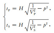
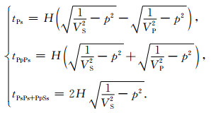
远震P波从地幔传播到地壳的过程中,一部分P波透射过去,一部分则转化为S波继续传播,接收函数方法会增强这类转换波的信号.此外,这两种波在地表和莫霍面两个界上进行多次反射,形成了PpPs,PpSs,PsPs等多次波.根据地震波走时的基本理论,很容易得到地震波在地壳传播的走时表达式,即:
|
(1) |
式中,tP、tS分别表示P波与S波在厚度为H的层内走时,VP、VS分别表示P波与S波的速度,p表示射线参数,即:
|
(2) |
由公式(2)可知,结合数学知识,相比于VP,波速比κ(VP/VS)的改变更容易引起地壳厚度变化,即地壳厚度对波速比变化更加敏感.为了估算地壳厚度,Zhu和Kanamori(2000)提出H-κ叠加扫描法方法,即对一定范围的H和κ进行扫描,对搜索到的H和κ,带入到方程(2)中进行计算,便可以计算各个震相到达时差,然后带入到构造的目标函数中

|
(3) |
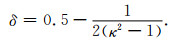
其中,S(H, κ)在三个震交汇处取得最大值,由此便可以近似得到对应的地壳平均厚度与波速比.泊松比可以由其与波速比的关系求出,即:
|
(4) |
H-κ叠加过程中,将P波的速度设定为6.2 km·s-1 (郑圻森等,2013),H的搜索区间设为20~50 km,κ的搜索区间设为1.5~2.0,PpPs、PpSs、PsPs等多次波的加权系数设置为0.7、0.2、0.1, 实际上加权系数的取值并不会对计算结果产生大的影响(Wei et al., 2016).图 4为三个流动台站(C085、C098、HJ11)与一个固定台站(JX_DAY)的结果,从图中可以看出,加权最佳估计点(绿色五角星表示)汇聚较好,且未出现多极值情况,数据可信度较高.

|
图 4 H-κ方法获得的地壳厚度与波速比结果 Fig. 4 Crustal thickness and Poisson′s ratio obtained by H-κ stacking method |
前人研究表明,全国地壳厚度平均值约为37 km,泊松比平均值约为0.25,青藏地区地壳最深,平均值大于70 km(Chen et al., 2010;Teng et al., 2013).扬子地块地壳厚度东西变化较大,西部可达50 km,东部不到30 km,均值在40 km左右,华夏地块相对较薄,均值约为32 km(熊小松等,2009;邓阳凡等,2011;范军等,2015).扬子地块泊松比变化幅度较大,平均值约为0.28,华夏地块整体偏小,平均值不到0.26(Ji et al., 2009;Wei et al., 2016;Guo et al., 2018).
研究区下方的地壳厚度与泊松比分布如图 5所示,所有统计结果如表 1所示(共90台),其中由于台站场地条件等原因,有10个台站的接收函数波形受浅层多次波干扰严重,计算出来的地壳厚度和泊松比数据可信度较低,因此并未采用,这些台站主要集中在罗霄山脉中南段衡阳盆地周围(具体位置在图 1已标出,黄色圆圈所示).研究区域内地壳厚度的平均值为31.2 km,泊松比的平均值为0.23,29.5~32.5 km为地壳厚度(H)优势分布范围,0.21~0.27为泊松比(σ)优势分布区间(图 6),相比全国其他区域,整体呈现了薄地壳、低泊松比的特征.以上结果与地理位置相邻的人工地震结果基本吻合(Zhang et al., 2005;Li et al., 2006;Teng et al., 2013),也与前人采集的邻区或更大范围的H-κ数据有较好的一致性(杨中书等,2010;Huang et al., 2015;Guo et al., 2018).

|
图 5 (a) 台站下方地壳厚度分布图;(b)台站下方波速比分布图 Fig. 5 (a) Distribution of crucial thickness beneath the stations; (b) Distribution of velocity ratio beneath the stations |
|
|
表 1 台站下方地壳厚度H、波速比κ及泊松比σ Table 1 Crustal thickness H, velocity ratio κ and Poisson′s ratio σ beneath stations |

|
图 6 (a) 台站下方地壳厚度分布直方图;(b)台站下方波速比分布直方图 Fig. 6 (a) Histogram-based distribution of crucial thickness beneath the stations; (b) Histogram-based distribution of velocity ratio beneath the stations |
为直观起见,对台站的地壳厚度与泊松比数据进行了插值计算,结果如图 7所示.插值采用曲面网格插值算法(surface),是一种改进的标准最小曲率算法,由于本文数据分布较为密集,插值结果清晰表现了研究区地壳结构及泊松比三维变化特征.

|
图 7 (a) 研究区地壳厚度插值图;(b)研究区波速比插值图 Fig. 7 (a) Differential chart of crucial thickness in the study area; (b) Differential chart of velocity ratio in the study area |
所谓共转换点(CCP)叠加其实质是将走时上具有时间延迟的Ps转换震相映射到发生震相转换的深度的过程.如图 1所示,剖面line1是一条近东西剖面,西起江绍断裂,止于华夏地块内,台站间距平均15 km, 本文基于全球平均速度模型(IASP91),沿此剖面方向对网格进行划分,沿剖面走向5 km,垂直剖面走向60 km, 深度方向2 km,最后对每个网格单元进行共转换点叠加,由于剖面方向的台站高程平均不到300 m,可忽略不计.另外,为了与CCP叠加结果对比,本文对剖面所有台站的接收函数进行动校正叠加,时差校正参考的慢度为6.4 s/°,相应的震中距为67°,对叠加后的结果按台站顺序由西往东依次排列,并将此剖面计算的H-κ数据投影到CCP叠加结果上,如图 8所示.在图 8a中3~4 s处观测到一明显的正震相(Pms),且信号较强,结合图 8b可知,正震相所示的地壳厚度范围主要集中在30 km左右,且清晰的看到从西往东,由厚变薄.在江绍断裂处的台站(HA01、HA02)由于受到沉积层的影响,转换波信号受到一定干扰,在CCP成图当中分辨率相对较低.在图 8a中7~9 s处可观察到一明显的弱负震相,推测为岩石圈-软流层界面(LAB)上的转换波Pls震相或岩石圈内部不连续面(MLD),有待于进一步做S波接收函数分析确认.结合图 8b所示,该负震相由西向东抬升,由剖面西端的80 km抬升到东端的65 km左右,与地壳的减薄趋势一致,表明地壳与地幔岩石圈的变形是上下耦合的.

|
图 8 接收函数动校正叠加及CCP叠加剖面图 (a)台站动校正结果示意图;(b) CCP叠加结果示意图;黑色倒三角形代表H-κ计算结果. Fig. 8 Dynamic correction stacking of receive functions and CCP stacking profiles (a) Dynamic correction result of stations; (b) CCP stacking profiles; black inverted triangles denote H-κ result. |
(1) 研究区域内地壳厚度的平均值为31.2 km,相较于中国大陆平均地壳厚度37 km(Li et al., 2006; Chen et al., 2010),研究区地壳厚度整体较薄.区内的地壳厚度分布有明显的分块特征,且从西北往东南呈由厚变薄的趋势,厚度值从益阳—长沙地区的约35 km到赣州—韶关地区的约27 km,这与区域地壳伸展特征相一致(李廷栋,2010;袁学诚和华九如,2011;Wan and Zhao, 2012;张岳桥等,2012).从构造应力角度分析,印度板块朝北东方向推挤青藏高原,后者强烈变形并向远程传递应力,太平洋板块沿北西向俯冲于欧亚大陆之下,同时欧亚大陆岩石圈自台湾北部至南海一带俯冲于菲利宾海板块之下,在以上动力学环境下,华南地块有进一步俯冲于菲利宾海板块的可能,即向南东方向运动,从而岩石圈整体伸展,地壳厚度整体减薄.
(2) 图 7a显示,九岭及罗霄山脉中南段局部地壳厚度较周边约有2 km增厚,与这些部位的相对高地形正相关.而武夷山及邻区的地壳相对厚,可能是华夏陆块的残留痕迹(Li et al., 2013).
(3) 在地壳伸展特征的构造背景下,Li等(2013)利用穿过华夏地块的几条宽频带地震观测剖面的接收函数H-κ数据,结合广东及邻区固定台站的H-κ数据和人工地震剖面Moho深度采样结果,通过插值得出的地壳厚度等值线图,揭示出一条自南西—北东向半环绕武夷地块的Moho凸起带.Huang等(2015)利用华南地区的固定台站数据,用接收函数H-κ叠加方法揭示出华南东部存在两条地壳相对减减薄带并成V形展布.其中“V”形的右支即Li等(2013)所描述和本研究进一步限定的韶关—赣州—吉安—南昌一线的地壳减薄带.但是,由于资料覆盖的缺陷(缺失湖南、江西数据),Li等(2013)的等值线图对地壳减减薄带的西南边界没有很好约束;而Huang等(2015)由于台站间距过大,图像分辨率不高,难以较精确限定减薄带的宽度和局部不连续细节.本研究所用台站更加密集,横向分辨率更高,对南岭—武夷构造交汇部位地壳减减薄带的刻画更加清晰,进一步确认了该地壳减薄带的存在.
地壳减薄带的Moho面深度总体在28 km,较西南和东北两侧构造单元减薄3~5 km.地壳减薄带呈南西—北东走向展布,主体位于华夏地块内,分隔武夷地块和云开地块,向北东延伸到江南造山带内部(南昌盆地下方).可以看出,地壳减薄带分布空间上明显与赣江断裂相关.据相关研究结果,赣江断裂南延与四会—吴川断裂相接(舒良树,2012),可能直至南海北部陆缘.如果该地壳减薄带与赣江断裂的形成有关,其深部过程应该与南海张开的深部背景是一致的.至于地壳减薄带的北端是否继续朝北东方向延伸,是否与郯庐断裂相联系,有待进一步数据补充研究.
(4) 图 8所示,Line1剖面地壳平均厚度30 km,H-κ、动校正、CCP叠加三种结果彼此一致:地壳厚度呈西向东变薄趋势,从剖面西端的32 km减小到东端的28 km.CCP叠加结果显示对应地表赣江断裂形迹处地壳厚度有1~2 km突变,向东明显变薄,暗示赣江断裂可能为超壳断裂,深部到达岩石圈地幔,断层面向北西倾斜.这些信息在以往的低分辨率结构图像中是很难获知的.
2.2 泊松比(1) 泊松比反映应地壳的岩石属性,对地壳的物质组成和后期构造变形较为敏感(Wan and Zhao, 2012).铁镁质含量的增加与石英质含量的减少都会导致岩石泊松比值的增大,部分熔融,双相介质流体成分的增加也会提高泊松比(Christensen and Fountain, 1975;Zandt and Ammon, 1995;Ji et al., 2009;Chen et al., 2010).研究区内泊松比如图 7b和表 1所示,平均值为0.23,整体泊松比偏低.
(2) 如图 7所示,条带状地壳减薄带的泊松比(波速比)相对较高(平均值约0.27),笔者推测应该是在地壳伸展背景下,古太平洋板块俯冲华南大陆,弧后环境的地幔对流—地幔热作用造成Moho面凸起的同时提高了泊松比(Zandt and Ammon, 1995;Arcay et al., 2006;Guo et al., 2018).
(3) 如图 9所示,通过统计华夏地块和江南造山带内泊松比与地壳厚度的关系发现,前者呈现弱的负相关,而后者几乎不相关,表明两个块体的性质存在着一定的差异.江南构造带泊松比总体相对较低,大致位于衡阳盆地和萍乡东部的两处波速比极低值(<0.21)也都落于江南构造带内,这与前人在此区域得到的低泊松比特征相一致(He et al., 2013;Song et al., 2017;Guo et al., 2018).华夏地块地壳厚度与泊松比之间的负相关关系意味着随着地壳厚度增大,铁镁质的下地壳厚度在整个地壳厚度中所占的比例减小(Ji et al., 2009;刘琼林等,2011).零星分布的几个局部奇高泊松比异常(>0.26)与深切穿Moho面的块体边界断裂、断裂交汇处以及局部软流层凸起密切相关.基于前人研究结果(Chen et al., 2010;Wei et al., 2016;Song et al., 2017),扬子地块的泊松比整体大于华夏地块,四川盆地等西部稳定克拉通区域泊松比平均值大于0.28,与地壳形成越早,演化成熟度越高(分异度越高),泊松比值越大的趋势是一致的(Gao et al., 1998;侯广顺等,2003).华夏地块的泊松比整体小于扬子地块,与其地壳形成较晚,显生宙以来又经历多次构造活动,地壳分异度不高有关(舒良树,2006;王清晨和蔡立国,2007).

|
图 9 地壳厚度与泊松比关系图 黑色倒三角表示H-κ叠加结果;红色线段表示地壳厚度与泊松比的拟合曲线;Ca:华夏地块;Jn:江南造山带;R:相关系数. Fig. 9 Relation of crustal thickness and Poisson′s ratio Black inverted triangle denote H-κ stacking results; Red line segment denote the fitting curves between crustal thickness and Poisson′s ratio; Ca: Cathaysia Block; Jn: Jiangnan orogenic belt; R: Correlation coefficient. |
利用密集台站记录的宽频带地震数据,采用P波接收函数H-κ方法、共转换叠加(CCP)方法获取了研究区地壳厚度、泊松比和Moho面起伏形态,揭示了扬子地块与华夏地块地壳结构及泊松比差异特征,给出了南岭和武夷之间一条莫霍凸起带的高分辨图像,结合已有的地质、地球物理资料对南岭—武夷交汇区的深部背景和动力学机制进行了探讨,主要取得了以下新认识:
(1) 研究区内地壳厚度平均值为31.2 km,泊松比平均值为0.23,总体呈现薄地壳、低泊松比的特征.地壳厚度从西北往东南呈现由厚变薄的趋势,与区域地壳伸展特征相一致.推测可能是印度板块朝北东方向推挤青藏高原,后者强烈变形并向远程传递应力,太平洋板块朝北西方向俯冲欧亚大陆,同时后者自台湾北部至南海一带俯冲菲律宾板块,以上应力环境造成了华南板块向南东方向运动的可能,从而岩石圈伸展,地壳厚度减薄.
(2) 进一步确认了南岭和武夷之间一条地壳厚度异常带的存在.获得南岭—武夷构造交汇部位地壳薄弱带边界和内部结构的清晰图像,该带由一系列孤立的Moho凸起组成,其Moho面深度总体在28 km,较西南、东北两侧构造单元减薄3~5 km.展布方向为南西—北东向,主体位于华夏地块内,分隔武夷地块和云开地块.地壳薄弱带的泊松比值略微升高,地幔热作用为其主要作用.推测是来自南海方向的地幔热流上涌导致了该地壳薄弱带的形成,并在调节华南地壳应力场中扮演重要角色.
(3) 江南构造带泊松比偏低,有两处平均值不到0.21的区域,与前人得到的结果相一致.华夏地块地壳厚度与泊松比之间的负相关性表示随着Moho面的抬升,铁镁质的下地壳厚度在整个地壳厚度中所占的比例增大,泊松比整体小于扬子地块,与其地壳形成较晚,显生宙以来又经历多次构造活动,地壳分异度不高有关.
致谢 感谢国家数字测震台网数据备份中心为本研究提供固定台站地震波形数据,感谢安美建、叶卓、龚辰等野外台站布设人员的辛苦劳动,感谢审稿专家为本文提出的建设性意见.
Ai Y S, Chen Q F, Zeng F, et al. 2007. The crust and upper mantle structure beneath southeastern China. Earth and Planetary Science Letters, 260(3-4): 549-563. DOI:10.1016/j.jpgl.2007.06.009 |
Arcay D, Doin M P, Tric E, et al. 2006. Overriding plate thinning in subduction zones:Localized convection induced by slab dehydration. Geochemistry, Geophysics, Geosystems, 7(2): Q02007. DOI:10.1029/2005GC001061 |
Carlson R W, Pearson D G, James D E. 2005. Physical, chemical, and chronological characteristics of continental mantle. Reviews of Geophysics, 43(1): RG1001. DOI:10.1029/2004RG000156 |
Chen Y L, N iu, F L, Liu R F, et al. 2010. Crustal structure beneath China from receiver function analysis. Journal of Geophysical Research:Solid Earth, 115(B3): B03307. DOI:10.1029/2009JB006386 |
Chevrot S, Van Der Hilst R D. 2000. The Poisson ratio of the Australian crust:geological and geophysical implications. Earth and Planetary Science Letters, 183(1-2): 121-132. DOI:10.1016/S0012-821X(00)00264-8 |
Christensen N I, Fountain D M. 1975. Constitution of the lower continental crust based on experimental studies of seismic velocities in granulite. GSA Bulletin, 86(2): 227-236. DOI:10.1130/0016-7606(1975)86<227:COTLCC>2.0.CO;2 |
Deng J F, Wu Z X. 2001. Lithospheric thinning event in the lower Yangtze Craton and Cu-Fe Metallogenic Belt in the middle and lower Yangtze river reaches. Geology of Anhui (in Chinese), 11(2): 86-91. |
Deng Y F, Li S L, Fan W M, et al. 2011. Crustal structure beneath South China revealed by deep seismic soundings and its dynamics implications. Chinese Journal of Geophysics (in Chinese), 54(10): 2560-2574. DOI:10.3969/j.issn.0001-5733.2011.10.013 |
Deng Y F, Zhang Z J, Badal J, et al. 2014. 3-D density structure under South China constrained by seismic velocity and gravity data. Tectonophysics, 627: 159-170. DOI:10.1016/j.tecto.2013.07.032 |
Fan J, Zhu J S, Jiang X T, et al. 2015. Crustal structure of Sichuan from Receiver Functions. Earthquake (in Chinese), 35(1): 65-76. |
Gao R, Dong S W, He R Z, et al. 2004. Subduction process of the Yangtze continental block from Moho reflection image, South China. Earth Science Frontiers (in Chinese), 11(3): 43-49. |
Gao S, Luo T C, Zhang B R, et al. 1998. Chemical composition of the continental crust as revealed by studies in East China. Geochimica et Cosmochimica Acta, 62(11): 1959-1975. DOI:10.1016/S0016-7037(98)00121-5 |
Guo Z, Gao X, Li T, et al. 2018. Crustal and uppermost mantle structures of the South China from joint analysis of receiver functions and Rayleigh wave dispersions. Physics of the Earth and Planetary Interiors, 278: 16-25. DOI:10.1016/j.pepi.2018.03.001 |
He C S, Dong S W, Chen X H, et al. 2014. Crustal structure and continental dynamics of Central China:A receiver function study and implications for ultrahigh-pressure metamorphism. Tectonophysics, 610: 172-181. DOI:10.1016/j.tecto.2013.11.012 |
He C S, Dong S W, Santosh M, et al. 2017. Seismic evidence for a geosuture between the Yangtze and Cathaysia Blocks, South China. Scientific Reports, 3: 2200. |
Hou G S, Han Y W, Qu J F. 2003. Research of continental crust chemical texture of Qinling-Dabie orogenic belt. Geochemica (in Chinese), 32(3): 230-238. |
Huang H B, Guo X W, Xia S H, et al. 2014. Crustal thickness and Poisson's ratio in the coastal areas of south China. Chinese Journal of Geophysics (in Chinese), 57(12): 3896-3906. DOI:10.6038/cjg20141204 |
Huang J L, Zhao D P. 2006. High-resolution mantle tomography of China and surrounding regions. Journal of Geophysical Research:Solid Earth, 111(B9): B09305. DOI:10.1029/2005JB004066 |
Huang R, Xu Y X, Zhu L P, et al. 2015. Detailed Moho geometry beneath southeastern China and its implications on thinning of continental crust. Journal of Asian Earth Sciences, 112: 42-48. DOI:10.1016/j.jseaes.2015.09.002 |
Ji S C, Wang Q, Salisbury M H. 2009. Composition and tectonic evolution of the Chinese continental crust constrained by Poisson's ratio. Tectonophysics, 463(1-4): 15-30. DOI:10.1016/j.tecto.2008.09.007 |
Ji S C, Wang Q, Yang W C. 2009. Correlation between Crustal thickness and Poisson's ratio in the North China Craton and its implication for Lithospheric thinning. Acta Geologica Sinica (in Chinese), 83(3): 324-330. |
Langston C A. 1979. Structure under Mount Rainier, Washington, inferred from teleseismic body waves. Journal of Geophysical Research:Solid Earth, 84(B9): 4749-4762. DOI:10.1029/JB084iB09p04749 |
Li Q S, Gao R, Wu F T, et al. 2013. Seismic structure in the southeastern China using teleseismic receiver functions. Tectonophysics, 606: 24-35. DOI:10.1016/j.tecto.2013.06.033 |
Li S L, Mooney W D, Fan J C. 2006. Crustal structure of mainland China from deep seismic sounding data. Tectonophysics, 420(1-2): 239-252. DOI:10.1016/j.tecto.2006.01.026 |
Li T D. 2010. Principal characteristics of the lithosphere of China. Earth Science Frontiers (in Chinese), 17(3): 1-13. |
Li Z X, Li X H. 2007. Formation of the 1300-km-wide intracontinental orogen and postorogenic magmatic province in Mesozoic South China:A flat-slab subduction model. Geology, 35(2): 179-182. DOI:10.1130/G23193A.1 |
Ligorría J P, Ammon C J. 1999. Iterative deconvolution and receiver-function estimation. Bulletin of the Seismological Society of America, 89(5): 1395-1400. |
Liu M, Cui X J, Liu F T. 2004. Cenozoic rifting and volcanism in eastern China:a mantle dynamic link to the Indo-Asian collision?. Tectonophysics, 393(1-4): 29-42. DOI:10.1016/j.tecto.2004.07.029 |
Liu Q L, Wang C Y, Yao Z X, et al. 2011. Study on crustal thickness and velocity ratio in mid-western North China Craton. Chinese Journal of Geophysics (in Chinese), 54(9): 2213-2224. DOI:10.3969/j.issn.0001-5733.2011.09.003 |
Mao J R, Li Z L, Ye H M. 2014. Mesozoic tectono-magmatic activities in South China:Retrospect and prospect. Science China Earth Sciences, 57(12): 2853-2877. DOI:10.1007/s11430-014-5006-1 |
Shen Y S, Kang Y, Xu G M. 2013. The crustal thickness and Poisson's ratio distribution in Guangdong and its adjacent areas. Earthquake Research in China (in Chinese), 29(2): 210-218. |
Shi D N, Lü Q T, Xu W Y, et al. 2013. Crustal structure beneath the middle-lower Yangtze metallogenic belt in East China:Constraints from passive source seismic experiment on the Mesozoic intra-continental mineralization. Tectonophysics, 606: 48-59. DOI:10.1016/j.tecto.2013.01.012 |
Shu L S. 2006. Predevonian tectonic evolution of South China:from Cathaysian block to Caledonian period folded orogenic belt. Geological Journal of China Universities (in Chinese), 12(4): 418-431. |
Shu L S. 2012. An analysis of principal features of tectonic evolution in South China Block. Geological Bulletin of China (in Chinese), 31(7): 1035-1053. |
Shu L S, Zhou X M, Deng P, et al. 2006. Principle geological features of Nanling Tectonic Belt, South China. Geological Review (in Chinese), 52(2): 251-265. |
Song P H, Zhang X M, Liu Y S, et al. 2017. Moho imaging based on receiver function analysis with teleseismic wavefield reconstruction:Application to South China. Tectonophysics, 718: 118-131. DOI:10.1016/j.tecto.2017.05.031 |
Teng J W, Zhang Z J, Zhang X K, et al. 2013. Investigation of the Moho discontinuity beneath the Chinese mainland using deep seismic sounding profiles. Tectonophysics, 609: 202-216. DOI:10.1016/j.tecto.2012.11.024 |
Tkalčić H, Chen Y L, Liu R F, et al. 2011. Multistep modelling of teleseismic receiver functions combined with constraints from seismic tomography:crustal structure beneath southeast China. Geophysical Journal International, 187(1): 303-326. DOI:10.1111/gji.2011.187.issue-1 |
Wan T F, Zhao Q L. 2012. The genesis of tectono-magmatism in eastern China. Science China Earth Sciences, 55(3): 347-354. DOI:10.1007/s11430-011-4361-4 |
Wang Q C, Cai L G. 2007. Phanerozoic Tectonic evolution of South China. Acta Geologica Sinica (in Chinese), 81(8): 1025-1040. |
Wei Z G, Chen L, Li Z W, et al. 2016. Regional variation in Moho depth and Poisson's ratio beneath eastern China and its tectonic implications. Journal of Asian Earth Sciences, 115: 308-320. DOI:10.1016/j.jseaes.2015.10.010 |
Xiong X S, Gao R, Li Q S, et al. 2009. The moho depth of south China revealed by seismic probing. Acta Geoscientica Sinica (in Chinese), 30(6): 774-786. |
Xu W W, Zheng T Y, Zhao L. 2011. Mantle dynamics of the reactivating North China Craton:Constraints from the topographies of the 410-km and 660-km discontinuities. Science China Earth Sciences, 54(6): 881-887. DOI:10.1007/s11430-010-4163-0 |
Yang M G, Huang S B, Lou F S, et al. 2009. Lithospheric structure and large-scale metallogenic process in Southeast China continental area. Geology in China (in Chinese), 36(3): 528-543. |
Yang Z S, Chong J J, Ni S D, et al. 2010. Study on moho depth and poisson's ratio distribution beneath seismic stations in Jiangxi province by teleseismic receiver function. South China Journal of Seismology (in Chinese), 30(1): 47-55. |
Ye Z, Li Q S, Gao R, et al. 2013. Seismic receiver functions revealing crust and upper mantle structure beneath the continental margin of southeastern China. Chinese Journal of Geophysics (in Chinese), 56(9): 2947-2958. DOI:10.6038/cjg20130909 |
Yuan X C, Hua J R. 2011. 3D lithospheric structure of South China. Geology in China (in Chinese), 38(1): 1-19. |
Zandt G, Ammon C J. 1995. Continental crust composition constrained by measurements of crustal Poisson's ratio. Nature, 374(6518): 152-154. DOI:10.1038/374152a0 |
Zhang G W, Guo A L, Wang Y J, et al. 2013. Tectonics of South China continent and its implications. Science China Earth Sciences, 56(11): 1804-1828. DOI:10.1007/s11430-013-4679-1 |
Zhang P, Zhu L B, Chen H P, et al. 2014. Crustal structure in China from teleseismic receiver function. Acta Seismologica Sinica (in Chinese), 36(5): 850-861. |
Zhang W, Jin W J, Li C D, et al. 2009. Yanshanian large-scale magmatism and lithosphere thinning in Eastern China:Relation to large igneous province. Earth Science Frontiers (in Chinese), 16(2): 21-51. |
Zhang Y Q, Dong S W, Li J H, et al. 2012. The new progress in the study of mesozoic tectonics of South China. Acta Geoscientia Sinica (in Chinese), 33(3): 257-279. |
Zhang Y Y, Chen L, Ai Y S, et al. 2018. Lithospheric structure of the South China Block from S-receiver function. Chinese Journal of Geophysics (in Chinese), 61(1): 138-149. DOI:10.6038/cjg2018L0226 |
Zhang Z J, Badal J, Li Y K, et al. 2005. Crust-upper mantle seismic velocity structure across Southeastern China. Tectonophysics, 395(1-2): 137-157. DOI:10.1016/j.tecto.2004.08.008 |
Zhang Z J, Zhang X, Badal J. 2008. Composition of the crust beneath southeastern China derived from an integrated geophysical data set. Journal of Geophysical Research:Solid Earth, 113(B4): B04417. DOI:10.1029/2006JB004503 |
Zhang Z J, Yang L Q, Teng J W, et al. 2011. An overview of the earth crust under China. Earth Science Reviews, 104(1-3): 143-166. DOI:10.1016/j.earscirev.2010.10.003 |
Zhao B, Zhang Z, Bai Z M, et al. 2013. Shear velocity and Vp/Vs ratio structure of the crust beneath the southern margin of south China continent. Journal of Asian Earth Sciences, 62: 167-179. DOI:10.1016/j.jseaes.2012.08.013 |
Zhao L, Xue M. 2013. Mantle flow pattern and geodynamic cause of the North China Craton reactivation:Evidence from seismic anisotropy. Geochemistry, Geophysics, Geosystems, 11(7): Q07010. DOI:10.1029/2010GC003068 |
Zhao L, Zheng T Y, Lu G, et al. 2011. No direct correlation of mantle flow beneath the North China Craton to the India-Eurasia collision:constraints from new SKS wave splitting measurements. Geophysical Journal International, 187(2): 1027-1037. DOI:10.1111/gji.2011.187.issue-2 |
Zheng Q S, Zhu J S, Xuan R Q, et al. 2003. An approach to the crustal velocities in southern China. Sedimentary Geology and Tethyan Geology (in Chinese), 23(4): 9-13. |
Zhou L Q, Xie J Y, Shen W S, et al. 2012. The structure of the crust and uppermost mantle beneath South China from ambient noise and earthquake tomography. Geophysical Journal International, 189(3): 1565-1583. DOI:10.1111/gji.2012.189.issue-3 |
Zhu L P, Kanamori H. 2000. Moho depth variation in southern California from teleseismic receiver functions. Journal of Geophysical Research:Solid Earth, 105(B2): 2969-2980. DOI:10.1029/1999JB900322 |
Zhu R X, Chen L, Wu F Y, et al. 2011. Timing, scale and mechanism of the destruction of the North China Craton. Science China Earth Sciences, 54(6): 789-797. DOI:10.1007/s11430-011-4203-4 |
邓晋福, 吴宗絮. 2001. 下扬子克拉通岩石圈减薄事件与长江中下游cu-fe成矿带. 安徽地质, 11(2): 86-91. DOI:10.3969/j.issn.1005-6157.2001.02.002 |
邓阳凡, 李守林, 范蔚茗, 等. 2011. 深地震测深揭示的华南地区地壳结构及其动力学意义. 地球物理学报, 54(10): 2560-2574. DOI:10.3969/j.issn.0001-5733.2011.10.013 |
范军, 朱介寿, 江晓涛, 等. 2015. 利用接收函数方法研究四川地区地壳结构. 地震, 35(1): 65-76. |
高锐, 董树文, 贺日政, 等. 2004. 莫霍面地震反射图像揭露出扬子陆块深俯冲过程. 地学前缘, 11(3): 43-49. DOI:10.3321/j.issn:1005-2321.2004.03.006 |
侯广顺, 韩吟文, 曲军锋. 2003. 秦岭大别造山带地壳化学结构研究. 地球化学, 32(3): 230-238. DOI:10.3321/j.issn:0379-1726.2003.03.004 |
黄海波, 郭兴伟, 夏少红, 等. 2014. 华南沿海地区地壳厚度与泊松比研究. 地球物理学报, (12): 3896-3906. DOI:10.6038/cjg20141204 |
嵇少丞, 王茜, 杨文采. 2009. 华北克拉通泊松比与地壳厚度的关系及其大地构造意义. 地质学报, 83(3): 324-330. |
李廷栋. 2010. 中国岩石圈的基本特征. 地学前缘, 17(3): 1-13. |
刘琼林, 王椿镛, 姚志祥, 等. 2011. 华北克拉通中西部地区地壳厚度与波速比研究. 地球物理学报, 54(9): 2213-2224. DOI:10.3969/j.issn.0001-5733.2011.09.003 |
毛建仁, 厉子龙, 叶海敏. 2014. 华南中生代构造-岩浆活动研究:现状与前景. 中国科学:地球科学, 44(12): 2593-2617. |
沈玉松, 康英, 徐果明. 2013. 广东及其邻域的地壳厚度和泊松比分布. 中国地震, 29(2): 210-218. DOI:10.3969/j.issn.1001-4683.2013.02.003 |
舒良树. 2006. 华南前泥盆纪构造演化:从华夏地块到加里东期造山带. 高校地质学报, 12(4): 418-431. DOI:10.3969/j.issn.1006-7493.2006.04.002 |
舒良树. 2012. 华南构造演化的基本特征. 地质通报, 31(7): 1035-1053. DOI:10.3969/j.issn.1671-2552.2012.07.003 |
舒良树, 周新民, 邓平, 等. 2006. 南岭构造带的基本地质特征. 地质论评, 52(2): 251-265. DOI:10.3321/j.issn:0371-5736.2006.02.016 |
王清晨, 蔡立国. 2007. 中国南方显生宙大地构造演化简史. 地质学报, 81(8): 1025-1040. DOI:10.3321/j.issn:0001-5717.2007.08.002 |
熊小松, 高锐, 李秋生, 等. 2009. 深地震探测揭示的华南地区莫霍面深度. 地球学报, 30(6): 774-786. DOI:10.3321/j.issn:1006-3021.2009.06.009 |
许卫卫, 郑天愉, 赵亮. 2011. 华北地区410 km间断面和660 km间断面结构——克拉通活化的地幔动力学状态探测. 中国科学:地球科学, 41(5): 678-685. |
杨明桂, 黄水保, 楼法生, 等. 2009. 中国东南陆区岩石圈结构与大规模成矿作用. 中国地质, 36(3): 528-543. DOI:10.3969/j.issn.1000-3657.2009.03.004 |
杨中书, 崇加军, 倪四道, 等. 2010. 利用远震接收函数研究江西省地震台站下方莫霍面深度及泊松比分布. 华南地震, 30(1): 47-55. DOI:10.3969/j.issn.1001-8662.2010.01.007 |
叶卓, 李秋生, 高锐, 等. 2013. 中国大陆东南缘地震接收函数与地壳和上地幔结构. 地球物理学报, 56(9): 2947-2958. DOI:10.6038/cjg20130909 |
袁学诚, 华九如. 2011. 华南岩石圈三维结构. 中国地质, 38(1): 1-19. |
张国伟, 郭安林, 王岳军, 等. 2013. 中国华南大陆构造与问题. 中国科学:地球科学, 43(10): 1553-1582. |
张攀, 朱良保, 陈浩朋, 等. 2014. 用接收函数方法研究中国境内地壳结构. 地震学报, 36(5): 850-861. |
张旗, 金惟俊, 李承东, 等. 2009. 中国东部燕山期大规模岩浆活动与岩石圈减薄:与大火成岩省的关系. 地学前缘, 16(2): 21-51. DOI:10.3321/j.issn:1005-2321.2009.02.002 |
张耀阳, 陈凌, 艾印双, 等. 2018. 利用S波接收函数研究华南块体的岩石圈结构. 地球物理学报, 61(1): 138-149. DOI:10.6038/cjg2018L0226 |
张岳桥, 董树文, 李建华, 等. 2012. 华南中生代大地构造研究新进展. 地球学报, 33(3): 257-279. |
郑圻森, 朱介寿, 宣瑞卿, 等. 2003. 华南地区地壳速度结构分析. 沉积与特提斯地质, 23(4): 9-13. DOI:10.3969/j.issn.1009-3850.2003.04.002 |