 2019, Vol. 62


2. 中国科学院大学, 北京 100049;
3. 国土资源部海底矿产资源重点实验室, 广州海洋地质调查局, 广州 510075;
4. 中海石油(中国)有限公司湛江分公司, 广东湛江 524057
2. University of Chinese Academy of Sciences, Beijing 100049, China;
3. Guangzhou Marine Geological Survey, MLR Key Laboratory of Marine Mineral Resources, Guangzhou 510075, China;
4. Zhanjiang Branch of CNOOC Ltd., Zhanjiang Guangdong 524057, China
地球物理和岩石地球化学数据显示南海西北部海南岛下方存在深部低速和热异常.层析成像研究显示南海西北部海南岛下方存在明显的柱状低速异常结构(Lebedev and Nolet, 2003; Montelli et al., 2004, 2006; Zhao, 2007; Lei et al., 2009; Tang and Zheng, 2013; Le et al., 2015; Wei and Chen, 2016; Xia et al., 2016),该低速异常向下可能穿过地幔过渡带,甚至可能延伸到核幔边界(Zhao, 2004; Montelli et al., 2006; 王晨阳和黄金莉, 2012; Wei and Chen, 2016).更精细的地震成像显示,雷琼地区下方存在直径约80 km的柱状低速异常体,该异常体往东南方向下延深度超过250 km(Lei et al., 2009)(下文称“雷琼低速异常体”).由横波速度转换得到的深部热结构显示雷琼区域下方存在热异常(Yu et al., 2017).雷琼地区上新世以来发育有相当数量、具有Dupal型洋岛玄武岩(OIB)特征的碱性玄武岩(Ru, 1986; Tu et al., 1991; Flower et al., 1992; 邹和平等,1995;Xu et al., 2012; Wang et al., 2012)(图 1b).由这些碱性玄武岩分析获得了地幔潜在温度Tp=1541±10 ℃(Wang et al., 2012),该温度值明显高于正常地幔潜在温度(Tp=1280 ℃).此外,该区存在异常高的热流值(唐晓音等,2014;施小斌等,2017),区内阳江新洲是我国有名的地热田(周毅等,2016).
南海西北部是我国主要盆地聚集区,也是破坏性强震多发区,深入研究雷琼低速异常体所代表的深部过程及其演化,对认识南海及其陆缘盆地的形成演化、油气资源评价、强震机制和火山活动等都具有重要意义.虽然现有基于层析成像和岩石地球化学研究已经取得了重要进展,但是对该深部异常过程的形成、演化及其对表层过程的影响程度的认知还是有限的.深部过程与表层过程往往存在耦合响应(Campbell et al., 1990; Griffiths et al., 1989, 1991),沉积盆地的构造沉降史和剥蚀特征很可能是深部异常体活动的反映.位于雷琼区域的北部湾盆地和珠三坳陷历经多年油气勘探(朱伟林等,2010;龚贺,2014;李晓唐2016),积累了丰富的钻孔和地震资料,为深入分析该区深部过程提供了宝贵的基础数据.本文以大量地质、地球物理资料为基础,通过系统分析北部湾盆地和珠三坳陷晚新生代的构造沉降、剥蚀面发育和岩浆活动特征,试图提取雷琼区域深部低速异常体的相关信息.
1 地质背景南海是西太平洋新生代边缘海之一,起源于晚白垩世以来的华南大陆裂解,并于渐新世早期发生破裂,海底扩张一直延续到早中新世(Taylor and Hayes, 1983; Briais et al., 1993; Li et al., 2014).古近纪,南海西北陆缘经历多期裂陷作用,发育有莺歌海盆地、北部湾盆地、琼东南盆地和珠江口盆地等新生代沉积盆地(图 1a).

|
图 1 (a) 研究区构造位置,火山岩分布据(Xu et al., 2012; Zhang et al., 2013; Zhao et al., 2016; Fan et al., 2017; 谢安远等,2017; Song et al., 2017);(b)构造区划(据朱伟林等, 2010) 简写:(1)北部湾盆地: WXN-涠西南凹陷;HZ-海中凹陷;HTB-海头北凹陷;WS-乌石凹陷;MC-迈陈凹陷;FS-福山凹陷;LD-雷东凹陷;qxlq-企西隆起;ls-流沙凸起;xw-徐闻凸起;(2)珠三坳陷:YJ-A:阳江A凹陷;YJ-B:阳江B凹陷;QH-琼海凹陷;WC-A:文昌A凹陷;WC-B:文昌B凹陷;yj-阳江凸起;yjd-阳江低凸起;qh-琼海凸起;shlq-神狐隆起;hnlq-海南隆起. Fig. 1 (a) Regional map of the SCS region. Volcanic rocks distribution of Cenozoic volcanism in the South China Sea and its adjacent regions (after Xu et al., 2012; Zhang et al., 2013; Zhao et al., 2016; Fan et al., 2017; Xie et al., 2017; Song et al., 2017); (b) The location and structural divisions(after Zhu et al., 2010) Abbreviations: (1)Beibuwan Basin: WXN-Weixinan Sag; HZ-Haizhong Sag; HTB-Haitoubei Sag; WS-Wushi Sag; MC-Maichen Sag; FS-Fushan Sag; LD-Leidong Sag; qxlq-Qixi uplift; ls-Liusha arch; xw-Xuwen arch; (2) Zhu Ⅲ depression: YJ-B-Yangjiang B Sag; YJ-A-Yangjiang A Sag; QH-Qionghai Sag; WC-A-Wenchang A Sag; WC-B-Wengchang B Sag; yj-Yangjiang arch; yjd-Yang jiangdi arch; qh-Qionghai arch; shlq-Shenhu uplift; hnlq-Hainan uplift. |
北部湾盆地主要位于海南岛北侧的浅水陆架区,为NEE向展布的陆内裂谷盆地,发育有涠西南凹陷、海中凹陷、乌石凹陷、迈陈凹陷、海头北凹陷、福山凹陷、雷东凹陷、徐闻凸起和流沙凸起等构造单元(图 1b)(朱伟林等, 2010).古近系裂陷层序为半地堑陆相沉积,最大厚度约6 km;新近系裂后层序主要为滨浅海相沉积(Xie et al., 2006; 朱伟林等, 2010),累积厚度为1~2 km(图 2).珠江口盆地为NE向展布的被动大陆边缘盆地,珠三坳陷位于盆地西部陆架区,包含文昌A凹陷、文昌B凹陷、文昌C凹陷、琼海凹陷、阳江A凹陷、阳江B凹陷、阳江凸起、阳江低凸起和琼海凸起(图 1b)等构造单元(龚贺, 2014).古新统-下渐新统裂陷层序为陆相沉积,累积厚度约6 km.上渐新统-第四系裂后层序为滨浅海相沉积(图 2),累积厚度约1~3 km(Xie et al., 2006; 朱伟林等, 2010).

|
图 2 研究区晚新生代地层格架与主要地质事件 全球海平面变化据Haq(1987),珠江口盆地海平面变化据秦国权(1996),沉积相和构造事件据朱伟林等(2010),地质年龄据国际地层年代表v2016/12. Fig. 2 Late Cenozoic Stratigraphy and main geological events in study area The global and local sea level curves are from Haq et al. (1987) and Qin (1996) respectively. Sedimentary facies and key tectonic events are from Zhu et al. (2010). Geologic time-scale after the International Chronostratigraphic Chart v2016/12. |
新生代以来南海及周缘地区发育大量火山岩(图 1a)(Xu et al., 2012; Zhang et al., 2013; Zhao et al., 2016; Fan et al., 2017; Xie et al., 2017; Song et al., 2017),根据发育时间可划分为南海前扩张期、扩张期和后扩张期3个期次.扩张前期既有喷出岩,也有侵入岩,岩石系列以钙碱性为主,散落分布于华南沿海和南海北部陆缘(邹和平等,1995;Xu et al., 2012; Zhang et al., 2013).南海扩张期,除洋盆玄武岩外,火山岩在北部陆缘也有零星发育(Zhang et al., 2013; Zhao et al., 2016).后扩张期,雷琼区域和印支半岛发育大规模火山岩,雷琼区域主要发育OIB型玄武岩(Tu et al., 1991),K-Ar年龄集中在5.9~0 Ma,更新世为玄武岩发育鼎盛期(Xu et al., 2012).
2 数据与方法珠江口盆地和北部湾盆地经过近50年的油气勘探,累积有大量2D、3D地震资料和钻孔资料,其中一部分已经公开发表.我们共收集数十口钻井分层数据和40余条二维和三维多道地震剖面(朱伟林等,2010;龚贺,2014;李晓唐,2016),地震剖面的地震子波为零相位子波,显示方式为SEG定义的负极性显示,即正反射界面对应波峰.
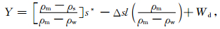
本文根据现今地层厚度,采用一维解压回剥法(Watts and Ryan, 1976; Sclater and Christie, 1980),经过解压实、载荷沉降、古水深校正和全球海平面变化校正,获得单井实测构造沉降曲线.假设艾利均衡,某时刻载水构造沉降Y为(Sclater and Christie, 1980):
|
(1) |
式中:Y为含水构造沉降(m);ρm,ρs,ρw分别为软流圈、沉积层和水的平均密度(kg·m-3);s*是解压实后的沉积层厚度(m);Δsl是古海平面相对于现今海平面的变化(m);Wd为沉积时期的古水深(m).
文中所用地层界面及相关参数见表 1.界面深度据时-深转换公式计算,北部湾盆地和珠三坳陷时-深转换据由钻井分层数据拟合得到,珠一坳陷和珠二坳陷时-深转换关系分别采用赵中贤等(2010)和Xie(2014)的关系式.研究区位于中、内陆架区,古水深变化较小,而且地层学、沉积相研究程度高(Nie et al., 2001; Xie et al., 2014; 龚贺,2014;张迎朝等,2011;赵中贤等,2010;朱伟林等,2010),根据岩相古地理研究成果,我们可以估算地层沉积时的古水深和砂泥岩百分比(表 1,图 2).全球海平面据Haq等(1987)的三级层序对应的海平面中值(表 1).
|
|
表 1 北部湾盆地及珠江口盆地地层参数(界面年龄据CNOOC) Table 1 Strata parameters in Beibuwan Basin and Pearl River Mouth Basin (after CNOOC) |
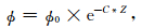
解压实公式采用Sclater和Christie(1980)指数模型(参数见表 2):
|
(2) |
|
|
表 2 回剥法计算参数 Table 2 Values of parameters |
其中,ϕ为孔隙度,ϕ0为原始孔隙度,C为压实系数(km-1),Z为深度(km).
3 构造沉降特征我们总共计算了人工井40余口,钻井20余口,图 3给出了21口典型井的构造沉降史.这些计算点不仅包括了筛选得到的部分钻井,还包括了在过凹陷中心的地震测线上选取的人工井.为了便于区域对比,我们在珠一和珠二坳陷也选取了部分人工井进行计算.考虑到晚新生代构造沉降计算过程中,若只用新近系和第四系地层进行回剥计算,结果会因为古近纪地层的压实作用而导致计算结果偏大,因此,我们首先计算了盆地新生代以来完整的构造沉降史,然后从中截取晚新生代的构造沉降史.

|
图 3 晚新生代构造沉降 Fig. 3 Tectonic subsidence curves in the Late Cenozoic |
计算结果显示,早中新世,北部湾盆地凹陷区构造沉降速率普遍介于10~30 m/Ma,凸起区构造沉降速率较大,约60 m/Ma;珠一、珠三坳陷沉降速率约50~110 m/Ma;珠二坳陷最大沉降速率约130 m/Ma.中中新世,北部湾盆地沉降速率介于30~40 m/Ma;珠三坳陷北部构造沉降大于南部,北部地区构造沉降速率为50~80 m/Ma,坳陷南部沉降速率与北部湾盆地相当;珠一坳陷沉降速率介于30~50 m/Ma;珠二坳陷白云凹陷中心沉降速率高达150 m/Ma(图 3,C4).晚中新世,北部湾盆地和珠三坳陷构造沉降速率非常低,北部湾盆地仅4~10 m/Ma(图 3,B1-B8),珠三坳陷仅8~20 m/Ma(图 3,A1-A9).珠一和珠二坳陷沉降速率大于北部湾盆地和珠三坳陷,介于30~40 m/Ma(图 3,C1-C4).上新世—至今,北部湾盆地沉降速率较晚中新世有所增大,介于10~20 m/Ma;珠三坳陷构造沉降速率介于20~40 m/Ma;珠一、珠二坳陷构造沉降速率与珠三坳陷相当(图 3,C1-C4).
据经典张裂盆地的沉降模型(McKenzie, 1978),盆地裂后期理论构造沉降随时间逐渐减低.然而,研究区构造沉降趋势却存在异常:晚中新世时期,北部湾盆地和珠三坳陷的构造沉降明显低于其他时期,为晚新生代最低值(图 3,B1-B8,A1-A9);珠一坳陷和珠二坳陷中中新世以来沉降速率逐渐降低,晚中新世沉降并无类似的异常特征(图 3,C1-C4).
4 剥蚀面发育特征深部异常体的热浮力和岩浆上涌的动力效应会引起地壳隆升,若隆升导致浅部暴露地表,会形成剥蚀面(杨展览等,1992).研究区不仅存在基底隆起形成的剥蚀面,还存在受海平面升降控制的剥蚀面,二者在地震剖面中表现不同.北部湾盆地和珠三坳陷位于中、内陆架,地质历史过程中,海平面变化使其频繁暴露地表,形成多个剥蚀面,这类剥蚀面之下的地层无构造抬升、呈近水平状,若沉积后地层抬升,地层会呈平行状,如T4界面(~16.5 Ma)(图 4).基底隆升形成的剥蚀面与前者不同,这类剥蚀面之下的地层因基底隆升发生翘倾,表现为“削截”接触关系,在地震剖面中较易识别,文中重点关注此类剥蚀面.需要注意的是,地震资料解释应区分“削截”与“顶超”,“顶超”代表过路沉积,多由海平面降低,沉积物向海方向推进形成,如T3界面.我们通过对钻井和地震数据综合分析,发现研究区T5界面(18.5 Ma)为层序内部界面,代表最大海泛面;T4界面(16.5 Ma)和T3为受海平面下降形成的区域性剥蚀面;T2是由反转构造导致的局部剥蚀面;而T1和T0界面除受海平面降低影响外,在局部区域还因基底隆升发生地层剥蚀,形成明显削截(图 5).下面描述反转构造形成的局部剥蚀面和因基底隆升而导致地层剥蚀的界面特征.

|
图 4 珠三坳陷地震解释剖面 显示晚中新世存在明显的差异沉降. Fig. 4 The interpreted seismic profile (A1-A2-A3-A4) in the Zhu Ⅲ depression showing late Miocene discrepancy subsidence in the region from Hainan uplift to Zhu Ⅲ Depression |

|
图 5 海南隆起区地震解释剖面(位置见图 4) S1-S9为层序界面. Fig. 5 The interpretated of seismic profile in Hainan uplift (see Fig. 1 for location) S1-S9 represent sequence boundaries. |
(1) T2界面
T2界面年龄约10.5 Ma,研究区大部分区域T2为整合面,局部区域因为构造反转表现为剥蚀面特征,如北部湾盆地海中凹陷和珠三坳陷的文昌B凹陷(图 6g).在海中凹陷,T2界面之下地层发生褶皱弯曲,褶曲程度由西向东逐渐减小,褶皱顶部被剥蚀,界面之上地层持续上超(图 6a),构造反转从晚中新世持续至上新世末.珠三坳陷T2剥蚀面由断层反转导致,反转构造T2界面之下地层被剥蚀,表现为低角度削截,界面之上地层上超于T2(图 6b).从断层两盘地层厚度分析,珠三坳陷构造反转始于中中新世末期,主要发生于晚中新世,沿坳陷西部北东向断层分布(徐子英等,2010;苗顺德等,2013;李辉等,2014).反转构造的发育表明研究区区域应力发生了变化.

|
图 6 研究区晚新生代剥蚀面特征 剖面(a)修改自朱伟林等(2010). Fig. 6 Late Cenozoic erosion surfaces features in the study area Section (a) modified from Zhu et al. (2010). |
(2) T1界面
T1界面年龄约5.5 Ma,大部分区域T1为整合面,局部区域基底隆升,地层局部剥蚀形成剥蚀面(图 6c和6e),主要分布于北部湾盆地中东部和珠三坳陷西北部.北部湾盆地中东部晚中新世发生局部隆升,上中新统厚度(T2-T1)向东持续减薄,伴随同沉积上超,顶部有微弱削截(图 7,L-L′和M-M′).珠三坳陷西北部T1界面之下地层低角度翘倾,削截终止于T1界面,界面之上地层呈水平状,剥蚀地层双程走时约100 ms,折算为厚度约120 m(图 7,N-N′).T1剥蚀面分布范围位于雷琼低速异常体正上方.

|
图 7 研究区主干地震剖面解释(剖面位置见图 1) 地震地层解释基于钻井标定和层序对比,L-L′测线(李晓唐,2016)和M-M′测线(朱伟林等,2010)显示T2—T1之间的地层(上中新统)和第四系地层向东减薄,地层同沉积上超.N-N′测线显示T2—T1之间的地层被削截. Fig. 7 Line drawing from seismic lines in study area (see Fig. 1 for location) The section is interpreted according to drill data and sequence correlation. Seismic line L-L′ (after Li, 2016) and M-M′ (after Zhu et al., 2010) show that upper Miocene and Quaternary strata gradually thin eastward with syn-sedimentary onlap. Seismic line N-N′ shows that the Upper Miocene was truncated. |
(3) T0界面
T0界面年龄约2.5 Ma,仅局部区域基底隆升、地层剥蚀,形成剥蚀面,分布位置大致与T1不整合面一致,但范围小于T1(图 6g).界面之下地层因抬升明显倾斜,倾伏端地层遭受剥蚀,界面之上地层水平超覆(图 5、图 6d和f).如海南隆起于S4-T0沉积期发生明显构造抬升,导致层序界面S4和S3上倾削截终止于T0(图 5),剥蚀地层双程走时约100 ms,折算为厚度约100 m.此外,T0在雷琼区域还是大套火山岩与沉积岩的分界面,称为非整合面.
5 岩浆活动研究区晚新生代岩浆活动强烈,雷琼区域有很多岩体分布(图 1b),海域地震剖面和钻孔也有揭示.我们在海域地震剖面新识别了4个规模较大的岩体,分析认为岩体形成时间为中中新世末-晚中新世和上新世末(图 8和图 9).

|
图 8 海南隆起侵入体(剖面位置见图 4 S1-S7为层序界面. Fig. 8 Magma intrusion in Hainan uplift (see Fig. 4 for location) S1-S7 represent sequence boundaries. |

岩浆岩体有较高的地震波速,与周围沉积层形成正反射波阻抗界面,地震剖面中表现为强振幅的波峰(SEG负极性显示).新揭示岩体分布于珠三坳陷和海南隆起,分为2类:一类为喷出岩,呈丘状外形,对下伏地层有明显能量屏蔽效应,岩体顶面为极强正反射,连续性较差,内部呈乱岗状反射,沉积地层超覆于岩体侧翼,下伏地层中具有清晰的刺穿路径(图 9);另一类为侵入岩,有明显侵入边界,顶部为强振幅正反射,为典型高速侵入体,侵入体内部为空白反射,周围地层呈层状反射,顶部沉积层有明显上拱(图 8).岩浆、泥质和岩盐都可能形成侵入体,文中侵入体为典型高速体侵入,固可以排除泥岩侵入;同时这些侵入体可以延伸至盆地基底面Tg以下的基底,固可排除盐岩侵入,因此新识别的侵入体应为岩浆侵入体.
5.2 岩浆活动时间岩浆活动时间为中中新世末-晚中新世(T3-T1)和上新世末(S4-T0).图 8显示,海南隆起区70~90 km区域侵入体刺穿Tg、T7、T6、MFS18.5,造成T4-T1之间的地层上拱隆起,T3之下的地层厚度未受岩浆上涌影响,T3-T1之间的沉积地层受侵入体上拱而发生同沉积减薄,侵入体侧翼见上超反射终止,表明在T3-T1间岩浆发生持续上侵.在80~90 km处,侵入体上方S2界面发生明显向上弯曲,而T0则为水平层状反射,指示在S2-T0之间岩浆再次上侵.图 9显示珠三坳陷文昌A凹陷岩体位于T1和T2之间,T1之上地层几乎不受岩体影响,推测该岩体形成时间为晚中新世末期.
6 雷琼低速异常体活动性分析实际观测和模拟研究表明,大型深部热异常体在岩浆大规模喷发前可使地表发生穹状上隆(何斌等,2006; Burov et al., 2007; Griffiths et al., 1989, 1991),在沉积盆地区必然导致盆地构造沉降减缓,甚至构造抬升.峨眉山大火成岩省在玄武岩喷发之前(早、晚二叠世间)即发生了公里级的穹状隆起,导致地层抬升剥蚀,剥蚀量可达近千米(Xu et al., 2004; He et al., 2010;朱传庆等,2009).印度德干高原、俄罗斯西伯利亚等大火成岩省也存在类似现象,地壳隆升幅度可达数百米至千米级(Campbell, 1990; Saunders et al., 2007).对比南海北部沉积盆地晚新生代构造沉降史(Xie et al., 2006; Shi et al., 2005, 2017; 刘安等,2011;王聪等,2016),晚中新世沉降减慢主要发生在北部湾盆地和珠三坳陷(图 10).虽然晚中新世南海东北部发生的东沙运动(李平鲁,1993;赵淑娟等,2012)可能引起同时期构造沉降速率降低,但是其应力来自于菲律宾海海盆的推挤和台湾弧陆碰撞作用,对南海北部的影响会由东向西逐渐减弱(赵淑娟等,2012).如果北部湾盆地和珠三坳陷晚中新世构造沉降减慢由东沙运动引起,那么珠一、珠二坳陷也会有类似特征,但是我们的计算结果表明珠一、珠二坳陷并没有类似特征.因此,我们认为晚中新世北部湾盆地和珠三坳陷沉降减慢并非由东沙运动引起,而是雷琼低速异常体热浮力影响的结果.这种地壳隆升不仅造成研究区在晚中新世沉降减慢,还导致T1和T0剥蚀面的发育.剥蚀面剥蚀厚度和岩体分布范围显示雷琼深部低速异常体规模较小.上文识别出的T2、T1和T0剥蚀面(图 6)中,T1和T0剥蚀面的分布范围和晚中新世构造沉降异常区重叠,以雷琼火山区为中心大致呈环状分布(图 11).剥蚀面估算的累积剥蚀量可达到100~200 m,表明研究区深部异常确实导致了基底一定程度抬升,但是抬升规模明显小于峨眉山大火成岩省形成的近千米地表隆升.峨眉山玄武岩分布面积约2.5×10⁵ km2,残留厚度最大约2700 m,体积达0.3×10⁶~0.6×10⁶ km3(何斌等,2006),而雷琼区域玄武岩面积仅为7.5×10³ km2,最大厚度约500 m(Tu et al., 1991).基底抬升规模和岩浆喷发规模均表明雷琼深部低速异常体的规模远低于峨眉山地幔柱级别.这种认识与前人层析成像结果和岩石地球化学分析结果是一致的(Lei et al., 2009; Wang et al., 2013).Lei(2009)等高分辨率的层析成像结果显示,该区雷琼低速体为往东南方向下延到250 km深度、直径约80 km的连续低速柱状异常体.Wang(2013)根据岩石地化分析提出的模型也显示,雷琼地区深部低速体仅为深部大规模低速异常体的一个分支.

|
图 10 研究区与周边地区晚新生代构造沉降对比 莺歌海盆地构造沉降据Xie(2006);白云凹陷F1-F4据Shi(2005);琼东南盆地数据据Shi(2017);珠江口盆地陆架区:G1、G2据Xie(2006),G3-6据刘安等(2011),G7-G8据王聪等(2016). Fig. 10 Comparison of late Cenozoic tectonic subsidence between the study area and adjacent basins Tectonic subsidence in Yinggehai Basin is from Xie et al.(2006); Tectonic subsidence in the Baiyun sag and Qiongdongnan Basin is from Shi et al. (2005) and Shi et al.(2017), respectively; Tectonic subsidence in the Pearl River Mouth Basin is from Xie et al., (2006)(G1, G2), Liu et al. (2011)(G3-G6) and Wang et al.(2006)(G7, G8). |

|
图 11 雷琼区域深部过程与表层过程耦合演化示意图 Fig. 11 A carton model showing the coupled evolution between the deep and surface processes in the Leiqiong region |
根据晚中新世构造沉降减缓以及雷琼地区岩体年龄主要分布于更新世等特点,我们推测该异常体分支对雷琼区域明显影响可能发生于晚中新世以来.但是南海及其周围区域存在多个玄武岩分布区(图 1),表明南海深部更大的低速异常体很可能曾经有其他的上涌分支和影响时间.结合前人研究成果,晚新生代以来,该深部异常体对雷琼区域的影响主要包括:(1)雷琼区域盆地晚中新世构造沉积速率降低;(2)地壳抬升形成局部剥蚀面;(3)中中新世末期以来岩浆活动(Tu et al., 1991);(4)第四纪强烈的火山活动使琼北地区和雷州半岛出露海底成为陆地(Zhu et al., 2001);(5)局部高热流和高地温梯度(唐晓音等,2014;施小斌等,2017).根据这些认识,我们建立了雷琼低速异常体晚新生代活动过程示意图(图 11):晚中新世雷琼区域深部岩浆发生明显上涌,形成地壳穹窿,使北部湾盆地、珠三坳陷和海南岛地区地壳发生小幅度隆升,穹隆顶部区域地层被剥蚀;晚中新世末期,深部岩浆分支局部刺穿地壳,开始火山喷发;上新世时期,雷琼区域岩浆刺穿地壳,开始较大规模的火山活动;至第四纪爆发大规模火山喷发,导致琼北地区和雷州半岛出露地表以及高地热异常.
7 结论通过分析研究区晚新生代构造沉降、剥蚀面发育和岩浆活动特征,得出以下主要结论:
(1) 北部湾盆地和珠三坳陷晚中新世时期的构造沉降速率明显低于其他时期,为晚新生代最低值,该特征在珠一坳陷、白云凹陷、莺歌海盆地和琼东南盆地并无明显表现.
(2) 研究区晚新生代发育因基底隆升形成的T1和T0局部剥蚀面,分布范围以雷琼火山区为中心大致呈环状分布,累积剥蚀量约100~200 m.
(3) 根据研究区构造沉降特征、剥蚀面时空分布和基底抬升幅度,表明雷琼深部低速异常体明显影响浅层构造的时间是晚中新世之后,且规模较小,推测是深部大规模低速异常体的一个分支.
Briais A, Patriat P, Tapponnier P. 1993. Updated interpretation of magnetic anomalies and seafloor spreading stages in the South China Sea:implications for the tertiary tectonics of Southeast Asia. Journal of Geophysical Research:Solid Earth, 98(B4): 6299-6328. DOI:10.1029/92JB02280 |
Burov E, Guillou-Frottier L, D'Acremont E, et al. 2007. Plumehead-lithosphere interactions near intra-continental plate boundaries. Tectonophysics, 434(1-4): 15-38. DOI:10.1016/j.tecto.2007.01.002 |
Campbell I H, Griffiths R W. 1990. Implications of mantle plume structure for the evolution of flood basalts. Earth and Planetary Science Letters, 99(1-2): 79-93. DOI:10.1016/0012-821X(90)90072-6 |
Fan C Y, Xia S H, Zhao F, et al. 2017. New insights into the magmatism in the northern margin of the South China Sea:Spatial features and volume of intraplate seamounts. Geochemistry, Geophysics, Geosystems, 18(6): 2216-2239. DOI:10.1002/ggge.v18.6 |
Flower M F J, Zhang M, Chen C Y, et al. 1992. Magmatism in the South China Basin:2. Post-spreading Quaternary basalts from Hainan Island, south China. Chemical Geology, 97(1-2): 65-87. DOI:10.1016/0009-2541(92)90136-S |
Gong H Y. 2014. Tectonic evolution and its control on coal-measure source rocks in Zhu-3 Depression of Pearl River Mouth Basin[Master's thesis] (in Chinese). Qingdao: China University of Mining and Technology.
|
Griffiths R W, Gurnis M, Eitelberg G. 1989. Holographic measurements of surface topography in laboratory models of mantle hotspots. Geophysical Journal International, 96(3): 477-495. DOI:10.1111/gji.1989.96.issue-3 |
Griffiths R W, Campbell I H. 1991. Interaction of mantle plume heads with the earth's surface and onset of small-scale convection. Journal of Geophysical Research, 96(B11): 18295-18310. DOI:10.1029/91JB01897 |
Han S. 2014. The tectonic characteristics and forming mechanism of Wushi sag[Master's thesis] (in Chinese). Xuzhou: China University of Petroleum (East China).
|
Haq B U, Hardenbol J, Vail P R. 1987. Chronology of fluctuating sea levels since the Triassic. Science, 235(4793): 1156-1167. DOI:10.1126/science.235.4793.1156 |
He B, Xu Y G, Xiao L, et al. 2006. Sedimentary responses to uplift of Emeishan mantle plume and its implications. Geological Review (in Chinese), 52(1): 30-37. |
He B, Xu Y G, Guan J P, et al. 2010. Paleokarst on the top of the Maokou Formation:Further evidence for domal crustal uplift prior to the Emeishan flood volcanism. Lithos, 119(1-2): 1-9. |
Le B M, Yang T, Gu S Y. 2015. Upper mantle and transition zone structure beneath Leizhou-Hainan region:Seismic evidence for a lower-mantle origin of the Hainan plume. Journal of Asian Earth Sciences, 111: 580-588. DOI:10.1016/j.jseaes.2015.06.008 |
Lebedev S, Nolet G. 2003. Upper mantle beneath Southeast Asia from S velocity tomography. Journal of Geophysical Research:Solid Earth, 108(B1): 2048. DOI:10.1029/2000JB000073 |
Lei J S, Zhao D P, Steinberger B, et al. 2009. New seismic constraints on the upper mantle structure of the Hainan plume. Physics of the Earth and Planetary Interiors, 173(1-2): 33-50. DOI:10.1016/j.pepi.2008.10.013 |
Li C F, Xu X, Lin J, et al. 2014. Ages and magnetic structures of the South China Sea constrained by deep tow magnetic surveys and IODP Expedition 349. Geochemistry, Geophysics, Geosystems, 15(12): 4958-4983. DOI:10.1002/2014GC005567 |
Li H, Zhang Y Z, Gan J, et al. 2014. The style distribution and hydrocarbon accumulation of inverted structures in Zhu-3 Depression. Journal of Oil and Gas Technology (Journal of Jianghan Petroleum Institute-J.JPI) (in Chinese), 36(4): 1-5. |
Li P L. 1993. Cenozoic tectonic movement in the Pearl River Mouth Basin. China Offshore Oil and Gas (Geology) (in Chinese), 7(6): 11-17. |
Li X T. 2016. Petroleum geology characteristic and prospect of Maichen sag in central and southern Beibuwan Basin[Master's thesis] (in Chinese). Guangzhou: Chinese Academy of Sciences, Guangzhou Institute of Geochemistry.
|
Liu A, Wu S M, Cheng W H. 2011. Tectonic subsidence history and dynamic mechanism of the Dongsha rise in the Zhujiang River Mouth Basin. Acta Oceanologica Sinica (in Chinese), 33(6): 117-124. |
McKenzie D. 1978. Some remarks on the development of sedimentary basins. Earth and Planetary Science Letters, 40(1): 25-32. DOI:10.1016/0012-821X(78)90071-7 |
Miao S D, Xu J Y, Yin B H. 2013. Inverted tectonic characters and prediction of potential area in Zhu-3 Depression of Pearl River Mouth Basin. Natural Gas Geoscience (in Chinese), 24(3): 566-573. |
Montelli R, Nolet G, Dahlen F A, et al. 2004. Finite-frequency tomography reveals a variety of plumes in the mantle. Science, 303(5656): 338-343. DOI:10.1126/science.1092485 |
Montelli R, Nolet G, Dahlen F A, et al. 2006. A catalogue of deep mantle plumes:New results from finite-frequency tomography. Geochemistry, Geophysics, Geosystems, 7(11): Q11007. DOI:10.1029/2006GC001248 |
Nie F J, Li S T, Wang H, et al. 2001. Lateral migration pathways of petroleum in the Zhu Ⅲ subbasin, Pearl River Mouth basin, South China Sea. Marine and Petroleum Geology, 18(5): 561-575. DOI:10.1016/S0264-8172(01)00013-7 |
Qin G Q. 1996. Application of micropaleontology to the sequence stratigraphic studies of Late Cenozoic in the Zhujiang River Mouth Basin. Marin Geology & Quaternary Geology (in Chinese), 16(4): 1-18. |
Ru K, Pigott J D. 1986. Episodic rifting and subsidence in the South China Sea. The AAPG Bulletin, 70(9): 1136-1155. |
Saunders A D, Jones S M, Morgan L A, et al. 2007. Regional uplift associated with continental large igneous provinces:The roles of mantle plumes and the lithosphere. Chemical Geology, 241(3-4): 282-318. DOI:10.1016/j.chemgeo.2007.01.017 |
Sclater J G, Christie P A F. 1980. Continental stretching:An explanation of the post-mid-cretaceous subsidence of the central North Sea Basin. Journal of Geophysical Research:Solid Earth, 85(B7): 3711-3739. DOI:10.1029/JB085iB07p03711 |
Shi X B, Burov E, Leroy S, et al. 2005. Intrusion and its implication for subsidence:A case from the Baiyun Sag, on the northern margin of the South China Sea. Tectonophysics, 407(1-2): 117-134. DOI:10.1016/j.tecto.2005.07.004 |
Shi X B, Jiang H Y, Yang J, et al. 2017. Models of the rapid post-rift subsidence in the eastern Qiongdongnan Basin, South China Sea:Implications for the development of the deep thermal anomaly. Basin Research, 29(3): 340-362. DOI:10.1111/bre.2017.29.issue-3 |
Shi X B, Yu C H, Chen M, et al. 2017. Analyses of variation features and influential factors of heat flow in the northern margin of the South China Sea. Earth Science Frontiers (in Chinese), 24(3): 56-64. |
Song X X, Li C F, Yao Y J, et al. 2017. Magmatism in the evolution of the South China Sea:Geophysical characterization. Marine Geology, 394: 4-15. DOI:10.1016/j.margeo.2017.07.021 |
Tang Q S, Zheng C. 2013. Crust and upper mantle structure and its tectonic implications in the South China Sea and adjacent regions. Journal of Asian Earth Sciences, 62: 510-525. DOI:10.1016/j.jseaes.2012.10.037 |
Tang X Y, Hu S B, Zhang G C, et al. 2014. Geothermal characteristics and hydrocarbon accumulation of the northern marginal basins, South China Sea. Chinese Journal of Geophysics (in Chinese), 57(2): 572-585. DOI:10.6038/cjg20140221 |
Taylor B, Hayes B E. 1983. Origin and history of the South China Sea Basin.//Hayes D E ed. The Tectonic and Geologic Evolution of Southeast Asian Seas and Islands, Part 2. Washington, D.C.: Geophysical Monograph, 27: 23-56.
|
Tu K, Flower M F J, Carlson R W, et al. 1991. Sr, Nd, and Pb isotopic compositions of Hainan basalts (south China):Implications for a subcontinental lithosphere Dupal source. Geology, 19(6): 567-569. DOI:10.1130/0091-7613(1991)019<0567:SNAPIC>2.3.CO;2 |
Wang C, Mei L F, Chen H L, et al. 2016. Post-rift subsidence history and mechanism of Huizhou depression in the Pearl River Mouth Basin. Journal of Central South University (Science and Technology) (in Chinese), 47(3): 807-818. |
Wang C Y, Huang J L. 2012. Mantle transition zone structure around Hainan by receiver function analysis. Chinese Journal of Geophysics (in Chinese), 55(4): 1161-1167. DOI:10.6038/j.issn.0001-5733.2012.04.012 |
Wang X C, Li Z X, Li X H, et al. 2012. Temperature, pressure, and composition of the mantle source region of late Cenozoic basalts in Hainan Island, SE Asia:A consequence of a young thermal mantle plume close to subduction zones?. Journal of Petrology, 53(1): 177-233. DOI:10.1093/petrology/egr061 |
Wang X C, Li Z X, Li X H, et al. 2013. Identification of an ancient mantle reservoir and young recycled materials in the source region of a young mantle plume:Implications for potential linkages between plume and plate tectonics. Earth and Planetary Science Letters, 377-378: 248-259. DOI:10.1016/j.epsl.2013.07.003 |
Watts A B, Ryan W B F. 1976. Flexure of the lithosphere and continental margin basins. Tectonophysics, 36(1-3): 25-44. DOI:10.1016/0040-1951(76)90004-4 |
Wei S S, Chen Y J. 2016. Seismic evidence of the Hainan mantle plume by receiver function analysis in southern China. Geophysical Research Letters, 43(17): 8978-8985. DOI:10.1002/2016GL069513 |
Xia S H, Zhao D P, Sun J L, et al. 2016. Teleseismic imaging of the mantle beneath southernmost China:New insights into the Hainan plume. Gondwana Research, 36: 46-56. DOI:10.1016/j.gr.2016.05.003 |
Xie A Y, Zhong L F, Yan W. 2017. Timing and genesis of Cenozoic magmatisms in the South China Sea and surrouding areas. Marine Geology & Quaternary Geology (in Chinese), 37(2): 108-118. |
Xie H, Zhou D, Li Y P, et al. 2014. Cenozoic tectonic subsidence in deepwater sags in the Pearl River Mouth Basin, northern South China Sea. Tectonophysics, 615-616: 182-198. DOI:10.1016/j.tecto.2014.01.010 |
Xie X N, Müller R D, Li S T, et al. 2006. Origin of anomalous subsidence along the Northern South China Sea margin and its relationship to dynamic topography. Marine and Petroleum Geology, 23(7): 745-765. DOI:10.1016/j.marpetgeo.2006.03.004 |
Xu Y G, He B, Chung S, et al. 2004. Geologic, geochemical, and geophysical consequences of plume involvement in the Emeishan flood-basalt province. Geology, 32(10): 917-920. DOI:10.1130/G20602.1 |
Xu Y G, Wei J X, Qiu H N, et al. 2012. Opening and evolution of the South China Sea constrained by studies on volcanic rocks:Preliminary results and a research design. Chinese Science Bulletin, 57(24): 3150-3164. DOI:10.1007/s11434-011-4921-1 |
Xu Z Y, Sun Z, Zhang Y F, et al. 2010. Inversion structures in the northern continental margin of the South China Sea:Taking Lingao Uplift in the Yinggehai Basin and Qionghai Sag in the Pearl River Mouth Basin as examples. Earth Science Frontiers (in Chinese), 17(4): 90-98. |
Yang Z L, Li X S, Huang W X. 1992. A Comprehensive Dictionary of Geography (in Chinese). Hefei: Anhui People's Press.
|
Yu C H, Shi X B, Yang X Q, et al. 2017. Deep thermal structure of Southeast Asia constrained by S-velocity data. Marine Geophysical Research, 38(4): 341-355. DOI:10.1007/s11001-017-9311-x |
Zhang B, Wang P J, Zhang G C, et al. 2013. Cenozoic volcanic rocks in the Pearl River Mouth and Southeast Hainan basins of South China Sea and their implications for petroleum geology. Petroleum Exploration and Development, 40(6): 657-665. |
Zhang Y Z, Chen Z H, Li X S, et al. 2011. Hydrocarbon plays and pool-forming patterns in the western part of the Pearl River Mouth Basin. Oil & Gas Geology (in Chinese), 32(1): 108-117, 123. |
Zhao D P. 2004. Global tomographic images of mantle plumes and subducting slabs:Insight into deep Earth dynamics. Physics of the Earth and Planetary Interiors, 146(1-2): 3-34. DOI:10.1016/j.pepi.2003.07.032 |
Zhao D P. 2007. Seismic images under 60 hotspots:Search for mantle plumes. Gondwana Research, 12(4): 335-355. DOI:10.1016/j.gr.2007.03.001 |
Zhao F, Alves T M, Wu S G, et al. 2016. Prolonged post-rift magmatism on highly extended crust of divergent continental margins (Baiyun Sag, South China Sea). Earth and Planetary Science Letters, 445: 79-91. |
Zhao S J, Wu S G, She H S, et al. 2012. Structures and dynamic mechanism related to the Dongsha movement at the northern margin of South China Sea. Progress in Geophysics (in Chinese), 27(3): 1008-1019. DOI:10.6038/j.issn.1004-2903.2012.03.022 |
Zhao Z X, Zhou D, Liao J, et al. 2010. Lithospheric stretching modeling of the continental shelf in the Pearl River Mouth Basin and analysis of post-breakup subsidence. Acta Geologica Sinica (in Chinese), 84(8): 1135-1145. |
Zhou Y, Liu J H, Sun Z X, et al. 2016. Characteristics of radioactive heat generation rate of granite basement in Yangjiang Xinzhou geothermal field. Modern Mining (in Chinese), (8): 157-158, 161. |
Zhu C Q, Xu M, San J N, et al. 2009. Quantifying the denudations of major tectonic events in Sichuan basin:Constrained by the paleothermal records. Geology in China (in Chinese), 36(6): 1268-1277. |
Zhu W L, Mi L J, Zhang H H, et al. 2010. Atlas of Oil and Gas Basins, China Sea (in Chinese). Beijing: Petroleum Industry Press.
|
Zhu Z Y, Xu Y F, Wen Q Z, et al. 2001. The stratigraphy and chronology of multicycle quaternary volcanic rock-red soil sequence in Leizhou peninsula, South China. Quaternary Sciences (in Chinese), 21(3): 270-276. |
Zou H P, Li P L, Rao C T. 1995. Geochemistry of Cenozoic volcanic rocks in Zhujiangkou Basin and its geodynamic significance. Geochimica (in Chinese), 24(S1): 33-45. |
Zou H B, Fan Q C. 2010. U-Th isotopes in Hainan basalts:Implications for sub-asthenospheric origin of EM2 mantle endmember and the dynamics of melting beneath Hainan Island. Lithos, 116(1-2): 145-152. DOI:10.1016/j.lithos.2010.01.010 |
宫贺晏. 2014.珠江口盆地珠三坳陷构造演化及其对煤系烃源岩的控制[硕士论文].徐州: 中国矿业大学. http://cdmd.cnki.com.cn/Article/CDMD-10290-1014074215.htm
|
韩帅. 2014.乌石凹陷构造特征及成因机制[硕士论文].青岛: 中国石油大学(华东). http://cdmd.cnki.com.cn/Article/CDMD-10425-1016711610.htm
|
何斌, 徐义刚, 肖龙, 等. 2006. 峨眉山地幔柱上升的沉积响应及其地质意义. 地质论评, 52(1): 30-37. DOI:10.3321/j.issn:0371-5736.2006.01.005 |
李辉, 张迎朝, 甘军, 等. 2014. 珠三坳陷反转构造样式与分布及其油气成藏. 石油天然气学报(江汉石油学院学报), 36(4): 1-5. |
李平鲁. 1993. 珠江口盆地新生代构造运动. 中国海上油气, 7(6): 11-17. |
李晓唐. 2016.北部湾盆地中南部迈陈凹陷油气地质特征及勘探前景[硕士论文].广州: 中国科学院大学. http://cdmd.cnki.com.cn/Article/CDMD-80165-1016188268.htm
|
刘安, 吴世敏, 程卫华. 2011. 珠江口盆地东沙隆起的沉降史及其动力机制. 海洋学报, 33(6): 117-124. |
苗顺德, 徐建永, 印斌浩. 2013. 珠江口盆地珠Ⅲ坳陷反转构造特征及有利反转构造区带评价. 天然气地球科学, 24(3): 566-573. |
秦国权. 1996. 微体古生物在珠江口盆地新生代晚期层序地层学研究中的应用. 海洋地质与第四纪地质, 16(4): 1-18. |
施小斌, 于传海, 陈梅, 等. 2017. 南海北部陆缘热流变化特征及其影响因素分析. 地学前缘, 24(3): 56-64. |
唐晓音, 胡圣标, 张功成, 等. 2014. 南海北部大陆边缘盆地地热特征与油气富集. 地球物理学报, 57(2): 572-585. DOI:10.6038/cjg20140221 |
王聪, 梅廉夫, 陈汉林, 等. 2016. 珠江口盆地惠州凹陷裂后期沉降特征及成因分析. 中南大学学报(自然科学版), 47(3): 807-818. |
王晨阳, 黄金莉. 2012. 应用接收函数方法研究海南及其邻区地幔转换带结构. 地球物理学报, 55(4): 1161-1167. DOI:10.6038/j.issn.0001-5733.2012.04.012 |
谢安远, 钟立峰, 颜文. 2017. 南海及其围区新生代岩浆活动时序与成因研究. 海洋地质与第四纪地质, 37(2): 108-118. |
徐子英, 孙珍, 张云帆, 等. 2010. 南海北部陆缘盆地反转构造研究:以莺歌海盆地临高隆起和珠江口盆地琼海凹陷为例. 地学前缘, 17(4): 90-98. |
杨展览, 李希圣, 黄伟雄. 1992. 地理学大辞典. 合肥: 安徽人民出版社.
|
张迎朝, 陈志宏, 李绪深, 等. 2011. 珠江口盆地西部油气成藏组合和成藏模式. 石油与天然气地质, 32(1): 108-117, 123. |
赵淑娟, 吴时国, 施和生, 等. 2012. 南海北部东沙运动的构造特征及动力学机制探讨. 地球物理学进展, 27(3): 1008-1019. DOI:10.6038/j.issn.1004-2903.2012.03.022 |
赵中贤, 周蒂, 廖杰, 等. 2010. 珠江口盆地陆架区岩石圈伸展模拟及裂后沉降分析. 地质学报, 84(8): 1135-1145. |
周毅, 刘金辉, 孙占学, 等. 2016. 阳江新洲地热田花岗岩基底放射性生热率特征. 现代矿业, (8): 157-158, 161. DOI:10.3969/j.issn.1674-6082.2016.08.047 |
朱传庆, 徐明, 单竞男, 等. 2009. 利用古温标恢复四川盆地主要构造运动时期的剥蚀量. 中国地质, 36(6): 1268-1277. DOI:10.3969/j.issn.1000-3657.2009.06.008 |
朱伟林, 米立军, 张厚和, 等. 2010. 中国海域含油气盆地图集. 北京: 石油工业出版社.
|
朱照宇, 徐义芳, 文启忠, 等. 2001. 华南雷州半岛第四纪多旋回火山岩一系列的层序与年代. 第四纪研究, 21(3): 270-276. DOI:10.3321/j.issn:1001-7410.2001.03.009 |
邹和平, 李平鲁, 饶春涛. 1995. 珠江口盆地新生代火山岩地球化学特征及其动力学意义. 地球化学, 24(S1): 33-45. |