 2018, Vol. 61

2. 浙江大学地球科学系, 杭州 310027;
3. National Institute of Oceanography, Karachi, Pakistan
 , NIU XiongWei1
 , RUAN AiGuo1,2, Syed Waseem Haider3, HU Hao2, WANG AoXing1, WEI XiaoDong1, ZHANG Jie1
2. Department of Earth Sciences, Zhejiang University, Hangzhou 310027, China;
3. National Institute of Oceanography, Karachi, Pakistan
分段式扩张是指洋中脊轴部的岩浆扩张段(NVR)被大量的非转换断层不连续带(NTD)隔开,形成地壳结构迥异的相邻构造单元(Minshull et al., 2006;Zhao et al., 2013),是超慢速扩张西南印度洋中脊(SWIR)的主要特征之一(Cannat et al., 1999;Sauter et al., 2011).而造成这一结构差异的主要原因是由于洋中脊处岩浆供应的不同.NVR通常是来自上地幔的岩浆供给的主要聚集地,其岩浆供给充足,地壳较厚(Sauter and Patriat, 2010),而NTD区域则由于缺少岩浆供给,地壳较薄,并且断层和裂隙较为发育,存在大范围的蛇纹石化地幔(Escartín et al., 1997;牛雄伟等,2015).对NVR和NTD的研究能更好的帮助我们了解洋中脊岩浆的集中供应情况.
前人研究表明西南印度洋中脊50°E附近存在厚地壳、低速熔融体和拆离断层等体现岩浆集中供给的空间特征(Li and Chen, 2010;Zhao et al., 2013;Niu et al., 2015),这为超慢速扩张洋中脊的分段性扩张提供了重要证据,大大改善了以往根据地形地貌(Mendel et al., 1997)、重力异常(Rommevaux-Jestin et al., 1997)等方法对洋中脊分段的精度,为进一步探索SWIR岩浆集中供给和分段扩张的深部机制提供了可能.以上认识多是源于对洋中脊轴部NVR和NTD的研究,而我们对于远离轴部相应区域的地壳结构如何变化却知之甚少.岩浆集中供给是否随时间变化?离轴地壳如何演化?NVR与NTD的形成及转化规律如何?对远离轴部相应区域洋壳结构的研究能够很好的帮助我们认识以上问题.
本研究使用2010年DY115-21航次第六航段在SWIR(50°E)采集的海底地震仪(OBS)数据,选取1条位于扩张轴偏北10 km的离轴测线d0d10,对SWIR第28扩张段(Seg.28)和其两侧的NTD区域进行研究,使用射线追踪正演和反演的方法,得到了NTD和NVR北部边缘的地壳及上地幔速度结构,为洋中脊离轴区域的地壳结构以及洋中脊轴部的岩浆运移通道和岩浆供给量的变化提供了地震学的观测证据.
1 数据和方法 1.1 数据采集和处理2010年1至2月的DY115-21航次中,“大洋一号”科考船使用40台OBS在SWIR中东段浅水区的龙旂和断桥热液活动区(Tao et al., 2007, 2012)开展了三维人工地震探测(Li and Chen, 2010;阮爱国等,2010).本文选取龙旂热液活动区北侧的1条OBS测线进行研究.该区域(图 1)包括SWIR第29段扩张中心的东部,向东延伸包含整个第28段扩张中心,在28和29段之间有一个明显的NTD(Cannat et al., 1999).研究区洋脊轴中部为狭长洼地,两侧隆起,南侧明显高于北侧,水深约1100~3900 m, 最深处位于SWIR第29段东端,最浅处位于SWIR第28段扩张中心南侧.

|
图 1 研究区及测线位置图 底图数据为船测多波束数据,左上插图中的红色矩形框为本研究区在全球的位置.红色实线为d0d10测线,线上带圆圈中的数字为本文使用的OBS站位编号.红色五角星为活动热液喷口(Tao et al., 2007, 2012).NTD为非转换断层不连续(白色虚线),Seg.28和Seg.29分别代表西南印度洋中脊第28、29段扩张脊(白色实线)(Cannat et al., 1999;Sauter et al., 2001).黑色粗实线为a2k2和y1y2测线(牛雄伟等,2015).彩色方块为洋脊轴两侧对称的磁条带,其中橘黄色代表现今扩张轴,其他分别为C2An.y(2.581 Ma,红色)、C3n.y(4.18 Ma,蓝色)和C3An.y(5.894 Ma,黑色)(Mendel et al., 2003;Cande and Kent, 1995). Fig. 1 Seafloor topography of the study area and the location of seismic lines The basemap data is measured by shipborne multi-beam bathymetry system. The inset shows the position of the study area in the world. Red solid line represents d0d10 survey line. The circles with numbers represent OBS positions used in this work. Red star shows the active hydrothermal vent (Tao et al., 2007, 2012). NTD is the non-transform fault discontinuity (white dashed line). Seg.28 and Seg.29 represent segments 28 and 29 of the SWIR spreading ridge (white solid line, Cannat et al., 1999; Sauter et al., 2001), respectively. Black thick solid lines mark the profiles of a2k2 and y1y2, respectively (Niu et al., 2015). The color squares are symmetrical magnetic stripes on both sides of the ridge axis for C2An.y (2.581 Ma, red), C3n.y (4.18 Ma, blue), C3An.y (5.894 Ma, black) and orange for the current spreading axis, respectively (Mendel et al., 2003; Cande and Kent, 1995). |
d0d10测线(图 1)位于洋脊轴北部,其南侧有NTD和Seg.28,长64 km,布设有3台OBS,近WE向平行于洋中脊轴,水深从2000 m到3500 m.OBS间距8 km,数据采样率为250 Hz(采样间隔4 ms).所有OBS仪器均包括3个检波器分量和1个水听器分量,本文只使用了垂直分量.震源由4支1500 in3(1 in=2.54 cm)的BOLT枪组成,总容量约为100 L.工作压力10.79 MPa,放炮时间间隔80~120 s,炮间距为200~300 m.OBS设备、气枪作业和导航均采用GPS授时和定位,统一使用UTC时间.
OBS数据处理主要包括震源激发时间和震源位置校正、OBS位置校正、记录器时钟漂移校正以及滤波处理(敖威等,2010).其中,震源位置校正还考虑了航向变化对GPS天线相对枪阵中心位置的影响.用最小二乘法将炮点投影到直线上作为剖面.OBS位置校正利用多波束水深测量数据确定海底面和OBS在海底的位置,最后通过小偏移距直达水波理论计算走时与实测走时的拟合,确定OBS最终位置(薛彬等,2008).采用4~20 Hz带通滤波器对OBS数据进行滤波(牛雄伟等,2014),折合速度取8 km·s-1.
1.2 震相识别和震相特征通过初步的走时模拟对震相进行确认和拾取,并在后续反演过程中作进一步的确认.这里指定Pw为直达水波,P2为洋壳层2的折射震相,P2P为洋壳层2的反射震相,P3是洋壳层3的折射震相,PmP为莫霍面的反射震相,Pn为上地幔的折射震相.
d0d10测线上有可用数据的三台OBS均记录了清晰的地壳内折射震相P2和P3,分别如图 2a,图 3a,图 4a,但未记录到莫霍面的反射震相PmP.在OBS17台站地震记录剖面中识别出了地壳折射震相P2和P3,在剖面42 km处(偏移距约34 km)开始出现大量Pn震相,西侧仅有少量P2震相;OBS09台站Pn震相出现在剖面约40 km处(偏移距约28 km),其东西两侧均有明显的P2、P3震相;OBS10台站地震记录剖面中未识别到Pn震相,不过在剖面约15 km处识别出少量的P2P震相.

|
图 2 OBS17台站的地震记录(a)、射线追踪(b)及走时拟合情况(c).折合速度为8.0 km·s-1 (a)中各种震相名称解释见上文;(b)中不同颜色的射线代表不同震相的路径,其震相类型与(a)中震相相对应,黑色虚线从上往下依次为最终模型中的海底面、洋壳层2与层3分界面和莫霍面; (c)为最终模型的理论走时与拾取走时的拟合结果,图中黑色圆圈为理论走时,彩色竖条为拾取走时,其颜色代表的震相类型与(b)中射线颜色类型一致,竖条高度为拾取走时误差的2倍(Zelt and Smith, 1992). Fig. 2 (a) Seismic section of vertical component of OBS17 on profile d0d10. (b) Simulation of ray-tracing. (c) Fitting of calculated travel time to observed. Reduction velocity is 8.0 km·s-1 The meanings of various phases in (a) are presented in text. In (b), rays of different colors represent paths of different seismic phases, of which the seismic phase types correspond to those in (a). Black dashed lines from top to bottom show the final model submarine surface, ocean crust interface for layers 2 and layer 3, and the Moho. (c) is the fitting result of the theoretical travel time marked as black circles and picking travel time marked as colorful bars in the final model. The colors of the bars represent the seismic phase types that are the same as the ray color types in (b). The height of the bar is twice the picking travel time error (Zelt and Smith, 1992). |

|
图 3 OBS09台站的地震记录(a)、射线追踪(b)及走时拟合情况(c)相关说明同图 2. Fig. 3 (a) Seismic section of vertical component of OBS09 on profile d0d10. (b) Simulation of ray-tracing. (c) The fitting of the calculated travel time to observed Others are the same as Fig. 2. |

|
图 4 OBS10台站的地震记录(a)、射线追踪(b)及走时拟合情况(c)相关说明同图 2. Fig. 4 (a) Seismic section of vertical component of OBS10 on profile d0d10. (b) Simulation of ray-tracing. (c) Fitting of the calculated travel time to observed Others are the same as Fig. 2. |
使用射线追踪拟合试错法进行正演模拟.初始模型分为4层,分别为海水层(层内速度为1.5 km·s-1),2 km厚的洋壳层2(层2,顶面速度1.8 km·s-1,底面速度6.4 km·s-1), 4 km厚的洋壳层3(层3,顶面速度6.4 km·s-1, 底面速度7.0 km·s-1)和上地幔(顶面速度8.0 km·s-1).上述分层和速度参考了多波束水深数据、标准洋壳模型(Kennett,1982;White et al., 1992)和SWIR 50°E扩张中心轴部的P波速度模型(Niu et al., 2015).网格划分方法是:水平网格节点间距在洋壳层2和层3分别为5 km,在上地幔为10 km;垂直方向上,除海水层外,设定层内速度为线性变化,由顶面和底面的速度差和厚度,自动确定网格划分,层内不设速度间断面.采用走时模拟和反演方法构建速度模型,用试错法手动修改各层的速度和分界面拟合各种震相(Zelt and Smith, 1992),主要修改层2的顶界面速度拟合P2震相,然后调整层2与层3的分界面和莫霍面的埋深拟合P3震相,修改上地幔顶部的速度拟合Pn震相,如图 2b(2c)、图 3b(3c)和图 4b(4c).当各层界面调整好后,以全局走时误差为目标函数,采用阻尼最小二乘法,由浅到深,逐层反演速度,得到最优化P波速度模型.
1.4 反演方法为降低速度模型的不确定性,使用Jive3D软件进行2D初至波反演(Hobro,1999).参考正演迭代获得的模型建立初始模型,包括海水层和地壳层,各层内速度场连续且光滑,设地壳内速度从上向下在1.8~8.2 km·s-1范围内变化.首先根据网格节点,将初始模型自动插值形成均匀模型(图 5),并且在随后的每次反演开始时,使用2次B型样条插值得到沿深度方向等速度梯度的新速度网格和线性界面.为了尽可能避免过度拟合,使用尽量粗糙但又不影响拟合误差的网格节点(Scott et al., 2009).采用的网格间距为1 km(水平1)×0.5 km(水平2)×0.5 km(垂直).模型长64 km,宽1 km,深14 km.使用的速度节点在地壳层为66×3×30,海底面节点数为67(代表节点间距为1 km).

|
图 5 自动反演模型地壳速度结构的初始模型 Fig. 5 The initial model of crustal velocity structure for automatic inversion |
d0d10测线分为三段,即西段的NTD北侧离轴区域(0~26 km),中段的NVR北侧离轴区域(岩浆活动区,即Seg.28,26~42 km)和东段的NTD北侧离轴区域(42~64 km).d0d10剖面地壳模型(图 6)大致可以分为三层:洋壳层2,洋壳层3和上地幔,未见明显的沉积层.

|
图 6 正演模型地壳速度结构 图中黑细线为速度等值线,黑粗线依次为海底面、洋壳层2与层3分界面,黑色虚线为莫霍面,红色三角为OBS站位,其顶上数字为OBS编号.白线为本文中展示的1D速度曲线的位置,白色数字为白线在模型中的位置,单位为km.V.E.=1.5为模型纵向放大倍数. Fig. 6 Crustal velocity structure from forward modeling Thin black lines are velocity contours. Thick black lines are seabed surface and ocean crust interface between Layer 2 and Layer 3, respectively. Black dashed line represents Moho. Red triangles are OBS stations with numbers at tops. White lines with numbers are positions of 1D velocity curves. V.E.=1.5 means the longitudinal power of magnification of the model. |
首先,从地壳厚度方面来分析,靠近NVR的剖面(中段)与靠近NTD的剖面(西、东段)在地壳厚度上差异明显,洋壳层2厚度横向均匀(约2 km),主要差异表现在洋壳层3上.洋壳层3厚度横向差异大(2.0~4.2 km),中段的NVR北侧离轴区域的地壳较厚(4 km左右),而两侧西、东段的NTD北侧离轴区域的地壳则明显较薄(约2 km).
其次,从速度结构方面来分析.洋壳层2横向速度不均匀,呈三段式分布,总体上表现为西、东段的速度高于中段,西段和东段结构对称,垂向速度分层现象明显,速度变化大(3.2~6.0 km·s-1),中段速度均匀(~4.5 km·s-1).洋壳层2与洋壳层3分界面与6.4 km·s-1速度等值线稍有出入,而且差别主要集中在剖面中段,此处的等值线向下凹,表示该段速度低于同一水平层的其他段速度.同时,层2与层3分界面在西、东段垂向速度连续,而在中段则差异明显,上下速度反差达1.6 km·s-1(图 6).向下到洋壳层3,中间厚,两边薄,垂向速度变化都很小,西、东段(6.4~7.4 km·s-1)略大于中段(6.4~7.2 km·s-1),不过横向速度变化明显,层3中段速度总体低于西、东两段.再向下,根据速度间断面大致确定莫霍面的位置.其中西、东段分界面处的速度大约是7.4 km·s-1左右,而在中段莫霍面与7.2 km·s-1速度等值线重合,在剖面上该等值线同样在中段向下凹.在上地幔,剖面西、东段的速度都在7.8 km·s-1左右,而且都略大于中段(7.5 km·s-1).纵观整个剖面,中段速度要低于西、东两段.
在正演模型的基础上,结合初至波自动反演模型,有助于我们获取更多关于地壳速度结构的有用信息.自动反演过程不再包括直达水波,其他数据与正演迭代法相同,包括震相类型(P2和P3统一为地壳内折射震相Pg)和走时不确定性.反演过程中,模型光滑度参数λm从-1.0减小到-9.9(步长为-0.5,负值代表光滑度降低),每个λm值迭代10次,直到获得稳定的模型,这时模型优化率从30%(λm为-1.0时)降低到0.1%(λm最小时),χ2从56.785降低到2.104.拾取走时拟合率为97%,这样得到的模型(图 7)能较好地反映真实地壳结构(Paulatto et al., 2010).纵观整个剖面(图 7),依然可以明显看出西、东段离轴区域的地壳厚度薄于中段,且西、东段地壳整体速度大于中段.

|
图 7 自动反演模型地壳速度结构的最终模型 其他说明同图 6. Fig. 7 The final model of crustal velocity structure from automatic inversion Others are the same as Fig. 6. |
正反演模型相似,地壳厚度接近,速度结构均为中段为低速区,东西两段速度增高.另外,两个模型也存在差别,原因可能在于反演模型缺少莫霍面的约束,在射线分布较差的边缘区域控制较差,但在射线分布较好的模型中段得到了明显的低速区等精细构造.
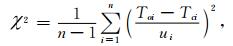
2.2 误差分析使用统计的方法对正演迭代获取的最终速度模型进行误差分析(表 1),各种震相都有较小的走时残差均方根(RMS).使用标准卡方分布(χ2)对走时拟合进行评估(Zelt and Smith, 1992),其定义为
|
|
表 1 d0d10测线误差统计 Table 1 Error statistics of profile d0d10 |
|
(1) |
其中,n是参与计算的走时数,Toi,Tci和ui分别为拾取走时、计算走时和走时的不确定性.对于某一种走时,χ2为1表示为在该走时不确定性范围内的最佳拟合,χ2小于1表示拟合残差小于走时不确定性,χ2大于1表示拟合残差大于走时不确定性,本文d0d10剖面拾取走时的不确定性见表 1.该剖面的射线密度分布见图 8,可以看出射线覆盖次数普遍大于5次,主要集中在10~40次,有较好的覆盖,保证了模型的可靠性(Zelt,1999).使用F测试统计的方法(Zelt, 1999)对模型层速度和界面的不确定性进行了分析(表 2),速度不确定性最大为0.28 km·s-1,洋壳层2与层3分界面埋深误差最大为0.2 km, 而莫霍面的埋深误差为-0.7~0.6 km.

|
图 8 d0d10测线的射线密度分布图(统计网格:0.5 km×0.2 km) 其他说明同图 5. Fig. 8 Ray density distribution for survey line d0d10 Others are the same as Fig. 5. |
|
|
表 2 速度模型的层速度和界面不确定性 Table 2 Uncertainties of layer velocities and interfaces |
使用检测板方法对反演模型进行分辨率测试(Paulatto et al., 2010;图 9).所加扰动为速度值的5%,扰动正弦函数半波长为1.3 km×1 km,结果表明,台站下方模型有较好的纵向分辨率和较好的横向分辨率,其他部分由于射线交叉较少,分辨率较差.也表明对于数据约束较少的剖面,反演方法有一定的局限性.

|
图 9 反演模型的检测板分辨率测试.扰动半波长为1.3 km×1 km,理论模型扰动速度等值线为0.03 km·s-1,恢复模型扰动速度等值线为0.01 km·s-1 (a)理论模型;(b)恢复模型.其他说明同图 6. Fig. 9 Checkerboard resolution test of the inversion model. The grid is 1.3 km×1 km, the disturbed velocity contour of theoretical model is 0.03 km·s-1, and contour value of the recovered model is 0.01 km·s-1 (a) Synthetic model; (b) Recovered model. Others are the same as Fig. 6. |
由图 6可知,从地壳厚度上而言,NTD北侧离轴区域的地壳厚度小于NVR北侧离轴区域的地壳厚度,且洋壳层2厚度横向均匀,主要差异集中在洋壳层3上.表明由于分段扩张明显,岩浆集中在NVR北侧离轴区域,NTD北侧离轴区域缺少岩浆,使得地壳厚度变化主要发生在层3.这种现象与前人关于轴部NTD和NVR区域的地壳厚度结果相符(Minshull et al., 2006;Muller et al., 2000),但此处的地壳速度结构有其特殊性.
d0d10测线平行于扩张轴,位于轴部北侧约10 km.该剖面中段的速度相对于东、西两段偏低,表明其下方可能存在高温异常,与牛雄伟(2014)计算出的岩石圈100 km深处温度异常(1360 ℃)相吻合.从磁异常条带C2An.y的变化趋势(图 1,Mendel et al., 2003;Cande and Kent, 1995)可以推断出中段离轴区域形成时间可能晚于东、西两段.从整个剖面来看(图 6),西、东段离轴区域在地壳厚度和速度结构上存在极大相似性且关于中段离轴区域对称.
蛇纹石化作用通常发生在洋中脊裂隙或断层发育、地壳厚度小于5~6 km(Escartín et al., 1997;Minshull et al., 1998)而温度低于400 ℃的区域.图 7剖面东段大面积的高速异常区域属于NTD北侧离轴区域,这一区域存在大量破碎区,裂隙和断裂都比较发育,导致海水向下运移以及地层的压力减小.地层压力减小有可能导致地幔物质上涌,同时海水向下运移又为地幔岩石发生蛇纹石化作用提供了条件.另外,这一区域的速度(7.2 km·s-1左右)也符合上地幔岩石发生蛇纹石化作用后的速度特征(Horen et al., 1996).因此推测该离轴区域地幔物质上涌发生了蛇纹石化作用,形成了局部的蛇纹石化现象.
3.2 岩浆供给变化由a2k2和y1y2测线可知,研究区南侧位于洋脊轴处的NTD区域的地壳厚度分别为3.2 km和4.5 km,可能存在蛇纹石化地幔,是典型的NTD地壳结构(牛雄伟等,2015).而本文中的离轴d0d10剖面OBS17台站和OBS09台站处地壳厚度都在5.2 km左右(图 6),上地幔顶部速度都在7.8 km·s-1左右,在正常的上地幔顶部速度范围内(7.8~8.2 km·s-1)(White et al., 2001).由此可见离轴地壳厚度比扩张轴下方厚,可能表明岩浆供给在逐渐减少.
据前人研究,基于过OBS17台站且垂直于d0d10测线的a2k2测线,可以知道地壳厚度从3.2 km慢慢的增厚到约4.8 km,而且增厚主要发生在洋壳层3,在剖面上的变化趋势非常明显(牛雄伟等,2015).虽然我们得出的离轴d0d10剖面OBS17台站下方地壳的厚度为5.2 km左右,大于4.8 km,但仍能很清晰的知道离轴剖面的地壳厚度比现在在轴的地壳厚度要大.同样,洋脊轴处的第28扩张段(NVR)地壳厚度约5.8 km(Niu et al., 2015),而位于第28扩张段北侧的离轴d0d10剖面处的地壳厚度有7 km左右(图 6).造成这一现象的主要原因可能是这一区域的洋中脊在超慢速扩张的过程中,岩浆的供给量逐渐变少,活动性逐渐减弱,导致洋壳层3越来越薄.
OBS17台站北侧的磁条带的时间为C2An.y(图 1,2.581 Ma,红色,Mendel et al., 2003;Cande and Kent, 1995),过此处与洋中脊上的磁条带上一点作一条恰经过OBS17台站的时间轴.将这条时间轴归一化后,洋脊到OBS17台站大约占据这条轴的0.65,所以OBS17台站处的时间大约是1.67765 Ma.洋脊处的地壳厚度为3.2 km,离轴的d0d10剖面OBS17台站处地壳厚度取5.2 km,假设SWIR以匀速扩张,且此处的地壳厚度以匀速减薄,则这一减薄速率约为1.19 mm·a-1.
3.3 一维地壳结构为了与大西洋中脊0~7 Ma洋壳速度(White et al., 1992)及蛇纹石化橄榄岩速度结构(Forsyth,1992)进行对比(图 10),选取正反演模型中不同位置处3条一维(1D)速度结构,位于西段离轴区域的三个台站下方各一条,分别位于测线7.50 km、15.5 km和23.5 km处(图 10).图中彩色实线代表正演模型的1D速度结构,彩色虚线代表反演模型的1D速度结构.正演模型中,台站下方的一维速度结构非常接近,与大西洋中脊0~7 Ma速度结构相似,反演模型中趋势相同.而且从图中可看出,反演模型中台站下方的一维速度总体小于正演模型中台站下方的一维速度.这可能是由于自动反演模型中包含更多非人为因素的细节信息,导致正反演模型一维速度结构有所差异,但由于剖面上数据分布不均匀,本文更多地还是以正演模型为准.总体而言,正反演模型的一维速度结构很好地反映了台站下方离轴地壳速度结构.

|
图 10 测线不同位置处1D速度结构与大西洋中脊0~7 Ma洋壳速度(White et al., 1992)及蛇纹石化橄榄岩速度(Forsyth,1992)对比图 其中,纵轴的深度指沉积基底以下的深度,本文测线由于没有沉积层,故从海底面算起.选取的1D速度结构距离间隔为非等间隔,三个台站下方各取一条.彩色实线为d0d10测线正演模型的1D速度结构,彩色虚线为d0d10测线反演模型的1D速度结构,黑色虚线为ODP1277井蛇纹石化橄榄岩速度曲线(Tucholke et al., 2004). Fig. 10 Comparison of the 1D velocity structure at different locations along the survey line with the 0~7 Ma oceanic crust speed in the Mid-Atlantic ridge (White et al., 1992) and the serpentinized peridotite velocity (Forsyth, 1992) Depth of longitudinal axis refers to that below sedimentary basement. As there is no sediment layer along the profile, the depth is calculated from the seabed. The selected 1D velocity structure is non-equidistantly spaced, one below each of the three stations. The colored solid lines are the 1D velocity structure of the forward modeling of d0d10 and the colored dashed lines are the 1D velocity structure of the d0d10 survey line inversion model, and the black dashed line shows the velocity curve of the ODP1277 well for the serpentinized peridotite (Tucholke et al., 2004). |
本文利用2010年西南印度洋中脊海底地震仪探测获得的广角地震数据,结合射线追踪正反演方法,得到了SWIR第28扩张段北侧平行洋中脊的离轴测线的P波速度模型,并与穿过这一区域垂直洋中脊的剖面进行对比分析,获得了研究区下方的岩浆运移模式(图 11),初步探讨了洋中脊地壳随着时间变化的演化过程.

|
图 11 西南印度洋中脊离轴地壳结构形成演化模式示意图 NVR代表岩浆扩张中心,洋中脊半扩张速率为7 mm·a-1,扩张方向如图所示(直箭头),弯箭头代表可能的岩浆迁移方向. Fig. 11 Schematic showing the possible magma migration mode beneath the off-axis at the Southwest Indian Ridge NVR represents the neo-volcanic ridge. 7 mm·a-1 is the half spreading rates of SWIR. Straight and curved arrows denote the ridge spreading directions and magma migration directions, respectively. |
主要结论如下:
(1) 洋中脊区域离轴地壳结构中,NTD的地壳厚度仍小于NVR区域地壳厚度,且洋壳层2厚度横向均匀,地壳厚度变化主要发生在洋壳层3,NTD北侧离轴区域的地壳速度总体上大于NVR北侧离轴区域,与洋中脊在轴测线的研究结果一致;
(2) 洋中脊NTD离轴区域的地壳厚度虽然较薄(约5.2 km),但明显比洋脊轴处的NTD下方地壳厚(3.2~4.5 km,牛雄伟等,2015),同样NVR北侧离轴区域的地壳厚度(约7 km)也比洋脊轴处的NVR下方地壳厚(约5.8 km,Niu et al., 2015).表明洋脊轴区域的岩浆供给的不断减少导致地壳在不断减薄,活动性不断减弱,经过计算得出的均匀减薄速率约为1.19 mm·a-1.
致谢 感谢DY115-21航次第六航段的所有科研人员及船员对本文的数据采集付出了辛勤劳动.感谢于志腾博士和王新洋博士在本文成文过程中的有益讨论.感谢英国南安普顿大学Tim Minshull教授提供了Jive3D软件,RayInvr软件由Colin Zelt提供(Zelt and Smith,1992).部分图件使用GMT绘图软件生成(Wessel and Smith,1995).感谢编辑及两位匿名审稿人的建设性意见和建议.
Ao W, Zhao M H, Qiu X L, et al. 2010. The correction of shot and OBS position in the 3D seismic experiment of the SW Indian Ocean Ridge. Chinese Journal of Geophysics (in Chinese), 53(12): 2982-2991. DOI:10.3969/j.issn.0001-5733.2010.12.022 |
Cande S C, Kent D V. 1995. Revised calibration of the geomagnetic polarity timescale for the Late Cretaceous and Cenozoic. Journal of Geophysical Research:Solid Earth, 100(B4): 6093-6095. DOI:10.1029/94JB03098 |
Cannat M, Rommevaux-Jestin C, Sauter D, et al. 1999. Formation of the axial relief at the very slow spreading Southwest Indian Ridge (49° to 69°E). Journal of Geophysical Research:Solid Earth, 104(B10): 22825-22843. DOI:10.1029/1999JB900195 |
Escartín J, Hirth G, Evans B. 1997. Effects of serpentinization on the lithospheric strength and the style of normal faulting at slow-spreading ridges. Earth and Planetary Science Letters, 151(3-4): 181-189. DOI:10.1016/S0012-821X(97)81847-X |
Forsyth D W. 1992. Finite extension and low-angle normal faulting. Geology, 20(1): 27-30. DOI:10.1130/0091-7613(1992)020<0027:FEALAN>2.3.CO;2 |
Hobro J. 1999. Three-dimensional tomographic inversion of combined reflection and refraction seismic traveltime data[Ph.D thesis]. Cambridge, U.K.: University of Cambridge.
|
Horen H, Zamora M, Dubuisson G. 1996. Seismic waves velocities and anisotropy in serpentinized peridotites from Xigaze ophiolite:Abundance of serpentine in slow spreading ridge. Geophysical Research Letters, 23(1): 9-12. DOI:10.1029/95GL03594 |
Kennett J P. 1982. Marine Geology. New Jersey: Prentice Hall, Englewood Cliffs.
|
Li J B, Chen Y J. 2010. First Chinese OBS experiment at Southwest Indian ridge. Inter Ridge News, 19: 16-28. |
Mendel V, Sauter D, Parson L, et al. 1997. Segmentation and morphotectonic variations along a super slow-spreading center:the southwest Indian Ridge (57°E-70°E). Marine Geophysical Researches, 19(6): 505-533. DOI:10.1023/A:1004232506333 |
Mendel V, Sauter D, Rommevaux-Jestin C, et al. 2003. Magmato-tectonic cyclicity at the ultra-slow spreading Southwest Indian Ridge:evidence from variations of axial volcanic ridge morphology and abyssal hills pattern. Geochemistry, Geophysics, Geosystems, 4(5): 9102. DOI:10.1029/2002GC000417 |
Minshull T A, Muller M R, Robinson C J, et al. 1998. Is the oceanic Moho a serpentinisation front?.//Mills R A, Harrison K, eds. Modern Ocean Floor Processes and the Geological Record. Geological Society, London, Special Publications, 1998, 148: 71-80.
|
Minshull T A, Muller M R, White R S. 2006. Crustal structure of the Southwest Indian Ridge at 66°E:Seismic constraints. Geophysical Journal International, 166(1): 135-147. DOI:10.1111/gji.2006.166.issue-1 |
Muller M R, Minshull T A, White R S. 2000. Crustal structure of the Southwest Indian ridge at the Atlantis Ⅱ fracture zone. Journal of Geophysical Research:Solid Earth, 105(B11): 25809-25828. DOI:10.1029/2000JB900262 |
Niu X W, Ruan A G, Wu Z L, et al. 2014. Progress on practical skills of Ocean Bottom Seismometer (OBS) experiment. Progress in Geophysics (in Chinese), 29(3): 1418-1425. DOI:10.6038/pg20140358 |
Niu X W. 2014. Wide angle seismic tomography (2D/3D) of Southwest Indian ridge[Ph.D thesis](in Chinese). Hangzhou: Zhejiang University.
|
Niu X W, Li J B, Ruan A G, et al. 2015. Evidence of serpentinized mantle beneath a non-transform discontinuity at an ultra-slow spreading ridge from wide-angle ocean bottom seismometer data. Chinese Science Bulletin (in Chinese), 60(10): 952-961. |
Niu X W, Ruan A G, Li J B, et al. 2015. Along-axis variation in crustal thickness at the ultraslow spreading Southwest Indian Ridge (50°E) from a wide-angle seismic experiment. Geochemistry, Geophysics, Geosystems, 16(2): 468-485. DOI:10.1002/2014GC005645 |
Paulatto M, Minshull T A, Baptie B, et al. 2010. Upper crustal structure of an active volcano from refraction/reflection tomography, Montserrat, Lesser Antilles. Geophysical Journal International, 180(2): 685-696. DOI:10.1111/gji.2010.180.issue-2 |
Rommevaux-Jestin C, Deplus C, Patriat P. 1997. Mantle Bouguer anomaly along an Ultra slow-spreading ridge:implications for accretionary processes and comparison with results from central mid-Atlantic ridge. Marine Geophysical Researches, 19(6): 481-503. DOI:10.1023/A:1004269003009 |
Ruan A G, Li J B, Chen Y J, et al. 2010. The experiment of broad band I-4C type OBS in the Southwest India Ridge. Chinese Journal of Geophysics (in Chinese), 53(4): 1015-1018. DOI:10.3969/j.issn.0001-5733.2010.04.026 |
Sauter D, Patriat P, Rommevaux-Jestin C, et al. 2001. The Southwest Indian Ridge between 49°15'E and 57°E:Focused accretion and magma redistribution. Earth and Planetary Science Letters, 192(3): 303-317. DOI:10.1016/S0012-821X(01)00455-1 |
Sauter D, Cannat M. 2010. The ultraslow spreading Southwest Indian ridge.//Rona P A, Devey C W, Dyment J, et al. Diversity of Hydrothermal Systems on Slow Spreading Ocean Ridges. Washington, DC: American Geophysical Union, 188: 155-173.
|
Sauter D, Sloan H, Cannat M, et al. 2011. From slow to ultra-slow:How does spreading rate affect seafloor roughness and crustal thickness?. Geology, 39(10): 911-914. DOI:10.1130/G32028.1 |
Scott C L, Shillington D J, Minshull T A, et al. 2009. Wide-angle seismic data reveal extensive overpressures in the Eastern Black Sea Basin. Geophysical Journal International, 178(2): 1145-1163. DOI:10.1111/gji.2009.178.issue-2 |
Tao C H, Lin J, Guo S, et al. 2007. Discovery of the first active hydro-thermal vent field at the ultraslow spreading Southwest Indian Ridge:The Chinese DY115-19 Cruise. Ridge Crest News, 16: 25-26. |
Tao C H, Lin J, Guo S Q, et al. 2012. First active hydrothermal vents on an ultraslow-spreading center:Southwest Indian Ridge. Geology, 40(1): 47-50. DOI:10.1130/G32389.1 |
Tucholke B, Sibuet J, Klaus A. 2004. Proceedings of the ocean 1000 drilling program, initial reports. Ocean Drilling Program, College 1001 Station, TX, 210.
|
Wessel P, Smith W. 1995. New version of generic mapping tools released. Eos Trans AGU, 76: 329. |
White R, McKenzie D, O'Nions R K. 1992. Oceanic crustal thickness from seismic measurements and rare earth element inversions. Journal of Geophysical Research:Solid Earth, 97(B13): 19683-19715. DOI:10.1029/92JB01749 |
White R S, Minshull T A, Bickle M J, et al. 2001. Melt generation at very slow-spreading oceanic ridges:Constraints from geochemical and geophysical data. Journal of Petrology, 42(6): 1171-1196. DOI:10.1093/petrology/42.6.1171 |
Xue B, Ruan A G, Li X Y, et al. 2008. The seismic data corrections of short period auto-floating ocean bottom seismometer. Journal of Marine Sciences (in Chinese), 26(2): 98-102. |
Zelt C A, Smith R B. 1992. Seismic traveltime inversion for 2-D crustal velocity structure. Geophysical Journal International, 108(1): 16-34. DOI:10.1111/gji.1992.108.issue-1 |
Zelt C A. 1999. Modelling strategies and model assessment for wide-angle seismic traveltime data. Geophysical Journal International, 139(1): 183-204. DOI:10.1046/j.1365-246X.1999.00934.x |
Zhao M H, Qiu X L, Li J B, et al. 2013. Three-dimensional seismic structure of the Dragon Flag oceanic core complex at the ultraslow spreading Southwest Indian Ridge (49°39'E). Geochemistry, Geophysics, Geosystems, 14(10): 4544-4563. DOI:10.1002/ggge.20264 |
敖威, 赵明辉, 丘学林, 等. 2010. 西南印度洋中脊三维地震探测中炮点与海底地震仪的位置校正. 地球物理学报, 53(12): 2982-2991. DOI:10.3969/j.issn.0001-5733.2010.12.022 |
牛雄伟, 阮爱国, 吴振利, 等. 2014. 海底地震仪实用技术探讨. 地球物理学进展, 29(3): 1418-1425. DOI:10.6038/pg20140358 |
牛雄伟. 2014.西南印度洋中脊2D/3D广角地震层析成像.杭州: 浙江大学.
|
牛雄伟, 李家彪, 阮爱国, 等. 2015. 超慢速扩张洋中脊NTD的蛇纹石化地幔:海底广角地震探测. 科学通报, 60(10): 952-961. |
阮爱国, 李家彪, 陈永顺, 等. 2010. 国产I-4C型OBS在西南印度洋中脊的试验. 地球物理学报, 53(4): 1015-1018. DOI:10.3969/j.issn.0001-5733.2010.04.026 |
薛彬, 阮爱国, 李湘云, 等. 2008. SEDIS Ⅳ型短周期自浮式海底地震仪数据校正方法. 海洋学研究, 26(2): 98-102. DOI:10.3969/j.issn.1001-909X.2008.02.014 |