 2017, Vol. 60

2. 成都理工大学沉积地质研究院, 成都 610059;
3. 成都理工大学地球探测与信息技术教育部重点实验室, 成都 610059
 , WANG Xu-Ben1,3
 , LI Yong1, LUO Wei1,3, YANG Yi-Hai1,3, WANG Xing-Jian1, SHAO Chong-Jian1, YAN Liang1
2. Institute of Sedimentary Geology, Chengdu University of Technology, Chengdu 610059, China;
3. Key Lab of Earth Exploration and Information Techniques of Ministry of Education, Chengdu 610059, China
地球深部过程与地表过程的耦合关系是当前国内外地学界研究的热点和难点之一.沉积盆地作为地球系统的浅层组成部分,其形成和演化受控于板块相互作用和地幔动力过程,这已经是盆地研究多年来的共识(李思田, 1995, 2015).2008年的汶川地震作为世界上最大的板内逆冲型地震之一(刘静等, 2008),不仅形成了长度超过200 km的地表破裂带,同时触发了龙门山冲断带及其前缘地区(四川盆地)的同震隆升、同震沉降、同震水平运动等地表形变(张培震, 2008; Wang et al., 2009, 2011; 单新建等, 2009; de Michele et al., 2010; Tong et al., 2010; 杨少敏等, 2012; Yan et al., 2016),总体上表现为地震驱动的冲断带的隆升和毗邻前陆盆地的沉降.这一地质过程为我们研究地球深部过程与表层地质过程的耦合关系提供了良好的契机.
前陆盆地是在造山带的前陆冲断带前缘发育的挠曲盆地(Sinclair et al., 1991).国内外研究者曾对冲断带-前陆盆地挠曲模拟开展了大量的理论和应用研究(Flemings and Jordan, 1989, 1990; Sinclair et al., 1991; 刘少峰, 1995, 2008; Cardozo and Jordan, 2001; Li et al., 2003; 李勇等, 2010; 胡明卿和刘少峰, 2012),提出了前陆盆地挠曲过程模拟的若干理论模型.笔者前期应用线性负载下破裂弹性板块的挠曲模型(Turcotte and Schubert, 2014),对汶川地震产生的构造负载进行挠曲模拟,重点分析了汶川地震驱动的构造负载与前陆盆地系统的同震沉降、隆升之间的关系,认为四川盆地的同震隆升与沉降是汶川地震构造负载的结果,同时也揭示四川盆地岩石圈有效弹性厚度(effective elastic thickness,Te)存在一定的空间差异性(Yan et al., 2016).
岩石圈有效弹性厚度(Te)是当前岩石圈动力学研究的热点之一.Te值作为一个抽象的物理量,是表示岩石圈力学强度的参数(Watts, 1951).大陆岩石圈Te值的影响因素较多,主要包括岩石圈的成分、构造、热年龄和热结构等(Burov and Michel, 1995; Tesauro et al., 2009a, 2009b).Te的绝对值并不具有确定的地质意义,因为采用不同的计算模型和方法,获得的Te值会存在一定的差异,但根据不同地区Te值的差异性,可以对某一地区的岩石圈差异性演化特征进行评价,结合具体的地质与地球物理条件可以对岩石圈动力学问题进行解释(陈石等, 2013).大陆岩石圈Te值变化主要反映了在山脉、冰川、火山和沉积物等(地表过程)的负载作用下,大陆岩石圈抵抗变形的能力,是研究大陆岩石圈大规模构造和岩石圈动力学的重要工具.因此,Te值可以作为分析岩石圈深部动力学过程和地表地质过程耦合关系的纽带.
本文以冲断带-前陆盆地弹性挠曲模型理论为基础,在对汶川地震构造负载进行弹性挠曲模拟的基础上,一方面结合前人成果,对现今四川盆地Te值的空间变化规律进行定量化约束;另一方面通过分析晚三叠世以来的龙门山前陆盆地古地形演化规律,反演晚三叠世以来龙门山前陆盆地岩石圈Te值的变化趋势.在此基础上,利用长周期大地电磁剖面和地震层析成像显示的地壳至上地幔顶部的电性结构以及弹性波速结构特征,初步分析该地区深部动力学过程,并探讨深部动力学过程与地表地质过程之间的耦合关系.
2 区域地质概况龙门山冲断带北起广元南至天全,长约500 km,宽约30~50 km,为四川盆地和松潘—甘孜褶皱带的分界,其既是青藏高原的东界,又是四川盆地的西缘,属于松潘—甘孜造山带的前缘冲断带(许志琴等, 2007).龙门山两侧地壳厚度和海拔陡变:从四川盆地到龙门山地区,地壳厚度从约40 km陡增至约65 km,海拔从约500 m陡增至最高峰约5000 m.龙门山自西向东发育有茂汶断裂(后山断裂)、北川断裂(中央断裂)和彭灌断裂(前山断裂),通常将北川断裂以西的部分称为龙门山后山带,以东的部分称为龙门山前山带(图 1).

|
图 1 青藏高原东缘地貌图 F1:茂汶断裂; F2:北川断裂; F3:彭灌断裂;F4:大邑断裂; F5:龙泉山断裂; WCE:汶川地震. Fig. 1 Geomorphologic map along the eastern margin of the Tibetan plateau F1: Maowen fault; F2: Beichuan fault; F3: Pengguan fault; F4: Dayi fault; F5: Longquanshan fault; WCE: Wenchuan earthquake. |
晚三叠世以来,在龙门山构造逆冲推覆所形成的构造负载和沉积物负载双重作用下,四川盆地西缘发生挠曲沉降,形成了龙门山前陆盆地(Li et al., 2003),并充填了厚约1万余米的陆相和少量早期的海相沉积物,这些沉积物包括了上三叠统至第四系巨厚的地层,与下伏地层以不整合面的形式接触.垂向上,该前陆盆地沉积具有由海相沉积物到海陆过渡相沉积物,再到陆相沉积物的组合特征,并且总体上具有向上变浅、变粗的序列,具有旋回式沉积和粗碎屑楔状体幕式出现等特点(Li et al., 2001; Yan et al., 2015).
2008年汶川(MS8.0) 地震发生后,国际地学界对龙门山的研究给予了前所未有的重视,目前在国际上已提出了4种龙门山隆升机制,分别为:① 地壳缩短机制(Hubbard and Shaw, 2009; Tian et al., 2013);② 挤出机制(许志琴等, 2007);③ 下地壳流机制(Royden et al., 1997; Clark and Royden, 2000; Enkelmann et al., 2006; Burchfiel et al., 2008);④ 地壳均衡反弹机制(Densmore et al., 2005; 李勇等, 2005; Fu et al., 2011; Molnar, 2012).前人对该地区开展大量的地震地质、构造地质、地球物理、地貌学、低温热年代学等方面的研究工作,积累了大量的基础资料,为该地区开展地球深部过程与表层过程的耦合关系研究奠定了良好的基础.
3 地表地质过程及其对岩石圈Te的反演 3.1 地表同震垂向位移弹性挠曲模拟反演汶川地震作为发生在地球浅层的构造事件,导致了龙门山及其前陆地区地表发生显著的同震垂向位移.笔者前期根据同震垂向位移GPS数据,在参考精密水准观测和卫星SAR数据的基础上,编制了龙门山及邻区同震隆升、沉降等值线图(Yan et al., 2016)(图 2),在此基础上本次编制了同震垂向位移三维图(图 3),总体上研究区发育互相平行的两个条带状同震隆升区,分别为北西侧的龙门山同震隆升区和南东侧的川中同震隆升区,呈NEE-SWW向展布.汶川地震驱动的同震沉降区可以分为三个部分,被上述的两个条带状同震隆升区分割,自北西向南东分别为青藏高原东部同震沉降区、川西坳陷同震沉降区和川东同震沉降区(图 2,图 3).

|
图 2 汶川地震同震隆升量与同震沉降量分布图(据Yan et al., 2016修改) F1:茂汶断裂; F2:北川断裂; F3:彭灌断裂;F4:大邑断裂; F5:龙泉山断裂; WCE:汶川地震. Fig. 2 Coseismic uplift and subsidence triggered by the Wenchuan earthquake (modified from Yan et al., 2016) F1: Maowen fault; F2: Beichuan fault; F3: Pengguan fault; F4: Dayi fault; F5: Longquanshan fault; WCE: Wenchuan earthquake. |

|
图 3 汶川地震同震垂向位移三维图 红色区域为同震隆升区,蓝色为同震沉降区. Fig. 3 Three-dimensional plot of coseismic vertical displacements triggered by the Wenchuan earthquake Red is coseismic uplift. Blue is coseismic subsidence. |
本次将北川断裂以东长220 km、宽110 km的主要变形区(图 2 AA′矩形区域)内的同震垂向位移投影到弹性挠曲模拟剖面(图 4),并对两者的相关性进行对比分析.为了能够更准确地判断两者的拟合程度,本次将分区域进行对比分析:① 在距离北川断层约0~50 km的范围内,实测同震垂向位移主要表现为沉降(对应前陆盆地的前渊地区),最大沉降幅度超过80 cm,Te为10 km或20 km时的两条弹性挠曲模拟曲线与该区域的同震垂向位移数据吻合较好(图 4);② 在距离北川断层约50~100 km的范围内,实测同震垂向位移约为0(对应于前陆盆地的前缘隆起与前渊之间的地区),Te为30 km、35 km和40 km的三条模拟曲线与实测垂向位移比较接近(图 4);③ 在距离北川断层约100~150 km的范围内,实测同震垂向位移主要表现为小幅的隆升(对应于前陆盆地的前缘隆起地区),Te为30 km、35 km和40 km的三条模拟曲线与该区域的实测垂向位移比较接近(图 4).

|
图 4 龙门山前陆盆地同震地表垂向位移与弹性挠曲模拟曲线对比 (a)地形廊带剖面图, 位置见图 1AA′; (b) GPS观测点平面位置见图 2AA′矩形区域, 其中弹性挠曲模拟曲线据Yan et al., 2016. Fig. 4 Comparison between measured coseismic vertical displacements and titting curves of elastic deflection in Longmenshan foreland basin (a) Topographic profile, location is AA′; in Fig. 1; (b) Observation points of GPS, location is the rectangular region AA′ in Fig. 2. Curves of elastic deflection modeling are from Yan et al. (2016). |
综上所述,通过分区域对比弹性挠曲模拟曲线与实测同震垂向位移,表明四川盆地中西部的有效弹性厚度具有明显的空间差异性,即有效弹性厚度具有自东向西逐渐减薄的趋势.初步获得以下认识:自川中地区到龙门山前缘地区岩石圈有效弹性厚度由30~40 km减至约10~20 km,具有“东厚西薄”的特征.
3.2 龙门山前陆盆地岩石圈现今Te特征分析近年来,前人利用地球物理的方法对龙门山及四川盆地岩石圈的有效弹性厚度做了大量的研究工作.袁炳强等(2002)利用Forsyth提出的相关技术(包括:① 计算布格重力异常和地形之间在频谱域中的相关性;② 迭代反演预测相关性并使其与实测相关性有最小均方误差)计算了北冰洋—欧亚大陆—太平洋地学断面东南段(四川黑水到福建泉州)的Te值变化曲线,在四川盆地Te值整体上具有东高西低的特征,盆地西缘的Te值仅为15 km左右.李永东等(2013)基于Fan小波相关性分析法,运用布格重力和地形资料获得了青藏高原东北部岩石圈Te及其各向异性二维分布的详细信息,认为龙门山断裂带Te值为5~20 km.Chen等(2013)基于地形和重力异常数据的多窗谱相关法和Fan小波谱相关法,获得了完整且高分辨率的中国及邻区的岩石圈有效弹性厚度,显示四川盆地岩石圈Te值也具有向西逐渐减薄的趋势.上述不同方法获得的四川盆地岩石圈Te值变化趋势与本文的结论比较吻合(图 5b),表明本文应用弹性挠曲模拟反演获得的岩石圈Te值及变化特征是可信的.

|
图 5 龙门山冲断带-前陆盆地地形剖面与Te剖面、泊松比剖面和大地电磁二维反演结果对比 (a)地形廊带剖面图(位置见图 1 AA′矩形区域);(b) Te值剖面对比图(Te值及曲线据袁炳强等, 2002; Chen et al., 2013; 李永东等, 2013);(c)泊松比剖面图(数据来自Wang et al., 2015, 位置见图 1 BB′);(d)二维反演电性结构解释图(王绪本等, 2013, 位置见图 1 CC′). Fig. 5 Comparison of topographic profile, Te profile, Poisson ratio profile and electrical structure model in the Longmenshan thrust belt and foreland basin (a) Topographic profile plot (the profile location is shown in Fig. 1 AA′); (b) Comparison plot of Te(Te and its curves are from Li et al., 2013; Chen et al., 2013; Yuan et al., 2002); (c) Possion′s Ratio profile (from Wang et al., 2015, the profile location is shown in Fig. 1 BB′); (d) Interpretation of the electrical structure model from 2D TM inversion(from Wang et al., 2013, the profile location is shown in Fig. 1 CC′). |
根据Wang等(2015)在四川地区利用地震层析成像获得的三维泊松比数据,我们截取了沿本研究剖面的泊松比数值,并给出该剖面的泊松比分布图(图 5c).该图显示四川盆地刚性的中下地壳自东向西呈现出逐渐减薄趋势,向西跨过龙泉山后刚性的中下地壳已经基本消失,泊松比明显升高,显示出脆性的龙门山前缘地壳,这与上文通过弹性挠曲模拟反演获得的Te值空间分布特征(东厚西薄)具有很好的一致性.
青藏高原东缘二维电性结构(图 5d;王绪本等,2013)显示地壳至上地幔顶部的电性结构特征,以龙门山为界的松潘—甘孜地块和四川盆地表现为差异明显的多层电性结构.龙门山构造带浅部表现为中高阻块特征,地质上对应为一系列产状低缓从北西向南东依次叠置的铲状断层.在10~20 km深处存在一条向深部、向北西延伸较长的倾斜低阻带,推测为茂汶断裂带、北川断裂带及彭灌断裂带构成的龙门山逆冲断裂体系的深部分布状态,三条断裂在龙门山深部整体上形成范围较宽的低阻滑脱面;龙门山滑脱面以下深部岩石圈总体表现为一个巨厚的龙门山壳幔高阻体,该高阻块体由南东向北西逐渐变窄变尖,消失在松潘—甘孜地块的壳内低阻层和松潘壳幔低阻带结合部位;四川盆地岩石圈电性纵向上总体表现为低-高-低三元结构,浅部低阻西厚东薄,而高阻块则呈现东厚西薄的特征,且电阻率值向东不断增大,表征为稳定刚性的扬子地块.龙门山构造带及邻区大量的地震层析成像研究(Wang et al., 2010)发现,四川盆地除了浅部的沉积层显示为低速外,地壳至岩石圈上地幔均为高速(图 6),且高速块体显示为西薄东厚的特征,表现为稳定刚性的扬子地块特征.而龙门山以西的松潘—甘孜地块的地震波速度明显不同于四川盆地,松潘—甘孜地块下地壳至上地幔则显示为大面积低速,这与上述电性结构吻合.

|
图 6 横跨龙门山的S波速度剖面CD(左图)及剖面位置(右图) (引自Wang et al., 2010) SG:松潘—甘孜褶皱带; LM:龙门山断裂带; SB:四川盆地; Pc:晚前寒武基岩; SGF:松潘—甘孜复理石.图中符号f1, f2, f3分别代表汶川—茂汶断裂、映秀—北川断裂和灌县—江油断裂. Fig. 6 Vertical section ofS wave images along the Longmenshan CD (left) and locations of the section (right) (after Wang et al., 2010) SG: Songpan-Garzê fold system; LM: Longmenshan fault zone; SB: Sichuan basin; Pc: Late Precambrian basement rocks; SGF: Songpan-Garzê flysch. Symbols f1, f2, and f3 above the section denote the Wenchuan-Maowen fault, Yingxiu-Beichuan fault, and Guanxian-Jiangyou fault, respectively. |
综上所述,泊松比剖面、电性结构和波速结构均反映了四川盆地中部岩石圈强度(刚度)大于四川盆地西缘的特征(图 5),与上文获得的四川盆地中西部岩石圈Te值“东厚西薄”的特征具有较好的一致性,并与前人通过其他方法(袁炳强等, 2002; Chen et al., 2013; 李永东等, 2013)获得的四川盆地岩石圈Te值变化趋势较吻合.据此可以判定四川盆地岩石圈现今Te值具有明显空间差异性,总体上自东向西逐渐减小,四川盆地自川中地区到龙门山前缘地区岩石圈Te值由30~40 km减至约10~20 km.
3.3 龙门山前陆盆地岩石圈Te变化趋势分析Li等(2003)对该地区晚三叠世前陆盆地进行弹性挠曲模拟,获得的盆地挠曲刚度为5×10²³~5×1024Nm,有效弹性厚度(Te)约为43~54 km,明显大于上文获得的现今Te值,特别是龙门山前缘地区.因此,可以初步推断晚三叠世以来四川盆地西部岩石圈Te值具有逐渐减薄的变化趋势.下面将从造山带-前陆盆地挠曲模型的角度,对晚三叠世以来四川盆地西部岩石圈Te的变化趋势做进一步的探讨.
根据造山带-前陆盆地弹性挠曲模型,关于盆地宽度(x0)的计算公式(Turcotte and Schubert, 2014)为:

|
(1) |
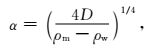
其中,α为挠曲参数,
|
(2) |
其中,D为挠曲刚度;ρm为地幔密度,3300 kg·m-3;ρw为空气密度,1 kg·m-3.
挠曲刚度(D)的计算公式(Watts et al., 1982; Turcotte and Schubert, 2014)为:

|
(3) |
其中,E为杨氏模量(5 GPa);Te为有效弹性厚度;v为泊松比(0.25).
根据上述计算公式,岩石圈有效弹性厚度(Te)值对盆地的宽度起到至关重要的作用,在相同的负载条件下,两者呈正相关,即岩石圈Te值越大,盆地宽度越大;反之岩石圈Te值越小,盆地宽度越小(图 7).

|
图 7 岩石圈有效弹性厚度与前陆盆地形态耦合关系模式图 Fig. 7 Model of coupling relationship between lithospheric effective elastic thickness and morphology of foreland basin |
四川盆地各阶段残留地层等厚图(郭正吾等, 1996; 李勇等, 2007;Yan et al., 2015)显示,四川盆地西部主要在晚三叠世、晚侏罗世、中白垩世-始新世和上新世-全新世发育楔状沉积地层(图 8),代表了该4个阶段是负载作用下楔形前陆盆地发育的主要时期.根据地层厚度反映出来的4个阶段NW-SE方向盆地古地形的演化特征,可以获得以下认识:盆地宽度具有逐渐减小的趋势,特别是中白垩世以来盆地宽度急剧减小(图 9).根据上述岩石圈有效弹性厚度(Te)值与前陆盆地宽度呈正相关的认识,可以初步判定:晚三叠世以来,四川盆地西部岩石圈Te具有逐渐减小的趋势.本文仅对岩石圈Te的变化趋势进行判别,如果要获得不同地质时期的岩石圈Te值以及随时间的变化特征,需要同时考虑构造负载和沉积负载,根据弹性挠曲模型,反演和计算不同地质时期岩石圈Te值.由于不同地质时期岩石圈Te绝对值不是本文研究的重点,本文对此不做讨论.

|
图 8 四川盆地上三叠统-全新统残留地层厚度等值线图(据郭正吾等, 1996; 李勇等, 2007; Yan et al., 2015修改) Fig. 8 Contours of residual stratum thickness of upper Triassic-Holocene in Sichuan basin (after Guo et al., 1996; Li et al., 2007; Yan et al., 2015) |
综上所述,晚三叠世以来四川盆地西部岩石圈Te值具有逐渐减小的变化趋势,岩石圈的这一变化过程在地球表层则表现为前陆盆地宽度逐渐减小(图 8,图 9).

|
图 9 龙门山前陆盆地古地形演化图(NW-SE方向)剖面位置见图 8A、图 8F、图 8H和图 8I. Fig. 9 Paleotopography evolution (NW-SE) of Longmenshan foreland basin Locations of profiles are shown in Figs. 8A, 8F, 8H and 8I. |
龙门山及其邻区的剖面电性结构(王绪本等, 2013)表明龙门山构造带浅部电性变化剧烈,较为破碎电性分块反映了脆性物质的逆冲推覆过程,在推覆体下方连续性较好的水平电性分界面标志着滑脱界面,在滑脱界面以下,电性结构则转换为大规模电性均匀分布的块体,从电性结构中可推测存在松潘、汉旺和龙泉山壳幔韧性剪切带(图 5d),标志着深部以韧性变形为主的构造特征.因此可推断龙门山碰撞构造带的形成是由于松潘—甘孜地块壳内高导层相对于上扬子地块向南东方向运动,受到坚硬上扬子地块的阻挡而产生塑性形变,将应力传递给脆性的上地壳,从而产生一系列收敛于壳内低阻层的断裂带,并逆冲推覆于四川盆地之上.
前期利用长周期大地电磁数据获得的二维反演电阻率模型(Wang et al., 2014)(图 10)显示,在松潘甘孜地区30~60 km深处广泛发育高导层,在龙门山西侧向更深处延伸,并且在约100 km下方开始向东延伸,推测该高导层在向东运移过程中,受扬子刚性板块的阻挡,导致其向下运移.而高导层所代表的热物质可能对扬子刚性板块西缘进行了长期的烘烤、熔融,导致扬子板块西部刚性高阻体厚度相对较小(图 10).

|
图 10 大地电磁和长周期大地电磁二维反演电阻率模型(引自Wang et al., 2014) 剖面位置见图 1 DD′.HCL:高导层;HRB:高阻体; M:莫霍面; EKLf:东昆仑断层;ABf:阿坝断层;LRBf:龙日坝断层;SJSf:刷经寺断层;MWf:茂汶断层;BYf:北川—映秀断层;PGf:彭灌断层;LQSf:龙泉山断层. Fig. 10 Resistivity model derived from two-dimensional inversion of MT combined LMT data (from Wang et al., 2014) Location of profile is DD′ in Fig. 1. HCL: high-conductivity layer; HRB: high-resistivity body; M: Moho; EKLf: East Kunlun fault; ABf: A′ba fault; LRBf: Longriba fault; SJSf: Shuajinsi fault; MWf: Maowen fault; BYf: Beichuan-Yinxiu fault; PGf: Pengguan fault; LQSf: Longquanshan fault. |
对龙门山及邻区远震接收函数和布格重力异常的分析(楼海等, 2008)表明,四川盆地地壳下部以高P波速度和高密度为特征,表明其为坚硬块体,青藏高原东部大范围的下地壳低速异常,表示处于富含流体或温度较高的状态,有助于高原下地壳物质向东侧向流动.刘启元等(2009)利用川西地区布设的大规模密集流动宽频带地震台阵记录的远震P波波形数据和接收函数非线性反演方法,获得的S波速度结构也表明,在青藏高原东向挤压与四川盆地坚硬地壳阻挡的长期作用,导致松潘—甘孜地块内部蓄积很大的应变能量以及上、下地壳在壳内低速层顶部边界的解耦,从而在龙门山断裂带附近形成上地壳的铲形逆冲推覆结构.龙门山区域的壳幔P波速度结构研究(韦伟等, 2010)也表明,松潘—甘孜块体在中下地壳低速异常显著,四川盆地在中下地壳以高速为主,指出软流圈热物质在长期的流动过程中造成了扬子克拉通在西南部的减薄.龙门山构造带的重力异常分布特征(张季生等, 2009)也体现出了同样的趋势,由重力异常推测该区域密度分界面分为两段,深部较陡的分界面为岩石圈块体的边界,浅部较缓的分界面则被认为与逆冲推覆构造有关.浅部较缓的分界面由地表构造单元的界线往深部密度界面缓倾,并与深部岩石圈块体边界相连接,反映了中上地壳脆性变形层的地质体由岩石圈块体界线沿缓倾密度界面推覆至地表构造单元界线处的逆冲推覆过程.
综上所述,根据地球物理资料发现松潘—甘孜下地壳至上地幔广泛存在的低阻、低速层,通过实验模拟,这些低阻软流层可能是由于岩石含水或地壳增温所致,它构成了极佳的滑脱层(Unsworth et al., 2005; 朱介寿, 2008),使上、下地壳发生解耦.软流物质的流动影响了扬子地块西缘电性结构,分析推测软流圈热物质在长期的流动过程中,造成了四川盆地西部(龙门山前陆盆地前渊地区)岩石圈下部的长期熔融,并导致该地区晚三叠世以来岩石圈刚度逐渐降低,Te值逐渐减小,在岩石圈浅层则表现为龙门山前陆盆地的宽度逐渐变窄,反映了该地区深部动力学过程与表层过程的耦合关系.
5 结论与认识通过对地表地质过程、深部动力学过程的讨论,初步获得以下三点认识:
(1) 基于弹性挠曲模型对现今龙门山前陆盆地岩石圈有效弹性厚度(Te)的反演,结合地球物理资料,认为现今四川盆地中西部岩石圈Te具有东厚西薄的特征,自川中地区到龙门山前缘地区岩石圈Te值由30~40 km减至约10~20 km.
(2) 根据弹性挠曲模型,结合前人对四川盆地岩石圈Te值的估算以及晚三叠世以来龙门山前陆盆地古地形演化趋势(盆地宽度逐渐变窄),初步判定自晚三叠世以来四川盆地西部岩石圈Te值具有逐渐减薄的变化趋势.
(3) 根据地球物理资料初步推断四川盆地西缘岩石圈Te的减薄可能与松潘—甘孜地体下方的软流圈热物质对四川盆地西缘岩石圈下部的熔融有关,这一深部地质过程通过改变四川盆地西部岩石圈的Te值,控制了处于岩石圈浅层的龙门山前陆盆地的构造演化和沉积充填过程,体现了地球深部动力学过程与地球表层盆地演化之间的耦合关系.
致谢感谢中国地质大学(武汉)王琪教授为本文提供汶川地震同震位移GPS数据,感谢中山大学田云涛教授对本文弹性挠曲模拟工作给予的帮助,感谢两位审稿专家提出的宝贵建议.
| Burchfiel B C, Royden L H, Van Der Hilst R D, et al. 2008. A geological and geophysical context for the Wenchuan earthquake of 12 May 2008, Sichuan, People's Republic of China. GSA Today, 18(7): 4-11. DOI:10.1130/GSATG18A.1 | |
| Burov E B, Michel D. 1995. The effective elastic thickness (Te) of continental lithosphere:What does it really mean?. Journal of Geophysical Research:Solid Earth, 100(B3): 3905-3927. DOI:10.1029/94JB02770 | |
| Cardozo N, Jordan T. 2001. Causes of spatially variable tectonic subsidence in the Miocene Bermejo Foreland Basin, Argentina. Basin Research, 13(3): 335-357. DOI:10.1046/j.0950-091x.2001.00154.x | |
| Chen B, Chen C, Kaban M K, et al. 2013. Variations of the effective elastic thickness over China and surroundings and their relation to the lithosphere dynamics. Earth and Planetary Science Letters, 363: 61-72. DOI:10.1016/j.epsl.2012.12.022 | |
| Chen S, Xu W M, Shi L, et al. 2013. Gravity field and lithospheric mechanical properties of Longmenshan fault zone and its surrounding areas. Acta Seismologica Sinica, 35(5): 692-703. | |
| Clark M K, Royden L H. 2000. Topographic ooze:Building the eastern margin of Tibet by lower crustal flow. Geology, 28(8): 703-706. DOI:10.1130/0091-7613(2000)28<703:TOBTEM>2.0.CO;2 | |
| De Michele M, Raucoules D, De Sigoyer J, et al. 2010. Three-dimensional surface displacement of the 2008 May 12 Sichuan earthquake (China) derived from Synthetic Aperture Radar:evidence for rupture on a blind thrust. Geophysical Journal International, 183(3): 1097-1103. DOI:10.1111/j.1365-246X.2010.04807.x | |
| Densmore A L, Li Y, Ellis M A, et al. 2005. Active tectonics and erosional unloading at the eastern margin of the Tibetan Plateau. Journal of Mountain Science, 2(2): 146-154. DOI:10.1007/BF02918330 | |
| Enkelmann E, Ratschbacher L, Jonckheere R, et al. 2006. Cenozoic exhumation and deformation of northeastern Tibet and the Qinling:Is Tibetan lower crustal flow diverging around the Sichuan Basin?. Geological Society of America Bulletin, 118(5-6): 651-671. DOI:10.1130/B25805.1 | |
| Flemings P B, Jordan T E. 1989. A synthetic stratigraphic model of foreland basin development. Journal of Geophysical Research:Solid Earth, 94(B4): 3851-3866. DOI:10.1029/JB094iB04p03851 | |
| Flemings P B, Jordan T E. 1990. Stratigraphic modeling of foreland basins:Interpreting thrust deformation and lithosphere rheology. Geology, 18(5): 430. DOI:10.1130/0091-7613(1990)018<0430:SMOFBI>2.3.CO;2 | |
| Fu B H, Shi P L, Guo H D, et al. 2011. Surface deformation related to the 2008 Wenchuan earthquake, and mountain building of the Longmen Shan, eastern Tibetan Plateau. Journal of Asian Earth Sciences, 40(4): 805-824. DOI:10.1016/j.jseaes.2010.11.011 | |
| Guo Z W, Deng K L, Han Y H, et al. 1996. The Formation and Development of Sichuan Basin. Beijing: Geological Publishing House. | |
| Hu M Q, Liu S F. 2012. 3-D modeling for flexural subsidence and deposition process of foreland basin. Acta Geologica Sinica, 86(1): 181-187. | |
| Hubbard J, Shaw J H. 2009. Uplift of the Longmen Shan and Tibetan plateau, and the 2008 Wenchuan (M=7.9) earthquake. Nature, 458(7235): 194-197. DOI:10.1038/nature07837 | |
| Li S T. 1995. Geodynamics of sedimentary basins-the main trend of basin research. Earth Science Frontiers, 2(3-4): 1-8. | |
| Li S T. 2015. Advancement, trend and new challenges in basin geodynamics. Earth Science Frontiers, 22(1): 1-8. | |
| Li Y, Allen P A, Densmore A L, et al. 2003. Evolution of the Longmen Shan foreland basin (western Sichuan, China) during the Late Triassic Indosinian orogeny. Basin Research, 15(1): 117-138. DOI:10.1046/j.1365-2117.2003.00197.x | |
| Li Y, Densmore A L, Allen P A, et al. 2001. Sedimentary responses to thrusting and strike-slipping of Longmen Shan along eastern margin of Tibetan Plateau, and their implication of Cimmerian continents and India/Eurasia collision. Scientia Geologica Sinica, 10(4): 223-243. | |
| Li Y, He P, Yan Z K, et al. 2010. Dynamics of Late Triassic Longmenshan foreland basin, China. Journal of Chengdu University of Technology (Science & Technology Edition), 37(4): 401-411. | |
| Li Y, Li B, Zhou R J, et al. 2007. The quantitative correlation between denudation volume and sedimentary flux in the denudation-accumulation system:examples from Minjiang river drainage system. Acta Geologica Sinica, 81(3): 332-343. | |
| Li Y, Xu G D, Zhou R J, et al. 2005. Isostatic gravity anomalies in the Longmen Mountains and their constraints on the crustal uplift below the mountains on the eastern margin of the Qinghai-Tibet Plateau. Regional Geology of China, 24(12): 1162-1168. | |
| Li Y D, Zheng Y, Xiong X, et al. 2013. Lithospheric effective elastic thickness and its anisotropy in the northeast Qinghai-Tibet plateau. Chinese Journal of Geophysics, 56(4): 1132-1145. DOI:10.6038/cjg20130409 | |
| Liu J, Zhang Z H, Wen L, et al. 2008. The MS8.0 Wenchuan earthquake co-seismic rupture and its tectonic implications-an out-of-sequence thrusting event with slip partitioned on multiple faults. Acta Geologica Sinica, 82(12): 1707-1722. | |
| Liu Q Y, Li Y, Chen J H, et al. 2009. Wenchuan MS8.0 earthquake:preliminary study of the S-wave velocity structure of the crust and upper mantle. Chinese Journal of Geophysics, 52(2): 309-319. | |
| Liu S F. 1995. The theoretical models for simulating the flexural process of foreland basin. Earth Science Frontiers, 2(3-4): 69-77. | |
| Liu S F. 2008. Dynamic subsidence, another kind of subsidence superposed on flexural subsidence of retroarc foreland basin. Earth Science Frontiers, 15(3): 178-185. | |
| Lou H, Wang C Y, Lv Z Y, et al. 2009. Deep tectonic setting of the 2008 Wenchuan MS8.0 earthquake in southwestern China-Joint analysis of teleseismic P-wave receiver functions and Bouguer gravity anomalies. Science in China Series D:Earth Sciences, 52(2): 166-179. DOI:10.1007/s11430-009-0009-z | |
| Molnar P. 2012. Isostasy can't be ignored. Nature Geoscience, 5(2): 83. | |
| Royden L H, Burchfiel B C, King R W, et al. 1997. Surface deformation and lower crustal flow in eastern Tibet. Science, 276(5313): 788-790. DOI:10.1126/science.276.5313.788 | |
| Shan X J, Qu C Y, Song X G, et al. 2009. Coseismic surface deformation caused by the Wenchuan MS8.0 earthquake from InSAR data analysis. Chinese Journal of Geophysics, 52(2): 496-504. | |
| Sinclair H D, Coakley B J, Allen P A, et al. 1991. Simulation of foreland basin stratigraphy using a diffusion model of mountain belt uplift and erosion:an example from the central Alps, Switzerland. Tectonics, 10(3): 599-620. DOI:10.1029/90TC02507 | |
| Tesauro M, Kaban M K, Cloetingh S A P L. 2009a. A new thermal and rheological model of the European lithosphere. Tectonophysics, 476(3-4): 478-495. DOI:10.1016/j.tecto.2009.07.022 | |
| Tesauro M, Kaban M K, Cloetingh S A P L. 2009b. How rigid is Europe's lithosphere?. Geophysical Research Letters, 36(16): 1-6. | |
| Tian Y T, Kohn B P, Gleadow A J W, et al. 2013. Constructing the Longmen Shan eastern Tibetan Plateau margin:insights from low-temperature thermochronology. Tectonics, 32(3): 576-592. DOI:10.1002/tect.v32.3 | |
| Tong X P, Sandwell D T, Fialko Y. 2010. Coseismic slip model of the 2008 Wenchuan earthquake derived from joint inversion of interferometric synthetic aperture radar, GPS, and field data. Journal of Geophysical Research:Solid Earth, 115(B4): B04314. DOI:10.1029/2009JB006625 | |
| Turcotte D L, Schubert G. 2014. Geodynamics. (3rd ed). Cambridge: Cambridge University Press. | |
| Unsworth M J, Jones A G, Wei W, et al. 2005. Crustal rheology of the Himalaya and Southern Tibet inferred from magnetotelluric data. Nature, 438(7064): 78-81. DOI:10.1038/nature04154 | |
| Wang Q L, Cui D X, Zhang X, et al. 2009. Coseismic vertical deformation of the MS8.0 Wenchuan earthquake from repeated levelings and its constraint on listric fault geometry. Earthquake Science, 22(6): 595-602. DOI:10.1007/s11589-009-0595-z | |
| Wang Q, Qiao X J, Lan Q G, et al. 2011. Rupture of deep faults in the 2008 Wenchuan earthquake and uplift of the Longmen Shan. Nature Geoscience, 4(9): 634-640. DOI:10.1038/ngeo1210 | |
| Wang X B, Luo W, Zhang G, et al. 2013. Electrical resistivity structure of Longmenshan crust-mantle under sector boundary. Chinese Journal of Geophysics, 56(8): 2718-2727. DOI:10.6038/cjg20130820 | |
| Wang X B, Zhang G, Fang H, et al. 2014. Crust and upper mantle resistivity structure at middle section of Longmenshan, eastern Tibetan plateau. Tectonophysics, 619-620: 143-148. DOI:10.1016/j.tecto.2013.09.011 | |
| Wang Z, Su J R, Liu C X, et al. 2015. New insights into the generation of the 2013 Lushan Earthquake (MS7.0), China. Journal of Geophysical Research:Solid Earth, 120(5): 3507-3526. DOI:10.1002/2014JB011692 | |
| Wang Z, Zhao D P, Wang J. 2010. Deep structure and seismogenesis of the north-south seismic zone in southwest China. Journal of Geophysical Research:Solid Earth, 115(B12): B12334. DOI:10.1029/2010JB007797 | |
| Watts A B. 1951. An analysis of isostasy in the world's oceans 1. Hawaiian-Emperor Seamount Chain. Journal of Geophysical Research:Solid Earth, 83(B12): 5989-6004. | |
| Watts A B, Karner G D, Steckler M S. 1982. Lithospheric flexure and the evolution of sedimentary basins. Philosophical Transactions of the Royal Society A:Mathematical, Physical and Engineering Sciences, 305(1489): 249-281. DOI:10.1098/rsta.1982.0036 | |
| Wei W, Sun R M, Shi Y L. 2010. P-wave tomographic images beneath southeastern Tibet:Investigating the mechanism of the 2008 Wenchuan earthquake. Science China Earth Sciences, 53(9): 1252-1259. DOI:10.1007/s11430-010-4037-5 | |
| Xu Z Q, Li H Q, Hou L W, et al. 2007. Uplift of the Longmen-Jinping orogenic belt along the eastern margin of the Qinghai-Tibet Plateau:Large-scale detachment faulting and extrusion mechanism. Geological Bulletin of China, 26(10): 1262-1276. | |
| Yan Z K, Li Y, Li H B, et al. 2015. Application of the material balance method in paleoelevation recovery:a case study of the Longmen mountains foreland basin on the eastern margin of the Tibetan Plateau. Acta Geologica Sinica, 89(2): 598-609. DOI:10.1111/1755-6724.12450 | |
| Yan Z K, Li Y, Shao C J, et al. 2016. Interpreting the coseismic uplift and subsidence of the Longmen Shan foreland basin system during the Wenchuan earthquake by a elastic flexural model. Acta Geologica Sinica, 90(2): 555-566. DOI:10.1111/acgs.2016.90.issue-2 | |
| Yang S M, Lan Q G, Nie Z S, et al. 2012. Coseismic displacement caused by the 2008 great Wenchuan earthquake derived from various types of geodetic data. Chinese Journal of Geophysics, 55(8): 2575-2588. DOI:10.6038/j.issn.0001-5733.2012.08.009 | |
| Yuan B Q, Djomani Y H P, Wang P, et al. 2002. Effective lithospheric elastic thickness of southeastern part of Arctic Ocean-Eurasia Continent-Pacific Ocean geoscience transect. Earth Science-Journal of China University of Geosciences, 27(4): 397-402. | |
| Zhang J S, Gao R, Ceng L L, et al. 2009. Relationship between characteristics of gravity and magnetic anomalies and the earthquakes in Longmenshan range and adjacent areas. Chinese Journal of Geophysics, 52(2): 572-578. | |
| Zhang P. 2008. Coseismic displacement field of the 2008 MS8.0 Wenchuan earthquake determined by GPS. Sci. China (Ser. D), 38(10): 1195-1206. | |
| Zhu J. 2008. The Wenchuan earthquake occurrence background in deep structure and dynamics of lithosphere. Journal of Chengdu University of Technology (Science & Technology Edition), 35(4): 348-356. | |
| 陈石, 徐伟民, 石磊, 等. 2013. 龙门山断裂带及其周边地区重力场和岩石层力学特性研究. 地震学报, 35(5): 692–703. | |
| 郭正吾, 邓康龄, 韩永辉, 等. 1996. 四川盆地形成与演化. 北京: 地质出版社. | |
| 胡明卿, 刘少峰. 2012. 前陆盆地挠曲沉降和沉积过程3-D模型研究. 地质学报, 86(1): 181–187. | |
| 李思田. 1995. 沉积盆地的动力学分析——盆地研究领域的主要趋向. 地学前缘, 2(3-4): 1–8. | |
| 李思田. 2015. 沉积盆地动力学研究的进展、发展趋向与面临的挑战. 地学前缘, 22(1): 1–8. | |
| 李勇, 徐公达, 周荣军, 等. 2005. 龙门山均衡重力异常及其对青藏高原东缘山脉地壳隆升的约束. 地质通报, 24(12): 1162–1168. DOI:10.3969/j.issn.1671-2552.2005.12.012 | |
| 李勇, 黎兵, 周荣军, 等. 2007. 剥蚀-沉积体系中剥蚀量与沉积通量的定量对比研究——以岷江流域为例. 地质学报, 81(3): 332–343. | |
| 李勇, 贺佩, 颜照坤, 等. 2010. 晚三叠世龙门山前陆盆地动力学分析. 成都理工大学学报(自然科学版), 37(4): 401–411. | |
| 李永东, 郑勇, 熊熊, 等. 2013. 青藏高原东北部岩石圈有效弹性厚度及其各向异性. 地球物理学报, 56(4): 1132–1145. DOI:10.6038/cjg20130409 | |
| 刘静, 张智慧, 文力, 等. 2008. 汶川8级大地震同震破裂的特殊性及构造意义——多条平行断裂同时活动的反序型逆冲地震事件. 地质学报, 82(12): 1707–1722. DOI:10.3321/j.issn:0001-5717.2008.12.007 | |
| 刘启元, 李昱, 陈九辉, 等. 2009. 汶川MS8.0地震:地壳上地幔S波速度结构的初步研究. 地球物理学报, 52(2): 309–319. | |
| 刘少峰. 1995. 前陆盆地挠曲过程模拟的理论模型. 地学前缘, 2(3-4): 69–77. | |
| 刘少峰. 2008. 叠加于弧后前陆盆地挠曲沉降之上的另一类沉降——动力沉降. 地学前缘, 15(3): 178–185. | |
| 楼海, 王椿镛, 吕智勇, 等. 2008. 2008年汶川MS8.0级地震的深部构造环境——远震P波接收函数和布格重力异常的联合解. 中国科学:地球科学, 38(10): 1207–1220. | |
| 单新建, 屈春燕, 宋小刚, 等. 2009. 汶川MS8.0级地震InSAR同震形变场观测与研究. 地球物理学报, 52(2): 496–504. | |
| 王绪本, 罗威, 张刚, 等. 2013. 扇形边界条件下的龙门山壳幔电性结构特征. 地球物理学报, 56(8): 2718–2727. DOI:10.6038/cjg20130820 | |
| 韦伟, 孙若昧, 石耀霖. 2010. 青藏高原东南缘地震层析成像及汶川地震成因探讨. 中国科学:地球科学, 40(7): 831–839. | |
| 许志琴, 李化启, 侯立炜, 等. 2007. 青藏高原东缘龙门-锦屏造山带的崛起——大型拆离断层和挤出机制. 地质通报, 26(10): 1262–1276. | |
| 杨少敏, 兰启贵, 聂兆生, 等. 2012. 用多种数据构建2008年汶川特大地震同震位移场. 地球物理学报, 55(8): 2575–2588. DOI:10.6038/j.issn.0001-5733.2012.08.009 | |
| 袁炳强, DjomaniY H P, 王平, 等. 2002. 北冰洋-欧亚大陆-太平洋地学断面东南段岩石圈有效弹性厚度. 地球科学——中国地质大学学报, 27(4): 397–402. | |
| 张季生, 高锐, 曾令森, 等. 2009. 龙门山及邻区重、磁异常特征及与地震关系的研究. 地球物理学报, 52(2): 572–578. | |
| 张培震. 2008. GPS测定的2008年汶川MS8.0级地震的同震位移场. 中国科学D辑:地球科学, 38(10): 1195–1206. | |
| 朱介寿. 2008. 汶川地震的岩石圈深部结构与动力学背景. 成都理工大学学报(自然科学版), 35(4): 348–356. | |