 2017, Vol. 60


2. 中国科学院大学, 北京 100049
2. University of Chinese Academy of Sciences, Beijing 100049, China
喜马拉雅造山带位于青藏高原南部,是世界上海拔最高的造山带,由45~65 Ma(Yin and Harrison, 2003; Ding et al., 2005)以来印度与欧亚板块的相互碰撞挤压而形成.至今为止其深、浅部壳幔结构仍在发生强烈的相互作用,地壳物质发生了大规模的水平缩短和垂直增厚.东喜马拉雅构造结(简称东构造结)位于喜马拉雅造山带的东段,被雅鲁藏布江缝合带(简称雅江缝合带)分割为北部的拉萨地体和南部的南迦巴瓦变质体两部分(图 1).雅江缝合带由一系列不同性质的断裂组成,包括NW-SE走向的嘉黎断裂、西兴拉断裂和NE-SW走向的东久—米林断裂、墨脱—阿尼桥断裂(Ding et al., 2001; Deng et al., 2003; Xu et al., 2016).近东西向的欧亚大陆边缘在东构造结碰撞后发生了90°的顺时针突然偏转,是两个板块碰撞作用和地表侵蚀作用最为强烈的地区之一(Tapponnier et al., 2001; Wang et al., 2014).
GPS地表形变监测表明,造山带俯冲边界地壳相对缩短率约为20 mm·a-1(Ader et al., 2012),与此相应地震活动比较频繁,中国有史以来记录到的最大地震——1950年MS8.6察隅地震即发生在东构造结地区(Reddy et al., 2008).北京时间2017年11月18日06时34分,在雅鲁藏布江缝合带顶端发生了里氏震级为6.9的地震(Zhang et al., 2017)(图 1).全球质心矩张量解(gCMT)和美国地质调查局(USGS)目录给出的北倾节面的走向、倾角、滑动角分别为(328°/66°/108°)和(303°/36°/83°),震源机制解以逆冲型为主,兼有走滑成分.震后野外地质考察发现,震中附近发生多处房屋倒塌,山体塌方,沿江有明显沙土液化和水位上升现象,推测雅江下游震中区可能发生了堵江(图 2a—2c).本次地震震源区地形起伏高达8 km,地势险峻,人迹罕至.USGS地震目录给出的震中位置位于数条主要断裂的交汇部位,西部与加拉白垒峰及山间谷地发育的大型冰川相邻(图 1),构造背景非常复杂.

|
图 1 研究区域构造背景 蓝线为主要缝合带和断层,分别是:LS-拉萨地块,NJBW-南迦巴瓦构造结,SS-桑构造结,AS-阿萨姆构造结,IYS-雅鲁藏布江缝合带,BNS-班公—怒江缝合带,STDS-藏南拆离带,BLF-巴青—类乌齐走滑断裂带,JSF-嘉黎走滑断裂带,XXL-西兴拉断裂带,MAF-墨脱—阿尼桥走滑断裂带,DMF-东久—米林走滑断裂带,MCT-主中央逆冲断层,MBT-主边界俯冲断层.右下角插图为研究区域地质图(Ding et al., 2001),红色圆圈为USGS给出的震中位置,红色三角形为藏东南台站位置. Fig. 1 The tectonic background of the study area Blue lines are major sutures and faults. Abbreviations: LS, Lhasa block; NJBW, Namche Barwa syntaxis; SS, Sang syntaxis; AS, Assam syntaxis; IYS, Indus-Yalu suture; BNS, Bangong-Nujiang suture; STDS, South Tibet Detachment System; BLF, Baqing-Leiwuqi strike-slip fault; JSF, Lhari strike-slip fault; XXL, Xixingla fault; MAF, Mêdog-Aniqiao strike-slip fault; DMF, Dongjiu-Mainling strike-slip fault; MCT, Main Central thrust; MBT, Main boundary thrust. Insert at the lower-right corner is the geological map (Ding et al., 2001). The red circle shows the USGS epicenter. |

|
图 2 野外地质考察与地震观测 (a)米林县派镇直白村房屋严重受损,二楼倒塌;(b)米林县派镇直白村房屋墙面裂隙;(c)林芝县排龙乡小规模崩滑体;(d)震中附近的藏东南宽频带地震台站. Fig. 2 The field investigation and seismic observation (a) The damaged house with the second floor collapsed at the Zhibai village, Pai town, Mainling prefecture; (b) Crack on the wall of a house at the Zhibai village; (c) Small-scale land slide at the Pailong village, Nyingchi prefecture; (d) Broadband seismic station near the epicenter at the southeastern Tibet. |
本研究首先对研究区域的地震活动性和地壳结构进行简单回顾,基于中科院青藏高原研究所在藏东南高山环境综合观测研究站(藏东南站)(图 2d)架设的宽频带固定地震台站记录的波形资料,结合国内外其他地震台网记录的波形和到时数据,利用远震波形拟合和HypoSAT地震定位方法,对本次地震的震源位置和发震时刻进行重新确定.在此基础上,结合本次地震的震源机制解、震源区断层分布和中小地震活动性,对印度大陆俯冲前缘地震活动规律、现今尺度的地下应力状态进行深入讨论.
2 东构造结地区地震活动据中国地震台网地震目录记载,东构造结地区1970年以来共发生3级以上地震2000余次,其中4.5级以上地震约240次.近50年主要以中小地震为主(杨建亚等,2017)(图 4),地震大多集中在雅鲁藏布江大拐弯顶端及北部,沿着西兴拉断裂呈北西—南东向展布(Zeitler et al., 2014),南迦巴瓦变质岩系内部地震不发育,墨脱剪切带东南方向与喜马拉雅主中央断裂的桑构造结和阿萨姆构造结顶端地震活动频繁.东久—米林断裂带以西地震不活跃.

|
图 4 台站与地震分布 红色三角形表示藏东南台站位置,红色沙滩球所指位置为重新定位后的结果.其他标志分别代表:红色细线圆圈为本次地震CENC、USGS和gCMT震中位置,小圆圈为1964年以来发生的4.5级以上地震,大圆圈为1000—1964年间发生的6.0级以上地震,蓝色沙滩球为1900年以来发生的两次7级以上地震,黑色沙滩球为1964年以来发生的较大地震的震源机制解.左上角插图表示地震定位使用的台站. Fig. 4 Station and earthquake distribution Red triangle is the nearby station at southeastern Tibet. The location indicated toward the red beach ball is the relocated Mainling earthquake. Other symbols are: red thin circles, CENC, USGS and gCMT locations; small circles, earthquakes of MW≥4.5 since 1964; large circles, earthquakes of MW≥6.0 between 1000 and 1964; blue beach balls, two large earthquakes of MW≥7.0 since 1900, black beach balls, relatively large earthquakes with focal mechanism available since 1964. The insert at the upper-left corner is the stations used for earthquake relocation. |
20世纪以来共发生6级以上地震27次,其中包括1950年MS8.6西藏察隅地震和1947年MS7.7朗县东南地震.察隅地震发生在北京时间1950年8月15日22点09分,震中位于西藏察隅县、墨脱县与印度阿萨姆邦相接的位置,因此又被称为墨脱地震或阿萨姆地震.震中最大烈度11度,断层长度约250 km(Ben-Menahem et al., 1974; Chen and Molnar, 1977),产生了约7~8 m的断层滑移(Chen and Molnar, 1977),造成近4000人死亡,整个青藏高原及毗邻的印度平原均有明显震感.李保昆等(2015)基于P波初动方向,结合余震分布和当地的地质特征确定了该地震的震中位置和震源机制解,认为震中经纬度为(28.65°N,96.68°E),是走向为NW-SE向的右旋走滑型地震.前震主要发生在雅江大峡谷北部,初期余震大部分位于震中察隅附近,此后逐渐扩展到印度和缅甸等南部大范围地区,呈现由NW至SE方向的顺时针旋移,显示出分时段分区分布的特征.Ben-Menahem等(1974)利用面波和体波振幅信息,结合余震和滑坡分布规律,同样认为该地震发生在走滑断层上.Chen and Molnar(1977)基于主事件定位方法,对主震及其100个余震进行了重新定位,发现余震没有明显的方位分布规律,低角度北倾的逆冲断层同样可以很好地拟合所观测到的地震波形,符合米什米(Mishmi)山逆冲断裂的产状(图 4).然而由于早期数据资料的局限,历史大地震的发生规律还存在很大争议.
3 东构造结地区地壳结构地表GPS形变观测表明,在东构造结周边地区,地表形变方向相对于稳定的欧亚大陆呈现绕构造结顺时针旋转的环形变化特征(Gan et al., 2007; Devchandra et al., 2014),与SKS波分裂(Sol et al., 2007; Chang et al., 2015)和Pn波成像(崔仲雄等,2009)所揭示的上地幔各向异性方向基本一致.中科院青藏高原所于2015—2016年间在该地区布置了24个宽频带流动地震台(程成等,2017),利用P波接收函数和波形反演等方法研究了该地区的地壳结构,发现东构造结地区MOHO面深度呈现自SW向NE逐渐变深的趋势,SW侧印度大陆的MOHO面深度在53~58 km范围内,其周围的拉萨地块的MOHO面深度为60 km以上,与前人利用接收函数研究获得的藏东南地区的结果基本一致(Xu et al., 2013).东构造结周边的拉萨地块内普遍存在低速层,分布在20~40 km深度范围内,厚度约为5~15 km.基于宽频带地震台阵资料和面波(Fu et al., 2010)与体波(Zhang et al., 2012)成像方法获得的研究区S和P波速度结构研究,同样发现东构造结地区25~50 km的中下地壳存在低速层,平均速度降约为1%~2%.
4 2017年林芝地震重新定位 4.1 数据中科院青藏高原所在林芝市鲁朗镇设有藏东南综合观测研究站并安装了宽频带固定地震台站.针对该地区地下沉积层较厚、地震波信号衰减大的实际情况,我们对台站的地基进行了改造,挖掘了10 m的深井,将钢管置入深井中,使台站与地下基岩之间接触更加紧密(图 2d).藏东南台站位于震中以西约30 km,清晰地记录了这次米林地震,尽管强震使地震记录的大振幅限幅,但是P波初动非常清晰,为地震定位提供了宝贵的近震观测资料.
我们同时收集了国际地震学联合研究会(IRIS)提供的波形数据,在震中距30°~95°范围内选取信噪比较高的波形,并进行滤波、积分等前期处理.地震到时数据主要来源于中国地震台网中心(CENC)和USGS(图 4,左上角插图).基于Crust1.0模型(Laske et al., 2013)和其他前人的研究结果(见前文),我们对震源区的速度模型进行了一维简化处理,震源区四层速度结构分别代表上地壳、中地壳、下地壳和地幔(表 1).
|
|
表 1 地震定位和波形拟合使用的速度结构 Table 1 Velocity structure used for earthquake relocation and waveform modeling |
本研究采用两个步骤对震源参数进行重新计算.首先,基于远震体波波形确定震源深度.目前波形拟合是确定震源深度的最有效的方法,当深度较浅时,P波及其后续震相到时接近,需要对多种震相叠加以后的波形进行拟合.为了对包含各种后续震相的复杂P波进行理论计算,我们采用了Kikuchi和Kanamori发展的远震波形拟合方法(Kikuchi and Kanamori, 1982).震中初始位置和震源机制解来源于全球质心矩张量(gCMT)地震目录.由于P波后续震相的反射点位于地表,因此波形拟合获得的震源深度为相对于地表的深度.
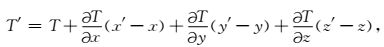
其次,以波形拟合获得的震源深度为基础,对地震的经纬度和深度进行重新定位.地震重新定位采用Hyposat方法实现(Schweitzer,2001).其实质是将非线性方程线性化,并通过最小二乘原理求解.其基本思路是把走时T在初值(x,y,z)附近作泰勒展开,取一级近似,即
|
其中T为实际走时,T′是相对于(x,y,z)附近一点(x′,y′,z′)的走时.该方法可以适用于近震和远震不同震中距多种不同类型震相的到时数据.为了对震源深度进行更加合理的约束,采用3种不同的方法进行地震定位,即固定震源深度为初始深度、从第一次迭代开始反演震源深度、经纬度获得稳定解之后反演震源深度,最后将残差最小的震源位置作为最后定位结果.
5 重新定位结果该地震的震源深度为地表以下10±2 km或海平面以下7 km±2 km.波形拟合结果表明(图 3),该地震的震源破裂在深度上没有明显的方向性,破裂较大的位置主要集中在初始破裂点的深度,与前人破裂过程的波形反演结果基本一致(王卫民等,2017;张勇等,2017).罗钧等(2014)使用波形拟合方法得到了2007年8月至2013年9月发生于青藏高原东南缘的161次地震(3.5<MS < 7.0)的震源机制解和震源质心深度,发现研究区的中等以上地震震源深度绝大部分在5~15 km的深度范围内.接收函数研究结果表明,喜马拉雅东构造结周边的拉萨地块内普遍存在低速层,分布在20~40 km深度范围内,厚度约为5~15 km(程成等,2017),表明该地区地震发震层主要位于拉萨地块上地壳.

|
图 3 采用P波拟合确定震源深度 粗线、细线和虚线分别表示观测波形、震源深度10 km拟合波形和15 km拟合波形.震源深度后面括号中数字表示波形拟合的残差.右下角表示gCMT震源机制解. Fig. 3 Determination of focal depth using P-wave modeling The waveforms are (from top to bottom) the raw data (bold lines), the synthetics at 10-km depth (thin lines), and the synthetics at 15-km depth (dotted line). The numbers in parentheses following the depth are least-square misfits between observed and synthetic seismograms. The beach ball is the focal mechanism listed in the gCMT catalog. |
重新定位获得的震中位置为(29.87°N±0.01°N,95.02°E±0.01°E),位于印度大陆俯冲前缘南迦巴瓦变质体与欧亚大陆拉萨地块相互碰撞的交界处.不同地震目录的对比表明(表 2),本次地震重新定位后的位置位于CENC、USGS和gCMT震源位置的东北部,更加靠近西兴拉断裂(图 4).波形拟合获得的断层面走向为NNW-SSE向(http://www.itpcas.ac.cn/kycg/yjcg/201711/t20171118_4895879.html),与西兴拉断裂走向和中小型余震的分布规律具有很好的一致性(余震分布初步结果:http://www.csi.ac.cn;http://www.eq-igl.ac.cn).
|
|
表 2 不同地震目录给出的震源参数的比较 Table 2 Comparison of earthquake source parameters given by different catalogs |
地震定位精度直接影响了人们对地震发生规律的认识程度.CENC的地震目录来源于区域地震台网的到时数据,可以对震源位置提供较好的约束,但是绝大多数台站位于中国东部,高原内部台站较少,震源区速度结构复杂,这些因素都会给地震定位带来误差.USGS提供的地震目录主要是基于远震体波到时数据获得的,后续震相到时数据的引入在一定程度上提高了地震定位的精度(Engdual et al., 1998).以USGS目录给出的震源位置为基础,gCMT目录同时对震源机制解和震源位置进行了重新计算,波形信息的加入使部分地震的定位精度有所提高(Ekström et al., 2012),但是gCMT目录的主要目标是确定震源机制解,使用的波形数据主要包括面波和长周期的体波,获得的震源深度定位误差仍然较大.统计规律表明,常规地震目录给出的俯冲带地区较大地震的定位误差在90%的置信区间内仍然高达20~30 km(Bondar et al., 2015; Bai et al., 2017),有必要对地震参数进行重新确定.
西兴拉断裂位于雅鲁藏布江大拐弯顶部,南部与雅鲁藏布江缝合带相互交汇,北部止于右旋走滑型嘉黎断裂,西部与加拉白垒峰及山间谷地发育的大型冰川相邻,是青藏高原向东南逃逸的南边界.西兴拉断裂是研究区地震发生最频繁的断裂之一,4级左右中等地震多发,上世纪以来曾发生过3次6级以上地震,包括1938年11月21日6级地震和1950年2月23日6级地震(图 4).本次地震重新定位后的位置和断层面走向与西兴拉断裂具有很好的一致性,揭示了造山带东部以大规模挤压和右旋侧向挤出为主的构造活动特征.
喜马拉雅造山带是全球人口密度最大和地震风险最高的地区之一.本次地震位于喜马拉雅造山带东段,沿这条长达2500 km的造山带曾发生过多次强烈地震,其中包括8.0级以上地震3次,自东向西分别是1950年我国察隅8.6级地震、1934年尼泊尔比哈尔8.1级地震、1505年尼泊尔格尔纳利河8.2级地震(Reddy et al., 2009; Kumar et al., 2010;Sapkota et al., 2012).2017年米林6.9级地震位于雅江大峡谷北部,与1950年察隅地震发生前中小地震活动的位置比较接近,未来地震的发生规律值得进一步关注.该地震是有现代地震记录以来在造山带东构造结地区发生的较大地震,为深入探讨板块边界大地震及其相关地质灾害的发生机理提供了宝贵的资料.
致谢余震观测的开展受到了第二次青藏高原综合科学考察研究的资助,中国地震局地球物理所为本研究提供了近震到时数据,房立华、蒋长胜研究员和田宝峰博士与作者进行了有益的讨论,审稿专家和编辑为本文提供了建设性修改意见,在此表示感谢.
Ader T, Avouac J P, Liu-Zeng J, et al.
2012. Convergence rate across the Nepal Himalaya and interseismic coupling on the Main Himalayan Thrust:Implications for seismic hazard. Journal of Geophysical Research, 117(B4): 1-16.
DOI:10.1029/2011JB009071 |
|
Bai L, Li G, Khan N G, et al.
2017. Focal depths and mechanisms of shallow earthquakes in the Himalayan-Tibetan region. Gondwana Research, 41: 390-399.
DOI:10.1016/j.gr.2015.07.009 |
|
Bai L, Liu H, Ritsema J, et al.
2016. Faulting structure above the Main Himalayan Thrust as shown by relocated aftershocks of the 2015 MW7. 8 Gorkha, Nepal earthquake. Geophysical Research Letter, 43: 637-642.
DOI:10.1002/2015GL066473 |
|
Ben-Menahem A, Abbodi E, Schild R.
1974. The source of the great Assam earthquake-An interplate wedge motion. Physics of the Earth and Planetary Interior, 9: 265-289.
DOI:10.1016/0031-9201(74)90056-9 |
|
Bondár I, Engdahl E R, Villaseñor A, et al.
2015. ISC-GEM:Global Instrumental Earthquake Catalogue (1900-2009), Ⅱ. Location and seismicity patterns. Phys. Earth Planetary Interior, 239: 2-13.
DOI:10.1016/j.pepi.2014.06.002 |
|
Chang L, Wang C, Ding Z, et al.
2015. Upper mantle anisotropy of the eastern Himalaya syntaxis and surrounding regions from shear waves splitting. Science China Earth Sciences, 58(10): 1872-1882.
DOI:10.1007/s11430-015-5098-2 |
|
Chen W, Molnar P.
1977. Seismic moments of major earthquakes and the average rate of slip in central Asia. Journal of Geophysical Research, 82: 2945-2969.
DOI:10.1029/JB082i020p02945 |
|
Cheng C, Bai L, Ding L, et al.
2017. Crustal structure of Eastern Himalayan Syntaxis revealed by receiver function method. Chinese J. Geophys. (in Chinese), 60(8): 2969-2979.
DOI:10.6038/cjg20170806 |
|
Cui Z, Pei S.
2009. Study on Pn velocity and anisotropy in the uppermost mantle of the Eastern Himalayan Syntaxis and surrounding regions. Chinese J. Geophys. (in Chinese), 52(9): 2245-2254.
DOI:10.3969/j.issn.0001-5733.2009.09.008 |
|
Deng Q, Zhang P, Ran Y, et al.
2003. Basic characteristics of active tectonics of China. Science China Series D-Earth Sciences, 46: 356-372.
|
|
Devachandra M, Kundu B, Catherine J, et al.
2014. Global Positioning System (GPS) Measurements of Crustal Deformation across the Frontal Eastern Himalayan Syntaxis and Seismic-Hazard Assessment. Bulletin of the Seismological Society of America, 104: 1518-1524.
DOI:10.1785/0120130290 |
|
Ding L, Zhong D, Yin A, et al.
2001. Cenozoic structural and metamorphic evolution of the eastern Himalayan syntaxis (Namche Barwa). Earth and Planetary Science Letters, 192: 423-438.
DOI:10.1016/S0012-821X(01)00463-0 |
|
Ding L, Kapp P, Wan X.
2005. Paleocene-Eocene record of ophiolite obduction and initial India-Asia collision, south-central Tibet. Tectonics, 24(TC3001): 1-18.
DOI:10.1029/2004TC001729 |
|
Ekström G, Nettles M, Dziewoński A M.
2012. The global CMT project 2004-2010:Centroid-moment tensors for 13, 017 earthquakes. Physics of the Earth and Planetary Interiors, 200: 1-9.
|
|
Fu Y V, Li A, Chen Y J.
2010. Crustal and upper mantle structure of southeast Tibet from Rayleigh wave tomography. Journal of Geophysical Research, 115: B12323, 2010.
|
|
Gan W, Zhang P, Shen Z, et al.
2007. Present-day crustal motion within the Tibetan Plateau inferred from GPS measurements. Journal of Geophysical Research:Solid Earth, 112(B8).
DOI:10.1029/2005JB004120 |
|
Hatzfeld D, Molnar P.
2010. Comparisons of the kinematics and deep structures of the Zagros and Himalaya and of the Iranian and Tibetan plateaus and geodynamic implications. Reviews of Geophysics, 48(2): 1-448.
DOI:10.1029/2009RG000304 |
|
Kikuchi M, Kanamori H.
1982. Inversion of complex body waves-Ⅱ. Physics of the Earth and Planetary Interiors 43, 43: 205-222.
|
|
Kumar S, Wesnousky S G, Jayangondaperumal R.
2010. Paleoseismological evidence of surface faulting along the northeastern Himalayan front, India:Timing, size, and spatial extent of great earthquakes. Journal of Geophysical Research, 115: B12422.
DOI:10.1029/2009JB006789 |
|
Laske G, Masters G, Ma Z, et al. 2013. Update on CRUST1.0-A 1-degree Global Model of Earth's Crust. EGU General Assembly Conference, Abstract id:EGU2013-2658.
|
|
Li B, Diao G, Xu X, et al.
2015. Redetermination of the source parameters of the Zayu, Tibet M8.6 earthquake sequence in 1950. Chinese J. Geophys. (in Chinese), 58(11): 4254-4265.
DOI:10.6038/cjg20151130 |
|
Luo J, Zhao C, Lv J, et al.
2014. The Focal mechanism and strain field properties. Chinese Geophysical Union.
|
|
Reddy D V, Nagabhushanam P, Kumar D, et al.
2009. The great 1950 Assam Earthquake revisited:Field evidences of liquefaction and search for paleoseismic events. Tectonophysics, 474: 463-472.
DOI:10.1016/j.tecto.2009.04.024 |
|
Schweitzer J.
2001. HYPOSAT-An Enhanced Routine to Locate Seismic Events. Pure and Applied Geophysics, 158: 277-289.
DOI:10.1007/PL00001160 |
|
Sapkota S N, Bollinger L, Klinger Y, et al.
2012. Primary surface ruptures of the great Himalayan earthquakes in 1934 and 1255. Nature Geoscience, 6: 71-76.
DOI:10.1038/NGEO1669 |
|
Sol S, Meltzer A, Burgmann R, et al.
2007. Geodynamics of the southeastern Tibetan Plateau fromseismic anisotropy and geodesy. Geology, 35: 563-566.
DOI:10.1130/G23408A.1 |
|
Tapponnier P, Xu Z, Roger F, et al.
2001. Oblique stepwise rise and growth of the Tibet plateau. Science, 294: 1671-1677.
DOI:10.1126/science.105978 |
|
Wang P, Scherler D, Liu-Zeng J, et al.
2014. A 2.5 Myr-old canyon beneath the Yarlung Tsangpo Valley, Southern Tibet. Science, 346: 978-981.
DOI:10.1126/science.1259041 |
|
Wang W, He J, Hao J, et al. 2017. Preliminary result for rupture process of Nov.18, 2017, M6.5 Earthquake, Nyingchi, Tibet, China. http://www.itpcas.ac.cn/kycg/yjcg/201711/t20171118_4895879.html.
|
|
Xu X, Han Z, Yang X, et al. 2016.
Seismotectonic Map in China and Its Adjacent Regions. Beijing: Seismogical Press.
|
|
Xu Q, Zhao J, Pei S, et al.
2013. Imaging lithospheric structure of the eastern Himalayan syntaxis:new insights from receiver function analysis. Journal of Geophysical Research, 118: 2323-2332.
DOI:10.1002/jgrb.50162 |
|
Yang J, Bai L, Li G, et al.
2017. Seismicity in the eastern Himalayan syntaxis and its tectonic implications. Recent Developments in World Seismology, 6: 12-18.
|
|
Yin A, Harrison T M.
2003. Geologic Evolution of the Himalayan-Tibetan Orogen. Annual Review of Earth & Planetary Sciences, 28: 211-280.
|
|
Zhang H., Zhao D., Zhao J., et al.
2012. Convergence of the Indian and Eurasian plates under eastern Tibet revealed by seismic tomography. Geochemistry Geophysics Geosystems, 13: Q06W14.
DOI:10.1029/2012GC004031 |
|
Zhang X, Du G, Liu J, et al. 2018. An M6.9 earthquake at Mainling, Tibet on Nov. 18, 2017. Earth and Planetary Physics, 2:1-2.
|
|
Zeitler P K, Meltzer A S, Brown L, et al.
2014. Tectonics and topographic evolution of Namche Barwa and the easternmost Lhasa block, Tibet. Geological Society of America, 507: 23-58.
DOI:10.1130/2014.2507(02) |
|
Zhang Y, Xu L, Chen Y. 2017. The Nov. 18, 2017 M6.9 earthquake at Mainling, Tibet (emergent report), http://www.cea-igp.ac.cn/tpxw/276003.html.
|
|
程成, 白玲, 丁林, 等.
2017. 利用接收函数方法研究喜马拉雅东构造结地区地壳结构. 地球物理学报, 60: 2969–2979.
|
|
崔仲雄, 裴顺平.
2009. 青藏高原东构造结及周边地区上地幔顶部Pn速度结构和各向异性研究. 地球物理学报, 52(9): 2245–2254.
DOI:10.3969/j.issn.0001-5733.2009.09.008 |
|
李保昆, 刁桂苓, 徐锡伟, 等.
2015. 1950年西藏察隅M8.6强震序列震源参数复核. 地球物理学报, 58(11): 4254–4265.
|
|
罗钧, 赵翠萍, 吕坚等. 2014. 青藏高原东南缘的震源机制和应力场特征研究. 中国地球科学联合学术年会.
http://cpfd.cnki.com.cn/Article/CPFDTOTAL-ZGDW201410017040.htm |
|
王卫民, 何建坤, 郝金来等. 2017. 2017年11月18日西藏林芝6. 5级地震震源破裂过程反演初步结果. http://www.itpcas.ac.cn/kycg/yjcg/201711/t20171118_4895879.html.
|
|
杨建亚, 白玲, 李国辉, 等.
2017. 东喜马拉雅构造结地区地震活动及其构造意义. 国际地震动态, 462: 12–18.
|
|
张勇, 许力生, 陈运泰. 2017. 2017年11月18日西藏米林6. 9级地震(应急处置产品报告), http://www.cea-igp.ac.cn/tpxw/276003.html.
|
|