 2014, Vol. 57


2. 中国地震局地震观测与地球物理成像重点实验室, 北京 100081;
3. 中国地震局地球物理研究所, 北京 100081
2. Key Laboratory of Seismic Observation and Geophysical Imaging, China Earthquake Administration, Beijing 100081, China;
3. Institute of Geophysics, China Earthquake Administration, Beijing 100081, China
中国东北—华北地区地处中朝克拉通和中亚造山带两个构造单元之内.其中中朝克拉通由若干个太古代块体组成,年龄在3.6~2.5 Ga,它们在晚太古代到古元古代联成一体,形成现今的中朝准地台.克拉通以北的兴蒙造山带是巨大的中亚褶皱系的一部分,其被认为是众多微陆残块、岛弧、封闭的洋盆形成的混杂体,夹持于西伯利亚和中朝地块之间.当 分隔西伯利亚和中朝克拉通的蒙古—鄂霍茨克洋于 晚侏罗世—早白垩世闭合时,中朝地块和西伯利亚才焊合成一体(李锦轶等,2009;Yin and Harrison, 2000).
中、新生代以来,受印度板块、菲律宾海板块—太平洋板块与欧亚大陆相互作用的影响,致使中国东北—华北地区形成了以挤压为主,局部伸展的大地构造格局,并形成了一系列北东向、北东东向为主的造山带—盆地构造单元(图 1),并伴随着强烈的岩浆活动(任纪舜等,1990).基于中、新生代火成岩岩石学和地球化学研究表明,研究区的岩石圈结构遭受了强烈的破坏与减薄作用(邓晋福等,1994;吴福元等,2008; Xu et al.,2001;Liu et al.,2001; Deng et al.,2004).
 |
图 1 研究区地质构造概况(a)与地震台站(b)分布图 1a中 NSGL代表南北重力梯度带,F1, F2, F3,F4和F5分别为嫩江断裂,佳伊断裂, 敦密断裂,牡丹江断裂和西拉木伦河—延吉缝合带;①鄂尔多斯盆地,②太行山,③华北平原,④阴山—燕山褶皱带,⑤大兴安岭,⑥松辽盆地,⑦佳木斯地块.图 1b中不同颜色的实心圆表 示该地震台站具有不同数量的接收函数叠加测量结果. Fig.1 Sketch tectonic map (a) and distribution of data points from seismic stations with Receiver Function (b) In figure1a, NSGL represent the North South Gravity Lineament. F1, F2, F3, F4 and F5 represent the Nenjiang fault, Jiayi fault, Dunmi fault, Mudanjiang faults and Xar Moron-Yanji suture zone respectively. ①Ordos Basin, ②Taihang Moutain,③North China Plain,④Yinshan-Yanshan Orogen, ⑤Da Hinggan Ling, ⑥Songliao Basin,⑦Jiamusi Block. In figure1b, the solid circles, colored according to the number, “N”, of different measurements. |
越来越多的地球物理探测结果(张瑞青等,2005; Huang et al.,2006;Li et al,2009,2012,2013; Zhao et al.,2012; Zhang et al,2011,2012)不仅证实了上述推论,而且也进一步揭示出研究区岩石圈被改造的程度与过程存在显著的横向差异.事实上,详细描绘和刻画研究区的地壳结构(如,地壳厚度、波速、泊松比分布等)具有非常重要的实用价值,这主要体现在:上述地壳参数不仅可以用于地震波波形模拟研究,也将有助于利用地震成像等手 段正确揭示地壳结构的横向变化等信息,从而为了解地壳演 化、现今构造活动等地球动力学过程提供重要的约束.如,可以依据地壳厚度与地壳泊松比的相互关系约束和重建地质构造的形成与演化过程(李永华等, 2006;嵇少丞等,2009;Ji et al., 2009; Tian et al.,2013).
接收函数方法被认为是开展地壳厚度与泊松比研究的最有效手段之一(吴庆举,1998,2003;Zhu and Kanamori,2000).近年来,众多学者采用接收函数方法利用中国地震台网和流动地震台阵的资料,在该区开展了了大量的地壳厚度与泊松比方面的研究工作,为认识该区的形成与演化提供了详实的深部资料(刘春等,2009;王峻等,2009;张洪双等,2009;李传金等,2010;葛粲等,2011;刘琼林等,2011;武岩等,2011;武岩,2011;任枭等,2012;危自根等,2012;张广成等,2012; Liu et al.,2011; Pan et al., 2011; Tong et al.,2007).然而,由于不同的研究人员得到的地壳厚度与泊松比结果仍存在诸多不一致的地方,影响了对研究区岩石圈构造演化过程的认识.为此,本文试图在收集和综合分析前人接收函数研究结果的基础上,编制中国东北—华北地区地壳厚度与地壳平均波速比分布图,以探讨地壳结构与中国东北—华北地区大型盆地、火成岩以及矿产资源形成等之间的可能联系.
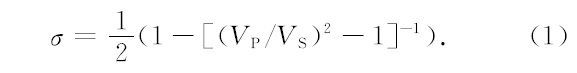
2 地壳厚度与泊松比数据的筛选及处理本文主要使用了刘春等(2009)及前述其他文献采用远震P波接收函数方法得到的地壳厚度与泊松比结果.远震P波接收函数是用远震P波波形的垂直分量对径向分量和切向分量作反褶积处理后得到的时间序列,被认为基本消除了震源时间函数和深地幔传播路径效应的影响,可以近似为台站下方地壳上地幔速度结构对近垂直入射平面波的脉冲响应(吴庆举,1998,2003;Zhu and Kanamori,2000).远震接收函数主要由直达波、台站下方速度界面产生的P、S转换波及速度界面与地表之间的多次反射波等震相组成.接收函数H-k方法(Zhu and Kanamori,2000)正是利用径向接收函数的Ps、PpPs及PpSs/PsPs震相与直达P波的到时关系共同约束Moho界面深度与地壳平均波速比.泊松比(σ)与波速比的相互关系,可用下式表示:
尽管同样采用了接收函数H-k方法,然而,不同作者往往对同一台站给出了不同的地壳厚度与泊松比结果.如,Liu等(2011)给出的黑龙江SYS台站的地壳厚度与波速比分别为26.9 km和1.74;而张广成等(2012)给出的该台站下方地壳厚度与波速比则为38.1 km和1.75.李传金等(2010)给出的ZCH台站下方地壳厚度与波速比为43.8 km和1.75;而葛粲等(2011)和任枭等(2012)给出的该台下方地壳厚度与波速比则分别为36.9 km/1.95和39.2 km/1.90.造成上述差异的客观原因在于地壳结构和壳幔过渡带的横向变化,而不同作者在开展接收函数H-k研究中选取不同的滤波器、接收函数数量、转换波与多次波的权重及假定不同的地壳平均P波速度等也都会造成同一台站得出不同的研究结果.尽管上述例子在现有的研究中仅占有很小的比例(<5%),但是要想编制可靠的地壳厚度与泊松比分布图,仍需要认真地核实比对、并合理取舍不同作者给出的结果.
本文收集了前人采用接收函数H-k方法得到的721个地震台站下方的地壳厚度与泊松比研究结果.本文统计表明其中297个台站具有2个或者2个以上的分析结果(图 1).对于有3个或3个以上测量结果的157个台站,通过对已有测量结果按照相等的权重进行加权平均的办法获得了台站下方的地壳厚度、波速比并计算了其相对应的标准偏差(图 2).分析表明,多数台站的地壳厚度与波速比标准偏差分别小于2 km和0.04.对于有2个测量结果的140个台站,本文也通过同样的加权平均办法获得 了台站下方的地壳厚度和波速比.本文分析(图 3)表明,多数台站的2个地壳厚度与波速比分析结果之差都在2 km和0.04之内.对于地壳厚度和波速比之差或者标准偏差超过4 km和0.07的42个台站分析结果,我们认为可能与台站远震记录的多少、信噪比、台站下方地壳结构的复杂性等有关,因此不予采信.上述地震台站基本覆盖了研究区的大部分范围.然而,在华北平原和松辽盆地内部的相关研究结果相对要少.这主要是因为沉积层结构所导致的多次波信号往往会严重干扰接收函数直达P波附近的波形,从而致使采用接收函数H-k方法测定华北平原、东辽盆地等台站下方的地壳结构存在严重偏差.为了弥补这一不足,本文采用了武岩(2011)用接收函数CCP叠加方法得到的73个华北平原台站下方地壳厚度.对于松辽盆地内部的地震台站,尤其是只有1个分析结果的台站,本文根据接收函数CCP叠加和接收函数H-k方法相结合的办法(张广成等,2012),对其结果的可靠性进行了评估.
 |
图 2 研究区具有3个以上测量结果的157个台站的地壳厚度(a)和地壳平均波速比(b)标准偏差 Fig.2 Distribution of standard deviations of crustal thickness (a) and Vp/Vs (b) for 157 stations with three or more different estimates |
 |
图 3 研究区具有2个测量结果的140个台站的地壳厚度(a)和地壳平均波速比(b)之差 Fig.3 Difference of crustal thickness (a) and Vp/Vs (b) for 140 stations with two different estimates |
图 4(a, c)所示分别为研究区地震台站下方的地壳厚度及采用基于Voronoi图(图 4e)自然近邻插值得到的研究区地壳厚度分布.图 4e中的Voronoi图仅是对数据模型有数值点进行较为合理的分块划分,分块大小显示了不同区域的分辨.由图可见松嫩、华北东部分辨是较低的.研究区的地壳厚度介于28~55 km之间,但多数台站下方地壳厚度介于30~40 km之间.研究区地壳厚度的总体特征 表现为鄂尔多斯盆地及其周缘最厚(约40~55 km), 其中大于50 km的地壳厚度仅在鄂尔多斯西南缘六盘山区域;大兴安岭、燕山—太行地区的地壳厚度介于36~45 km范围,其中燕山造山带地壳由东向西逐渐加深,厚度相差可达10 km;而松辽盆地、华北平原地区以及汾渭地堑下方的地壳厚度最薄,介于28~35 km之间.
 |
图 4 接收函数H-k方法获得的研究区地壳厚度(a, c)和Vp/Vs(b,d)分布图 (a)752个地震台站下方的地壳厚度;(b)679个地震台站下方的波速比;(c)和(d)分别为地壳厚度与地壳波速比的插值图, c中的黑线为图 6中对应的剖面位置;(e) 和(f)分别为地壳厚度与地壳波速比插值所对应的Voronoi图. Fig.4 Crustal thickness and crustal Vp/Vs map for the region based on receiver function H-k method (a) Crustal thickness variations for 752 data points; (b)Crustal Vp/Vs variations for 679 data points; (c) and (d) are contour map of crustal thickness and Vp/Vs. The black line represent the location of two transects in Fig.6; (e) and (f) are optimized Voronoi diagrams for crustal thickness and Vp/Vs. |
事实上,除了接收函数方法外,众多学者曾经采 用人工地震测深(Li et al.,2006; Teng et al.,2013)、 重力反演(黄建平等,2006; 郭良辉等,2012)、地震波成像(Sun et al., 2008)、天然地震与人工地震相结合(卢造勋等, 2005; 熊小松等, 2011; Stolk et al., 2013)等手段获得了研究区Moho界面的深度.与以往研究相比(图 5),本研究收集了更为密集的观测点下方的地壳厚度,因而更为详细地揭示了研究区厚度分布及其横向变化.图 5结果显示,与本文结果相比,Sun等(2008)采用地震波成像给出的松辽盆地及其周缘下方地壳厚度则明显要厚6~12 km.事实上,Sun等(2008)的体波走时成像研究中所采用的Sg和Sn震相本身对地壳厚度并不能提供约束.因此,尽管其在已有地壳模型的基础上,通过走时反演给出了地壳厚度这一参数,但相对人工源地震方法和接收函数方法而言,其所获取的地壳厚度可靠性相对要差.而与Stolk等(2013)最新编制的地壳厚度相比,除了大兴安岭西缘和燕山造山带北缘等缺少地震台站的地区外,其他地方的地壳厚度之差都不超过5 km;为了更进一步证明本文结果的可靠性与合理性,我们还将本文结果与2条典型测深剖面下方的地壳厚度进行了比较(图 6).图 6显示采用接收函数得到的地壳厚度较采用人工地震测深得到的地壳厚度要浅,二者的厚度之差基本都在5 km之内,即完全属于正常的误差之内.除了接收函数和人工地震数据覆盖并不理想外,造成上述人工地震测深与远震接收函数地壳厚度差异的原因很多,如人工地震测深反映了地壳的P波速度结构,而接收 函数研究则主要对地壳的S波速度结构敏感;高频的人工地震测深数据反映了地壳尺度的细结构,而远震接收函数研究则对Moho界面的渐变更为敏感,等等.
 |
图 5 其他机构给出的地壳厚度及其与本文结果的比较(a) APcrust模型的地壳厚度(Stolk et al. 2013);(b)MIT模型的地壳厚度(Sun et al.2008). (c)本文地壳厚度与APcrust模型地壳厚度之差;(d)本文地壳厚度与MIT模型地壳厚度之差. Fig.5 Comparison between the crustal thickness in this study and those from other seismic models(a) Crustal thickness from APcrust model (stolk et al. 2013);(b) Crustal thickness from MIT model(Sun et al.2008); (c) Crustal thickness difference between the newly derived model and APcrust model(stolk et al. 2013); (d) Crustal thickness difference between the newly derived model and MIT model (Sun et al. 2008). |
 |
图 6 接收函数与人工地震测深地壳厚度比较其中人工地震测深剖面的具体位置见图 4c,黑色实线为接收函数结果,虚线为人工地震测深结果. Fig.6 Comparison between the crustal thickness in this study and those from deep seismic soundinds (DSS) The location of transects are denoted in Fig.4c. The solid and dashed lines represent the crustal thickness from receiver function and DSS, respectively. |
波速比/泊松比是描述地球物质成分的一个非常重要的弹性力学参数,测量泊松比已成为人类探索地球内部物质成分、构造和物理状态最有用的方法之一(Zandt et al., 1995; Christensen, 1996 ).岩石物理实验和地球物理研究表明,地壳平均泊松比σ的变化可能为许多地球物理和地球化学因素所致.如大的(大于流体静压力)孔隙流体压力会导致波速比/泊松比显著提高.岩石的矿物组成对σ的变化有着重要影响.一般来说,当岩石的SiO2含量≥55%时,岩石的泊松比值与SiO2含量成反相关关系(Christensen,1996).如酸性岩(σ≤0.26),中性岩(0.26<σ≤0.28)和基性岩(0.28<σ≤0.30).此外,部分熔融对P波和S波速度比也有很大的影响,地震波速比值Vp/Vs随着熔融体熔融程度的增加而增大,如部分熔融程度为5%的花岗岩σ约为0.31,而没有熔融的花岗岩σ约为0.24.因此,当σ>0.30时,一般被解释为地壳存在部分熔融(Zandt and Ammon, 1995).
为此,研究区的地壳波速比/泊松比分布对认识该区的地壳物质组成及状态可以起到重要的约束作用.图 4(b,d)分别为本研究得到的研究区679个台站下方的地壳波速比分布及采用基于Voronoi图(图 4f)自然近邻插值得到的研究区地壳波速比分布特征.研究区的地壳波速比介于1.65~1.95之间,但多数台站下方地壳波速比值都高于全球大陆平均值(1.73).其中长白山地区、张家口—大同一带、汾渭地堑以及内蒙河套平原等地区的地壳平均波速比甚至高于1.80,事实上,这些地区新生代火成岩活动非常强烈、在地表有大量新生代火山岩的出露(Liu et al.,2001),最新的接收函数(段永红等,2005; Hetland et al.,2004)、大地电磁测深(汤吉, 2005,2006)、人工地震测深(张先康等,2002;张成科等,2002; 嘉世旭等,2005)等研究表明,在长白山、大同—张家口等地存在显著的壳内低速层,被认为是壳内岩浆房的主要证据.上述地区异常高的地壳温度或壳内低速部分熔融的岩浆房可能是导致地壳波速比/泊松比显著提高的主要原因.上述地区高的Vp/Vs值、大地热流值(Wang,2001)、异常低的上地幔速度(孙莲等,2012;Huang et al.,2006; Li et al, 2009, 2012, 2013; Zhao et al.,2012)以及中新生代强烈火山活动(Liu et al.,2001)都暗示东北—华北地区东部岩石圈遭受了强烈的改造与减薄.西部的鄂尔多斯盆地内部地壳波速比值约为1.76(泊松比约0.26),这一结果与世界其他克拉通地区(Tugume et al., 2012)的地壳波速比相当,不仅表明鄂尔多斯盆地具有稳定的构造块体特征,还暗示其地壳组成以中酸性岩为主.
5 地壳厚度与泊松比的关系及其地质意义地壳厚度和波速比/泊松比之间关系可能隐含大陆地壳形成和构造演化过程的重要信息(嵇少丞等,2009;Ji et al., 2009).不同的构造变形模式将可能导致不同的地壳厚度与波速比/泊松比关系,关于解释泊松比和地壳厚度相关性的流变学构造模式详见嵇少丞等(2009).众多学者(李永华等,2006;嵇少丞等,2009;Ji et al., 2009; Tian et al.,2013)正是利用地壳厚度与波速比/泊松比的相互关系,来研究和约束大陆地壳的构造演化过程.
本文研究(图 7)显示,大兴安岭造山带地区地壳厚度与波速比/泊松比成负消长关系,即地壳的波速比/泊松比随地壳厚度增加而降低,这一点在危自根等(2012)的研究中也有体现.关于这一观测现象,我们认为有两种可能的解释:(1)可能暗示大兴安岭在形成过程中,地壳的增厚以长英质上地壳增厚为主;(2)由于大兴安岭造山带地壳厚度总的变化趋势是由东向西加厚,因此其波速比变化可能也与东侧地壳减薄等改造有关.
 |
图 7 研究区不同构造单元地壳厚度与泊松比的相关性(a)大兴安岭地区;(b)松辽盆地及周缘地区. Fig.7 Measured Vp/Vs as function of crustal thickness for Da Hinggan Ling (a) and Songliao Baisn (b) |
研究区内的渤海湾盆地和松辽盆地是中国最大的伸展盆地,也是石油最富集的地区.关于上述盆地可能成因的模式很多,其中至少包括下地壳拆沉模式(邓晋福等,2004;吴福元等,2008)和伸展模式(Xu et al.,2001)等.由于渤海湾盆地缺少泊松比的相关研究资料,因此本研究重点就松辽盆地的可能 成因进行探讨.本文研究显示,与大兴安岭地区不同,松辽盆地及周边地区地壳厚度与泊松比没有明显的相关性(图 7).跨越松辽盆地开展的人工地震测深研究(刘殿秘等, 2007)显示,松辽盆地下方地壳的减薄主要发生在下地壳范围.构造伸展作用导致的松辽盆地基性下地壳物质组分的减少,将会导致地壳泊松比也相应变小,从而使得地壳的泊松比随地壳的厚度减小而降低;而拆沉作用所致的松辽盆地榴辉岩下地壳物质组分的减少,将会导致地壳泊松比相应变高,从而使得地壳的泊松比随地壳的厚度减小而增大(嵇少丞等,2009).尽管拆沉模型导致下地壳减薄这一构造过程可以解释松辽盆地东、南缘地壳厚度—泊松比分布特征,但是与松辽盆地及其周缘总的地壳厚度—泊松比分布特征并不相符.地质调查研究表明,新生代以来松辽盆地及其周缘地区有多期次基性火山岩的喷发(Liu et al.,2001).因此,新生代以来基性岩浆底侵到松辽盆地下方,将会导致其下地壳铁镁质组分的增加与地壳泊松比的增大,从而抵消一部分下地壳拆沉所造成的地壳泊松比减小.这样在上述多种过程的综合作用下,造就了松辽盆地复杂的地壳厚度与泊松比关系.
6 结论本文收集了采用接收函数方法得到的中国东北地区752个台站下方的地壳厚度与679个台站下方地壳平均波速比观测结果,并据此编制了研究区的地壳厚度与波速比分布图.由于更多可靠数据的约束,新编制的地壳厚度较以往的地壳厚度图具有更高的可信度,揭示出更多的细节与地壳结构变化.此外,我们也通过比较,对已有的地壳厚度结果进行了评估,确认了一些可靠的地壳厚度特征.研究揭示出该区地壳厚度具有强烈的横向变化,其中地壳最薄的地方出现在松辽盆地东、南缘和华北平原地区(28~35 km),而最厚的地方则出现在鄂尔多斯盆地西南缘(约55 km).大兴安岭、燕山—太行造山带地壳厚度介于36~45 km之间,且具有由东向西逐渐增厚的趋势.研究区地壳平均波速比分布图显示,该区平均波速比为1.76±0.05,较全球大陆平均值明显偏高,这可能与中、新生代以来该区遭受的岩石圈减薄与破坏过程有关.其中地壳波速比最高的地方出现在山西地堑、长白山、大同—张家口等新生代火山区(波速比>1.80),暗示这些地区具有较高的地壳温度或存在广泛的壳内部分熔融.
本文研究显示大兴安岭造山带地区的地壳厚度与波速比/泊松比成负消长关系,暗示大兴安岭在形成过程中,地壳的增厚以长英质上地壳增厚为主,此外,由于大兴安岭造山带地壳厚度总的变化趋势是由东向西加厚,因此其波速比变化可能也与东侧地壳减薄等改造有关.与大兴安岭地区不同,松辽盆地及周边地区地壳厚度与松比没有明显的相关性,这可能与该区复杂的构造演化过程有关.另外,由于松嫩盆地和华北盆地内部测点少,有关盆地内部地壳结构及泊松比关系需进一步深入探测研究.
致谢 在本文完成过程中,诸多同行分别提供了其接收函数研究成果中有关地震台站位置、地壳厚度与波速比等信息.两位匿名审稿人对本文提出了非常具 体的修改意见和建议,这对本文的完善提供 了巨大帮助,作者在此向他们表示衷心的感谢.| [1] | Christensen N I. 1996. Poisson's ratio and crustal seismology. J. Geophys. Res., 101(B2): 3139-3156. |
| [2] | Deng J F, Mo X X, Zhao H L, et al. 1994. Lithosphere root/de-rooting and activation of the East China continent. Geoscience, 8(3): 349-356. |
| [3] | Deng J F, Mo X X, Zhao H L, et al. 2004. A new model for the dynamic evolution of Chinese lithosphere: continental roots-plume tectonics. Earth-Science Reviews, 65(3-4): 223-275. |
| [4] | Duan Y H, Zhang X K, Liu Z, et al. 2005. A study on crustal structures of Changbaishan-Jingpohu volcanic area using receiver functions. Chinese J. Geophys. (in Chinese), 48(2): 352-358. |
| [5] | Ge C, Zheng Y, Xiong X. 2011. Study of crustal thickness and Poisson ratio of the North China Craton. Chinese J. Geophys. (in Chinese), 54(10): 2538-2548. |
| [6] | Guo L H, Meng X H, Shi L, et al. 2012. Preferential filtering method and its application to Bouguer gravity anomaly of Chinese continent. Chinese J. Geophys. (in Chinese), 55(12): 4078-4088. |
| [7] | Hetland E A, Wu F T, Song J L. 2004. Crustal structure in the Changbaishan volcanic area, China, determined by modeling receiver functions. Tectonophysics, 386(3-4): 157-175. |
| [8] | Huang J L, Zhao D P. 2006. High-resolution mantle tomography of China and surrounding regions. J. Geophys. Res., 111, B09305, doi: 10. 1029/2005JB004066. |
| [9] | Huang J P, Fu R S, Xu P, et al. 2006. Inversion of gravity and topography data for the crust thickness of China and its adjacency. Acta Seismologica Sinica, 28(3): 250-258. |
| [10] | Ji S C, W Q, Yang W C. 2009. Correlation between crustal thickness and Poisson's ratio in the North China Craton and its implication for lithospheric thinning. Acta Geologica Sinica, 83(3): 324-330. |
| [11] | Ji S C, Wang Q, Salisbury M H. 2009. Composition and tectonic evolution of the Chinese continental crust constrained by Poisson's ratio. Tectonophysics, 463(1-4): 15-30. |
| [12] | Jia S X, Qi C, Wang F Y, et al. 2005. Three dimensional crustal gridded structure of the Capital area. Chinese J. Geophys. (in Chinese), 48(6): 1316-1324. |
| [13] | Li C J, Xu P F, SunY J, et al. 2010. The Jinzhong transition belt and its geological significance by receiver function in Shanxi region. Chinese J. Geophys. (in Chinese), 53(5): 1143-1148. |
| [14] | Li J Y, Zhang J, Yang T N, et al. 2009. Crustal tectonic division and evolution of the southern part of the North Asian orogenic region and its adjacent areas. Journal of Jilin University (Earth Science Edition), 39(4): 584-605. |
| [15] | Li S L, Mooney W D, Fan J C. 2006. Crustal structure of mainland China from deep seismic sounding data. Tectonophysics, 420(1-2): 239-252. |
| [16] | Li Y H, Wu Q J, An Z H, et al. 2006. The Poisson ratio and crustal structure across the NE Tibetan Plateau determined from receiver functions. Chinese J. Geophys. (in Chinese), 49(5): 1359-1368. |
| [17] | Li Y H, Wu Q J, Pan J T, et al. 2012. S-wave velocity structure of northeastern China from joint inversion of Rayleigh wave phase and group velocities. Geophys. J. Int., 190(1): 105-115. |
| [18] | Li Y H, Wu Q J, Pan J T, et al. 2013. An upper-mantle S-wave velocity model for East Asia from Rayleigh wave tomography. Earth Planet. Sci. Lett., 377: 367-377. http: //dx. doi. org/10. 1016/j. epsl. 2013. 06. 033. |
| [19] | Li Y H, Wu Q J, Zhang RQ, et al. 2009. The lithospheric thinning of the North China inferred from Rayleigh wave inversion. Geophys. J. Int., 177(3): 1334-1342. |
| [20] | Liu C, Chong J J, Ni S D, et al. 2009. Study on the ctustal thickness beneath stations of seismic network in Shaanxi province by teleseismic receiver function. Seismology and Geology, 31(2): 313-320. |
| [21] | Liu D M, Han L G, Weng A H, et al. 2007. Partial geophysical features of the northwest boundary in Songliao basin. Progress in Geophysics, 22(6): 1722-1727. |
| [22] | Liu H F, Niu F L. 2011. Receiver function study of the crustal structure of northeast China: Seismic evidence for a mantle upwelling beneath the eastern flank of the Songliao Basin and the Changbaishan region. Earthq. Sci., 24(1): 27-33. |
| [23] | Liu J Q, Han J T, Fyfe W S. 2001. Cenozoic episodic volcanism and continental rifting in northeast China and possible link to Japan Sea development as revealed from K-Ar. Tectonophysics, 339(3-4): 385-401. |
| [24] | Liu Q L, Wang C Y, Yao Z X, et al. 2011. Study on crustal thickness and velocity ratio in mid-western North China Craton. Chinese J. Geophys. (in Chinese), 54(9): 2213-2224. |
| [25] | Lu Z X, Jiang D L, Bai Y, et al. 2005. Exploration and research on the structure of the crust and upper mantlein northeast China. Seismological Research of Northeast China, 21(1): 1-8. |
| [26] | Pan S Z, Niu F L. 2011. Large contrasts in crustal structure and composition between the Ordos plateau and the NE Tibetan plateau from receiver function analysis. Earth Planet. Sci. Lett., 303(3-4): 291-298. |
| [27] | Ren J S, Chen T Y, Niu B G, et al. 1990. Tectonic Evolution of the Continental Lithosphere and Metallogeny in Eastern China and Adjacent Areas (in Chinese). Beijing: Science Press. |
| [28] | Ren X, Xu Z G, Yang H, et al. 2012. Moho depth distribution character beneath the Ordos block's southeastern margin areas. Chinese J. Geophys. (in Chinese), 55(12): 4089-4096. |
| [29] | Stolk W, Kaban M, Beekman F, et al. 2013. High resolution regional crustal models from irregularly distributed data: Application to Asia and adjacent areas. Tectonophysics, 602: 55-68. |
| [30] | Sun L, Li Y H, Wu Q J, et al. 2012. Q0 tomography of S wave attenuation in Northeast China and adjacent regions. Chinese J. Geophys. (in Chinese), 55(4): 1179-1185. |
| [31] | Sun Y S, Toksöz M N, Pei S P, et al. 2008. The layered shear wave velocity structure of the crust and uppermost mantle in China. Bull. Seisml. Soc. Am., 98(2): 746-755. |
| [32] | Tang J, Wang J J, Chen X B, et al. 2005. Preliminary investigation on electricity structure of the crust and upper mantle in arxan volcanic area. Chinese J. Geophys. (in Chinese), 48(1): 196-202. |
| [33] | Tang J, Zhao G Z, Wang J J, et al. 2006. Study of the formation mechanism for volcanism in Northeast China based on deep electric structure. Acta Petrologica Sinica (in Chinese), 22(6): 1503-1510. |
| [34] | Teng J W, Zhang Z J, Zhang X K, et al. 2013. Investigation of the Moho discontinuity beneath the Chinese mainland using deep seismic sounding profiles. Tectonophysics, http: //dx. doi. org/10. 1016/j. tecto. 2012. 11. 024 |
| [35] | Tian X B, Zhang Z J. 2013. Bulk crustal properties in NE Tibet and their implications for deformation model. Gondwana Research, 24(2): 548-559, doi: 10.1016/j. gr. 2012. 12. 024 |
| [36] | Tong W W, Wang L S, Mi N, et al. 2007. Receiver function analysis for seismic structure of the crust and uppermost mantle in the Liupanshan area, China. Sci. China Ser. D-Earth Sci., 50(2): 227-233. |
| [37] | Tugume F, Nyblade A, Julià J. 2012. Moho depths and Poisson's ratios of Precambrian crust in East Africa: Evidence for similarities in Archean and Proterozoic crustal structure. Earth and Planetary Science Letters, 355-356: 73-81. |
| [38] | Wang J, Liu Q Y, Chen J H, et al. 2009. The crustal thickness and Poisson's ratio beneath the Capital Circle Region. Chinese J. Geophys. (in Chinese), 52(1): 57-66. |
| [39] | Wang Y. 2001. Heat flow pattern and lateral variations of lithosphere strength in China mainland: constraints on active deformation. Phys. Earth Planet. Interiors, 126(3-4): 121-146. |
| [40] | Wei Z G, Chen L. 2012. Regional differences in crustal structure beneath northeastern China and northern North China Craton: constraints from crustal thickness and Vp/Vs ratio. Chinese J. Geophys. (in Chinese), 55(11): 3601-3614. |
| [41] | Wu F Y, Xu Y G, Gao S, et al. 2008. Lithospheric thinning and destruction of the North China Craton. Acta Petrologica Sinica, 24(6): 1145-1174. |
| [42] | Wu Q J, Tian X B, Zhang N L, et al. 2003. Receiver function estimated by maximum entropy deconvolution. Acta Seismologica Sinica, 25(4): 382-389. |
| [43] | Wu Q J, Zeng R S. 1998. The crustal structure of Qinghai-Xizang plateau inferred from broadband teleseismic waveform. Chinese J. Geophys. (in Chinese), 41(5): 669-679. |
| [44] | Wu Y, Ding Z F, Zhu L P. 2011. Crustal structure of the North China Craton from teleseismic receiver function by the Common Conversion Point stacking method. Chinese J. Geophys. (in Chinese), 54(10): 2528-2537. |
| [45] | Wu Y. 2011. The sturucture of the crust and upper mantle in North China Craton from teleseismic receiver function [Ph. D. thesis]. Beijing: Institute of Geophysics, China Earthquake Administration. |
| [46] | Xiong X S, Gao R, Zhang X Z, et al. 2011. The Moho depth of North China and Northeast China revealed by seismic detection. Acta Geoscientica Sinica, 32(1): 46-56. |
| [47] | Xu Y G. 2001. Thermo-tectonic destruction of the Archean lithospheric keel beneath eastern China: evidence, timing, and mechanism. Phys. Chem. Earth (A): Solid Earth and Geodesy, 26(9-10): 747-757. |
| [48] | Yin A, Harrison M. 1996. The Tectonic Evolution of Asia. Cambridge: Cambridge University Press. |
| [49] | Zandt G, Ammon C J. 1995. Continental crust composition constrained by measurements of crustal Poisson's ratio. Nature, 374: 152-154. |
| [50] | Zhang C K, Zhang X K, Zhao J R, et al. 2002. Study on the crustal and upper mantle structure in the Tianchi volcanic region and its adjacent area of Changbaishan. Chinese J. Geophys. (in Chinese), 45(6): 812-820. |
| [51] | Zhang G C. 2012. The sturucture of the crust and upper mantle in Northeast China from teleseismic receiver function [Ph. D. thesis]. Beijing: Institute of Geophysics, China Earthquake Administration. |
| [52] | Zhang H S, Tian X B, Liu F, et al. 2009. Structure of crust and mantle beneath the Hu-bao basin and its adjacent region. Progress in Geophysics, 24(5): 1609-1615. |
| [53] | Zhang R Q, Li Y H, Yao X R. 2006. A review of latest crustal and upper mantle discontinuities studies beneath northeast China in northwest Pacific subduction zone. Progress in Geophysics, 21(4): 1080-1085. |
| [54] | Zhang X K, Zhang C K, Zhao J R, et al. 2002. Deep seismic sounding investigation into the deep structure of the magma-system structure of Changbaishan Tianchi volcanic region. Acta Seismologica Sinica, 24(2): 135-143. |
| [55] | Zhang Z J, Wu J, Deng Y F, et al. 2012. Lateral variation of the strength of lithosphere across the eastern North China Craton: New constraints on lithospheric disruption. Gondwana Research, 22(3-4): 1047-1059. |
| [56] | Zhang Z J, Yang LQ, Teng J W, et al. 2011. An overview of the earth crust under China. Earth-Science Reviews, 104(1-3): 143-166. |
| [57] | Zhao L, Allen R M, Zheng T, et al. 2012. High-resolution body wave tomography models of the upper mantle beneath eastern China and the adjacent areas. Geochem. Geophys. Geosyst., 13, Q06007, doi: 10. 1029/2012GC004119. |
| [58] | Zhu L, Kanamori H. 2000. Moho depth variation in southern California from teleseismic receiver functions. J. Geophys. Res., 105(B2): 2969-2980. |
| [59] | 邓晋福, 莫宣学, 赵海玲等. 1994. 中国东部岩石圈根/去根作用与大陆“活化”. 现代地质, 8(3): 349-356. |
| [60] | 段永红, 张先康, 刘志等. 2005. 长白山—镜泊湖火山区地壳结构接收函数研究. 地球物理学报, 48(2): 352-358. |
| [61] | 葛粲, 郑勇, 熊熊. 2011. 华北地区地壳厚度与泊松比研究. 地球物理学报, 54(10): 2538-2548. |
| [62] | 郭良辉, 孟小红, 石磊等. 2012. 优化滤波方法及其在中国大陆布格重力异常数据处理中的应用. 地球物理学报, 55(12): 4078-4088. |
| [63] | 黄建平, 傅容珊, 许萍等. 2006. 利用重力和地形观测反演中国及邻区地壳厚度. 地震学报, 28(3): 250-258. |
| [64] | 嵇少丞, 王茜, 杨文采. 2009. 华北克拉通泊松比与地壳厚度的关系及其大地构造意义. 地质学报, 83(3): 324-330. |
| [65] | 嘉世旭, 齐诚, 王夫运等. 2005. 首都圈地壳网格化三维结构. 地球物理学报, 48(6): 1316-1324. |
| [66] | 李传金, 徐佩芬, 孙勇军等. 2010. 用远震接收函数研究山西地区地壳厚度变化: “晋中坡折带”及其地质意义探讨. 地球物理学报, 53(5): 1143-1148. |
| [67] | 李锦轶, 张进, 杨天南等. 2009. 北亚造山区南部及其毗邻地区地壳构造分区与构造演化. 吉林大学学报(地球科学版), 39(4): 584-605. |
| [68] | 李永华, 吴庆举, 安张辉等. 2006. 青藏高原东北缘地壳S波速度结构与泊松比及其意义. 地球物理学报, 49(5): 1359-1368. |
| [69] | 刘春, 崇加军, 倪四道等. 2009. 利用远震接收函数反演陕西地震台站下方的地壳厚度. 地震地质, 31(2): 313-320. |
| [70] | 刘殿秘, 韩立国, 翁爱华等. 2007. 松辽盆地西北边界部分地球物理特征. 地球物理学进展, 22(6): 1722-1727. |
| [71] | 刘琼林, 王椿镛, 姚志祥等. 2011. 华北克拉通中西部地区地壳厚度与波速比研究. 地球物理学报, 54(9): 2213-2224. |
| [72] | 卢造勋, 姜德禄, 白云等. 2005. 东北地区地壳上地幔结构的探测与研究. 东北地震研究, 21(1): 1-8. |
| [73] | 任纪舜, 陈廷愚, 牛宝贵等. 1990. 中国东部及邻区大陆岩石圈的构造演化与成矿. 北京: 科学出版社. |
| [74] | 任枭, 徐志国, 杨辉等. 2012. 鄂尔多斯地块东南缘地带Moho深度变化特征研究. 地球物理学报, 55(12): 4089-4096. |
| [75] | 孙莲, 李永华, 吴庆举等. 2012. 中国东北及周边地区地壳横波衰减的成像研究. 地球物理学报, 55(4): 1179-1185. |
| [76] | 汤吉, 王继军, 陈小斌等. 2005. 阿尔山火山区地壳上地幔电性结构初探. 地球物理学报, 48(1): 196-202. |
| [77] | 汤吉, 赵国泽, 王继军等. 2006. 基于地下电性结构探讨中国东北活动火山形成机制. 岩石学报, 22(6): 1503-1510. |
| [78] | 王峻, 刘启元, 陈九辉等. 2009. 首都圈地区的地壳厚度及泊松比. 地球物理学报, 52(1): 57-66. |
| [79] | 危自根, 陈凌. 2012. 东北地区至华北北缘地壳结构的区域差异: 地壳厚度与波速比的联合约束. 地球物理学报, 55(11): 3601-3614. |
| [80] | 吴福元, 徐义刚, 高山等. 2008. 华北岩石圈减薄与克拉通破坏研究的主要学术争论. 岩石学报, 24(6): 1145-1174. |
| [81] | 吴庆举, 田小波, 张乃铃等. 2003. 计算台站接收函数的最大熵谱反褶积方法. 地震学报, 25(4): 382-389. |
| [82] | 吴庆举, 曾融生. 1998. 用宽频带远震接收函数研究青藏高原的地壳结构. 地球物理学报, 41(5): 669-679. |
| [83] | 武岩, 丁志峰, 朱露培. 2011. 利用共转换点叠加方法研究华北地区地壳结构. 地球物理学报, 54(10): 2528-2537. |
| [84] | 武岩. 2011. 利用接收函数方法研究华北克拉通地壳上地幔结构[博士论文]. 北京: 中国地震局地球物理研究所. |
| [85] | 熊小松, 高锐, 张兴洲等. 2011. 深地震探测揭示的华北及东北地区莫霍面深度. 地球学报, 2011, 32(1): 46-56. |
| [86] | 张成科, 张先康, 赵金仁等. 2002. 长白山天池火山区及邻近地区壳幔结构探测研究. 地球物理学报, 45(6): 812-820. |
| [87] | 张广成. 2012. 用接收函数方法研究中国东北地区地壳上地幔结构[博士论文]. 北京: 中国地震局地球物理研究所. |
| [88] | 张洪双, 田小波, 刘芳等. 2009. 呼包盆地周缘壳、幔结构研究. 地球物理学进展, 24(5): 1609-1615. |
| [89] | 张瑞青, 李永华, 姚雪绒. 2005. 西北太平洋俯冲带东北地区壳幔结构研究进展. 地球物理学进展, 21(4): 1081-1085. |
| [90] | 张先康, 张成科, 赵金仁等. 2002. 长白山天池火山区岩浆系统深部结构的深地震测深研究. 地震学报, 24(2): 135-143. |