 2018, Vol.38


矿物风化在地球表层系统中发挥了重要作用。风化产生的土壤是地表关键带最重要的组成部分,具有众多的生态服务功能[1]。化学风化释放的元素是陆地和海洋生态系统众多营养元素的主要来源[2]。化学风化和气候之间的负反馈作用还是调节地球气候的长期稳定性和碳循环平衡的重要机制[3]。
平衡情况下土壤的产生速度等于剥蚀速度[4~6]。土壤厚度与剥蚀速度的比值决定了土壤的存留时间,从而影响风化作用的时间,进而控制风化强度和风化通量[7]。一般认为,土壤产生速度应随着土壤厚度的增加而减小,从而形成负反馈机制维持土壤的动态平衡[8]。当土壤产生速度大于土壤剥蚀速度时,土壤厚度增加,从而导致土壤产生速度下降,直到土壤产生速度下降到与剥蚀速度相等,这时土壤厚度不再发生变化,达到新的平衡。当土壤产生速度小于剥蚀速度时,土壤变薄,从而增加土壤产生速度,达到另一个新的平衡。引起土壤产生速度随着土壤厚度增加而下降的原因有多种,如温度引起的矿物热胀冷缩变化幅度随深度的增加而减少,氧化作用受控氧气的扩散随深度增加而减弱,化学风化速度因土壤溶液随着深度的增加趋近饱和而减小,等等[9~10]。
一般认为,高物理剥蚀情况下,土壤厚度薄,土壤存留时间短,风化程度弱,风化通量对温度、降水量等气候条件非常敏感[11~12]。在低物理剥蚀情况下,土壤厚,风化时间长,风化强度高,风化通量取决于新鲜岩石的提供,受控于物理剥蚀速度。因此,建立土壤厚度与剥蚀速度的关系是理解地表风化作用机理,预测构造抬升、气候变化影响化学风化的关键[12~13]。
前人通过大量土壤剖面研究提出了土壤产生方程,即土壤产生速度随着土壤深度的增加往往呈指数级下降[4, 14]:
|
(1) |
其中E为土壤产生速度,平衡条件下即剥蚀速度,H为土壤厚度,ε0和α为常数。ε0可以理解为当风化深度为零时可以达到的最大剥蚀速度,α是与土壤厚度有关的参数(1/m)。但是,不同地区往往具有不同的ε0值和α值。小尺度范围内土壤剖面的不均一性可能是导致这种复杂性的原因。全球风化模型往往需要知道全球尺度物理剥蚀和土壤厚度的关系,土壤剖面研究的结果是否可以应用于流域乃至更大尺度还需要进一步研究。
流域尺度土壤厚度测量具有很大的挑战性,铀同位素破碎年龄学可能为解决这一难题提供新的思路。细粒物质的(234U/238U)比值反映颗粒从母岩破碎以来经历的时间[15]。细粒物质的产生过程就是颗粒在土壤中的运移过程。由于研究对象均是小流域,假设颗粒在流域中搬运时间忽略不计,细颗粒物质破碎年龄对应了颗粒在土壤中的存留时间。通过破碎年龄与剥蚀速度的关系可以考察流域尺度的土壤产生方程。本研究通过调查青藏高原及其周边多个地貌单元河流沉积物的铀同位素破碎年龄与剥蚀速度的关系(图 1),解析流域尺度上经典土壤产生方程的有效性。

|
图 1 样品采集位置图 采样点分别为:①贡嘎雪山(Gongga Mountain),②岷江(Minjiang River),③祁连山东北缘黑河等众多流域(a wide range of catchments including Black River on the northern Qilian Mountains),④格尔木河流域(Golmud River basin),⑤青藏高原中部(the central Tibetan Plateau),⑥戈壁冲积扇(Gobi Alluvial Fan),⑦黄河上游(the upper Yellow River) Fig. 1 Locations of smaple sites |
岩石中234U由238U经过一次α衰变和两次快速的β衰变生成。同时,234U核素并不稳定,经过α衰变成为230Th。在多个234U-230Th半衰期(245 6 ka)[16]以后,岩石中234U的产生速度等于234U的衰变速度,达到稳定状态:
|
(2) |
其中λ为衰变常数。因此,在平衡条件下,岩石中的234U的放射性活度(λ234234U)等于238U的放射性活度(λ238238U),234U与238U活度比,通常表示为(234U/238U)值,等于1。
岩石一旦发生破碎以后,稳态平衡就被打破,颗粒中部分238U核素α衰变产生的234Th(234U的母体)被反冲作用推出颗粒表面[17],导致颗粒中234U的累积速度小于衰变速度。因此,颗粒的(234U/238U)值自破碎开始,会随着时间逐渐变小,直到新的稳定状态[15, 18~19]:
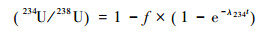
|
(3) |
其中t是破碎时间,f为被反冲作用推出颗粒表面的234Th的比例,与颗粒的粒径和比表面积有关。当颗粒足够小(< 50 μm)时,(234U/238U)值变化越明显。
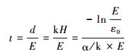
根据公式(1),土壤颗粒产生后在土壤剖面中的停留时间为:

|
(4) |
如流域尺度的平均土壤产生速度符合等式(1)经典土壤产生方程,结合公式(3)和(4)可以预测颗粒的(234U/238U)与物理剥蚀速度存在以下关系:

|
(5) |
河流沉积物样品,根据已经发表物理剥蚀速度数据从高到低排序,分别采自如下(表 1):1)贡嘎雪山,1~2 mm/a[20];2)岷江,0.4±0 1 mm/a[21];3)祁连山东北缘黑河等众多流域,0.080±0 027 mm/a[22];4)格尔木河流域,0.078±0 010 mm/a[23];5)青藏高原中部,0.0351±0 017 mm/a[23];6)戈壁冲积扇,0.028±0 016 mm/a[24];7)黄河上游,0.011±0.001 mm/a[23]。
| 表 1 样品的U同位素组成与剥蚀速度 Table 1 U isotopic composition of the samples and their erosion rates |
所有样品的前处理和同位素分析在南京大学表生地球化学教育部重点实验室完成[19]。首先将约10 g样品用0.5 mol/L醋酸自然浸泡2 h分散并去除碳酸盐。分散后的样品用电成型筛分离出20~25 μm粒级。筛分出的样品先后用碳酸氢钠-二水合柠檬酸三钠-连二亚硫酸钠还原清洗方法去除铁锰氧化物和氢氧化物,双氧水浸泡去除有机质。清洗后的样品采用HF-HNO3消解硅酸盐,并用UTEVA树脂分离出U[19, 25]。U同位素比值由Neptune Plus型(Thermo-Fisher Scientific)多接收等离子体质谱仪测量。238U通过法拉第杯接收,234U通过二次离子倍增器(SEM)接收,采用括标法(Standard Sample Bracketing)校正仪器短期漂移。括标采用已标定的实验室内部标样NJU,其(234U/238U)值为0.950。(234U/238U)值测量误差为±0.002(±2σ)。长期测量BCR-2标准物质的(234U/238U)值为1.001±0.002(n=21,2σ)[19],在误差范围内与国际认可比值一致。
3 结果与讨论各个地貌单元河流沉积物的(234U/238U)比值与剥蚀速度呈现很好的正相关关系,剥蚀速度越大,(234U/238U)比值越高(图 2)。戈壁冲积扇、青藏高原中部以及黄河上游物质的铀同位素值较低,分别为0.939±0.013(2σ)、0.932±0.022(2σ)和0.925±0.001(2σ),这可能与地貌单元内平坦的地形有关,颗粒在土壤剖面停留时间长;祁连山东北缘物质的铀同位素0.961±0.004,与黄土高原的新鲜黄土物质的(234U/238U)一致[19];格尔木河流域物质的铀同位素为0.973±0.007,这可能与昆仑山冰川作用提供大量新鲜破碎颗粒有关[23]。岷江流域的(234U/238U)值接近平衡值1,为1.001±0.003[21],这可能有两方面的原因,一方面岷江流域处于青藏高原边缘地带,流域内地势起伏,落差大,同时构造活动也很强烈,导致颗粒在土壤中的停留时间短,一旦剥蚀就被搬运至下游地区[20];另一方面,汶川地震对岷江流域的物质循环也有很大影响,地震产生大量的新鲜颗粒[26~28],这些颗粒由于破碎时间短,其(234U/238U)值接近平衡。贡嘎雪山物质的铀同位素为0.992,这是因为冰川搬运时间很短[29],颗粒刚破碎就沉积,搬运时间物质的(234U/238U)值接近平衡。

|
图 2 (234U/238U)值与剥蚀速度的关系图 曲线是公式(5)对数据点的拟合线 Fig. 2 Correlation between (234U/238U) and erosion rates. The black line is best fit to eq. (5) |
流域细颗粒物质的铀同位素与剥蚀速度的关系与理论预测(公式(5))一致(图 2,R2=0.92),证明经典土壤产生方程(公式(1))可以应用于流域尺度。本研究所选样品同黄土样品都通过了粒径分选,其粒径大小一致,因此假设本研究样品的f值与同粒级黄土一致,为0.088[19],根据公式(5)计算得到经验常数α为0.612,大于前人对土壤剖面的研究结果(0.017~0.050)[14, 30],这可能与风化深度的定义差异有关。理论上,颗粒发生破碎的厚度应小于经典土壤产生方程中的土壤厚度。这是因为并不是所有颗粒都是从土壤最底层开始破碎的,在土壤剖面中各个层位应该都有可能发生颗粒破碎。假设平均颗粒破碎深度(d)与土壤厚度(H)存在正比关系(d=kH,k是比例系数),公式(4)可以表示为
|
(6) |
拟合数据可以得到α/k=0.612。由于k < 1,可得出与土壤厚度有关的参数α < 0.612,与土壤剖面研究结果的范围一致,其中k是平均破碎深度与土壤厚度的比例。
4 结论固体颗粒的(234U/238U)比值记录了颗粒自破碎以来所经历的时间,具有示踪地表物质搬运的一系列中间过程的潜力[15, 18, 31]。本研究调查了青藏高原及其周边多个地貌单元河流沉积物的(234U/238U)比值(戈壁冲积扇:0.939±0.013;青藏高原中部:0.932±0.022;黄河上游:0.925±0.001;祁连山东北缘流域:0.961±0.004;格尔木河流域:0.973±0.007;岷江流域:1.001±0.003;贡嘎雪山:0.992±0.006),发现各个地貌单元流域(234U/238U)比值与剥蚀速度呈现很好的正相关关系,细粒物质的破碎时间随着物理剥蚀速度的增加而减小。流域尺度细颗粒物质的铀同位素与剥蚀速度的关系与理论预测一致,证明经典土壤产生方程可以应用于流域尺度。
致谢 感谢同行评审专家和编辑部老师提出的宝贵修改意见!
| 1 |
Brantley S L, Goldhaber M B, Ragnarsdottir K V. Crossing disciplines and scales to understand the critical zone. Elements, 2007, 3(5): 307-314. DOI:10.2113/gselements.3.5.307 |
| 2 |
Vitousek P, Chadwick O, Matson P et al. Erosion and the rejuvenation of weathering-derived nutrient supply in an Old Tropical Landscape. Ecosystems, 2003, 6(8): 762-772. DOI:10.1007/s10021-003-0199-8 |
| 3 |
Berner R A. The Phanerozoic Carbon Cycle:CO2 and O2. New York: Oxford University Press, 2004: 160.
|
| 4 |
Heimsath A M, Dietrich W E, Nishiizumi K et al. The soil production function and landscape equilibrium. Nature, 1997, 388(6640): 358-361. DOI:10.1038/41056 |
| 5 |
Heimsath A M, Dibiase R A, Whipple K X. Soil production limits and the transition to bedrock-dominated landscapes. Nature Geoscience, 2012, 5(3): 210-214. DOI:10.1038/ngeo1380 |
| 6 |
Ferrier K L, Kirchner J W. Effects of physical erosion on chemical denudation rates:A numerical modeling study of soil-mantled hillslopes. Earth and Planetary Science Letters, 2008, 272(3-4): 591-599. DOI:10.1016/j.epsl.2008.05.024 |
| 7 |
Gabet E J, Mudd S M. A theoretical model coupling chemical weathering rates with denudation rates. Geology, 2009, 37(2): 151-154. DOI:10.1130/G25270A.1 |
| 8 |
Carson M A, Kirkby M J. Hillslope form and process. Geographical Journal, 1972, 139(1): 140. |
| 9 |
Kim H, Stinchcomb G, Brantley S L. Feedbacks among O2 and CO2 in deep soil gas, oxidation of ferrous minerals, and fractures:A hypothesis for steady-state regolith thickness. Earth and Planetary Science Letters, 2017, 460: 29-40. DOI:10.1016/j.epsl.2016.12.003 |
| 10 |
Maher K. The dependence of chemical weathering rates on fluid residence time. Earth and Planetary Science Letters, 2010, 294(1-2): 101-110. DOI:10.1016/j.epsl.2010.03.010 |
| 11 |
Maher K, Chamberlain C P. Hydrologic regulation of chemical weathering and the geologic carbon cycle. Science, 2014, 343(6178): 1502-1504. DOI:10.1126/science.1250770 |
| 12 |
West A J. Thickness of the chemical weathering zone and implications for erosional and climatic drivers of weathering and for carbon-cycle feedbacks. Geology, 2012, 40(9): 811-814. DOI:10.1130/G33041.1 |
| 13 |
Larsen I J, Almond P C, Eger A et al. Rapid soil production and weathering in the Southern Alps, New Zealand. Science, 2014, 343(6171): 637-640. DOI:10.1126/science.1244908 |
| 14 |
Dietrich W E, Reiss R, Hsu M L et al. A process-based model for colluvial soil depth and shallow landsliding using digital elevation data. Hydrological Processes, 1995, 9(3-4): 383-400. DOI:10.1002/(ISSN)1099-1085 |
| 15 |
DePaolo D J, Maher K, Christensen J N et al. Sediment transport time measured with U-series isotopes:Results from ODP North Atlantic drift site 984. Earth and Planetary Science Letters, 2006, 248(1-2): 394-410. DOI:10.1016/j.epsl.2006.06.004 |
| 16 |
Cheng H, Edwards Lawrence R, Shen C-C et al. Improvements in 230Th dating, 230Th and 234U half-life values, and U-Th isotopic measurements by multi-collector inductively coupled plasma mass spectrometry. Earth and Planetary Science Letters, 2013, 371-372: 82-91. DOI:10.1016/j.epsl.2013.04.006 |
| 17 |
Kigoshi K. Alpha-recoil thorium-234:Dissolution into water and the uranium-234/uranium-238 disequilibrium in nature. Science, 1971, 173(3991): 47-48. DOI:10.1126/science.173.3991.47 |
| 18 |
DePaolo D J, Lee V E, Christensen J N et al. Uranium comminution ages:Sediment transport and deposition time scales. Comptes Rendus Geoscience, 2012, 344(11-12): 678-687. DOI:10.1016/j.crte.2012.10.014 |
| 19 |
Li L, Liu X, Li T et al. Uranium comminution age tested by the eolian deposits on the Chinese Loess Plateau. Earth and Planetary Science Letters, 2017, 467: 64-71. DOI:10.1016/j.epsl.2017.03.014 |
| 20 |
Ouimet W B, Whipple K X, Granger D E. Beyond threshold hillslopes:Channel adjustment to base-level fall in tectonically active mountain ranges. Geology, 2009, 37(7): 579-582. DOI:10.1130/G30013A.1 |
| 21 |
Chappell J, Zheng H, Fifield K. Yangtse River sediments and erosion rates from source to sink traced with cosmogenic 10Be:Sediments from major rivers. Palaeogeography, Palaeoclimatology, Palaeoecology, 2006, 241(1): 79-94. DOI:10.1016/j.palaeo.2006.06.010 |
| 22 |
Pan B, Geng H, Hu X et al. The topographic controls on the decadal-scale erosion rates in Qilian Shan Mountains, N.W. China. Earth and Planetary Science Letters, 2010, 292(1-2): 148-157. DOI:10.1016/j.epsl.2010.01.030 |
| 23 |
Li Y, Li D, Liu G et al. Patterns of landscape evolution on the central and northern Tibetan Plateau investigated using in-situ produced 10Be concentrations from river sediments. Earth and Planetary Science Letters, 2014, 398: 77-89. DOI:10.1016/j.epsl.2014.04.045 |
| 24 |
Jolivet M, Ritz J-F, Vassallo R et al. Mongolian summits:An uplifted, flat, old but still preserved erosion surface. Geology, 2007, 35(10): 871-874. DOI:10.1130/G23758A.1 |
| 25 |
Zhang W, Chen J, Ji J et al. Evolving flux of Asian dust in the North Pacific Ocean since the Late Oligocene. Aeolian Research, 2016, 23(1): 11-20. |
| 26 |
West A J, Hetzel R, Li G et al. Dilution of 10Be in detrital quartz by earthquake-induced landslides:Implications for determining denudation rates and potential to provide insights into landslide sediment dynamics. Earth and Planetary Science Letters, 2014, 396: 143-153. DOI:10.1016/j.epsl.2014.03.058 |
| 27 |
Jin Z, West A J, Zhang F et al. Seismically enhanced solute fluxes in the Yangtze River headwaters following the A.D. 2008 Wenchuan earthquake. Geology, 2016, 44(1): 47-50. DOI:10.1130/G37246.1 |
| 28 |
Li G, West A J, Densmore A L et al. Connectivity of earthquake-triggered landslides with the fluvial network:Implications for landslide sediment transport after the 2008 Wenchuan earthquake. Journal of Geophysical Research Earth Surface, 2016, 4(121): 703-724. |
| 29 |
Lee V E, DePaolo D J, Christensen J N. Uranium-series comminution ages of continental sediments:Case study of a Pleistocene alluvial fan. Earth and Planetary Science Letters, 2010, 296(3-4): 244-254. DOI:10.1016/j.epsl.2010.05.005 |
| 30 |
Heimsath A M, Furbish D J, Dietrich W E. The illusion of diffusion:Field evidence for depth-dependent sediment transport. Geology, 2005, 33(12): 949-952. DOI:10.1130/G21868.1 |
| 31 |
Li L, Li L, Li G. Uranium comminution age responds to erosion rate semi-quantitatively. Acta Geochimica, 2017, 36(1): 1-3. DOI:10.1007/s11631-016-0130-6 |
Abstract
The relationship between the erosion rate and weathering depth is of critical importance to an understanding of the influence of tectonic and climate on chemical weathering. At soil profile scale, the classical equation of soil production showed that the erosion rate decreased exponentially with increasing soil depth. However, the relationship between erosion rate and soil depth is not clear at basin scale. The (234U/238U) ratio of fine particles can record the time since the particle breaking, which depend on the soil depth and erosion rates, may provide a new technique to study the soil production function at basin scale. This study investigated the (234U/238U) ratio of the catchment sediments across several geomorphic units on the Tibetan Plateau and its surrounding areas, including Gobi Alluvial Fan (0.939±0.013), the central Tibetan Plateau (0.932±0.022), the upper Yellow River (0.925±0.001), the catchments of Northern Qilian Mountains (0.961±0.004), Golmud River basin (0.973±0.007), Minjiang River (1.001±0.003)and Gongga Mountain (0.992±0.006). The results show the (234U/238U) ratio of catchments on each geomorphic unit has a good positive correlation with the denudation rate. The comminution age of the fine particles decreases with the increasing denudation rate. The relationship between uranium comminution age of soil particles and erosion rates is consistent with the theoretical prediction, proving that the classical soil production function can be applied to the basin scale.