 2018, Vol.38


近年来,地表过程的研究逐步由定性分析转变到半定量-定量分析阶段[1]。如何从现有的地貌形态定量提取构造活动信息是构造地貌研究的重要内容,有助于理解构造与地表过程之间的耦合关系及其对地形发育的影响。近年来,随着数字高程模型(DEM)和地理信息空间分析等技术的发展[2~5],许多地貌指标如河流坡降指标和Hack剖面[6~8]、面积-高程积分[9~12]、基岩河道侵蚀模型[13~16]等已被广泛发展应用于探测地形的变动、地貌演化阶段的界定以及新构造活动特征的分析等方面。其中,河流坡降指标与Hack剖面可以一维线性方式描述河流纵剖面的局部坡度变化和形态调整,得到了学术界的普遍关注[6~8, 17]。
作为亚洲内陆主要的、规模巨大的年轻山系之一,天山山脉一直是构造地貌学研究的热点区域。乌鲁木齐河是天山北麓重要的水系之一,相关学者对乌鲁木齐河流域的地质与地貌研究已取得了一些重要认识,早期的研究侧重于第四纪地质方面的内容,包括第四纪地层与地貌[18~20]、乌鲁木齐河流域第四纪冰期划分[21~22]及冰川侵蚀与堆积地貌[23~25]。近年来,关于冰川地貌发育年代的研究取得了新进展[26~28],对乌鲁木齐河山前砾石堆积与天山第四纪隆升的关系有了新认识[29],对河流纵剖面特征与构造活动之间的内在关系进行了有益探讨[30],特别是在乌鲁木齐城区及其周缘开展的活动断层与古地震研究有了质的飞跃[31~34]。最近,Lu等[35~36]重建了乌鲁木齐河山前萨尔乔克背斜的构造变形历史,并探讨了背斜生长对河流地貌发育的影响。上述这些工作主要涉及乌鲁木齐河流域第四纪冰期划分、冰川侵蚀与堆积地貌、山前砾石堆积与天山晚新生代逆冲扩展、乌鲁木齐城区及周缘的古地震等方面,但关于乌鲁木齐河整个流域的构造地貌研究还较为缺乏。鉴于此,本文主要选用河长坡降指标SL和Hack剖面等地貌计量指标,对乌鲁木齐河流域新构造特征进行探讨。
1 区域概况乌鲁木齐河属于北天山水系(图 1a),其发源于北天山喀拉乌成山的主峰天格尔峰北坡一号冰川,河流全长约214 km,流域总面积为约4684 km2[37]。根据构造结构,乌鲁木齐河流域自河源向北至山前依次可划分为天山主脉、后峡断陷带、南山隆起带和山前坳陷区等4个构造单元[28](图 1b);各构造单元地层分布差异较大[38]。本文对新疆维吾尔自治区1︰200000地质图[39~40]乌鲁木齐河流域进行了矢量化,由图 1可知天山主脉向山前坳陷,地层依次由老到新呈条带状分布。天山主脉地层以古生界为主,区内主要分布泥盆系凝灰岩、凝灰质粉砂岩、石英片岩、硅质岩、灰岩等,并在河源区局部分布有华力西期花岗闪长岩、红色花岗岩、石英闪长岩,以及志留系片麻岩、绢云母石英片岩等地层;后峡断陷带主要以中生代地层为主,分布侏罗系砾岩、砂岩和泥岩,并夹杂石炭系凝灰质粉砂岩等(图 1b);南山隆起带地层组成主要为石炭系凝灰岩、凝灰质粉砂岩等(图 1b),地层上与后峡断陷带侏罗系地层呈不整合接触关系;山前坳陷则以第四系冲积砂砾石堆积为主,由于逆冲断层作用,在山前的萨尔乔克背斜区出露新近系泥岩、粉砂岩、砂岩以及砾岩(图 1b)。部分高地貌面上覆盖着厚度不等的黄土及黄土状土堆积[35]。

|
图 1 乌鲁木齐河流域地质构造简图(据文献[38]) 地形与水系基于数字高程模型(DEM),地层与构造依据1︰200000地质图[39~40],4个构造分区据参考文献[28] Fig. 1 Geological sketch of the Ürümqi River drainage basin(after the reference [38]). The terrain and water system are obtained based on the digital elevation model(DEM). The strata and structure were obtained according to 1:200, 000 Geological Map[39~40], and the four tectonic zones are based on reference [38] |
乌鲁木齐河流域气候为典型的大陆性气候,降水主要集中于夏季(6~8月)。由于整个流域地形复杂,地势起伏悬殊,导致年降水量空间分异十分明显,在海拔1900~2200 m的天山北坡中山带出现降水量为550~600 m的最大降水带,降水量由此向南北两侧逐渐减少[41]。受气候条件的影响,乌鲁木齐河补给来源主要为冰雪融水。除了地层分布存在差异外,乌鲁木齐河流域4个构造分区的地表过程也不同。天山主脉大部分区域受现代冰川与冰缘作用影响明显,基岩风化主要以寒冻风化导致的机械破坏为主,形成坡度较大的碎石坡和倒石堆;后峡断陷带则以堆积过程为主,形成厚层沉积,表明其正处于持续下沉的状态[42];南山隆起带受强烈的河流下切与坡地侵蚀过程作用,地表破碎,发育峡谷地形;山前坳陷区堆积厚层第四纪砂砾石,在南山山前和萨尔乔克背斜之间,乌鲁木齐河强烈的下切发育形成多级阶地[35~36]。
2 数据来源与分析方法本文选用的数字高程模型(DEM)数据是从地理空间数据云网站(http://www.gscloud.cn/)下载所得,该数据来源于美国和日本ASTER GDEM高程数据,数据初始分辨率为30 m×30 m。基于获得的数据,本文利用ArcGIS软件水文分析和空间分析模块提取出乌鲁木齐河流域DEM,将该流域DEM的属性数据(高程)导出作为本研究河长坡降指标SL和Hack剖面等地貌计量指标分析的基础数据。河流纵剖面形态对岩性和构造等因素十分敏感,受这些因素驱动常发生调整和变动[43~44],河流坡降指标(slope-length)与Hack剖面则被发展并应用于探讨河流纵剖面局部坡度变化和纵剖面形态的调整[7]。
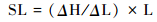
河流坡降指标(SL)是Hack[6]于1973年研究美国东南部的阿帕拉契山流域岩石抗蚀性提出的,其数学表达式如下:
|
其中,ΔH是某河段的高程差,ΔL是该河段的长度,ΔH/ΔL是该河段的坡度,L是该河段中点到河流源头的距离。利用河长坡降指标进行河段坡度对比的基本原理是[6]:河流源头坡度较大,而在出水口河床较为平缓,因此不能直接将河流上下游的坡度作为比较参数;将河流距源头的距离乘以河段的坡度,可放大下游地区的坡度数值效应。
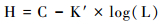
若将河流距源头的长度取对数,此时的半对数曲线剖面称之为Hack剖面(图 2),其曲线方程式为:
|

|
图 2 河流坡降指标SL与Hack剖面示意图(据文献[45]) (1)呈对数曲线形态的均衡河流纵剖面;(2)半对数坐标下的均衡河流纵剖面;(3)受到抬升作用的河流纵剖面;(4)Hack剖面;(5)呈现曲线形态的Hack剖面,由4个均衡河段(Ⅰ、Ⅱ、Ⅲ和Ⅳ)组成,每个河段皆有其SL index值,而这些SL index值即构成阶梯状SL index曲线。当河流的全河段达到均衡剖面(graded profile)状态时,其斜率K即为均衡坡降指标 Fig. 2 The map of the SL index and the Hack profile, after the reference [45]. (1)Logarithmic curve of the equilibrium river profile; (2)Equilibrium River longitudinal profile under semi-logarithmic coordinates; (3)The longitudinal profile of the river that is uplifted; (4)Hack profile; (5)The Hack profile of the curve form consists of four equalized sections (Ⅰ, Ⅱ, Ⅲ and Ⅳ), each with its SL index value, which forms a stepped SL index curve. When the river reaches the "equilibrium profile" state, its slope K is "equilibrium slope index" |
其中,H是河谷纵剖面的高程,C为常数,K′代表半对数坐标下的河流纵剖面的斜率(图 2(2)),L同上。将Hack剖面自源头向出水口连成一条直线,这条直线代表整个河流纵剖面达到动态平衡(dynamic equilibrium),即所谓的均衡剖面(graded profile)状态,此时的斜率K即为均衡坡降指标(图 2(5)),换句话说,K值是K′的特殊情况。
河流坡降指标SL可以指示河流纵剖面的局部坡度变化情况,常被应用于探讨中-小时空尺度的构造活动(断层错动)或岩性差异等问题,而Hack剖面能反映河流纵剖面的变化,常被用于指示较大时空尺度的构造运动[6]。一般来说,SL值偏高的河段,说明该河段可能构造活动比较活跃,岩性较为坚硬或该段所处地形较陡;相反,在构造活动性较弱或者无构造活动,岩性较弱或地形较为平缓的河段,相应的河谷比降指标值偏低[6, 45~48]。因而,若某区域岩性较一致,河流坡降指标可以反映该区构造活动特征,即河流流经构造活跃区时其SL指标值将偏高,反之则偏低。在构造抬升速率较高的河段,其Hack剖面会呈现上凸形态,而构造抬升速率中等或较低的河段,其Hack剖面曲线形态则呈直线或凹形(图 3)[45~49]。同时,K值的大小还可以反映出河流的侵蚀能力和河道的陡缓,较高的K值代表河道较陡,往往反映了流域区内差异隆升作用强烈;反之,K值异常偏低则表明河流侵蚀能力很弱,区域构造相对稳定,差异隆升作用微弱[45]。通常情况下,规模较大的河流具有较大的K值[15, 50],因此,对比不同规模的河流需利用K值对SL进行标准化处理,得到标准化河长坡降指标SL/K[15, 40]。Seeber和Gomitz[50]曾利用此方法划分了喜马拉雅山地区河流的陡缓级别,本文参考该标准划分乌鲁木齐河干流河段陡缓级别,即SL/K值介于2~10之间为陡河段,SL/K大于10时为极陡河段。据此,本文在实际研究工作中,综合利用这几个指标可以分析构造活动、岩性等对河谷纵剖面演化的影响。

|
图 3 Hack剖面形态与抬升速率关系示意图(据文献[48]) (a)抬升速率较小的河流,剖面呈凹形;(b)抬升速率中等的河流,剖面介于凹形和凸形之间;(c)抬升速率较大的河流,剖面呈凸形 Fig. 3 The implication map of the relationship between the Hack profile and the uplift-rate, after the reference [48]. (a)The river with a smaller uplift rate has a concave section; (b)A river with moderate uplift rate, a section between concave and convex; (c)The river with a larger uplift rate has a convex profile |
为分析乌鲁木齐河流域,特别是各分区的构造活动性,依据张天琪等[38]对乌鲁木齐河流域的研究,本文基于ArcGIS的统计分析技术,以9 km2面积阈值为标准划分出66个次集水盆地(盆地中每条河流对应编号见图 4a),并分别得出各次集水盆地的K、meanSL和meanSL/K值,继而对乌鲁木齐河流域及各构造分区的K、meanSL和meanSL/K进行内插(图 5)。得到如下:1)乌鲁木齐河流域K值大小空间分布依次为:天山主脉>南山隆起>山前坳陷>后峡断陷。除后峡部分K值接近0外,K值大致趋势由上游地区向下游递减。2)meanSL在天山主脉和南山地区内部空间差异较大,出现高值区(> 500),而后峡和山前meanSL值整体偏低。3)利用K值对meanSL标准化后,山前坳陷分区萨尔乔克背斜河段meanSL/K异常被突出出来。

|
图 4 乌鲁木齐河流域子流域(a)和干流河段SL/K异常值位置(b) Fig. 4 The sub-basins (a) and abnormality of slope-length analysis (b) of the Vrümqi River drainage basin |

|
图 5 乌鲁木齐河流域K、meanSL和meanSL/K空间分布特征 Fig. 5 Relevant slope-length results of the Vrümqi River drainage basin |
为探讨中小尺度岩性差异和断层活动以及大尺度构造活动对乌鲁木齐河流域地貌演化的影响,本文统计了乌鲁木齐河流域干流河流坡降指标SL和Hack剖面,并进一步利用K值将SL标准化,统计干流在各分区段SL/K的空间分布特征。乌鲁木齐河干流部分横跨山前坳陷、南山隆起、后峡断陷和天山主脉4个分区(图 1b和图 4a),各分区的岩性、地表过程均存在较大的差异。为去除下游受人类活动干扰较大的河段,干流SL/K和Hack剖面向下游统计至萨尔乔克背斜出露段(图 4a和6)。

|
图 6 乌鲁木齐河流域干流SL/K和Hack剖面特征 Fig. 6 Slope-length result of the Vrümqi River |
从图 6可看出,干流河段Hack剖面形态整体上凸且均衡坡降指标K值偏高(K=531)。仔细观察发现,全河段Hack剖面曲线形态并非平滑上凸,而是由不同凹凸形状的曲线段组成(图 6)。比如天山主脉段和南山隆起段Hack剖面形态为上凸,而在后峡断陷段则表现为下凹形态。即使在各分区内部,干流河段Hack剖面曲线的凹凸形态也发生了多次变化。对于这一现象,按照前人研究[51]的解释,这主要是由于在自然界中,某一河流很少存在整个河段抗侵蚀能力完全均一的情况,而实际上多半是由具不同抗蚀能力的河段所组成。再加上河流本身还可能流经不同的活动构造带(如断层、褶皱等),这些局部的构造活动也会对河段产生影响,而使得Hack剖面形态表现为凹凸不一。
为了更细致地分析各构造分区干流河段间的构造隆升以及河流侵蚀能力差异等,沿分区界线将乌鲁木齐河干流SL/K和Hack剖面分为山前坳陷、南山隆起、后峡断陷和天山主脉4个部分,各分区干流河段分界点如图 4b所示。由各分区的河流干流纵剖面可知(图 7),各河段分界点海拔高度大致为山前-南山(1757 m)、南山-后峡(1974 m)、后峡-主脉(2103 m)。由图 7可以看到:1)天山主脉和南山分区干流河段的Hack剖面曲线形态均为上凸。后峡断陷分区Hack剖面整体形态偏于下凹,局部河段Hack剖面形态出现了上凸。山前分区干流河段Hack剖面曲线形态不十分平滑,但整体近乎直线形态,河道坡度无明显变化。2)K值统计结果依次为(图 7):天山主脉(K=149)、后峡断陷(K=653)、南山隆起(K=1388)和山前坳陷(K=1533)。3)标准化河长坡降指标SL/K与Hack剖面之间存在较好的地形地貌对应关系。SL/K异常高值均对应了Hack剖面曲线凹陷的位置。相反,Hack剖面上凸位置对应的SL/K偏低。4)天山主脉分区在位于天山主脉与后峡断陷分区交界处干流发育较陡河段,且有两处出现SL/K值异常偏高(海拔高度分别是2400 m、2275 m)(见图 4b和7a)。5)后峡分区多处发育了陡河段(2 < SL/K < 7),其中在海拔2100 m、2070 m和2010 m这3处SL/K值异常偏高,分别为6.2、4.8和6.0(见图 4b和7b)。6)南山分区干流河段基本为陡河段(2 < SL/K≤10)和极陡河段(SL/K > 10),在海拔1900 m处SL/K值异常偏高,约为48.0(图 7c)。7)山前分区SL/K除在海拔1700 m、1575 m和1550 m出现了极陡河段,SL/K值分别约为11.0、10.0和10.8,其余河段的SL/K变化较为一致,在2~8范围内,属于陡河段(图 7d)。

|
图 7 乌鲁木齐河流域四大分区干流河段SL/K和Hack剖面 Fig. 7 Slope-length analysis of sub-basins in the Vrümqi River drainage basin |
河长坡降指标SL和Hack剖面形态包含了许多与河道坡度相关的地质信息[6, 45~48, 52~53]。河长坡降指标SL常被用于揭示中小尺度岩性差异和局部断裂构造,Hack剖面曲线形态则主要反映了河道纵剖面整体的变化,多用于揭示较大尺度的构造活动[6]。据此,本文对乌鲁木齐河流域及其四大构造分区干流河段进行了河长坡降指标SL和Hack剖面分析,以探讨河道坡度对岩性、支流汇入和构造活动的响应。
5.1 Hack剖面揭示的乌鲁木齐河流流域构造活动特征乌鲁木齐河流域干流河段整体Hack剖面曲线上凸,同时K值也较高(K=531)(图 6),表明其目前构造仍较为活跃。周尚哲等[29]的研究表明,乌鲁木齐河流域段天山在第四纪期间呈阶梯状的断裂抬升;此外,乌鲁木齐河山前发育的多级高阶地也表明550 ka以来天山向柴窝铺盆地逆冲扩展使得萨尔乔克背斜以大于0.36 mm/a的平均生长速率抬升[35, 38]。这些研究成果与本研究的结论较为一致。分区干流河段K值统计结果(图 7)显示,天山主脉分区(K=149)目前差异隆升作用最弱,河道梯度变化不大;南山隆起(K=1388)和山前坳陷(K=1533)分区目前河流梯度变化最大,差异隆升作用较强;后峡分区(K=653)所处位置地形为一断陷盆地,南北两侧分别为构造较为活跃的天山主脉分区和南山隆起分区,因此区域整体构造差异隆升也较为明显。
流域内构造分区的干流河段Hack剖面形态揭示了更加详细的信息(图 7)。天山主脉和南山分区干流河段的Hack剖面曲线形态均为上凸。后峡断陷分区Hack剖面整体形态偏于下凹(图 7b)。这可参考Merritts和Vincent[54]的研究结论,其指出位于下游的河流在受到构造运动的影响后,由于其河流流量较大,较容易在相对短时间内经过流水下切侵蚀作用恢复其原先的河道坡度,而位于上游河道坡度则相对增加,造成上游的Hack剖面呈现较为上凸的形态,河流坡降指标值亦相对较高。这表明天山主脉和南山分区可能因受到依连哈比尔尕断裂带及其分支的影响目前正处于强烈的构造隆升状态,而后峡分区和山前分区构造活动性较弱。依连哈比尔尕断裂是形成于华力西期而新近纪地质时期重新复活的大断裂,位于北天山中段北坡中山带和高山带之间[55~56],横穿本研究区。后峡分区内局部河段Hack剖面形态也出现上凸(图 7b)。考虑到其内部岩性分布较为均一(主要为侏罗系地层[35]),造成这一现象的原因应该是干流东西两侧支流(河流编号20和27)汇入的影响(图 4b)。山前坳陷分区干流河段Hack剖面曲线形态不十分平滑,但整体近乎直线形态,河道坡度无明显变化。这是因为山前坳陷分区基岩河道被第四系冲积物所覆盖,且岩性分布较为均一,使其Hack剖面呈一直线形态,接近均衡剖面状态。南山隆起分区与山前坳陷分区交界处位于准噶尔南缘断裂带[17, 29],这两个分区的干流河段Hack剖面以准噶尔南缘断裂带(交界处)为拐点,位于断裂带上游的河段(南山隆起区),其曲线形态呈现上凸,向下游(山前坳陷区)则转变为直线(图 4b和7c,7d)。根据Brookfield[46]的解释,河流在向均衡剖面演化过程中,受断层活动影响,其纵剖面会发生调整。在达到新的均衡剖面之前,其Hack剖面曲线会出现“上凸下凹”或“上凸下直”的形态。据此认为,南山隆起-山前坳陷分区过渡河段目前尚处于过渡至新均衡剖面的初期阶段。张天琪等[38]基于面积-高程积分分析,探讨乌鲁木齐河流域地形地貌演化特征时,也表明山前坳陷区、南山隆起带目前处于前均衡-均衡状态演化阶段。
5.2 河长坡降指标SL/K异常的指示意义标准化河长坡降指标SL/K对岩性、局部断裂活动以及河流径流量的增加响应较为明显,同时与Hack剖面二者存在较好的地形地貌对应关系[47, 54]。河长坡降指标SL/K在局部地区所产生的峰值,代表了该处坡度急剧改变,原因可能是构造活动、岩性改变、支流汇入、人类活动等[17]。为排除人类活动的影响,乌鲁木齐河干流河段向下游统计至萨尔乔克背斜出露段,该段以南至天山山脉人类活动较小。如图 4b所示,乌鲁木齐河流域干流河段SL/K在9处出现异常高值,其值与海拔高度自上游至下游分别约为:2.1(2400 m)、6.0(2275 m)、6.2(2100 m)、4.8(2070 m)、6.0(2010 m)、48.0(1900 m)、11.0(1700 m)、10.0(1575 m)和10.8(1550 m),详细数值见图 7标注。在天山主脉分区干流河段有两处SL/K异常偏高,其海拔高度分别是2400 m和2275 m。根据地质资料分析[38~40],该段岩性未发生明显变化(主要为泥盆系地层),也没有出现明显的断裂构造线(图 4b),不过在SL/K突增的位置发现有支流的汇入(河流编号38和57)。类似的现象也出现在了后峡分区(海拔2010 m,河流编号20和27)和山前分区(海拔高度分别为1575 m,河流编号2;1700 m,河流编号9)(图 4b)——这推测为支流汇入使得河水流量增大,河道冲刷侵蚀增强,河道坡度增大,造成SL/K值异常。褶皱构造活动对SL/K也有影响,比如山前分区干流某河段(海拔1550 m),此河段受萨尔乔克背斜生长变形的影响显著(图 1和图 4b)[38]。位于准噶尔南缘断裂带[17, 28]的南山分区和山前分区过渡段同样观察到了异常增大的SL/K,值约为48.0,海拔高度1900 m(图 4b和图 7c),该河段位于石炭系地层和第四纪砾石层的交界处(图 1),岩性差异和断裂构造应该是造成此处SL/K异常的主要原因;此外,部分干流河段还受到岩性转变、断裂构造和支流汇入的叠加影响,比如在后峡分区海拔2100 m处,既发育断裂构造,岩性也存在显著变化(侏罗系地层与石炭系地层交界),并存在支流汇入(河流编号24和28)(图 4b)。值得注意的是,后峡分区海拔2070 m处存在SL/K异常峰值(4.8),但该处河段并未有支流汇入,附近也未发现明显的断裂构造,且岩性较为单一(图 1),因此该处SL/K异常峰值的原因尚不明晰。本文推测可能是因为地质图精度不够,未能体现较小空间尺度更详细的岩性和断层信息,或者是DEM数据分辨率不高,一些规模较小的支流未能体现出来等。这需日后获取更高精度的DEM数据和详尽的地质信息并结合野外调查进一步深入研究探讨。
6 结论本文对乌鲁木齐河流域及其四大构造分区干流河段进行了河长坡降指标SL和Hack剖面分析,结论如下:
(1) 乌鲁木齐河流域干流全河段Hack剖面形态上凸,同时均衡坡降指标值K值较高(K=531),表明其目前构造仍较为活跃。分区干流河段K值统计结果:天山主脉分区(K=149)目前差异隆升作用最弱,河道梯度变化不大;南山隆起(K=1388)和山前坳陷(K=1533)分区目前河流梯度变化最大,差异隆升作用较强;后峡分区(K=653)所处位置地形为一断陷盆地,南北两侧分别为构造较为活跃的天山主脉分区和南山隆起分区,因此区域整体构造差异隆升也较为明显。
(2) 天山主脉和南山隆起分区干流河段Hack剖面曲线形态表现为上凸,显示分区内部处于相对强烈的构造隆升状态;后峡分区除局部因规模较大的支流汇入导致干流河段SL/K异常偏高外,其整体Hack剖面曲线形态趋于下凹,表明其内部构造活动性较弱。山前坳陷分区干流河段因基岩河道被第四系冲积物所覆盖,且岩性分布较为均一,其Hack剖面曲线形态虽不十分平滑,但整体近乎直线形态,接近均衡剖面状态。
(3) 南山隆起分区与山前坳陷分区的干流河段Hack剖面以准噶尔南缘断裂带(交界处)为拐点,位于断裂带上游的河段(南山隆起区),其曲线形态呈现上凸,向下游(山前坳陷区)则转变为直线。据此认为,南山隆起-山前坳陷分区过渡河段目前尚处于过渡至新均衡剖面的初期阶段。
(4) 乌鲁木齐河流域干流河段SL/K共出现9处异常高值,其值与海拔高度自上游至下游分别约为:2.1(2400 m)、6.0(2275 m)、6.2(2100 m)、4.8(2070 m)、6.0(2010 m)、48.0(1900 m)、11.0(1700 m)、10.0(1575 m)和10.8(1550 m)。这9处异常高值均对应了Hack剖面曲线凹陷的位置,这表明乌鲁木齐河流域标准化河长坡降指标SL/K与Hack剖面之间存在较好的地形地貌对应关系。乌鲁木齐河流域干流河段河长坡降指标SL/K出现异常高值的原因是构造活动、岩性改变、支流汇入等,其中海拔高度2400 m、2275 m、2010 m、1575 m和1700 m处的SL/K异常高值主要是受到支流汇入的影响,海拔高度1550 m处的SL/K异常高值主要是受到断裂构造和支流汇入的影响,海拔高度1900 m处的SL/K异常高值主要是受到岩性差异和断裂构造的影响,海拔高度2100 m处的SL/K异常高值受到构造活动、岩性改变和支流汇入的综合影响。
| 1 |
Summerfield M A, Hulton N J. Natural control on fluvial denudation rates in major world drainage basins. Journal of Geophysical Research, 1994, 99(B7): 13871-13883. DOI:10.1029/94JB00715 |
| 2 |
常直杨, 王建, 白世彪等. 基于DEM的白龙江流域构造活动定量分析. 第四纪研究, 2011, 34(2): 292-301. Chang Zhiyang, Wang Jian, Bai Shibiao et al. Appraisal of active tectonic in Bailongjiang basin based on DEM data. Quaternary Sciences, 2011, 34(2): 292-301. |
| 3 |
陶旸, 汤国安, 王春等. DEM地形信息量计算的不确定性研究. 地理科学, 2010, 30(3): 398-402. Tao Yang, Tang Guo'an, Wang Chun et al. Uncertainty of terrain information content based on grid DEM. Scientia Geographica Sinica, 2010, 30(3): 398-402. |
| 4 |
秦翔, 施炜, 李恒强等. 基于DEM地形特征因子的青藏高原东北缘宁南弧形断裂带活动性分析. 第四纪研究, 2017, 37(2): 213-223. Qin Xiang, Shi Wei, Li Hengqiang et al. Tectonic differences of the Southern Ningxia arc-shape faults in the northeast Tibetan Plateau based on Digital Elevation Model. Quaternary Sciences, 2017, 37(2): 213-223. |
| 5 |
杜国云. 基于DEM的莱州湾南岸典型水系河间地提取及区域地貌演化研究. 第四纪研究, 2015, 35(2): 475-483. Du Guoyun. Interfluves extract based on DEM and Holocene development of geomorphology for the typical rivers in the south coast of the Laizhou Bay. Quaternary Sciences, 2015, 35(2): 475-483. DOI:10.11928/j.issn.1001-7410.2015.02.22 |
| 6 |
Hack J T. Stream-profile analysis and stream-gradient index. Journal of Research of the US Geoolgical Survey, 1973, 1(4): 421-429. |
| 7 |
赵国华, 李勇, 颜照坤等. 龙门山中段山前河流Hack剖面和面积-高程积分的构造地貌研究. 第四纪研究, 2014, 34(2): 302-311. Zhao Guohua, Li Yong, Yan Zhaokun et al. Tectonic geomorphology analysis of piedmont rivers of the middle Mt. Longmenshan based on Hack profile and hypsometric integral. Quaternary Sciences, 2014, 34(2): 302-311. |
| 8 |
徐越仁, 何宏林, 邓起东等. 山西霍山山脉河流地貌定量参数及其构造意义. 第四纪研究, 2013, 33(4): 746-759. Xu Yueren, He Honglin, Deng Qidong et al. Quantitative river geomorphic parameters surrounding Mts. Huoshan, Shanxi Province and their tectonic implications. Quaternary Sciences, 2013, 33(3): 746-759. |
| 9 |
程璐, 武登云, 靳文等. 基于地貌计量指标分析的钱塘江流域地貌演化特征. 第四纪研究, 2017, 37(2): 343-352. Cheng Lu, Wu Dengyun, Jin Wen et al. Geomorphic evolution of the Qiantang River drainage basin based on the analysis of topographic indexs. Quaternary Sciences, 2017, 37(2): 343-352. |
| 10 |
刘蓓蓓, 崔之久, 刘耕年等. 基于面积-高程积分法的岷山雪宝顶-九寨沟地貌形态分析. 第四纪研究, 2017, 37(2): 224-233. Liu Beibei, Cui Zhijiu, Liu Gengnian et al. Geomorphologic analysis of the Xuebaoding-Jiuzhaigou area in Min Shan based on Hypsometric Integral method. Quaternary Sciences, 2017, 37(2): 224-233. |
| 11 |
Strahler A N. Hypsometric (area-altitude) analysis of erosional topography. Geological Society of America Bulletin, 1952, 63(11): 1117-1142. DOI:10.1130/0016-7606(1952)63[1117:HAAOET]2.0.CO;2 |
| 12 |
Ohmori H. Changes in the hypsometric curve through mountain building resulting from concurrent tectonics and denudation. Geomorphology, 1993, 8(4): 263-277. DOI:10.1016/0169-555X(93)90023-U |
| 13 |
Whipple K X, Tucker G E. Dynamics of the stream-power river incision model:Implications for height limits of mountain ranges, landscape response timescales and research needs. Journal of Geophysical Research:Solid Earth (1978-2012), 1999, 104(B8): 17661-17674. DOI:10.1029/1999JB900120 |
| 14 |
Kirby E, Whipple K. Quantifying differential rock-uplift rates via stream profile analysis. Geology, 2001, 29(5): 415-418. DOI:10.1130/0091-7613(2001)029<0415:QDRURV>2.0.CO;2 |
| 15 |
王一舟, 张会平, 郑德文等. 基岩河道河流水力侵蚀模型及其应用:兼论青藏高原基岩河道研究的迫切性. 第四纪研究, 2016, 36(4): 884-897. Wang Yizhou, Zhang Huiping, Zheng Dewen et al. Stream power incision model and its implications:Discussion on the urgency of studying bedrock channel across the Tibetan Plateau. Quaternary Sciences, 2016, 36(4): 884-897. |
| 16 |
李琼, 潘保田, 高红山等. 祁连山东段基岩河道宽度对差异性构造抬升的响应. 第四纪研究, 2015, 35(2): 453-464. Li Qiong, Pan Baotian, Gao Hongshan et al. Bedrock channel width responses to differential tectonic uplift in eastern Qilian Mountain. Quaternary Sciences, 2015, 35(2): 453-464. DOI:10.11928/j.issn.1001-7410.2015.02.20 |
| 17 |
赵洪壮, 李有利, 杨景春等. 北天山流域河长坡降指标与Hack剖面的新构造意义. 北京大学学报(自然科学版), 2010, 46(2): 237-244. Zhao Hongzhuang, Li Youli, Yang Jingchun et al. Implication of active structure along the northern Tianshan by stream length-gradient index and Hack profile. Acta Scientiarum Naturalium Universitatis Pekinensis, 2010, 46(2): 237-244. |
| 18 |
周廷儒. 中国第四纪古地理环境的分异. 地理科学, 1983, 8(3): 191-206. Zhou Tingru. Changes of the natural environment in China during the Quaternary time. Scientia Geographica Sinica, 1983, 8(3): 191-206. |
| 19 |
阎顺. 第四纪地质研究进展简介. 干旱区地理, 1986, 9(3): 51-54. Yan Shun. The Quaternary geological research progress. Arid Land Geography, 1986, 9(3): 51-54. |
| 20 |
邱思静, 陈一凡, 王振等. 天山北麓乌鲁木齐河阶地晚更新世黄土磁学特征及古气候意义. 第四纪研究, 2016, 36(5): 1319-1330. Qiu Sijing, Chen Yifan, Wang Zhen et al. Rock magnetic properties and paleoclimatic implications of Late Pleistocene loess in the range front of the Ürümqi River, Xinjiang, NW China. Quaternary Sciences, 2016, 36(5): 1319-1330. |
| 21 |
杨怀仁, 邱淑彰. 乌鲁木齐河上游第四纪冰川与冰后期气候波动. 地理学报, 1965, 31(3): 194-210. Yang Huairen, Qiu Shuzhang. Quaternary glaciation and the postglacial climatic fluctuations in the region of upper Ürümqi Valley, Sinkiang. Acta Geographica Sinica, 1965, 31(3): 194-210. |
| 22 |
施雅风, 苏珍. 天山乌鲁木齐河源冰川的形态特征与历史演变[M]//中国科学院地理研究所冰川冻土研究室. 天山乌鲁木齐河冰川与水文研究. 北京: 科学出版社, 1956: 83-87. Shi Yafeng, Su Zhen. The glaciers features and the glaciers' evolution history at the headwater of the Ürümqi River, Tianshan Mountains[M]//Glacier Permafrost Laboratory of the Institute of Geographic Sciences and Natural Resources Research, Chinese Academy of Sciences. The Study of Glaciers Hydrology of Ürümqi River, Tianshan Mountains. Beijing: Science Press, 1965: 83-87. |
| 23 |
张国飞, 李忠勤, 王文彬等. 天山乌鲁木齐河源1号冰川1959~2009年物质平衡变化过程及特征研究. 冰川冻土, 2012, 34(6): 1301-1309. Zhang Guofei, Li Zhongqin, Wang Wenbin et al. Change processes and characteristics of mass balance of the Ürümqi Glacier No. 1 at the headwaters of the Ürümqi River, Tianshan Mountains, during 1959-2009. Journal of Glaciology and Geocryology, 2012, 34(6): 1301-1309. |
| 24 |
冯兆东, 秦大河. 天山乌鲁木齐河源末次冰期以来终碛的沉积类型和沉积过程. 冰川冻土, 1984, 6(3): 39-50. Feng Zhaodong, Qin Dahe. Glacial environment and sedimentary processes of end moraine since last ice age at the headwater of Ürümqi River, Tianshan. Journal of Glaciology and Geocryology, 1984, 6(3): 39-50. |
| 25 |
崔之久. 中天山冰冻圈地貌过程与沉积特征. 石家庄: 河北科学技术出版社, 1998: 135-177. Cui Zhijiu. The Cryosphere of Tianshan Mountain in Geomorphologic Processes and Sedimentary Characteristics. Shijiazhuang: Hebei Science and Technology Press, 1998: 135-177. |
| 26 |
易朝路, 焦克勤, 刘克新等. 冰碛物ESR测年与天山乌鲁木齐河源末次冰期系列. 冰川冻土, 2001, 23(4): 389-393. Yi Chaolu, Jiao Keqin, Liu Kexin et al. ESR dating on tills and the last glaciation at the headwater of the Ürümqi River, Tianshan Mountains, China. Journal of Glaciology and Geocryology, 2001, 23(4): 389-393. |
| 27 |
Zhao Jingdong, Zhou Shangzhe, He Yuanqing et al. ESR dating of glacial tills and glaciations in the Ürümqi River headwaters, Tianshan Mountains, China. Quaternary International, 2006, 144(1): 61-67. DOI:10.1016/j.quaint.2005.05.013 |
| 28 |
Kong Ping, Fink D, Na Chunhuang et al. Late Quaternary glaciation of the Tianshan, cosmogenic 10Be surface exposure dating. Quaternary Research, 2009, 72(2): 229-233. DOI:10.1016/j.yqres.2009.06.002 |
| 29 |
周尚哲, 焦克勤, 赵井东等. 乌鲁木齐河河谷地貌与天山第四纪抬升研究. 中国科学(D辑):地球科学, 2002, 32(2): 157-162. Zhou Shangzhe, Jiao Keqin, Zhao Jingdong et al. Quaternary valley geomorphology of the Ürümqi River and uplift of the Tianshan Mountains. Science in China (Series D):Earth Sciences, 2002, 32(2): 157-233. |
| 30 |
赵洪壮, 李有利, 杨景春等. 天山北麓河流纵剖面与基岩侵蚀模型特征分析. 地理学报, 2009, 64(5): 563-570. Zhao Hongzhuang, Li Youli, Yang Jingchun et al. The longitudinal profiles of the rivers in north Tianshan Mountains and their tectonic significance. Acta Geographica Sinica, 2009, 64(5): 563-570. DOI:10.11821/xb200905005 |
| 31 |
邓起东, 张培震. 史前古地震的逆断层崩积楔. 科学通报, 2000, 45(6): 650-655. Deng Qidong, Zhang Peizhen. The prehistoric earthquake thrust colluvial wedge. Chinese Science Bulletin, 2000, 45(6): 650-655. |
| 32 |
陈立春. 北天山乌鲁木齐转换区构造系晚第四纪活动性[D]. 北京: 中国地震局地质研究所博士学位论文, 2011: 201-203. Chen Lichun. Late Quaternary Behavior of the Active Tectonic System in the Ürümqi Transform Region of the North Tianshan[D]. Beijing: The Doctoral Dissertation of China Seismological Bureau of Geological Research Institute, 2011: 201-203. |
| 33 |
陈建波. 新疆地震构造特征研究[D]. 兰州: 中国地震局兰州地震研究所硕士论文, 2008: 100-103. Chen Jianbo. The Structure Characteristics of the Xinjiang Earthquake Research[D]. Lanzhou: The Master's Thesis of China Seismological Bureau of Lanzhou Institute of Earthquake, 2008: 100-103. |
| 34 |
宋和平. 乌鲁木齐市活断层探测与地震危险性评价. 北京: 地震出版社, 2009: 292-305. Song Heping. The Aactive Fault Detection of the Ürümqi City and Seismic Risk Evaluation. Beijing: Seismological Press, 2009: 292-305. |
| 35 |
Lu Honghua, Zhang Tianqi, Zhao Junxiang et al. Late Quaternary alluvial sequence and uplift-driven incision of the Ürümqi River in the north front of the Tian Shan, Northwestern China. Geomorphology, 2014, 219: 141-151. DOI:10.1016/j.geomorph.2014.05.001 |
| 36 |
Lu Honghua, Wang Zhen, Zhang Tianqi et al. Latest Miocene to Quaternary deformation in the southern Chaiwopu Basin, northern Chinese Tian Shan foreland. Journal of Geophysical Research:Solid Earth, 2015, 120(12): 8656-8671. DOI:10.1002/2015JB012135 |
| 37 |
李瑞雪, 张明军, 金爽等. 乌鲁木齐河流域气候变化的区域差异特征及突变分析. 干旱区地理, 2010, 33(2): 243-250. Li Ruixue, Zhang Mingjun, Jin Shuang et al. Regional difference and catastrophe of climate change over Ürümqi River Basin. Arid Land Geography, 2010, 33(2): 243-250. |
| 38 |
张天琪, 王振, 张晓明等. 北天山乌鲁木齐河流域面积-高程积分及其地貌意义. 第四纪研究, 2015, 35(1): 60-70. Zhang Tianqi, Wang Zhen, Zhang Xiaoming et al. Hypsometric integral analysis of the Ürümqi River drainage basin and its implications for topographic evolution. Quaternary Sciences, 2015, 35(1): 60-70. |
| 39 |
陈哲夫. 新疆维吾尔自治区1: 20万地质图[Z]. 北京: 地质出版社, 1985. Chen Zhefu. Geological Map of 1: 200000 Scale at Xinjiang Province[Z]. Beijing: Geological Publishing House, 1985. |
| 40 |
新疆维吾尔自治区地质矿产局. 新疆维吾尔自治区区域地质志. 北京: 地质出版社, 1993: 1-84. The Geological and Mineral Bureau of Xinjiang Province. Regional Geology Chronicles of Xinjiang Province. Beijing: Geological Publishing House, 1993: 1-84. |
| 41 |
张山清, 普宗朝. 基于DEM的乌鲁木齐河流域降水量时空变化分析. 中国农业气象, 2011, 32(3): 437-443. Zhang Shanqing, Pu Zongchao. Analysis of precipitation change characteristic in Ürümqi River basin based on DEM. Chinese Journal of Agrometeorology, 2011, 32(3): 437-443. |
| 42 |
邓起东, 冯先岳, 张培震等. 天山活动构造. 北京: 地震出版社, 2000: 251-300, 348-372. Deng Qidong, Feng Xianyue, Zhang Peizhen et al. Active Tectonics of the Tian Shan Mountains. Beijing: Seismological Press, 2000: 251-300, 348-372. |
| 43 |
Burnett A, Schumm S. Alluvial-river response to neotectonic deformation in Louisiana and Mississippi. Science, 1983, 222(4619): 49-50. DOI:10.1126/science.222.4619.49 |
| 44 |
Snow R S, Slingerland R L. Stream profile adjustment to crustal warping:Nonlinear results from a simple model. The Journal of Geology, 1990, 98(5): 699-708. DOI:10.1086/629434 |
| 45 |
Chen Y C, Sung Q C, Cheng K Y. Along strike variations of morphotectonic features in the western foothills of Taiwan:Tectonic implications based on stream-gradient and hypsometric. Geomorphology, 2003, 56(1): 109-137. |
| 46 |
Brookfield M E. The evolution of the great river systems of Southern Asia during the Cenozoic India-Asia:Collision river draining southwards. Geomorphology, 1998, 22(3-4): 285-312. DOI:10.1016/S0169-555X(97)00082-2 |
| 47 |
Zovoili E, Konstantinidi E, Koukouvelas I K. Tectonic geomorphology of escarpments:The cases of Kompotades and Nea Anchialos faults. Bulletin of the Geological Society of Greece, 2004, 36(5): 1716-1725. |
| 48 |
Keller E A, Pinter N. Active Tectonics:Earthquake, Uplift and Landscape. New Jersey: Prentice Hall, 1996: 19-96.
|
| 49 |
Merritts D, Bull W B. Interpreting Quaternary uplift rates at the Mendocino triple junction, northern California, from uplifted marine terraces. Geology, 1989, 17(11): 1020-1024. DOI:10.1130/0091-7613(1989)017<1020:IQURAT>2.3.CO;2 |
| 50 |
Seeber L, Gomitz V. River profiles along the Himalayan arc as indicators of active tectonics. Tectonophysics, 1983, 92(4): 335-367. DOI:10.1016/0040-1951(83)90201-9 |
| 51 |
Chen Y C, Sung Q, Cheng K Y. Along-strike variations of morphotectonic features in the Western Foothills of Taiwan:Tectonic implications based on stream-gradient and hypsometric analysis. Geomorphology, 2003, 56(1): 109-137. |
| 52 |
褚永彬, 朱利东, 陈伟等. 疏勒河上游河流地貌特征及其演化. 第四纪研究, 2015, 35(2): 465-474. Chu Yongbin, Zhu Lidong, Chen Wei et al. Geomorphology and evolution of the upper Shule River. Quaternary Sciences, 2015, 35(2): 465-474. DOI:10.11928/j.issn.1001-7410.2015.02.21 |
| 53 |
李雪梅, 张会平. 河流瞬时地貌:特征、过程及其构造-气候相互作用内涵. 第四纪研究, 2017, 37(2): 416-430. Li Xuemei, Zhang Huiping. Transient fluvial landscape:Features, processes and its implication for tectonic-climate interaction. Quaternary Sciences, 2017, 37(2): 416-430. |
| 54 |
Merritts D, Vincent K R. Geomorphic response of coastal streams to low, intermediate, and high rates of uplift, Mendocino Triple Junction region, Northern California. Geological Society of America Bulletin, 1989, 110(11): 1373-1388. |
| 55 |
Carroll A R, Yanhai S A, Grahan X et al. Junggar Basin, Northwestern China:Trapped Late Paleozoic ocean. Tectonophysics, 1990, 181(1-4): 1-14. DOI:10.1016/0040-1951(90)90004-R |
| 56 |
Windley B F, Allen C. Paleozoic accretion and Cenozoic redeformation of the Chinese Tianshan range Central Asia. Geology, 1990, 18(2): 123-131. |
Abstract
How to extract tectonic activity information from the existing geomorphic form is an important part of geomorphic research. The river slope index SL can indicate the local slope of the longitudinal profile of the river, and is often used to discuss the problem of tectonic activity (fault)or lithology difference. The Hack profile can reflect the changes in the longitudinal profile of the river and is often used to indicate the structural movement of larger time scales. In this paper, we choose the stream length-gradient SL index, Hack profile and gradient index (SL/K)with the method of ArcGIS statistical analysis technology to interpolate the basin K value and meanSL/K value. Combining the spatial distribution characteristics of the K value and the meanSL/K value with the lithology, we discusses four partitions tectonic division of neotectonic activity and landform evolution stage of the Ürümqi River. The Ürümqi River is one of the main rivers in the northern Tian Shan foreland, which flows through the Tianshan uplift zone, Houxia graben, Nanshan uplift zone and piedmont depression successively. The strata are distributed in succession from old to new. The Tianshan uplift zone is mainly Paleozoic. The Houxia graben is mainly dominated by Mesozoic strata. The Nanshan uplift zone is composed mainly of Carboniferous tuff and tuffaceous siltstone. The piedmont depression is mainly composed of Quaternary alluvial and gravel. The digital elevation model (DEM)data used in this paper are derived from the ASTER GDEM elevation data with an initial resolution of 30 m×30 m. Based on the analysis of SL and Hack profiles of river slopes in the mainstream of the Ürümqi River Basin and its four major structural strata, this paper draws the following conclusions: (1) The whole Hack profile of the Ürümqi River basin is on convex form and the balancing grade index K value is high (K=531), which shows that current structure in this basin is still active. (2) Analysis of 4 partitions in the Ürümqi River basin about SL and Hack profile reveal that the Tianshan uplift zone and partition of nanshan Hack profile present convex curve; Houxia graben after integral to Hack profile curve tends to sink; in the Nanshan uplift zone and piedmont depression junction, Hack profile is convex shape with the downstream into a linear form. Additionally, the four partitions balancing grade index K value are 149, 653, 1388 and 653, respectively. These show that Tianshan uplift zone and partition of Nanshan interior is currently in a state of intense tectonic uplift; Houxia graben is in the weak current tectonic activity; Nanshan uplift zone and piedmont depression are due to the southern margin of Junggar fault dislocation effects, which might be in a new equilibrium profile adjustment stage. (3) There are 9 abnormally high values of the SL/K in the mainstream reach of the Ürümqi River Basin. These values from the upstream to the downstream are about:2.1 (2400 m), 6.0 (2275 m), 6.2 (2100 m), 4.8 (2070 m), 6.0 (2010 m), 48.0 (1900 m), 11.0 (1700 m), 10.0 (1575 m) and 10.8 (1550 m), respectively. These anomaly values correspond to the position of the Hack profile curve, which indicates that there is a good topography correspondence between the SL/K and the Hack profile in the Ürümqi River Basin. The causes of abnormal high values of SL/K in the mainstream slope of the Ürümqi River Basin are due to tectonic activity, lithological change, tributary import, etc. The high value of SL/K at 2100 m above sea level is affected by tectonic activity, lithological change and tributary import. The high value of SL/K at an altitude of 1550 m is mainly affected by the fault structure and tributary import. The high value of SL/K anomaly at 1900 m is mainly affected by lithological differences and fracture structures. Among them, the high value of SL/K at the altitude of 2400 m, 2275 m, 2010 m, 1575 m and 1700 m is mainly affected by the tributary import.