 2017, Vol.37


② 西安交通大学, 全球环境变化研究院, 西安 710049;
③ 湖南文理学院资源环境与旅游学院, 常德 415000;
④ 中国科学院水利部成都山地灾害与环境研究所, 成都 610041)
土壤侵蚀涉及到地球关键带(Earth's Critical Zone)关注的风化、水文和生物地球化学等三大过程,是控制流域关键带物质、能量和信息流动与转化的重要节点[1, 2]。地处东亚季风边缘地带的中国黄土高原地表以强烈的土壤侵蚀和脆弱的生态环境为特征[3~5]。因此,示踪流域内土壤侵蚀及其与气候水文的关系对认识黄土高原地球关键带功能具有重要的意义。
通过在小流域建立沟谷侵蚀监测点,黄土高原现代水土流失及地表过程有了较为全面的认识[6, 7]。黄土高原特有的坝库(聚湫、淤地坝和水库)沉积物为高分辨率研究地球关键带中侵蚀和沉积、水文事件、土地利用等过程和历史提供了难得的地质载体[8~14]。然而,由于缺乏精确的定年方法和有效的代用指标,对历史时期黄土高原地球关键带过程的认识还十分有限,成为该地区地球关键带研究的重点之一。
黄土高原分布有大量的聚湫、淤地坝和水库,一些坝库具有确切形成或修建时间,可以追溯到几百年前。这些聚湫/淤地坝将自坝体形成以来的经历再次侵蚀搬运的黄土截留在坝库中,并以沉积旋回为最小单元连续地保存下来,形成约10m到60m不等的沉积序列[15, 16]。这些沉积序列由物源一致且层理明显的沉积旋回叠加而成,每个沉积旋回是单次暴雨侵蚀堆积形成的,记录了土壤侵蚀历史、暴雨强度和频率、生态环境变化及土地利用方式[14~17]。每次暴雨后,流域内的地表泥沙侵蚀进入聚湫和淤地坝,通过分选和成层作用,形成两层结构的沉积旋回,即下部粗颗粒层和上部细颗粒层。沉积旋回数量和厚度主要受控于暴雨的次数和强度[8]。更有意义的是,在黄土高原库坝沉积序列中存在年际冻融层:该冻融层是一年内最后一次暴雨侵蚀泥沙形成的、经历当年冬季和次年春季霜冻和融化作用的细颗粒层,具有特殊的“冻豆腐状”结构,可用作沉积序列和旋回的年际划分[9]。两个冻融层之间的沉积旋回数量和产沙模数可用于反映该年内发生的暴雨次数和强度。
一些学者对黄土高原坝库沉积序列开展了相关研究,从沉积结构、孢粉、粒度分布及元素组成等方面描述了沉积旋回及其组成特征[18~21],并认识到库坝沉积可指示流域暴雨和侵蚀历史[16, 22~25]。Zhang等[26]根据粒度和137Cs含量划分了云台山淤地坝在1960~1970年间的44个沉积旋回,并结合降水数据确定了各个旋回的发生时间、产沙模数及其对应的暴雨。随后,不少学者根据这一思路,反演了不同流域最近60年不同时期的侵蚀量,及其与次降水的关系[10, 13, 16, 23, 27]。然而,除了Zhang等[9]和Long等[15]利用榆林子洲县黄土洼古聚湫沉积粒度和孢粉恢复了该流域1569年后31年的侵蚀历史外;大多数基于库坝沉积序列的研究主要集中于20世纪50年代以来这一时段[10~13, 22, 27, 28]。同时,这些工作大都是基于野外肉眼可见的沉积旋回开展的,缺乏对旋回全面的认识,更缺乏划分沉积旋回的有效指标,特别是一些肉眼不易分辨的旋回,从而阻碍了沉积序列信息的全面提取及对流域地表过程的深入认识。
本文以黄土高原中部丘陵沟壑区(陕西靖边)和高塬沟壑区(甘肃合水)两个代表性聚湫沉积序列为研究对象,利用高分辨率XRF Core Scanning获取元素分布,提出高分辨率划分沉积旋回的地球化学指标,并识别年际冻融层,获得年际产沙量及产沙模数,进而讨论土壤侵蚀与暴雨频率和强度的关系及区域差异,从而为库坝沉积序列旋回划分、反演流域侵蚀历史及生态环境演变过程,以及认识黄土高原地球关键带过程提供基础。
2 研究区、采样及研究方法 2.1 聚湫概况靖边聚湫(JB:37°18′N,108°36′E)地处靖边县王渠则镇花豹湾村,黄河一级支流无定河源头红柳河上游沟谷(图 1a),形成于清朝咸丰年间(公元1851~1861年)沟谷左岸黄土坡自然滑坡和坍塌,阻截沟谷并形成天然“聚湫”(图 1b)[29]。该聚湫自形成以来未曾冲垮,完整地保存了流域内近160年侵蚀的泥沙[8]。经野外测量,该聚湫当前坝高67m,淤积地面平均海拔约1560m,沟谷相对高差约200m,流域面积为2.87km2,纵长约1.15km,淤积地面面积约为0.19km2。该流域地处黄土高原北部边缘,以破碎梁状丘陵带峁顶的地貌景观为特征,地质类型为上更新统上部风积黄土层,土壤质地稍细且极易受蚀,水土流失严重[29]。该地区属半干旱大陆性季风气候,年平均气温为7.8℃,年平均降水量为395.4mm(1957~1980年)。降水主要集中在汛期(6~9月),占全年降水量的62.3 %,且多为雷阵雨、暴雨等,年均蒸发量为891.7mm(1957~1980年),约为降水量的2.5倍。

|
图 1 靖边(JB)和合水(HS)聚湫地理位置(a)和采样点(b,c) Fig. 1 Geography locations (a) and drilling sites(b, c) of the Jingbian(JB) and Heshui(HS) landslide-dammed reservoirs |
合水聚湫(HS:36°1′N,108°7′E)地处甘肃省合水县老城镇,黄河的二级支流马莲河流域中游(图 1a)。该聚湫因右岸黄土坡自然滑坡和坍塌,阻截沟谷并形成天然聚湫,距今已有100多年[30],因此合水聚湫内截留的沉积序列是滑坡大坝形成至耕地开垦前(约1996年)侵蚀的泥沙。目前,该聚湫坝高43m,淤积地面平均海拔约1206m,沟谷相对高差约200m,聚湫流域面积为1.98km2,纵长约1.25km,淤积地面面积约为0.14km2。流域内地形为典型的黄土高原沟壑区,主要为第四纪黑垆土和黄绵土,水土流失较为严重[30]。该流域具有典型的温带大陆性季风气候,据当地气象局1968~2006年间测量和统计,该地年平均气温为9.4℃,年平均降水量为557.7mm。降水主要集中在6~9月,占全年降水量的70 %,且多为暴雨。年均蒸发量为1470.1mm,约降水量的2.5倍。
2.2 样品采集和实验分析2014年11月利用配以HM 1800重型电冲击锤的04.19. SD冲击钻(荷兰生产),分别在靖边和合水聚湫中心(图 1b和1c)钻取了最上部4m和2m的沉积岩芯。土壤取芯器套入的塑料管长1m,外径为5cm,切割头长为3cm,取芯率为100 %。
所有岩芯在兰州大学西部环境教育部重点实验室利用Avaatech高分辨率XRF Core Scanner进行连续扫描。首先,利用该实验室高质量的Geotek岩芯切割机对所有钻探岩芯沿长轴进行切割和分离,并利用塑料三角铲压平分离的岩芯表面;其次,为了避免污染扫描仪测量探头和防止样品在扫描过程中变干,在岩芯表面覆盖4μm Ultralene薄膜,且确保薄膜没有褶皱和在薄膜下不存在气泡。Avaatech扫描仪设置参数为:利用锘(No)管在10kV电压下获取较轻元素(如Al、Si、K、Ca和Fe)的信号值,扫描步骤为2mm,曝光时间为20s;利用铅(Pb)管在30kV电压下获取较重元素(如Zr、Rb和Sr)的信号值,扫描步骤为2mm,曝光时间为40s。扫描的元素信号强度表示为峰域面积或计量数(Peak area/Counts),信号值提供了沉积序列元素组成的半定量信息[31, 32]。
在中国科学院水利部成都山地灾害与环境研究所利用n型高纯锗探头(LOAX HPGe)的低能量、低本地γ能谱仪对合水和靖边聚湫沉积序列中细颗粒层进行137Cs比活度测定。在进行测定前,先将各个样品自然风干并研磨通过2mm筛,称重各个样品的重量并记录,测试时间约为11小时(40000s),测试误差为± 6% (95 %的置信区间)。
另外,我们还对分样过程中获取的4个植物残体在中国科学院地球环境研究所的3.0MV加速器质谱仪(AMS)进行14C分析,再将之与北半球中纬度14C Fmod变化曲线[33]进行对比,获得植物残体的大致年代,见表 1。
| 表 1 靖边(JB)和合水(HS)聚湫植物残体14C测年结果 Table 1 The dating results of 14C of plant residues in the Jingbian(JB) and Heshui(HS)landslide-dammed reservoirs |
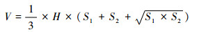
聚湫平面呈“闷葫芦状”,沟谷较窄,两侧山体较为陡峭,整个聚湫呈倒锥体。因此,聚湫内沉积旋回呈梯形台地,利用梯形台体积公式[8, 9, 13]计算得到其体积(V):
|
其中,S1和S2分别为梯形台上部和下部表面积(m2),H为沉积旋回的厚度(m)。计算得到的V乘以黄土平均容重(取1.4[22]),获得各个旋回的产沙量;除以聚湫的流域面积,估算各个旋回的产沙模数;结合年际冻融层,计算不同年份的年际产沙量和产沙模数。
3 结果与讨论 3.1 沉积旋回的元素分布和年际冻融层划分高分辨率XRF Core Scanning获取的元素信号值能反映沉积物沉积序列的元素分布特征[31, 32],并得到广泛地应用[34~36]。考虑到XRF扫描获得的单个元素信号强度和分布受X射线源、曝光时间、沉积物物理特征(如岩芯表面平整度、岩芯裂隙、粒度与矿物一致性、有机质含量、含水量等)的影响[37~43],故采用以稳定元素为分母的元素比值识别沉积旋回元素分布特征[8]。其中,Si和Ti性质较为稳定,在黄土中主要赋存在石英等一些密度较大的硅酸盐矿物中,在分选过程中可率先沉积,分布在粗粉砂和细砂中[8, 44]。然而,细颗粒层中仍然富集粘土矿物和一些硅酸盐矿物,而且两者的XRF信号强度均受沉积物含水量的明显影响,致使它们的信号强度夸大或削弱某些地表过程的影响[37, 38];与之相反,Zr在黄土中主要以锆石存在,该矿物难风化、密度较大,主要存在于粗粉砂和细砂中[44, 45]。同时,由于其相对大的原子量(40),高分辨率XRF岩芯连续扫描得到的Zr强度主要只受沉积物粒度、表面粗糙度、矿物分布等物理特征的影响[41~43],而这3个因素对所有元素的影响是一致的。因此,我们选择Zr作为分母校正Al、K、Fe、Rb、Ca和Sr等元素信号强度以划分沉积旋回,而未采用受沉积物物理属性影响较大的Si和Ti作为校正因子。
为了展示不同元素比值的变化和差异,筛选出有效指示沉积旋回的元素比值(Rb/Zr),我们选择了靖边聚湫约1960~2945mm段(JB-3)为代表分析,见图 2。JB-3岩芯段Zr的信号强度变化于2.7×10³~11.8×10³ cps之间,其高值主要分布在该岩芯段可见旋回的粗颗粒层,而低值则出现在细颗粒层中,说明Zr富集在旋回下部的粗颗粒层中;与Zr相反,Al/Zr、K/Zr、Fe/Zr、Rb/Zr、Ca/Zr和Sr/Zr的高值对应于JB-3岩芯段可见旋回的细颗粒层,其分布基本一致,表明Al、K、Fe、Rb、Ca和Sr等元素主要富集于旋回上部的细颗粒层中(图 2)。

|
图 2 靖边聚湫代表性岩芯段(JB-3)Zr及其他元素与之比值的分布 示意不同元素比值之间的差异、划分的沉积旋回及对应的照片 Fig. 2 Distributions of Zr and other elements to Zr ratios of a representative core section(JB-3) from the Jingbian reservoir, showing differences among the ratios and deposition couplets, along with its optical image |
通过对以Zr为分母的元素比值曲线(图 2)仔细对比和分析发现,Fe/Zr、K/Zr、Ca/Zr比值振幅大、波动频繁,而Rb/Zr和Sr/Zr比值的相对振幅小且偏向均一,可呈现清晰的上下层界线,前者可能与它们XRF扫描易受沉积物含水量的影响有关,特别是对于含水量较高的细颗粒层[8, 37, 38]。尽管Rb(37)和Sr(38)信号强度也只受粒度、表面粗糙度、矿物分布等物理特征的影响,但是Sr活动性较强,极易随着土壤水向下淋溶和迁移[46, 47]。因此,考虑到:1)Rb和Zr分别稳定富集在沉积旋回的上部细颗粒层和下部粗颗粒层中,在分选和成层后不再受水分和冻融作用的影响发生迁移;2)Rb和Zr信号强度在高分辨率XRF扫描时均只受沉积物表面物理特征的影响,我们推荐Rb/Zr比值作为划分黄土高原聚湫沉积序列中沉积旋回的有效地球化学指标。事实上,Rb/Zr比值指示的是黄土和海洋沉积序列中粒度组成的变化[45, 48~50],所以Rb/Zr比值划分聚湫沉积序列中沉积旋回在本质上也是指示了沉积分选过程中粒度的分布。
已有研究表明[51],沉积旋回上部细颗粒层可分为两种类型,即受冻融作用影响形成的年际冻融层和年内强降水形成的细颗粒层;细颗粒层中的Ca/Zr和Fe/Zr相关性可用于识别沉积序列中的年际冻融层。在利用Rb/Zr划分靖边和合水聚湫沉积旋回的基础上,各旋回细颗粒层的Ca/Zr和Fe/Zr相关性显示在图 3中。结果显示,两个聚湫沉积序列中的年际冻融层和年内细颗粒层在Ca/Zr和Fe/Zr的值和相关性斜率上均有明显差异,从而有效地识别了年际冻融层。有意义的是,合水沉积序列中的年内细颗粒层Ca/Zr和Fe/Zr比值和斜率均高于靖边的年内细颗粒层(图 3),这表明合水流域的表土成壤和淋溶作用更强,是该地区气候比靖边温暖湿润的直接表现。靖边年际冻融层Ca/Zr和Fe/Zr的斜率较年内细颗粒层更高,说明靖边流域受到的冻融作用更加强烈,溶解于土壤孔隙水中的Ca等活泼元素在强烈的冻融作用下进一步富集在年际冻融层中。

|
图 3 靖边和合水聚湫沉积序列Ca/Zr和Fe/Zr相关性(括弧内数字为年份) Fig. 3 Correlations between Ca/Zr and Fe/Zr ratios within the Jingbian and Heshui sediment sequences(the numbers in the brackets are ages of the years) |
根据Rb/Zr比值,结合Ca/Zr和Fe/Zr相关性对年际冻融层的分辨(图 3),靖边聚湫上部4m沉积序列共可划分为35个沉积旋回和27个年际冻融层(图 4a和4b),表明该4m沉积序列是在27个年份中共35次强降水侵蚀泥沙堆积而成。旋回厚度范围为2.8cm至45.6cm,最薄旋回为从上至下第26旋回,最厚为第13旋回。与之不同,合水上部2m沉积序列仅可划分为18个沉积旋回和10个年际冻融层(图 4c),表明该2m沉积序列是在1996年聚湫坝冲垮之前10个年份中共18次强降水侵蚀泥沙堆积而成。旋回厚度范围为2.0cm至36.8cm,最薄旋回为从上至下第18旋回,最厚为第7旋回。

|
图 4 聚湫沉积序列Rb/Zr比值划分的沉积旋回、各旋回细颗粒层137Cs比活度分布以及植物残体AMS-14C年代 (a)和(b)为靖边聚湫上部4m沉积序列,(c)为合水聚湫上部2m沉积序列;右侧时间为1963年以来强降水发生日期,可与沉积旋回一一对应 Fig. 4 istribution of deposition couplets identified by Rb/Zr ratios and 137Cs activity in fine-grained layer of each couplet of sediment sequences from two CLP (Chinese Loess Plateau) landslide-dammed reservoirs, along with AMS-14C dates. (a)and (b), topmost 4 m sediment sequences from the Jingbian reservoir, (c)topmost 2 m sediment sequences from the Heshui reservoir. The times along the right side of each curve are the dates of heavy rainfall events since 1963A.D. recorded by local meteorology stations, which is consistent one-to-one correspondence to deposition couplets |
确定Rb/Zr比值以及Ca/Zr和Fe/Zr相关性划分的沉积旋回和年际冻融层的沉积年代是获得年际产沙量、讨论土壤侵蚀与暴雨频率和强度关系的重要前提。Zhang等[22, 26]对放射性核素137Cs在不同粒级黄土中分布的研究表明,137Cs主要被吸附于聚湫沉积旋回的上部细颗粒层中,且137Cs最高值对应于1963年或其后几年首次强降雨侵蚀泥沙的沉积。从靖边和合水聚湫上部沉积序列中各个旋回细颗粒层的137Cs比活度可见,靖边沉积序列中从上至下的第30个沉积旋回的137Cs含量最高,为5.37Bq/kg(图 4a和4b),而合水序列中137Cs含量最高值出现在从上至下的第14个旋回,为3.15Bq/kg(图 4c),说明这两个旋回分别形成于1963年或附近几年(决定于1963年或较后几年首次暴雨)[22, 26]。
这一界线表明,靖边聚湫沉积序列具有最高137Cs比活度、从上至下第30个旋回的细颗粒层可对应于1963年5月23日暴雨侵蚀泥沙沉积,而其上的23个年际冻融层则形成于1963~2014年的23个年份中,期间共产生了30个沉积旋回。通过对比靖边县1963~2014年和吴起县1963~2008年降水资料,发现期间次降水量高于40mm的强降水次数[12]刚好为30次,与聚湫内沉积旋回个数完全相同。将1963~2014年期间次降水量高于40mm的强降水发生时间与沉积旋回进行一一对应,如图 4a和4b所示。重要的是,1977年10月4号和1994年8月10号发生的两次特大暴雨分别对应于两个最厚的沉积旋回(图 4a和4b)。沉积序列204cm和224cm两处植物残体的14C年龄分别约为公元1994年和1993年(表 1),其与强降水对应的旋回时间基本接近(图 4b),进一步证实了强降水次数确定的沉积序列的年代。由此可知,在1963~2014年的52年间,共有29年未能在靖边聚湫内形成可分辨的沉积旋回,特别是1965~1971年的7年没有形成沉积旋回,而大多数年份仅形成1~2个沉积旋回,只有在1994年形成了3个沉积旋回(图 4a和4b)。
同样地,将合水聚湫沉积序列具有最高137Cs比活度、从上至下第14个旋回的细颗粒层可对应于1966年7月26日暴雨侵蚀泥沙沉积,而其上沉积序列则形成于1963~1996年(该聚湫1996年冲垮)的7个年份中,期间共产生了13个沉积旋回。老城镇和西峰镇1963~1996年期间次降水量高于50mm的暴雨次数[12]也正好为13次,与合水聚湫内沉积旋回个数完全相同。将1963~1996年期间次降水量高于50mm的暴雨发生时间与沉积旋回进行一一对应,如图 4c所示。重要的是,1988年8月17~18号发生的特大暴雨也可对应于期间最厚的那个沉积旋回(图 4c)。沉积序列56cm和175cm两处植物残体和木炭的14C年龄分别约为公元1993年和1968年(表 1),其也与强降水次数确定的旋回年代基本接近(图 4c)。由此可知,在1963~1996年的33年间,共有26年未能在合水聚湫内形成可分辨的沉积旋回,特别是1967~1984年的18年内仅在1975年形成了一个沉积旋回,而1988年和1990年却分别形成了4个和3个沉积旋回(图 4c)。
3.3 旋回、年际的产沙量和产沙模数在划分旋回、确定各个旋回对应的年代之后,我们可以根据沉积序列中每个沉积旋回的厚度、实测台地表面积、沟谷两侧坡度,计算获得两个聚湫各旋回的及年际的产沙量和产沙模数。计算得到的靖边聚湫1963~2014年期间总产沙量为9.16×10⁵t,各个旋回的产沙量介于0.71×10⁴ t和11.86×10⁴t之间,平均为3.05×10⁴ t,与之对应的产沙模数变化于0.25×10⁴ t/km2和4.13×104 t/km2之间,平均为1.06×104 t/km2。根据各个旋回年际划分,靖边聚湫内年产沙量的范围为0.71×104~15.48×104t/a,平均值为3.82×104t/a;年产沙模数介于0.25×104~5.39×104t/km2/a,平均为1.33×104 t/km2/a。类似地,合水聚湫1966~1996年期间总产沙量为3.36×105 t,各个旋回的产沙量介于0.66×10⁴ t和7.12×10⁴ t之间,平均为2.24×10⁴ t,与之对应的产沙模数变化于0.33×10⁴ t/km2和3.59×104 t/km2之间,平均为1.13×104 t/km2。根据各个旋回年际划分,合水聚湫内年产沙量的范围为1.15×104~14.19×104 t/a,平均值为4.20×104t/a;年产沙模数介于0.58×104~7.17×104t/ km2/a之间,平均为2.12×104 t/km2/a。
3.4 土壤侵蚀与降水关系及区域差异黄土高原聚湫沉积旋回是强降水条件下流域内侵蚀泥沙在自然分选和成层作用下形成的,一个沉积旋回指示单次强降水情形下发生的土壤侵蚀强度。从图 4可知,靖边和合水聚湫自1963年以来的沉积旋回个数与强降水发生次数完全一致,这为探究降水量与土壤侵蚀强度的对应关系提供了条件。由两个聚湫1963年以来沉积旋回计算的产沙模数与对应年代强降水量的相关性可见,靖边聚湫旋回产沙模数与强降水量的相关系数r2为0.75,斜率为0.04,而合水聚湫两者的r2为0.83,斜率为0.01(图 5),表明两个流域的旋回产沙模数与强降水量各自呈线性正相关(图 5)。两者良好的线性相关关系进一步证实了强降水对沉积旋回产沙模数和流域侵蚀的主导控制[22],也为利用历史时期沉积旋回和厚度重建降水量和频率提供了线索和依据。

|
图 5 靖边和合水聚湫1963年以来沉积旋回产沙模数与强降水量的相关性,红色和绿色分别为靖边和合水沉积旋回的拟合线性回归曲线和方程(括弧内为年份) Fig. 5 Correlations between sediment yield of each couplet and heavy rainfall discharge within the Jingbian and Heshui reservoir catchments since 1963A.D.(the numbers in the brackets are age of the years), where red and green are linear regression curves and equations for respective deposition couplets of the Jingbian and Heshui reservoirs |
更有意义的是,1963年以来靖边聚湫沉积旋回的产沙模数与降水量相关的斜率要远高于合水聚湫(图 5),表明地处黄土高原北部的靖边流域土壤侵蚀对降水量比合水流域更敏感,即在相同的降水强度下,靖边流域的侵蚀和产沙量要远较合水的高。反而言之,要在合水聚湫流域侵蚀相同通量的土壤所需的降水强度要比靖边流域所需的更强。尽管地处偏南的合水具有比靖边更多、更强的降水,但是在同等时段内其堆积的沉积序列远比地处北部的靖边聚湫薄,且形成的沉积旋回也比靖边聚湫少,最大的产沙模数也只与靖边基本相当(图 5)。在次降水量为50mm的强度下,靖边流域的产沙模数约为合水流域的两倍。随着降水强度的增加,两者侵蚀通量的差别逐步加大。例如,当次降水量为120mm时,靖边流域的产沙模数是合水流域的3.5倍。这是黄土高原北部砂黄土比南部粘黄土更易遭受侵蚀的直接结果[5, 52, 53],同时还与合水地区高植被覆盖度、低坡度等因素有关[30],而本研究则提供了降水与黄土侵蚀的定量关系,有助于深入理解黄土高原不同区域地球关键带土壤侵蚀和水文循环等地表过程。
尽管靖边和合水地区的侵蚀强度和受降水控制的斜率存在显著的区域差别(图 5),形成沉积旋回的年份也不尽相同(图 4),但是两个聚湫沉积旋回共同反映了20世纪90年代以来强降水次数和强度呈增加趋势,即在相近的降雨量情形下,降水更集中,常常以暴雨形式出现。例如2013年7月在延安地区发生的长达一个月的强降雨,月降水量高达581mm,已达万年一遇的级别[54, 55];2017年7月25~26日,榆林地区发生百年一遇的大暴雨,最大日降水量高达230.1mm,溃坝导致了严重的人员伤亡和经济损失。类似降水模式的变化在青海湖流域也有体现[56]。黄土高原聚湫沉积记录的暴雨强度和频率是识别该地区地球关键带历史时期的降水特征、洪水历史和侵蚀响应的重要依据,从而为小流域内坝库建设、洪涝灾害预防等提供了关键数据。
4 结论通过对黄土高原中部丘陵沟壑区(陕西靖边)和高塬沟壑区(甘肃合水)两个代表性聚湫上部4m和2m沉积序列高分辨率XRF岩芯扫描,发现沉积旋回的下部粗颗粒层以高Zr为特征,上部细颗粒层则富集Al、Fe、Rb、Ca和Sr等造岩元素。通过各元素与Zr比值的分布及Rb和Zr的元素地球化学行为,提出Rb/Zr比值可用来高分辨率地划分聚湫沉积序列的沉积旋回。根据Rb/Zr比值的划分,表明靖边和合水聚湫上部4m和2m沉积序列分别有35个和18个沉积旋回。以细颗粒层的最高137Cs比活度(公元1963年前后)为界线,发现两个聚湫划分的1963年以来沉积旋回个数均可分别与区域强降水次数一一对应,而且沉积旋回的产沙模数与强降水量呈线性正相关,表明流域侵蚀形成的沉积旋回产沙模数随区域性降水强度呈线性增加。重要的是,在相同时期内,靖边聚湫的年际沉积旋回数量和产沙模数均高于合水,表明砂黄土的侵蚀更敏感地响应于强降水,即在次降水量为50mm的强度下,黄土高原北部砂黄土侵蚀通量约是南部粘黄土的两倍左右。聚湫沉积旋回记录的侵蚀过程及区域差异加深了我们对黄土高原地球关键带中土壤侵蚀、水文环境变化等地表作用的认识。通过更多沉积序列的对比研究,有望深入认识历史时期水文气候和人类活动对黄土高原地球关键带中土壤侵蚀、生态环境变化等地表作用的区域影响。
致谢 感谢兰州大学西部环境与气候变化研究院潘燕辉老师对XRF岩芯扫描的指导和帮助,中国科学院水利部成都山地灾害与环境研究所张润川老师协助测定137Cs含量。感谢同行评审专家和编辑部老师提出的宝贵修改意见!
| 1 |
Richter D D, Mobley M L. Monitoring Earth's critical zone. Science, 2009, 326(5956): 1067-1068. DOI:10.1126/science.1179117 |
| 2 |
Lin H. Earth's critical zone and hydropedology:Concepts, characteristics, and advances. Hydrology and Earth System Sciences, 2010, 6(2): 3417-3481. |
| 3 |
唐克丽, 张平仓, 王斌科. 土壤侵蚀与第四纪生态环境演变. 第四纪研究, 1991(4): 299-309. Tang Keli, Zhang Pingcang, Wang Binke. Relation of soil erosion process to the ecological environment changes in the Quaternary. Quaternary Sciences, 1991(4): 299-309. |
| 4 |
张宗祜. 黄土高原土壤侵蚀基本规律. 第四纪研究, 1993(1): 34-40. Zhang Zonghu. The basic features of soil erosion in Loess Plateau. Quaternary Sciences, 1993(1): 34-40. |
| 5 |
Zheng F L, Wang B. Soil erosion in the Loess Plateau region of China. In:Tsunekawa A, Liu G, Yamanaka N et al. eds. Restoration and Development of the Degraded Loess Plateau, China. Tokyo:Springer, 2014. 77~92
|
| 6 |
蔡强国, 刘纪根, 刘前进. 岔巴沟流域次暴雨产沙统计模型. 地理研究, 2004, 23(4): 433-439. Cai Qiangguo, Liu Jigen, Liu Qianjin. Research of sediment yield statistical model for single rainstorm in Chabagou drainage basin. Geographical Research, 2004, 23(4): 433-439. |
| 7 |
江忠善, 郑粉莉. 纸坊沟流域水土流失综合治理减沙效益评价. 泥沙研究, 2004(2): 56-61. Jiang Zhongshan, Zheng Fenli. Assessment on benefit of sediment reduction by comprehensive controls in the Zhifanggou watershed. Journal of Sediment Research, 2004(2): 56-61. |
| 8 |
王夏青. 黄土高原聚湫沉积旋回和年际冻融层及流域侵蚀通量--基于高分辨率XRF连续扫描的研究. 西安: 中国科学院地球环境研究所博士学位论文, 2016. 147 Wang Xiaqing. Deposition Couplet, Annual Freeze-thaw Layer and Catchment Erosion within the Landslide-Dammed Reservoirs on the Chinese Loess Plateau Based on High-resolution XRF Core Scanning. Xi'an:The Ph.D Dissertation of Institute of Earth Environment, Chinese Academy of Sciences, 2016. 147 |
| 9 |
Zhang X B, Walling D E, He X et al. Use of landslide-dammed lake deposits and pollen tracing techniques to investigate the erosional response of a small drainage basin in the Loess Plateau, China, to land use change during the late 16th century. Catena, 2009, 79(3): 205-213. DOI:10.1016/j.catena.2009.05.001 |
| 10 |
Zhao G J, Klik A, Mu X M et al. Sediment yield estimation in a small watershed on the northern Loess Plateau, China. Geomorphology, 2015, 241: 343-352. DOI:10.1016/j.geomorph.2015.04.020 |
| 11 |
Zhao G J, Kondolf G M, Mu X M et al. Sediment yield reduction associated with land use changes and check dams in a catchment of the Loess Plateau, China. Catena, 2017, 148: 126-137. DOI:10.1016/j.catena.2016.05.010 |
| 12 |
Li X G, Wei X, Wei N. Correlating check dam sedimentation and rainstorm characteristics on the Loess Plateau, China. Geomorphology, 2016, 265: 84-97. DOI:10.1016/j.geomorph.2016.04.017 |
| 13 |
Wei Y H, He Z, Li Y J et al. Sediment yield deduction from check-dams deposition in the weathered sandstone watershed on the north Loess Plateau, China. Land Degradation & Development, 2017, 28: 217-231. |
| 14 |
Chen F X, Fang N F, Wang Y X et al. Biomarkers in sedimentary sequences:Indicators to track sediment sources over decadal timescales. Geomorphology, 2017, 278: 1-11. DOI:10.1016/j.geomorph.2016.10.027 |
| 15 |
Long Y, Zhang X B, Li M et al. Identification of the deposited layers in landslides reservoir and investigation of the sediment yields during the later sixteenth century on the Hill Loess Plateau, China. Chinese Science Bulletin, 2008, 53(24): 3908-3913. |
| 16 |
Wang Y F, Chen L D, Fu B J et al. Check dam sediments:An important indicator of the effects of environmental changes on soil erosion in the Loess Plateau in China. Environmental Monitoring and Assessment, 2014, 186(7): 4275-4287. DOI:10.1007/s10661-014-3697-6 |
| 17 |
阚尚, 李福春, 田智宇等. 陕西靖边花豹湾聚湫坝地土壤的微生物群落结构特征及其影响因子. 土壤, 2016, 48(2): 291-297. Kan Shang, Li Fuchun, Tian Zhiyu et al. Characteristics and influencing factors of soil microbial community structure of Huabaowan landslide reservoir in Jingbian, Shaanxi. Soils, 2016, 48(2): 291-297. |
| 18 |
张信宝, Walling D E, 贺秀斌等. 黄土高原小流域植被变化和侵蚀产沙的孢粉示踪研究初探. 第四纪研究, 2005, 25(6): 60-66. Zhang Xinbao, Walling D E, He Xiubin et al. A test of the pollen tracing technique for studies of vegetation changes, erosion and sedimentation in a small catchment in the Loess Plateau of China. Quaternary Sciences, 2005, 25(6): 60-66. |
| 19 |
李勋贵, 李占斌, 魏霞. 黄土高原淤地坝坝地淤积物两个重要物理特性指标研究. 水土保持研究, 2007, 14(2): 218-220. Li Xungui, Li Zhanbin, Wei Xia. Two key physical characteristics indexes of farmland sediment for check dams in Loess Plateau. Research of Soil and Water Conservation, 2007, 14(2): 218-220. |
| 20 |
汪亚峰, 傅伯杰, 陈利顶等. 黄土高原小流域淤地坝泥沙粒度的剖面分布. 应用生态学报, 2009, 20(10): 2461-2467. Wang Yafeng, Fu Bojie, Chen Liding et al. Profile distribution of sediment particle sizes at a check dam in a small watershed of Loess Plateau. Chinese Journal of Applied Ecology, 2009, 20(10): 2461-2467. |
| 21 |
岳大鹏, 袁晓宁, 李奎等. 陕北子洲黄土洼坝淤地淤积剖面元素分布特征分析. 干旱区地理, 2014, 37(5): 875-882. Yue Dapeng, Yuan Xiaoning, Li Kui et al. Distribution features of deposition profile elements on dammed silt land in Huangtuwa of Zizhou County, Northern Shaanxi. Arid Land Geography, 2014, 37(5): 875-882. |
| 22 |
Zhang X B, Wen Z M, Feng M Y et al. Application of 137Cs fingerprinting technique to interpreting sediment production records from reservoir deposits in a small catchment of the Hilly Loess Plateau, China. Science in China (Series D): Earth Sciences, 2007, 50(2): 254-260. DOI:10.1007/s11430-007-2013-5 |
| 23 |
李勉, 杨剑锋, 侯建才等. 黄土丘陵区小流域淤地坝记录的泥沙沉积过程研究. 农业工程学报, 2008, 24(2): 64-69. Li Mian, Yang Jianfeng, Hou Jiancai et al. Sediment deposition process for a silt dam in a small watershed in loess hilly region. Transactions of the Chinese Society of Agricultural Engineering, 2008, 24(2): 64-69. |
| 24 |
颜艳, 岳大鹏, 陈宝群等. 陕北黄土洼天然淤地坝沉积物粒度特征与降雨关系研究. 干旱地区农业研究, 2014, 32(6): 201-206. Yan Yan, Yue Dapeng, Chen Baoqun et al. Study on the relationship between rainfall and grain-size characteristics of check dam sediments at Huangtuwa in Northern Shaanxi. Agricultural Research in the Arid Areas, 2014, 32(6): 201-206. DOI:10.7606/j.issn.1000-7601.2014.06.034 |
| 25 |
刘立峰, 金绥庆, 付明胜等. 基于坝地泥沙淤积信息的流域侵蚀产沙特征研究. 山西水土保持科技, 2015(1): 10-13. Liu Lifeng, Jin Suiqing, Fu Mingsheng et al. The characters of erosional sediment yield within the catchment based on sediment in the check dam reservoirs. Soil and Water Conservation Science and Technology in Shanxi, 2015(1): 10-13. |
| 26 |
Zhang X B, Walling D E, Yang Q et al. 137Cs budget during the period of 1960s in a small drainage basin on the Loess Plateau of China. Journal of Environmental Radioactivity, 2006, 86(1): 78-91. DOI:10.1016/j.jenvrad.2005.07.007 |
| 27 |
薛凯, 杨明义, 张风宝等. 利用淤地坝泥沙沉积旋廻反演小流域侵蚀历史. 核农学报, 2011, 25(1): 115-120. Xue Kai, Yang Mingyi, Zhang Fengbao et al. Investigation soil erosion history of a small watershed using sediment couplet in a dam. Journal of Nuclear Agricultural Sciences, 2011, 25(1): 115-120. DOI:10.11869/hnxb.2011.01.0115 |
| 28 |
Ran D C, Luo Q H, Zhou Z H et al. Sediment retention by check dams in the Hekouzhen-Longmen section of the Yellow River. International Journal of Sediment Research, 2008, 23(2): 159-166. DOI:10.1016/S1001-6279(08)60015-3 |
| 29 |
靖边县地方志编纂委员会. 靖边县志. 西安: 陕西人民出版社, 1993, 41-167. Local Annals of Jingbian County Editorial Committee. Annals of Jingbian County. Xi'an: Shaanxi People Press, 1993, 41-167. |
| 30 |
合水县志编纂委员会. 合水县志. 兰州: 甘肃文化出版社, 2006, 81-387. Annals of Heshui County Editorial Committee. Annals of Heshui County. Lanzhou: Gansu Culture Press, 2006, 81-387. |
| 31 |
Croudace I W, Rindby A, Rothwell R G. ITRAX:Description and evaluation of a new multi-function X-ray core scanner. Geological Society, London, Special Publications, 2006, 267(1): 51-63. DOI:10.1144/GSL.SP.2006.267.01.04 |
| 32 |
Rothwell R G. Micro-XRF Studies of Sediment Cores:A Perspective on Capability and Application in the Environmental Sciences. In:Micro-XRF Studies of Sediment Cores. Dordrecht:Springer, 2015. 1~21
|
| 33 |
Hua Q, Barbetti M, Rakowski A Z. Atmospheric radiocarbon for the period 1950~2010. Radiocarbon, 2013, 55(4): 2059-2072. DOI:10.2458/azu_js_rc.v55i2.16177 |
| 34 |
庞红丽, 高红山, 刘晓鹏等. 河流沉积物原位XRF岩芯扫描结果定量估算的初步研究. 第四纪研究, 2016, 36(1): 237-246. Pang Hongli, Gao Hongshan, Liu Xiaopeng et al. Preliminary study on calibration of X-ray fluorescence core scanner for quantitative element records in the Yellow River sediments. Quaternary Sciences, 2016, 36(1): 237-246. |
| 35 |
周锐, 李珍, 宋兵等. 长江三角洲平原湖沼沉积物XRF岩芯扫描结果的可靠性分析. 第四纪研究, 2013, 33(4): 697-704. Zhou Rui, Li Zhen, Song Bing et al. Reliability analysis of X-ray fluorescenc core-scanning in the Yangtze Delta limnetic sediments. Quaternary Sciences, 2013, 33(4): 697-704. |
| 36 |
谢曼曼, 孙青, 王宁等. 1200年来湖光岩玛珥湖高分辨率元素地球化学记录. 第四纪研究, 2015, 35(1): 152-159. Xie Manman, Sun Qing, Wang Ning et al. High resolution elements geochemical record during the past 1200 years in Hugangyan Maar Lake. Quaternary Sciences, 2015, 35(1): 152-159. |
| 37 |
Tjallingii R, Rohl U, Kolling M et al. Influence of the water content on X-ray fluorescence core-scanning measurements in soft marine sediments. Geochemistry, Geophysics, Geosystems, 2007, 8. DOI:10.1029/2006GC001393 |
| 38 |
Hennekam R, de Lange G. X-ray fluorescence core scanning of wet marine sediments:Methods to improve quality and reproducibility of high-resolution paleoenvironmental records. Limnology and Oceanography:Methods, 2012, 10(12): 991-1003. DOI:10.4319/lom.2012.10.991 |
| 39 |
Löwemark L, Chen H F, Yang T N et al. Normalizing XRF-scanner data:A cautionary note on the interpretation of high-resolution records from organic-rich lakes. Journal of Asian Earth Sciences, 2011, 40(6): 1250-1256. DOI:10.1016/j.jseaes.2010.06.002 |
| 40 |
Bertrand S, Hughen K, Giosan L. Limited influence of sediment grain size on elemental XRF core scanner measurements. In:Micro-XRF Studies of Sediment Cores. Dordrecht:Springer, 2015. 473~490
|
| 41 |
Maclachlan S E, Hunt J E, Croudace I W. An empirical assessment of variable water content and grain-size on X-ray fluorescence core-scanning measurements of deep sea sediments. In:Micro-XRF Studies of Sediment Cores. Dordrecht:Springer, 2015. 173~185
|
| 42 |
Weltje J G, Bloemsma R M, Tjallingii R et al. Prediction of geochemical composition from XRF core scanner data:A new multivariate approach including automatic selection of calibration samples and quantification of uncertainties. In:Micro-XRF Studies of Sediment Cores. Dordrecht:Springer, 2015. 507~534
|
| 43 |
Huang J J, L wemark L, Chang Q et al. Choosing optimal exposure times for XRF core-scanning:Suggestions based on the analysis of geological reference materials. Geochemistry, Geophysics, Geosystems, 2016, 17(4): 1558-1566. DOI:10.1002/2016GC006256 |
| 44 |
Cuven S, Francus P, Lamoureux S F. Estimation of grain size variability with micro X-ray fluorescence in laminated lacustrine sediments, Cape Bounty, Canadian High Arctic. Journal of Paleolimnology, 2010, 44(3): 803-817. DOI:10.1007/s10933-010-9453-1 |
| 45 |
Liang L J, Sun Y B, Beets C J et al. Impacts of grain size sorting and chemical weathering on the geochemistry of Jingyuan loess in the northwestern Chinese Loess Plateau. Journal of Asian Earth Sciences, 2013, 69(12): 177-184. |
| 46 |
Chen J, An Z, Head J. Variation of Rb/Sr ratios in the loess-paleosol sequences of Central China during the last 130, 000 years and their implications for monsoon paleoclimatology. Quaternary Research, 1999, 51(3): 215-219. DOI:10.1006/qres.1999.2038 |
| 47 |
Jin Z D, Cao J J, Wu J et al. A Rb/Sr record of catchment weathering response to Holocene climate change in Inner Mongolia. Earth Surface Processes and Landforms, 2006, 31(3): 285-291. DOI:10.1002/(ISSN)1096-9837 |
| 48 |
Dypvik H, Harris N B. Geochemical facies analysis of fine-grained siliciclastics using Th/U, Zr/Rb and(Zr+Rb)/Sr ratios. Chemical Geology, 2001, 181(1~4): 131-146. |
| 49 |
Liu L W, Chen J, Chen Y et al. Variation of Zr/Rb ratios on the Loess Plateau of Central China during the last 130000 years and its implications for winter monsoon. Chinese Science Bulletin, 2002, 47(15): 1298-1302. DOI:10.1360/02tb9288 |
| 50 |
Chen J, Chen Y, Liu L W et al. Zr/Rb ratio in the Chinese loess sequences and its implication for changes in the East Asian winter monsoon strength. Geochimica et Cosmochimica Acta, 2006, 70(6): 1471-1482. DOI:10.1016/j.gca.2005.11.029 |
| 51 |
Wang X Q, Jin Z D, Chen L M et al. High-resolution X-ray fluorescence core scanning of landslide-dammed reservoir sediment sequences on the Chinese Loess Plateau:New insights into the formation and geochemical processes of annual freeze-thaw layers. Geoderma, 2016, 279: 122-131. DOI:10.1016/j.geoderma.2016.06.008 |
| 52 |
Zhao G J, Mu X M, Jiao J Y et al. Evidence and causes of spatiotemporal changes in runoff and sediment yield on the Chinese Loess Plateau. Land Degradation & Development, 2017, 28(2): 579-590. |
| 53 |
He Y, Wang F, Mu X et al. Human activity and climate variability impacts on sediment discharge and runoff in the Yellow River of China. Theoretical & Applied Climatology, 2016, 124(1~2): 1-10. |
| 54 |
李慧娟, 高建恩, 张元星等. 延安极端降雨特性分析及对梯田侵蚀灾害影响. 水土保持学报, 2016, 30(6): 79-84. Li Huijuan, Gao Jian'en, Zhang Yuanxing et al. Analysis of Yan'an extreme rainfall characteristics and impacts of erosion disasters on terraces. Journal of Soil and Water Conservation, 2016, 30(6): 79-84. |
| 55 |
黄玉华, 冯卫, 李政国. 陕北延安地区2013年"7.3"暴雨特征及地质灾害成灾模式浅析. 灾害学, 2014, 29(2): 54-59. Huang Yuhua, Feng Wei, Li Zhengguo. Characteristics and geological disaster mode of the rainstorm happened on July 3 2013 in Yan'an area of Shaanxi Province. Journal of Catastrophology, 2014, 29(2): 54-59. |
| 56 |
金章东, 张飞, 王红丽等. 2005年以来青海湖水位持续回升的原因分析. 地球环境学报, 2013, 4(3): 1355-1362. Jin Zhangdong, Zhang Fei, Wang Hongli et al. The reasons of rising water level in Lake Qinghai since 2005. Journal of Earth Environment, 2013, 4(3): 1355-1362. |
② Institute of Global Environmental Change, Xi'an Jiaotong University, Xi'an 710049;
③ College of Resources and Environment and Tourism, College of Hunan Arts and Science, Changde 415000;
④ Institute of Mountain Hazards and Environment, Chinese Academy of Sciences and Ministry of Water Conservancy, Chengdu 610041)
Abstract
The sedimentary sequence in the landslide-and check-dammed reservoirs is originated from reworked loess within the catchment on the Chinese Loess Plateau, which is characterized by high sedimentation rate and various deposition couplets, so that it is one of the ideal objectives to understand processes and history of the Earth's Critical Zone within a single catchment on the Chinese Loess Plateau. How to effectively identify individual deposition couplets and to build their chronology is the first-order basis for reconstructing catchment soil erosion and for understanding its Earth's Critical Zone processes and history using reservoir sedimentary sequences on the Chinese Loess Plateau. In this study, the sedimentary sequences drilled from two typical landslide-dammed reservoirs at hilly and gully region (Jingbian, Shaanxi)and highland gully region (Heshui, Gansu)in the central Chinese Loess Plateau were scanned for elemental distributions using high-resolution X-ray fluorescence (XRF)core scanning, in order to plot out deposition couplets and annual freeze-thaw layers, then to obtain the sediment yields of individual couplet and annual sediment yields, and finally to address the relationship of soil erosion and frequency and intensity of heavy rainfall and its regional difference. The Jingbian landslide-dammed reservoir (37°18'N, 108°36'E) is located at Huabaowan Village, Jingbian County and belongs to a gully of the headstream of the Wuding River (one of major tributaries of the Yellow River). It was never destroyed, so its sediment has deposited since it formed during 1851 A.D. and 1861 A.D. The Heshui reservoir (36°1'N, 108°7'E) is located at Laocheng, Heshui County and belongs to a gully of the middle reaches of the Malian River (one of secondary tributaries of the Yellow River). Its sediment has deposited since it formed till 1996 A.D. when it was brought under cultivation. The topmost 4 m and 2 m sediments drilled from the depositional centers of the Jingbian and Heshui reservoirs respectively were used to obtain for elemental and 137Cs distributions. The results showed that the underlying coarse-grained layer of each couplet is enriched by high Zr and the upper fine-grained one by high lithophile elements (Al, Fe, Rb, Ca, and Sr), so that Rb/Zr ratio by high-resolution XRF core scanning can be employed as an excellent geochemical proxy to plot out deposition couplets. By combining with 137Cs activity distribution of the upper fine-grained layers in each couplet and identification of annual freeze-thaw layers among the couplets, there is consistent one-to-one correspondence between frequency of heavy rainfall and deposition couplets identified by Rb/Zr ratios since 1963 A.D. The number of deposition couplets and erosion flux reflect frequency and intensity of heavy rainfall respectively, with a good correlation between rainfall intensity and the erosion flux of each couplet in respective sedimentary sequences. The erosion fluxes within the Jingbian catchment are double relative to the Heshui one at a 50 mm rainfall condition, the former with higher sediment yield under same rainfall intensity resulting from easily eroded sandy loess on the hilly and gully region of the Chinese Loess Plateau. On the other hand, sediment yield is closely correlated with frequency and intensity of heavy rainfall in both catchments, behaving a linear increase in sediment yield with increasing rainfall intensity. These observations of soil erosion and regional difference recorded by deposition couplets from both landslide-dammed reservoirs highlight the Earth's Critical Zone processes and history of erosion, weathering, hydrology, and eco-environmental changes on the Chinese Loess Plateau at decadal timescale.